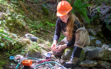
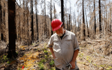
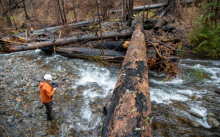
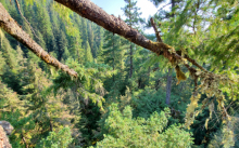
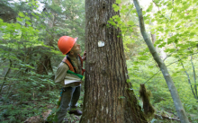
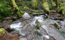
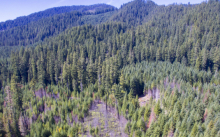
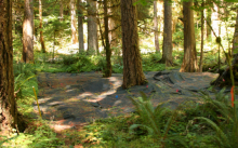
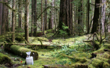
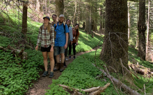
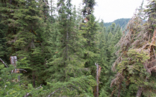
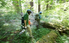
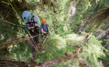
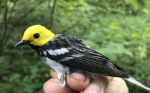
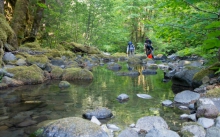
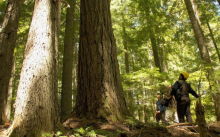
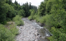
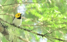
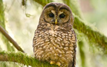
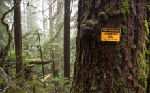
Research Highlights

"FOLLOWING FIRE: A Resilient Forest / An Uncertain Future" is a long term inquiry by photographer David Paul Bayles and disturbance ecologist Frederick J Swanson.  The collaboration combines David’s artistic sense of form and color and Fred’s scientific focus on the biological and physical processes shaping forest history and the forest’s future.

In September 2020, the Holiday Farm Fire, driven by fierce east winds, burned 173,000 acres along the forested McKenzie River canyon in the Cascade Range of Oregon. Two months later, David and Fred began a photography project to document the stark beauty of the burned forest and its vibrant response to fire. A fresh view of fire and forests emerged based on dozens of shared site visits. This project employs a variety of photographic approaches, including fine art, documentary, chronosequences (tracking change over time) and typologies (groups of images of single subjects), to highlight unique qualities of the blackened landscape.

They write, "Photographs and text weave a complex story of forest resilience in the face of  growing challenges and uncertainties. Despite headlines describing the forest as “incinerated” and “vaporized,” vast amounts of carbon and nutrients were retained, allowing abundant plant life to spring forth over the first few growing seasons. This gives us hope. However, the future forest must contend with profound uncertainties: accelerating climate change, invasive species, other legacies of past land use, and on-going intensive forest management."

The project is featured in a visually rich Januay 17 article on LENSCRATCH  and at https://www.followingfire.com/.

A cross-site synthesis marking the 40th anniversary of the LTER Network reveals how a long-term ecological research perspective facilitates insights into ecosystem response to climate change, described in an overview paper by Jones and Driscoll (2022). At all 28 LTER sites, from the Arctic to Antarctica, air temperature and moisture variability have increased since 1930, with increased disturbance frequency and severity and unprecedented disturbance types, altered primary production, enhanced cycling of organic and inorganic matter, and changes in populations and communities.

The Andrews Forest is one of nine forest/freshwater LTERs.  Campbell et al (2022) report that forest and freshwater ecosystems are tightly linked and together provide important ecosystem services, but climate change is affecting their primary production, carbon storage, water and nutrient cycling, and community dynamics.

Jones and Driscoll (2022) report that virtually all ecosystem and ecological processes are being affected by changing climate. Responses differ by region or ecosystem type, and interact with other past and ongoing human activities. Ecosystem responses to climate change are just emerging and are likely to intensify as climate change accelerates. Long-term ecological research can link changes in greenhouse gases to environmental forcing, ecosystem responses, ecosystem services, and climate feedback loops. These syntheses demonstrate the value of and need for continued long-term ecological research on ecosystem responses to global climate change.

In an introduction to the series, Nelson (2022) notes that our knowledge, our love, and our privilege as ecosystem researchers carry a corresponding responsibility to directly address climate change both by describing the impacts of climate change on ecosystems and by advocating on behalf of those ecosystems.

Press release from Oxford University Press: https://www.eurekalert.org/news-releases/961901

Researchers examined drivers behind patterns of high tree mortality levels (>~75%) within the five megafires that simultaneously burned in the western Oregon Cascades in 2020.  To learn whether, and the degree to which, the importance of drivers of tree mortality may have switched with the change in fire weather in the middle of the events, the researchers identified the drivers of fire activity and high tree mortality over two time periods: September 7-9, 2020, during which extreme winds fueled the explosive growth of the fires, and September 10-17, 2020, during which the fires continued burning under calm wind but still very dry conditions. No surprise, they found that wind was the most important factor; yet, they also demonstrated how vegetation structure (e.g., canopy height, the age of trees, etc.) and site topography played a significant role in burn severity patterns. Areas with younger trees and low canopy height and cover were particularly susceptible to high mortality rates. This finding is of particular consequence to lumber production in the Pacific northwest, where trees that are grown on plantations are typically younger, uniformly spaced, and located near communities and critical infrastructure.

Evers, C., Holz, A., Busby, S., & Nielsen-Pincus, M. (2022). Extreme Winds Alter Influence of Fuels and Topography on Megafire Burn Severity in Seasonal Temperate Rainforests under Record Fuel Aridity. Fire, 5, 41.   https://www.mdpi.com/2571-6255/5/2/41

Findings from a recent study indicate that old-growth forests may provide thermal refugia for species that are sensitive to climate change effects. The compositional diversity and microclimatic conditions of old-growth forests may provide resources and conditions that are less available in simple second-growth forest stands under global warming. The authors conclude that "Conservation of old-growth forests, or their characteristics in managed forests, could help slow the negative effects of climate warming on some breeding bird populations via microclimate buffering and possibly insurance effects."

The research is featured in an EcoWatch article and in a radio interview on Jefferson Public Radio.

Full article: "Forest microclimate and composition mediate long-term trends of breeding bird populations" in Global Change Biology, Hankyu Kim, Brenda C. McComb, Sarah J. K. Frey, David M. Bell, Matthew G. Betts

Researchers Steve Wondzell and Adam Ward propose the “channel-source hypothesis” in which the stream channel itself should be considered as a potential source of DOC to stream water during storms. Data collected during a small storm in the H. J. Andrews’ Watershed 1 could not be explained by existing conceptual models of stormflow generation. Simply put, DOC concentrations in the water samples collected from both the riparian and hillslope wells were lower than the concentrations in stream water so these areas could not be the primary source of DOC to the stream. This unexpected observation forced the researchers to consider other explanations for the patterns we observed in the stream chemistry. The “channel source hypothesis” is based on the well-known behavior of streams. Organic matter from litter fall or in-stream primary production can be stored in dead zones within the wetted stream channel under low-flow conditions. Leaching and microbial processes generate DOC within the organic matter. As water depth and flow velocity increase during the rising leg of the storm hydrograph, organic matter can be scoured out of dead zones, releasing the accumulated DOC into the active stream channel. The channel-source hypothesis does not replace existing conceptual models. Instead, it adds another potential mechanism that may explain DOC dynamics observed in streams during storms. The channel-source hypothesis has substantial implications for catchment studies examining sources of DOC in stream water or using DOC as a tracer to determine the locations of, and proportional contributions of, different source areas for streamflow generation.

Full paper: Wondzell and Ward. 2022. The Channel Source Hypothesis: Empirical Evidence for In-Channel Sourcing of Dissolved Organic Carbon to Explain Hysteresis in a Headwater Mountain Stream. Hydrological Processes, Vol 36, Issue 5. http://dx.doi.org/10.1002/hyp.14570

The summer and fall seasons in the Pacific Northwest are typically warm and dry, and solar radiation and breezes affect temperature and moisture content of the air under the forest canopy. In forest plantations, in which all trees are of similar height, the sun heats the canopy and creates an inversion—the air closest to the ground is cooler, and air near the top of the tree canopy is warmer. On days with strong canopy heating, this inversion limits moisture loss through the top of the canopy and enhances winds that flow downslope below the canopy, carrying moisture out of the system. On days with less canopy heating, winds mix air above and within the canopy and promote moisture loss to the air above the forest canopy. Regional models project declining dry-season relative humidity in the future. Collectively, these findings indicate that future climate conditions will increase vertical and downslope moisture loss from forest plantations, which represent a large fraction of forest cover of the Pacific Northwest of the USA.

Drake, S. A., Rupp, D. E., Thomas, C. K., Oldroyd, H. J., Schulze, M., & Jones, J. A. (2022). Increasing daytime stability enhances downslope moisture transport in the subcanopy of an even-aged conifer forest in western Oregon, USA. Journal of Geophysical Research: Atmospheres, 127, e2021JD036042. https://doi.org/10.1029/2021JD036042


In 1910, scientists with the USDA Forest Service Pacific Northwest Research Station and their collaborators established multiple permanent sample plots across the region, largely in natural, Douglas-fir forests, to study timber growth and yield. These plots were initially viewed as independent studies, but it became clear in the late 20th century that treating them as a cohesive plot network would broaden understanding of forest dynamics. A plot network, as opposed to individually managed plots, could support consistent monitoring efforts at each location and produce a large-scale, long-term dataset that would enable scientists to answer more complex questions about how forest dynamics vary across space and time. To learn more about this long-term research, visit the story map, Plotting the Future by Monitoring the Past.

Also see our Permanent Vegetation Plots page, the Pacific Northwest Permanent Sample Plot program website, and images of field work in our image gallery.  

Phenology is the study of the timing of major life-cycle events of organisms. A general prediction under climate change is that phenological events will occur earlier with increasingly warmer temperatures. For aquatic insects, a major life-cycle event is emergence, the transition of the aquatic juvenile stage to a terrestrial flying adult. We asked a simple question: If aquatic insects experience warmer water, do they emerge earlier? The answer, it turns out, is not so simple. We evaluated springtime emergence timing for two common species of stonefly, one mayfly, and one caddisfly across six headwater streams of the Lookout Creek basin, for six consecutive years. The six streams spanned a thermal/elevation gradient, and mean water temperature also varied through time by 1.6℃ (2.9℉) on average between the coolest and warmest years.

Among the four species, we detected three major responses. (1) The caddisfly responded directly to springtime temperatures, emerging predictably earlier in both warmer streams and in warmer years. (2) One of the stoneflies had a naturally lengthy emergence period (up to three months), such that differences in timing among streams or years were not detectable. (3) The final two species, a mayfly and the other stonefly, showed an intriguing pattern of nearly synchronized emergence throughout the Lookout Creek basin within individual years but in warmer years, they all emerged substantially earlier than in cooler years. This third pattern suggests intricate physiological mechanisms likely associated with timing and length of winter dormancy to ultimately coordinate mating periods. These final two species have short adult life spans, a characteristic that could make it “worth it”, evolutionarily speaking, to have complex physiological mechanisms for coordinating emergence among streams. After all, individuals of these species are in a major time crunch to mate and lay eggs.

Overall, despite the high variability in physiological response among species, our results meet general predictions and observations from other systems: we can expect aquatic insect emergence to occur earlier in the Lookout Creek basin as temperatures continue to warm.

Finn, D. S., Johnson, S. L., Gerth, W. J., Arismendi, I., & Li, J. L. (2022). Spatiotemporal patterns of emergence phenology reveal complex species-specific responses to temperature in aquatic insects. Diversity and Distributions, 00, 1– 18. https://doi.org/10.1111/ddi.13472 

There are few studies of vegetation responses to fire in young forests of the western Cascades, in contrast to a rich history of study in older forests. Researchers Charles Halpern and Joseph Antos conducted a study that capitalized on a system of previously established plots to explore the effects of fire in a young, naturally regenerating stand that was burned preemptively to limit spread of the 2018 Terwilliger Fire. The stand contained a mosaic of vegetation conditions, ranging from openings dominated by early-seral herbs to closed-canopy forests. Compositional change increased with fire severity, but the effect was weaker where early-seral species initially dominated. Species richness was unaffected by fire severity, as gains in early-seral herbs were balanced by loss of forest shrubs. However, species diversity declined with severity, reflecting a shift in the relative abundance of species, as early-seral bracken expanded and forest shrubs declined. Annuals contributed minimally to the vegetation—a stark contrast to their post-fire dominance in older stands. Although, as groups, early-seral and forest species responded predictably to fire, individual species varied in response, consistent with the type and depth of their perennating structures (root crowns, rhizomes, or tubers) and with their clonal potential (ability to spread via stolons, rhizomes, or roots). Overall, pre-fire conditions and burn severity are strong predictors of vegetation response to fire, and distinct differences in the species composition of young and old stands can lead to very different post-fire outcomes.

Full paper: Halpern, C. B., and J. A. Antos. 2022. Burn severity and pre-fire seral state interact to shape vegetation responses to fire in a young, western Cascade Range forest. Forest Ecology and Management 507:120028. https://doi.org/10.1016/j.foreco.2022.120028.

ShareLink: https://authors.elsevier.com/a/1eSSG1L%7EGwUjbY

A snow drought occurs when warm temperatures result in mountains receiving a higher proportion of precipitation as rain instead of snow. A new study measured the effects of the 2015 snow drought on water transit time, the time that water molecules spend moving through a basin. Dr. Catalina Segura modeled transit time in seven basins in the H.J. Andrews Experimental Forest and found that mean transit times during the 2015 drought were shorter (< 2yrs) than in 2016, 2017, or 2018. The lack of a snowpack in 2015 likely resulted in lower infiltration of water in the soil which limited the connection between water received as precipitation during 2015 and old ground water stored in the landscape. The 2016–2018 transit times were longer (2–6 yrs) varying widely across all basins but especially within the smaller high elevation watersheds, indicating that the impact of the 2015 snow drought was stronger in basins that depend heavily on snowmelt input.  These results were based on the analysis of water stable isotopes in 796 samples of stream water and precipitation. Although the impact of the 2015 snow drought appears short-lived, these results are critical considering the expected regional snowpack decline as the climate warms in the western USA. 

Reference: Segura, C. (2021). Snow drought reduces water transit times in headwater streams. Hydrological Processes, 35( 12), https://onlinelibrary.wiley.com/doi/full/10.1002/hyp.14437

Soil is the largest store of carbon (C) in the terrestrial biosphere, containing more than twice as much C as the atmosphere. Hence, even small changes in soil C may have a relatively large effect on atmospheric carbon dioxide (CO2) concentrations that modulate earth's climate. Protecting soil carbon and harnessing the sequestration potential of our soils requires an improved understanding of the processes through which soil organic carbon (SOC) accumulates. After twenty years of the Detrital Input and Removal Treatment experiment (DIRT) in the H.J. Andrews Experimental Forest, we analyzed the response of SOC stocks and pools (particulate vs. mineral associated C) to separate additions and removals of above (litter) and below ground (roots) organic matter inputs. Surprisingly, we found that the death of all live roots led to an increase in mineral associated SOC, which offset coincident losses in particulate SOC and led to an increase in the total SOC stock. This suggests that root activity may limit SOC stabilization. In contrast to recent theory, SOC stabilization did not increase in response to increases in more easily decomposed litter inputs (low C:N). In contrast, twenty years of regular additions of wood litter (high C:N) led to a large increase in bulk SOC. These findings offer insight into the pathways controlling SOC stocks and provide potential explanations for the often-limited potential to increase stabilized SOC in many vegetated soils and the observed buffered responses of soil C stocks to disturbances such as drought, fire, and timber harvest. 

Pierson, D.; Evans, L.; Kayhani, K.; Bowden, R. D.; Nadelhoffer, K.; Simpson, M.; Lajtha, K. . 2021. Mineral stabilization of soil carbon is suppressed by live roots, outweighing influences from litter quality or quantity. Biogeochemistry. 154(3): 433-449 

A commentary by Mark Harmon, OSU professor emeritus, recently published in the journal Biogeochemistry focuses on the role of woody detritus (aka dead trees) in biogeochemical cycles.  The ecological role of dead trees in aquatic, terrestrial, and riparian environments has been a topic of long-held interest within the Andrews Forest community.  Moreover, the Andrews Forest hosts the so-called 200-year Log Decomposition Study.  One the study sites, affectionately known as the “log bone yard”, also serves as an observation station for the Long-Term Ecological Reflections program.  So, our collective obsession with the dead tree has been well established across disciplines.  

Harmon’s latest contribution examines the current state of knowledge regarding how dead trees have, and will, influence water, nutrient and organic matter flows within and between ecosystems to influence very small scale (the soil nutrients beneath a log) to global phenomena (the amount of carbon in the atmosphere).  Harmon’s commentary anticipates the key scientific developments needed to more fully understand how recently observed and projected increases in tree mortality will influence forested ecosystems function and management in the future.  He does this by not only reviewing the literature, but by developing a series of mini-models that synthesize knowledge to suggest hypotheses for future exploration.  Many of these explorations reveal that the response we perceive will be highly dependent on the level, or scale, of the examination.  For example, nutrients can be lost from a decomposing tree, but accumulate in a collection of the trees as forests age. This suggests that we need to not only learn much more about the processes controlling dead tree dynamics, but also must meet the challenge of building an integrated, multi-scale understanding. 

More reading:  

Harmon, Mark E. 2021. The role of woody detritus in biogeochemical cycles: past, present, and future. Biogeochemistry. 154(2): 349-369. doi: 10.1007/s10533-020-00751-x 

The LTER Reflections Program and the Forest Log, a collection of works of writers and artists in residence, including Jerry Martien’s Return of the Dead Log People, written after a visit to a 200-year log decomposition study site


Thanks to the efforts of Kari O’Connell, the Andrews Forest has played a leadership role in establishing the Undergraduate Field Experiences Research Network (UFERN).  This network brings together educators and researchers from LTER sites, field stations and marine laboratories, and beyond who are committed to providing effective field experiences for undergraduates.  Since its inception in 2018, UFERN has been building a community of practice focused on identifying and sharing evidence-based models for engaging undergraduates in field experiences, developing effective assessment tools, investigating ways field programs can be more inclusive and conducting original research on student learning. UFERN hosts a range of workshops, webinars, and discussion groups designed to build community and provide resources for enhancing inclusive undergraduate field experiences.  Members of the network also develop articles on research findings and best practices in field education.  A recent article in the Bulletin of the Ecological Society of America summarizes successful strategies across field stations and marine laboratories for building inclusive communities. The article makes a persuasive case that to truly attain diversity, equity, inclusion and access goals field stations must make significant adaptations of programs and cultures; the article also highlights concrete and attainable measures that can have an impact in the short term.    

See the full paper: Flowers, Susan K.; O'Connell, Kari; McDermott, Victoria M. 2021. Crafting Field Station and Marine Lab Communities for Undergraduate Diversity, Equity, and Inclusion. The Bulletin of the Ecological Society of America. 6p. doi: 10.1002/bes2.1908  

In the face of a warming climate, organisms may find at least temporary refuge in cooler nooks and crannies of a landscape. Previous work from the Andrews Forest (Frey et al. 2016 – Science Advances) found that sites with concave microtopography and with old-growth forest structure tended to be cooler than other locations across the landscape. But how consistent is this effect? If plants, animals, fungi etc. are to find refuge in hot years, it is critical that such sites are consistent over time (otherwise biodiversity would need to move around the landscape to track refugia). This is where long-term undercanopy data from the Andrews Forest come in. Chris Wolf (a postdoc with Matt Betts’s group at OSU) and colleagues analyzed 10 years of microclimate data from 184 sites across the Andrews Forest to test whether there is temporal consistency in thermal refugia. Three important findings emerged. First, cool and hot sites were remarkably consistent and predictable across the 10-year study. This is good news for organisms that aren’t likely to pick and move to track microclimates (e.g., lungless salamanders, herbaceous plants, tree seedlings, mosses, lichens). Second, old-growth forests played an important role in this refugia effect (on the order of 3-5 degrees C cooler in summer months). Finally (and this is the less good news), free-air temperature (i.e., how warm it is in the region) overwhelmed the capacity of local sites to stay cool. That is, even though the coldest sites across the Andrews Forest are consistently so, even these sites warm up considerably in hot years. Overall, these findings have important implications for policy and management; to maintain microrefugia in a rapidly changing climate, conservation of old-growth and other structurally complex forest habitat is critical, especially at sites with high elevation relative to their surroundings.

Wolf, Christopher; Bell, David M.; Kim, Hankyu; Nelson, Michael Paul; Schulze, Mark; Betts, Matthew G. 2021. Temporal consistency of undercanopy thermal refugia in old-growth forest. Agricultural and Forest Meteorology. 307: 108520. doi:https://doi.org/10.1016/j.agrformet.2021.108520

Marie Tosa is a PhD student in the Department of Fisheries, Wildlife, and Conservation Sciences at Oregon State University working with Damon Lesmeister and Taal Levi. Marie spent 2.5 years from 2017-2019 at the Andrews Forest investigating the ecology of the western spotted skunk and surveying the biodiversity of numerous taxa including vegetation, fungus, invertebrates, birds, and mammals. Using camera traps and radio-collars, Marie captured and tracked 31 spotted skunks and has collected data on survival, movement, rest sites, and diet. Using a combination of next-generation genetic methods and more traditional methods (e.g., bird point count surveys), Marie also surveyed 96 sites in and around the Andrews Forest to explore changes in biodiversity across gradients of elevation and disturbance/logging with a focus on the importance of old-growth forests. Marie hopes that her research will inform how we can best manage federal forests and extract resources while also prioritizing biodiversity. 

Marie’s extensive and high-tech surveys led to a paper, “The Rapid Rise of Next-Generation Natural History,” which outlines the renaissance of natural history with modern technological and statistical tools.  Camera-traps and acoustic recorders, aircraft- and satellite-based remote sensing, animal-borne biologgers, genetics and genomics methods, and advances in statistics and computation reveal patterns in nature we couldn’t detect before. The new perspectives can be applied to conservation and management.  Further, the next-generation natural history observations are engaging scientists and non-scientists alike with new documentations of the wonders of nature, encouraging people to experience nature directly.

Full paper:  Tosa, Marie I.; Dziedzic, Emily H.; Appel, Cara L.; Urbina, Jenny; Massey, Aimee;  Ruprecht, Joel; Eriksson, Charlotte E.; Dolliver, Jane E.; Lesmeister, Damon B.; Betts, Matthew G.; Peres, Carlos A.; Levi, Taal. 2021. The Rapid Rise of Next-Generation Natural History. Frontiers in Ecology and Evolution. 9: 698131. doi: 10.3389/fevo.2021.698131   https://www.frontiersin.org/articles/10.3389/fevo.2021.698131/full#fun1

See the photo gallery of Marie's spotted skunk research at the Andrews Forest.

A food chain shows what eats what in an environment. A food web shows the structure of the interconnections between multiple food chains. Food webs show the architecture of trophic relationships, revealing the biodiversity and species interactions in an ecosystem. Most research about food webs has focused on species interactions while the influences of surrounding environments often have been overlooked.  Understanding which factors change the structure of a food web offers us the ability to predict how a food web will change when influential factors in the environment are altered.

A group of scientists from Oregon State University used pre-existing data from the HJ Andrews Experimental Forest to look at how the structure of aquatic food webs varied across a range of geophysical conditions within a whole stream system.

The researchers found that the structure of food webs responds to geophysical features at both local (i.e., slope) and broader (i.e., basin size) spatial extents. River food webs are complex because they not only include multiple species of aquatic insects and fish, but also all of their interactions. Researchers analyzed the size and complexity of stream food webs across the Lookout Creek basin in relation to stream size and local geophysical characteristics. They found that downstream food webs, with higher levels of omnivory, are more resilient than upstream food webs. This finding extends ecologists’ understanding of the stability of stream food webs and will help in predicting how food webs and stream communities may respond to both natural disturbances and current global environmental change.

Full paper:  Zatkos, Lauren; Arismendi, Ivan; Johnson, Sherri L.; Penaluna, Brooke E. 2021. Geophysical templates modulate the structure of stream food webs dominated by omnivory. Ecosphere. 12(3): e03444. doi:https://doi.org/10.1002/ecs2.3444

Like many academic disciplines, those in natural resources and conservation science are aspiring to enhance our diversity, equity, and inclusion (DEI). And like those disciplines we are fairly unimpressed with our successes thus far. A recent publication in BioScience entitled “Considering the Case for Diversity in Natural Resources” by Andrews Forest researchers Chelsea Batavia, Brooke Penaluna, and Michael Nelson examined the history of these calls for enhancing DEI by searching the publications in professional journals on this topic. The goal of the paper was “to understand the reasons why scholars and practitioners of natural resources seek to diversify their communities, and to critically evaluate those reasons by developing them into formal arguments.” The analysis reveals a number of things. First, enhancing DEI has been a long-standing and frequent aspiration in natural resources and conservation science. There are more than 200 papers, written over approximately 50 years, making the call for enhancing DEI. This paper, however, analyzed more recent called for enhancing DEI (2000-2019). Second, there are a wide-range of arguments for enhancing DEI in natural resources and conservation science. Third, when we employ argument analysis to formally lay out and assess these arguments you find that DEI looks different depending on your reason or argument for it. For example, if your reason for enhancing DEI is to represent the demographic make-up of the public at large, then your success would be measured on attaining that demographic make-up. Whereas, if you reason was to make sure that you were representing diverse perspectives, your success might be measured differently. That is, the reason for DEI is connected to what DEI looks like on the ground, and the reasons vary greatly. Finally, warning that “the recent natural resources discourse has been detached from the themes and critiques explored in” literatures in other disciplines, the paper suggests that the natural resources and conservation science community needs to be “actively engaging with diversity scholarship in other fields that can yield fresh and perhaps provocative insights.”

Full paper: Chelsea Batavia, Brooke E Penaluna, Thea Rose Lemberger, Michael Paul Nelson. Considering the Case for Diversity in Natural Resources, BioScience, Volume 70, Issue 8, August 2020, Pages 708–718, https://doi.org/10.1093/biosci/biaa068

Temperature is a primary control on ecological systems and processes, ranging from enzymatic reactions to tree growth. Temperature is also a fundamental characteristic of climate. Indeed, much of the concern about the impact of climate warming on ecosystems is motivated by the pervasive influence of temperature on organisms like plants. Although scientists often focus on air temperature, the actual temperature of a plant is more relevant; a plant’s temperature can depart from air temperature by 10-20 degrees Celsius. By mounting thermal cameras in trees, we can take trees’ temperatures directly using technology similar to what is found in night-vision goggles. The patterns that appear in canopy thermal images are interesting. For example, we see typically warmer trunks and branches and cooler leaves. Also, we see that the thermal patterns change rapidly throughout the day due to solar radiation, wind, and transpiration.

In a recent paper, researchers used canopy thermal images to understand connections between tree canopy temperatures and biological processes like photosynthesis, as well as the response of trees to heat waves and droughts. Thermal image data from an old-growth Doug-fir canopy at the Andrews Forest were showcased in the paper to highlight nighttime radiative cooling that leads to dewfall in the upper canopy, potentially ameliorating drought stress in the rainless summer at this site. Continued monitoring of tree canopy temperatures at the Andrews Forest is planned. New thermal imaging using drones will capture thermal data of forests of different ages and at different positions on the landscape such as along north- or south-facing hillslopes and proximity to streams.

The full paper is: Still, C. J., Rastogi, B., Page, G. F. M., Griffith, D. M., Sibley, A., Schulze, M., Hawkins, L., Pau, S., Detto, M., & Helliker, B. R. (2021). Imaging canopy temperature: shedding (thermal) light on ecosystem processes. New Phytologist. https://doi.org/10.1111/nph.17321


figure of thermal images
Evidence for canopy cooling and resulting dewfall in an old-growth Douglas fir canopy at the HJ Andrews Experimental Forest near Blue River, OR. (a) Canopy surface temperatures from thermal infrared imaging captured at 2350 on 06 August 6, 2020. (b) Aspirated air temperature, mean canopy leaf temperature, and dewpoint temperature (all measured at ~56m) during a representative 3-day period in August 2016. (c) Condensation dynamics as measured by leaf wetness sensors at different canopy heights (30, 40, and 56m) and used to infer dew formation.

In mountains, the air is often colder at higher elevations than at lower elevations. But under certain conditions, cold air can pool in valleys making the air colder at lower elevations than at higher elevations, creating what’s called a temperature inversion.  Understanding how and when cold-air pools form will help us understand what temperatures plants and animals on the landscape experience.  With that understanding, we may be able to anticipate, and manage for, the effects of potential future climate warming on plants and animals in mountain ecosystems.
 
In a recent study, researchers used decades of data from the Andrews Forest—measurements of air temperature, sunlight, wind, and rain—to understand how cold-air pools form, break up, and change throughout the day and from season to season.  A key finding is that cold‐air pooling was actually the norm, and not the exception, under the forest canopy.  Also, the researchers identified cold-air pools much more often in narrow valleys (~1 to 2 km wide) than what was previously estimated from basin-wide (~10-km scale) measurements.  Further, the researchers found a difference between the major causes of daytime and nighttime temperature inversions.  Nighttime inversions throughout the year seemed to be primarily influenced by the regional climate, such as wind patterns and cloud cover, while daytime inversions appeared to be more influenced by local factors, such as shading by the forest canopy.
 
Read the full paper:
Rupp, David E; Shafer, Sarah L; Daly, Christopher; Jones, Julia; Frey, Sarah JK. 2020. Temperature gradients and inversions in a forested Cascade Range basin: synoptic-to local-scale controls. Journal of Geophysical Research: Atmospheres. 125: 23.

Sixty oral histories totaling more than 160 hours of interviews of Andrews Forest researchers and staff and participants in Northwest Forest Plan formulation are now available online in the Voices of the Forests: Voices of the Mills archive in the OSU Library Special Collections and Archives Research Center.

Some of these records gathered from as early as 1991 are already being used in storytelling and historical work, such as the Oregon Public Broadcasting’s podcast “Timber Wars” which aired in 2020, and in a book on the Northwest Forest Plan currently in preparation by Norm Johnson, Jerry Franklin, and Gordie Reeves (OSU Press).

The interviews cover topics such as the establishment of the LTER Network and the Andrews Forest research program [Jerry Franklin, Art McKee] and the life of a District Ranger working closely with researchers during the Forest Wars of the early 1990s [Lynn Burditt, Steve Eubanks], to the plans for information management designed to carry through the decades [Susan Stafford].  In one interview, you’ll hear Eric Forsman’s reflection on growing up as a kid observing birds and other wildlife along the McKenzie River on the outskirts of Springfield; through his career as a Forest Service scientist, Eric focused on the northern spotted owl and now, in retirement, sees the species on the brink of extinction.

Another effort in historical archives work is the recent posting of the personal and professional records of Horace Justice (HJ) Andrews. This collection of 152 digital records is online as a database (SS008) in the Andrews Forest databank.  The collection includes early personal records of the 1920s, correspondence, news articles, and condolence letters to his widow from government officials, including Supreme Court Justice W. O Douglas.

Thanks to historians Sam Schmieding and Max Geier for their critical roles in this work, and for the support of Fred Swanson in the efforts to archive these records.

The U.S. Geological Survey (USGS) debris flow flume at the Andrews Forest is featured in "Eos: Science News by AGU":  "A New Era of Debris Flow Experiments in the Oregon Woods"  

Dick Iverson, USGS scientist, ran experiments on the flume for three decades. His findings have been pivotal in modeling debris flow runout, which is critical in hazard assessments/predictions associated with landslides, volcanic eruptions, wildfire, and other natural disasters.


The book A Place for Inquiry, A Place for Wonder: The Andrews Forest offers a historical account of the place and the people of Andrews Forest; its programs of research, education, partnership with land managers, and arts/humanities. Historian Bill Robbins places the work of the Andrews Forest within its larger and continuously evolving societal and political contexts, which both influenced and were influenced by discoveries at the Andrews Forest. Robbins recounts stories concerning watershed science, characterization of old growth, and the northern spotted owl, and extends the account to the current cast of characters and projects.

A conversation about the history of the Andrews Forest, including a Q&A with Bill Robbins and Michael Paul Nelson, is on the Andrews Forest YouTube channel:  https://youtu.be/5PikollmpwE

Bill Robbins discusses his book and the Andrews Forest long-term research, in light of the September 2020 Holiday Farm Fire, on the OSU Press Blog: http://osupress.oregonstate.edu/blog/inquiry-and-wonder-in-andrews-forest

If you are interested in learning more about or purchasing Bill Robbins’ book, A Place for Inquiry, A Place for Wonder: The Andrews Forest, you can find it at the OSU Press website. Through December 31, 2020, take 30% off and free shipping when you purchase directly through the OSU Press website. Enter the promo code 20HOLIDAY at checkout to receive the discount.

From OSU Press:  “In A Place for Inquiry, A Place for Wonder, historian William Robbins celebrates the long-overlooked Andrews Forest, highlighting its importance to environmental science and policy. From its founding in 1948, the experimental forest has been the site of wide-ranging research, beginning with postwar studies on the conversion of old-growth timber to fast-growing young stands. Research shifted in the next few decades to long-term ecosystem investigations of climate, streamflow, water quality, vegetation succession, biogeochemical cycling, and the effects of forest management, putting the Andrews at the center of a dramatic shift in federal timber practices: from industrial, intensive forest management policies to strategies emphasizing biodiversity and healthy ecosystems.”

Bill Robbins is an OSU Emeritus Distinguished Professor of History. He has authored and edited many books, including “Landscapes of Conflict: The Oregon Story, 1940-2000” (published 2004) and “Landscapes of Promise: The Oregon Story, 1800-1940” (published 1997).

The Holiday Farm fire ignited the night of September 7, 2020, south of the Andrews Forest. Fire entered the Andrews Forest on September 12, at the south boundary of Watershed 9, and progressed northward into Watershed 1, then Watershed 2. The fire burned mostly at low severity within the Andrews Forest, moving along the ground. We see small areas of canopy tree death in these watersheds, where fire continues to smolder in large snags, logs and roots, and could overwinter as embers to reignite next spring. 

Our attention turns now to assessing the damage from the fire and the fire suppression activities. Our headquarters facility was spared, and the stream gauging stations in the three burned watersheds suffered minor or no damage.  Fire lines were dug by hand and by bulldozer in Watersheds 1 and 2, along the 1507 and 2633 roads, and around the headquarters. In some places the fire and fire lines impacted permanent vegetation plots that have been studied for 50 years, and went through study plots for soil moisture, hydrology, plant phenology, and forest microclimate. Much of the cost of repairing research infrastructure will be the expense of extensive personnel time to relocate and resurvey the damaged areas and reinstall sensors.

As we have learned from our long-term work in the Andrews Forest, many unplanned disturbances happen over time; Watershed 1, for example, experienced extensive toppling of the young forest by heavy snow in the winter of 2019. With each event comes new opportunity to learn about this dynamic landscape.  Researchers are working quickly to set up monitoring and studies that will help us learn from the fire, and we have decades of pre-fire data to use as the foundation for comparisons.

Read more on our archived Fire Updates page, view fire photos in our photo gallery, or watch videos of the fire at our  Andrews Forest YouTube channel.  

https://andrewsforest.oregonstate.edu/news/andrews-forest-fire-updates

Dwarf mistletoe’s quaint name belies its severity. The native parasitic plant commonly infects western hemlock trees in western Oregon and Washington via projectile seeds that land on branches and bore through the tree’s bark, where the plant induces tissue swelling and deformities. The result: a diminished ability to transport water and other physiological effects, which reduce tree growth and increase mortality, especially among heavily-infected trees.

How might a parasitic plant, like dwarf mistletoe, interact with the climatic conditions scientists project? A long-term data set and new study may provide the answer.

David Bell, a research forester based at the Corvallis Forestry Sciences Laboratory, and Oregon State University colleagues Robert Pabst and David Shaw reviewed several decades of data gathered at the Wind River Experimental Forest, a 500-year-old-forest located in Washington State that is part of the Forest Service’s Experimental Forest and Range Network. Wind River, and the 83 other sites located across the country, are maintained as long-term experimental areas and represent the largest and longest-lived ecological research network in the United States. Bell and his colleagues studied five repeated measurements of nearly 1,400 individual hemlock trees from 1991 to 2014, examining how western hemlock tree growth and mortality varied with temperature increases, precipitation decreases, and mistletoe infection rates.                                                                                         

“Although mistletoe infection intensity varied across individual trees over this time frame, our results suggest that warmer, drier conditions amplified the parasitic plant’s effects on western hemlock growth and mortality,” Bell said.

Specifically, tree growth rates decreased and mortality rates increased during warmer‐drier time periods for all trees, regardless of infection status. Growth reductions and mortality increases were also related to mistletoe infection intensity, most notably during the warm and dry measurement intervals.

“Our study, grounded in a rich long-term data set, revealed an unrecognized vulnerability of forests to climate change as a function of common and endemic pests and pathogens, especially in westside forests, which are generally assumed to have low vulnerability,” Bell said. “We expect that other forest pests or pathogens also would amplify the effects of climate change.”

For managers, these findings suggest that native pest and pathogen management may be a key component of preparing for climate change.

--From: the US Forest Service Pacific Northwest Research Station "Science Spotlight"

The full article "Tree growth declines and mortality were associated with a parasitic plant during warm and dry climatic conditions in a temperate coniferous forest ecosystem" was published in "Global Change Biology".

A new research project at the Andrews Forest aims to shed light on how changes in temperature and precipitation affect patterns of biodiversity. The Forests of Oregon Elevation Gradient (FOREG) is a network of large sample plots, established in 2019, within the HJ Andrews Experimental Forest. Field studies and experiments will test the importance of species interactions to changes in density dependence and biodiversity across environmental gradients.The FOREG project was designed to dovetail and connect with the long-running Reference Stand study at the Andrews Forest.  FOREG is also a part of the much broader Smithsonian "Big Plot" program. The FOREG study is run by Joseph LaManna at Marquette University.  A new photo gallery highlights FOREG summer field work. 

Western hemlock dwarf mistletoe (Arceuthobium tsugense subsp. tsugense) is a small, parasitic plant that infects the leaves and branches of its host plant, the western hemlock (Tsuga heterophylla) tree. Within a forest, like the HJ Andrews Experimental Forest, areas of mistletoe infection are patchy. Some areas of the forest have trees that are not infected, while other areas have trees that are heavily infected. Hemlock trees infected with dwarf mistletoe grow dense, multi-branched growths, called witches’ brooms. Researchers believe that mistletoe infections cause changes in the tree’s growth and water use. To understand the effect of mistletoe in the canopy of a tree, and in the broader area of a forest, graduate student Stephen Calkins and postdoc scholar Sky (Yung-Hsiang) Lan are climbing into the canopy of dozens of western hemlock trees to take a closer look. They measure the extent of the mistletoe infection by noting size and location of brooms in each tree crown. They also map each branch in the tree, recording its location and measuring the size. Each tree will also be cored to measure its sapwood. With these data, Stephen and Sky, together with their advisor, Dave Shaw, from Oregon State University, hope to learn more about how dwarf mistletoe may be affecting forest stands across the Pacific Northwest. See a little of the field work, high in the canopy, at https://andrewsforest.oregonstate.edu/gallery/dwarf-mistletoe-survey-2019

Hermit Warblers are endemic breeders in forests of the Pacific Northwest; they migrate to Central America (Mexico south to Costa Rica) during their non-breeding period. A new study at the Andrews Forest aims to document migration routes, locations, and migratory connectivity of Hermit Warbler populations. For instance, where will birds from the Andrews Forest, southern Washington, and the Sierras of California overwinter? For the Hermit Warbler, changing climate and habitat loss in the breeding grounds seem to drive population losses. The new study will help us understand whether climate and habitat on the wintering grounds have similar influences, and whether habitat quality on the breeding grounds influence migration behavior. Stretching our knowledge across seasons and over borders will help us make sound conservation strategies for the migratory Hermit Warbler. 

A recent publication out of the HJ Andrews Experimental Forest LTER site illustrates the role that summer research experiences can play in contributing to LTER science and in engaging and mentoring students. Oregon State University graduate student Matthew Kaylor is the lead author on a paper about how trout and salamanders respond to drought. Kaylor wrote this paper in collaboration with two undergraduate students. The first student, Brian VerWay, worked with Kaylor to survey trout and salamanders in a set of streams in the Andrews Forest in 2014 and 2015. As it happened, 2015 was a severe spring/summer drought year in the Pacific Northwest region. VerWay wrote his senior undergraduate honors thesis and published a paper on the movement, growth and abundance responses of fish to drought in one tributary stream of the Andrews Forest (VerWey et al 2018). In 2016 and 2017, the second student, Alvaro Cortes, revisited six of the stream sites that Kaylor and VerWay had surveyed. Cortes wrote his senior theses about the recovery of fish and salamander populations from the 2015 drought. The three students worked with their advisor, OSU Assistant Professor Dana Warren, on a paper that pulled together their research into a broader story. The paper, “Drought impacts to trout and salamanders in cool, forested headwater ecosystems in the western Cascade Mountains” was published in Hydrobiologia. Their findings suggest that drought impacts salamanders and trout, but the responses differ. They found fewer adult trout in the drought year. Salamander abundance remained the same, but body condition was lower in the drought year. Both trout and salamander populations seemed to rebound within two years of the drought. The work could not have happened without strong leadership and mentoring by the graduate student, nor without the engagement and interest of the undergraduate student researchers. It was a collaborative exercise that reached across multiple years of data collection and multiple projects at the Andrews Forest LTER site. 

Researchers at the Andrews Forest, and the forest itself, are featured in an Oregon Public Broadcasting EarthFix television show, "Old Growth Could Be Key For Native Songbird Species To Beat Climate-Change Heat."   Get a stunning, bird's-eye view of the forest from above the trees, and through the trees, and find out what scientists are learning about how birds may be using the old-growth forest to beat the heat.

From OSU Press Release http://today.oregonstate.edu/news/streams-may-emit-more-carbon-dioxide-warmer-climate:

"Streams and rivers could pump carbon dioxide into the air at increasing rates if they continue to warm, potentially compounding the effects of global warming, a new worldwide analysis has shown.

To reach that conclusion, an international research team conducted the first continental-scale study of carbon flows into and out of streams across six major climatic zones. They collected data in watersheds from Puerto Rico and Oregon to Australia and Alaska. In each one, scientists analyzed the balance between photosynthesis — which uses atmospheric CO2 to generate plant material such as roots and leaves — and respiration, which pumps CO2 back into the air.

“This paper is the first to look at the effects of climate change on stream metabolism at the continental scale using field observations,” said Alba Argerich, co-author who monitored McRae Creek and Lookout Creek in the H. J. Andrews Experimental Forest. “This approach takes into consideration the complexity of an ecosystem, as opposed to controlled experiments where you recreate simplified versions of an ecosystem.” 

Argerich and other scientists monitored streams for water temperature, dissolved oxygen and sunlight at the water surface. The researchers also simulated the balance between net primary production (the product of photosynthesis by all organisms in the stream) and respiration under a 1-degree Celsius rise in stream temperature. The net result of the simulations, they reported, was a 24 percent shift toward more respiration and CO2 emissions. 

The shift toward more CO2 emissions appears to be more pronounced in warmer streams, the scientists found, while colder streams might actually see an increase in net primary production. Carbon cycling in streams can also be affected by other factors such as the plants and microbes in the stream ecosystem and nutrients flowing into the water from surrounding lands."

Also see:

Article from Oregon Public Radio's EarthFix program:https://www.opb.org/news/article/climate-change-warm-streams-carbon-pollution/ 

See the full article in Nature Geoscience, "Continental-scale decrease in net primary productivity in streams due to climate warming"

Old forests that contain large trees and a diversity of tree sizes and species may offer refuge to some types of birds facing threats in a warming climate. In a paper published in Diversity and Distributions researchers in the College of Forestry at Oregon State University reported that the more sensitive a bird species is to rising temperatures during the breeding season, the more likely it is to be affected by being near old-growth forest.  See the full article; View the press release; Watch the video.


Clearcuts often create stark boundaries between forest habitats. These ecological “edges” can seriously affect neighboring undisturbed ecosystems for some distance in from the edge, perhaps representing a multi-decadal legacy of has clearcutting. A new study led by David Bell took on the question of how historical timber harvests have affected the structure of neighboring old-growth forests in western Oregon. Bell and his team used a remote-sensing technique called lidar to map tree basal area (a measurement related to tree density and biomass) in lower and middle elevation mature and old-growth forests in the Andrews Forest. They then assessed how harvest edges have influenced tree basal area and how those effects varied with harvest size and age. They found that forests within 75 meters of harvest edges (approximately 20% on the unharvested forests) had 4-6 percent less live tree basal area than forests tucked in the interior away from edges. They were surprised to find that the length of time since harvest had little or no effect: whether the harvest happened 13 years ago or 60 made little difference on the structure of surrounding unharvested forest area. This implies that the edge influence persisted over many decades in spite of forest recovery processes. This study is important in examining the subtle impact of human activity on forest landscapes in western Oregon and showing how widespread and long-lasting the edge influence of past clearcutting has been on neighboring old-growth forest.

The paper, Historical harvests reduce neighboring old-growth basal area across a forest landscape, is published in the journal Ecological Applications: http://onlinelibrary.wiley.com/doi/10.1002/eap.1560/abstract

Adam Ward (Indiana University) was awarded an NSF CAREER Grant of more than $700,000 to implement an integrated program of research and education. Much of the work will occur at the Andrews Forest. Ward's research strongly leverages the Andrews Forest's geologic diversity, existing instrumentation network, and access to a 5th order river basin. The multi-scale work and educational initiatives will take advantage of the long-term data available from the Andrews Forest site and build upon a body of work from the Andrews Forest on streams, hyporheic zones, and valley bottoms.

Ward hopes his work will help inform an accurate framework to predict and manage hydrologic exchange in the river corridor and the associated ecosystem services and functions at the scales of stream reaches and entire networks. To advance our predictive capabilities in the river corridor, this research will achieve three objectives: (1) improve our understanding of dynamic exchange processes in the river corridor; (2) develop methods to scale findings from geomorphic features to the reach and network scales; and (3) improve predictive capacity that can be readily implemented without extensive field characterization of sites of interest.

The river corridor perspective considers the surface stream its hyporheic zone, riparian zone, hillslope, and aquifer as a continuum, exchanging water, solutes, energy and materials across a range of spatial and temporal scales. The need for prediction of river corridor exchange is underscored by the proposed Clean Water Rule, which clarifies that river corridors are to be regulated as part of the Clean Water Act.The primarily controls on river corridor exchange are broadly recognized to fall within two categories: geologic setting and hydrologic forcing. Geologic setting describes the relatively static physical characteristics of a site, such as stream morphology, the hydraulic conductivity field, macro-scale lithology, and geologic parent material. Hydrologic forcing includes both stream discharge and regional hydraulic gradients causing gaining or losing conditions. More recently, dynamic hydrologic forcing (e.g., storm responses, fluctuations due to tides, dam releases, snowmelt runoff, and baseflow recession) has been recognized as an important control on river corridor exchange.

Results of this research will improve our ability to predict the transport and fate of contaminants in river corridors, enabling more effective management of water resources. The integrated education and research plans will inspire a diverse group of K-12 and undergraduate students to pursue careers in STEM fields. Ward will provide specialized training in integration of hydrology, ecology, and informatics and in River Corridor Science and Management, preparing the next generation of resource managers to effectively and sustainably govern the water resources of the U.S.

There is much discussion about how plantation forestry affects streamflow in dry (lowflow) seasons, especially as climate change may exacerbate water scarcity. Analysis of 60‐year records of daily streamflow from eight paired‐basin experiments in the Andrews Forest revealed that the conversion of old‐growth forest to Douglas‐fir plantations had a major effect on summer streamflow. Average daily streamflow in summer (July through September) in basins with 34‐ to 43‐year‐old plantations of Douglas‐fir was 50% lower than streamflow from reference basins with 150‐ to 500‐year‐old forests dominated by Douglas‐fir, western hemlock, and other conifers. The study, by Timothy Perry and Julia Jones, was published in 2016 in the journal Ecohydrology. View the full article online: http://onlinelibrary.wiley.com/doi/10.1002/eco.1790/full

Andrews Forest researcher Dana Warren studies how light affects streams. Forest canopies along streams regulate stream light availability, which influences water temperature, in-stream primary productivity, nutrient dynamics, and, thereby, the entire aquatic ecosystem. In one publication, Dana and his team outlined a conceptual framework for understanding change in stream ecosystem processes and communities when disturbance first creates high light. As a young forest develops, stream light decreases; however, later in stand development canopy gaps are created by localized disturbances, such as windthrow, and stream light increases, but in patches. A second publication, reports results of in-stream experiments to explicitly examine how the spatial variability of stream light patches affects primary production and stream nutrient demand. In well-lit sections of the stream periphyton growth was nutrient limited; conversely, light availability was the limiting factor in poorly-lit sites. Ultimately, in the sites with more light patches (i.e., sites with old-growth riparian forests), the stream shifted frequently between light- versus nutrient-limitation.

“Long-term effects of riparian forest harvest on light in Pacific Northwest (USA) streams”  http://www.journals.uchicago.edu/doi/abs/10.1086/690624

“Characterizing short-term light dynamics in forested headwater streams”  http://www.journals.uchicago.edu/doi/abs/10.1086/691540

Streams move carbon from land into oceans and the atmosphere. Carbon in streams can come from leaf litter decomposing in the water. How quickly that leaf litter decomposes depends upon the temperature of the water — the higher the temperature of the water, the faster the rate of decomposition. With climate change, stream temperatures are expected to rise. The rise in stream temperature is projected to increase rates of leaf litter decomposition, thereby affecting the carbon cycle. A team of scientists, including Andrews Forest scientist Sherri Johnson, synthesized 1025 records of litter breakdown in streams and rivers to quantify its temperature sensitivity.

The study indicates average breakdown rates may increase 5 percent to 21 percent with a 1 degree to 4-degree Celsius rise in water temperature — half as much as the 10 percent to 45 percent increase predicted by metabolic theory. Mean annual water temperature for some streams and rivers is currently rising at an annual rate of about 0.01 degrees to 0.1 degrees Celsius due to changes in climate and land use. Read more in a University of Utah press release on the article.

The study “Global synthesis of the temperature sensitivity of leaf litter breakdown in streams and rivers” was published February 2016 in Global Change Biology. View the full article.

Research from the Andrews Forest suggests that old-growth forests may provide a buffer against rising air temperature. “To our knowledge, ours is the first broad-scale test of whether subtle changes in forest structure due to differing management practices influence forest temperature regimes,” wrote authors Sarah Frey, Adam Hadley, Sherri Johnson, Mark Schulze, Julia Jones, and Matthew Betts.  Read more about the paper, Spatial models reveal the microclimatic buffering capacity of old-growth forests, published in 2016, in the press release: http://bit.ly/1U7sBkd.

The amount of carbon stored in tree trunks, branches, leaves and other biomass — what scientists call “aboveground live carbon” — is determined more by timber harvesting than by any other environmental factor in the forests of the Pacific Northwest, according to a report published by researchers at Oregon State University: "Complex mountain terrain and disturbance history drive variation in forest aboveground live carbon density in the western Oregon Cascades, USA" (doi:10.1016/j.foreco.2016.01.036).

In forests that are about 150 years old or less, live carbon above the ground is associated primarily with the age of a stand — reflecting how long ago it was harvested — rather than with climate, soil, topography or fire. However, as forests mature into “old growth,” the density of carbon is determined largely by factors other than harvesting.

The Pacific Northwest has some of the highest forest-carbon densities in the world. Understanding how much carbon is stored in growing forests is a critical component of international efforts to reduce climate change. 

Researchers found that air temperatures, sun exposure and soils were also important in driving the variation in live carbon across the region. High-elevation forests tend to be cooler and contain lower amounts of carbon than do low-elevation forests. 

Researchers conducted the study at the H.J. Andrews Experimental Forest in the Cascade Range east of Eugene. They combined data from two types of measurements: LiDAR (an aerial mapping technique that uses lasers) and ground-based forest inventories in which scientists measured tree growth at 702 forest plots. The study is one of the few to quantify carbon in living forest biomass in mountainous terrain.

Harold Zald, research associate in the College of Forestry, is lead author of the paper published in the journal Forest Ecology and Management.

“Very few studies have looked at above-ground carbon at a landscape scale with the combination of LiDAR and detailed disturbance history (logging and fire) that we have at the H.J. Andrews Forest,” said Zald. “These findings can be applied to the Douglas-fir dominated forests on the west slope of the Cascades in Oregon and Washington.”

The researchers found that fire was not a significant driver of carbon density in the H.J. Andrews. In the last century, these forests have experienced little severe “stand replacing fire,” but it’s possible that fire played a significant role in shaping the structure of old-growth forests and increasing carbon density over time. “Remnant old-growth trees resulting from non-stand replacing fires likely enhance the recovery of forest C (carbon) density,” they wrote.

The study was conducted by researchers at Oregon State University, the Pacific Northwest Research Station of the U.S. Forest Service and the University of Natural Resources and Life Sciences (BOKU) in Vienna, Austria.

This story is also available at http://bit.ly/1U7tKrT.

In a 2016 publication from Andrews Forest, researcher Alba Argerich and colleagues suggest that forested watersheds may not store quite as much carbon as previously thought. Small, headwater streams, such as those found in the Andrews Forest, import a higher than expected amount of carbon. See the press release. The paper, "Comprehensive multi-year carbon budget of a temperate headwater stream," was published in Biogeosciences: http://onlinelibrary.wiley.com/doi/10.1002/2015JG003050/full.

A publication co-authored by a team of Oregon State University, US Forest Service, and US Geological Survey investigators compares quality of interpretation of northern spotted owl habitat based on traditional aerial photographs, Landsat satellite imagery, and recently-available, high-resolution LIDAR data. This team, led by Steve Ackers, head of the Andrews Forest-based spotted owl crew, uses the well-studied Blue River-Andrews Forest area as a test case. Information from these data sources is used in sophisticated species distribution models for the spotted owl, and many other species as well. As one might expect, each information source has its pluses and minuses. Air photo interpretation is rather subjective, hard to reproduce, and time consuming. Landsat has proven an adequate tool for extensive assessment of habitat quality, although it lacks the high precision possible with LiDAR. It is interesting to note that the first Landsat Thematic Mapper satellite was launched in 1972, just as Eric Forsman began studies of the spotted owl in the Andrews Forest and vicinity, and the first report using that imagery in habitat assessment appeared just two years later. The meter-scale LiDAR data describing topography and vegetation structure makes possible a very refined depiction of habitat, but LIDAR data are not available for the whole region, and the high precision is not necessary for many conservation purposes.  See the paper: The evolution of mapping habitat for northern spotted owls (Strix occidentalis caurina): A comparison of photo-interpreted, Landsat-based, and lidar-based habitat maps