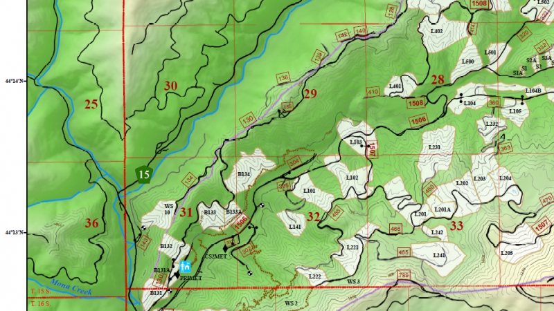
Road 1506 through the H.J. Andrews Experimental Forest will be closed for repair at mile post 4 beginning September 18th. Repair of the 1506 road at the landslide just west of spur road 320 will require a complete closure for a period of up to one month. The lower 3.6 miles of 1506 will remain open, as will the portion east of the 320 road junction. This affects access to the Lookout Creek Old Growth trail and the Carpenter Mountain Lookout trail. The recommended alternative route to access the upper elevations of the Andrews Forest is road 15 to the junction with 1506 ca. 1 mile east of Wolf Rock. This route is not considered viable for sedans or other low clearance vehicles and can receive snow as early as October. For those planning to visit the Andrews Forest during this period who are not familiar with the road system within the Andrews, please refer to our Forest map: https://andrewsforest.oregonstate.edu/data/map. Note that this map does not cover the Wolf Rock area, so the full alternative route is not visible on the map. A reference map of the alternate route can be found in the front office of Andrews Headquarters. We recommend that visitors planning to use the alternate route invest in the McKenzie River Ranger District Motor Vehicle Use Map available online or for purchase at the Ranger Station or Supervisor’s Office: https://www.fs.usda.gov/detail/willamette/maps-pubs/?cid=stelprdb5166883.