Solar Radiation Model (SOLARRAD)
This model estimates the solar radiation input to a site based on its latitude, elevation, aspect, slope, and cloud cover. The effects of topographic shading are not included in this version of these programs. The first program, SolarRad, is used for a single location. The second program, SolarImg, is used for a multiple locations in a grid . Both programs are coded in C and can be used either in a DOS or a UNIX environment.
These programs have several potential uses. The first is to supply estimates of solar radiation required to run simulation models (Urban 1993, Harmon et al. internal report). The second is to combine with other climatic data such as temperature to estimate other climatic variables such as Potential Evapotranspiration (Jensen and Haise 1963). The sun angle data can also be used to determine the effect of topographic shading, the passage of light through canopies (Urban 1993) or the effects of one patch of trees on another (Harmon et al internal report).
Full documentation and source code is available on line.
- Citation:
- Harmon, Mark E.; Marks, Barbara J. 1995. Programs to Estimate the Solar Radiation for Ecosystem Models. Department of Forest Science, Oregon State University. Internal web report. 15p (Pub No: 4979).
Sample products:
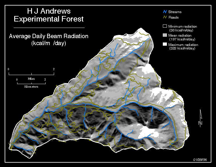
Average Daily Beam Radiation
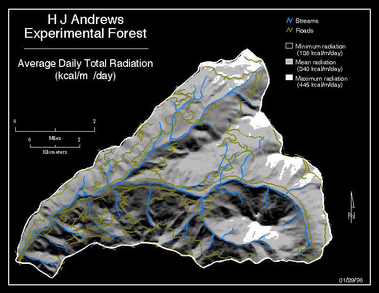
Average Daily Total Radiation