
Image Search
| Thumbnail | Media name | Gallery | Keyword Tags | Caption | Photographed date Sort ascending |
|---|---|---|---|---|---|
|
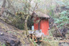
aeu_075.jpg | Holiday Farm Fire September 2020 | Watershed 9 gage house with tree fallen on it, steps and footbridge damaged by fire. |
||
|
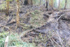
aeu_060.jpg | Holiday Farm Fire September 2020 | Remains of steps and electrical conduit in Watershed 1 |
||
|
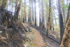
aeu_059.jpg | Holiday Farm Fire September 2020 | WS1 trail on north-facing slope |
||
|
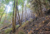
aeu_058.jpg | Holiday Farm Fire September 2020 | North-facing slope of Watershed 1 |
||
|
aeu_057.jpg | Holiday Farm Fire September 2020 | Looking up to the north-facing slope of Watershed 1. Note smoldering areas. Many of the trees on the ground came down in the 2019 snowdown event. Large stump is visible in historic photos of WS1 post-logging |
||
|
aeu_056.jpg | Holiday Farm Fire September 2020 | Looking down Watershed 1 towards gaging station from tower site. The fire burned on both slopes but did not burn the moist riparian area. Destroyed WS1 tower pieces in foreground. |
||
|
aeu_055.jpg | Holiday Farm Fire September 2020 | Looking up Watershed 1. The fire burned on both slopes but did not burn the moist riparian area |
||
|
aeu_054.jpg | Holiday Farm Fire September 2020 | Charred, south-facing slope of Watershed 1 |
||
|
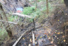
aeu_053.jpg | Holiday Farm Fire September 2020 | Looking down into Watershed 1, over the charred remains of the wooden steps and railing. The WS1 tower is in pieces. Hillside of south-facing slope is charred. |
||
|
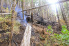
aeu_052.jpg | Holiday Farm Fire September 2020 | smoldering log, slope along road to Watershed 1 landing |
||
|
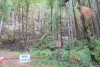
aeu_051.jpg | Holiday Farm Fire September 2020 | burned area, base of slope at road entrance to Watershed 1 landings |
||
|
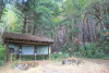
aeu_050.jpg | Holiday Farm Fire September 2020 | Andrews Forest information kiosk at the junction of the 15 and 1506 roads, with burned slope |
||
|
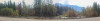
aeu_106.jpg | Holiday Farm Fire September 2020 | Looking across the McKenzie River from the 15 Road - HWY 126 junction |
||
|
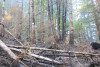
aeu_066.jpg | Holiday Farm Fire September 2020 | Phenology Core Site 1, on the north-facing slope of Watershed 1. Tree tags and dendrometer bands in the background. |
||
|
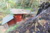
aeu_061.jpg | Holiday Farm Fire September 2020 | Watershed 1 gage house. Fire burned right up to its base. |
||
|
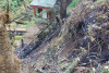
aeu_062.jpg | Holiday Farm Fire September 2020 | Watershed 1 gage house and weir in background, charred conduit on hillslope in foreground |
||
|
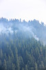
aeu_094.jpg | Holiday Farm Fire September 2020 | Smoke from hot spots of fire in Watershed 2 |
||
|
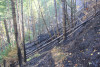
aeu_074.jpg | Holiday Farm Fire September 2020 | Photo of the north-facing slope of Watershed 1 |
||
|
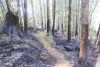
aeu_073.jpg | Holiday Farm Fire September 2020 | Trail in WS1, north-facing slope. Burned area described as having "ash up to the ankles" |
||
|
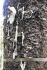
aeu_072.jpg | Holiday Farm Fire September 2020 | Melted tree label, intact aluminum tree tag, and dendrometer band. PC01 |
||
|
aeu_104.jpg | Holiday Farm Fire September 2020 | Area of high severity fire, along the 15 road (outside of the Andrews Forest), close to the junction with HWY126 |
||
|
aeu_070.jpg | Holiday Farm Fire September 2020 | Phenology Core Site 1, on the north-facing slope of Watershed 1. Tree tags and dendrometer bands in the background. |
||
|
aeu_069.jpg | Holiday Farm Fire September 2020 | Patchy burns in Phenology Core Site 1 (PC01) |
||
|
aeu_068.jpg | Holiday Farm Fire September 2020 | Patchy burns in Phenology Core Site 1 (PC01), Marked VAPA plant was top killed by heat but not burned over |
||
|
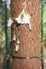
aeu_067.jpg | Holiday Farm Fire September 2020 | Melted tree label, intact aluminum tree tag, and dendrometer band. PC01 |
||
|
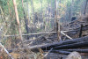
aeu_065.jpg | Holiday Farm Fire September 2020 | Looking down into the base of Watershed 1, from the north-facing hillslope |
||
|
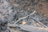
aeu_064.jpg | Holiday Farm Fire September 2020 | Melted remains of what was a fiberglass pole with a hobo temperature sensor on top, one of the 186 distributed temperature stations across the HJA |
||
|
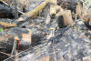
aeu_063.jpg | Holiday Farm Fire September 2020 | Charred remains of the powerline from the landing to the Watershed 1 gage house. |
||
|
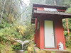
aeu_049.jpg | Holiday Farm Fire September 2020 | Watershed 2 gage house. Fire was in upper Watershed 2 but the fire had not reached the gage house |
||
|
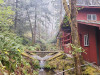
aeu_029.jpg | Holiday Farm Fire September 2020 | Weir and gage house of Watershed 1 |
||
|
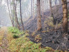
aeu_008.jpg | Holiday Farm Fire September 2020 | Looking up toward the Watershed 1 landing with burned area upslope |
||
|
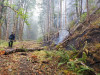
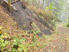
aeu_020.jpg | Holiday Farm Fire September 2020 | Fire in slope of Watershed 1, along access road |
||
|
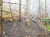
aeu_021.jpg | Holiday Farm Fire September 2020 | Fire in slope of Watershed 1, along access road |
||
|
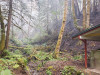
aeu_024.jpg | Holiday Farm Fire September 2020 | Fire on slope of Watershed 1 |
||
|
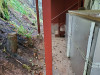
aeu_025.jpg | Holiday Farm Fire September 2020 | Looking up slope from the Watershed 1 gage house, fire damage on south slope to the right |
||
|
aeu_026.jpg | Holiday Farm Fire September 2020 | Fire damage next to the gage house of Watershed 1, mesocosm insulation intact |
||
|
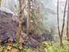
aeu_027.jpg | Holiday Farm Fire September 2020 | Active fire on south slope of Watershed 1 with sediment basin in bottom right view |
||
|
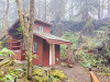
aeu_028.jpg | Holiday Farm Fire September 2020 | Gage house of Watershed 1 with fire activity on adjacent slope |
||
|
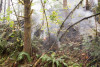
aeu_023.jpg | Holiday Farm Fire September 2020 | Fire on slope of Watershed 1 |
||
|
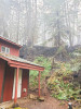
aeu_030.jpg | Holiday Farm Fire September 2020 | Gage house of Watershed 1 with fire activity on adjacent slope |
||
|
aeu_006.jpg | Holiday Farm Fire September 2020 | Fire line and sprinker set up behind apartment buildings at headquarters |
||
|
aeu_019.jpg | Holiday Farm Fire September 2020 | Fire in slope of Watershed 1, along access road |
||
|
aeu_018.jpg | Holiday Farm Fire September 2020 | Fire resource advisors in Watershed 1 landing area |
||
|
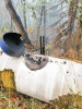
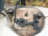
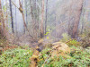
aeu_010.jpg | Holiday Farm Fire September 2020 | Propane tank at Watershed 1 landing, with fire damage |
||
|
aeu_011.jpg | Holiday Farm Fire September 2020 | Propane tank at Watershed 1 landing, with fire damage |
||
|
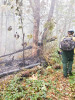
aeu_012.jpg | Holiday Farm Fire September 2020 | Fire in Watershed 1 landing area |
||
|
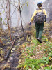
aeu_013.jpg | Holiday Farm Fire September 2020 | Fire resource advisors in Watershed 1 landing area |
||
|
aeu_014.jpg | Holiday Farm Fire September 2020 | Fire resource advisors in Watershed 1 landing area |
||
|
aeu_015.jpg | Holiday Farm Fire September 2020 | Fire resource advisors in Watershed 1 landing area |
||
|
aeu_016.jpg | Holiday Farm Fire September 2020 | Fire resource advisors in Watershed 1 landing area |
||
|
aeu_007.jpg | Holiday Farm Fire September 2020 | Fire line and sprinker set up behind apartment buildings at headquarters |
||
|
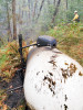
aeu_009.jpg | Holiday Farm Fire September 2020 | Propane tank at Watershed 1 landing, with fire damage |
||
|
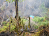
aeu_017.jpg | Holiday Farm Fire September 2020 | Looking down into Watershed 1, from the top of the (once) wooden stairs leading down to the tower shed, now covered in blue tarp. Both the north and south slopes burned. |
||
|
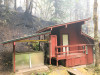
aeu_031.jpg | Holiday Farm Fire September 2020 | Gage house of Watershed 1 with fire activity on adjacent slope |
||
|
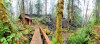
aeu_032.jpg | Holiday Farm Fire September 2020 | Panoramic view of Watershed 1 sediment basin with active fire on south/far slope |
||
|
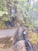
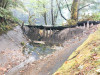
aeu_043.jpg | Holiday Farm Fire September 2020 | Active fire and burned sediment basin dam in Watershed 9 |
||
|
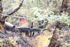
aeu_044.jpg | Holiday Farm Fire September 2020 | Burned dam in the sediment basin of Watershed 9 |
||
|
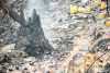
aeu_045.jpg | Holiday Farm Fire September 2020 | Burned dam in the sediment basin of Watershed 9, with gage house in background |
||
|
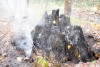
aeu_046.jpg | Holiday Farm Fire September 2020 | Charred tree stump and exposed soil, Watershed 9 |
||
|
aeu_047.jpg | Holiday Farm Fire September 2020 | Charred tree stump and exposed soil, Watershed 9 |
||
|
aeu_048.jpg | Holiday Farm Fire September 2020 | Watershed 10 gage house, not in fire boundary |
||
|
aeu_004.jpg | Holiday Farm Fire September 2020 | Fire line around PRIMET station |
||
|
aeu_003.jpg | Holiday Farm Fire September 2020 | Andrews Forest Headquarters |
||
|
aeu_002.jpg | Holiday Farm Fire September 2020 | Looking west across the Mona Bridge, over Blue River |
||
|
aeu_001.jpg | Holiday Farm Fire September 2020 | Smoke above the Blue River Reservoir, looking south |
||
|
aeu_022.jpg | Holiday Farm Fire September 2020 | Disturbance | Fire along slope of Watershed 1 |
|
|
aeu_042.jpg | Holiday Farm Fire September 2020 | Greg Downing collects a water sample from the Watershed 9 weir |
||
|
aeu_037.jpg | Holiday Farm Fire September 2020 | Active fire in Watershed 1 |
||
|
aeu_005.jpg | Holiday Farm Fire September 2020 | Fire hose and fire line at Headquarters |
||
|
aeu_033.jpg | Holiday Farm Fire September 2020 | closer view of damaged bypass hose between gage house and sediment basin of Watershed 1 |
||
|
aeu_034.jpg | Holiday Farm Fire September 2020 | Panoramic view of Watershed 1 sediment basin with active fire on south/far slope |
||
|
aeu_035.jpg | Holiday Farm Fire September 2020 | View of Watershed 1 sediment basin with active fire on south/far slope |
||
|
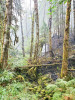
aeu_036.jpg | Holiday Farm Fire September 2020 | Active fire in Watershed 1 |
||
|
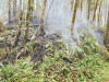
aeu_038.jpg | Holiday Farm Fire September 2020 | Active fire in Watershed 1 |
||
|
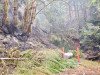
aeu_039.jpg | Holiday Farm Fire September 2020 | Watershed 9 gage house with fire damage and downed tree over gage house |
||
|
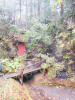
aeu_040.jpg | Holiday Farm Fire September 2020 | Watershed 9 gage house with fire damage to footbridge and downed tree over gage house. Fire activity just adjacent. |
||
|
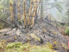
aeu_041.jpg | Holiday Farm Fire September 2020 | Fire damage on slope of Watershed 9 |
||
|
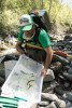
aes_043.jpg | Lookout Creek Sampling 2019 | Ivan Arismendi looks at several cutthroat trout caught in a reach of Lookout Creek. |
||
|
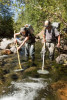
aes_002.jpg | Lookout Creek Sampling 2019 | Stream Ecology | Dave Leer (CreekWalker Photography) and OSU undergraduate student Rylee Rawson electroshocking to sample fish and salamanders. The animals are captured, measured, and released back into their original location. |
|
|
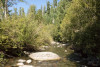
aes_001.jpg | Lookout Creek Sampling 2019 | Stream Ecology, Hydrology | Mainstem Lookout Creek, below the confluence with McRae Creek, in the HJ Andrews Experimental Forest |
|
|
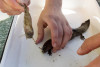
aes_023.jpg | Lookout Creek Sampling 2019 | Stream Ecology | This coastal giant salamander had a large fish, a sculpin, in its stomach. The fish came out during the gastric lavage procedure. |
|
|
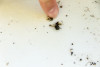
aes_017.jpg | Lookout Creek Sampling 2019 | Gut content of a trout included a yellow jacket, complete with stinger |
||
|
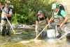
aes_033.jpg | Lookout Creek Sampling 2019 | Dave Leer, Rylee Rawson, and Ivan Arismendi electroshocking for fish and salamanders |
||
|
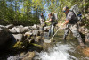
aes_003.jpg | Lookout Creek Sampling 2019 | Najma Ain, Rylee Rawson, and Dave Leer electroshocking in Lookout Creek |
||
|
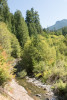
aes_049.jpg | Lookout Creek Sampling 2019 | Mainstem Lookout Creek, below the confluence with McRae Creek, in the HJ Andrews Experimental Forest |
||
|
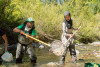
aes_035.jpg | Lookout Creek Sampling 2019 | Ivan Arismendi, left, and undergraduate stduent Najma Ain, catch fish in Lookout Creek |
||
|
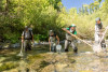
aes_034.jpg | Lookout Creek Sampling 2019 | Electroshocking in Lookout Creek |
||
|
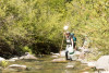
aes_032.jpg | Lookout Creek Sampling 2019 | Rylee Rawson, an undergraduate field technician, helps with sampling |
||
|
aes_031.jpg | Lookout Creek Sampling 2019 | The rocks in the stream were covered in algal growth |
||
|
aes_030.jpg | Lookout Creek Sampling 2019 | The pool behind this rock was home to a very large cutthroat trout |
||
|
aes_029.jpg | Lookout Creek Sampling 2019 | Electroshocking in Lookout Creek |
||
|
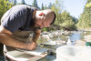
aes_028.jpg | Lookout Creek Sampling 2019 | A very large cutthroat trout |
||
|
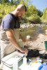
aes_027.jpg | Lookout Creek Sampling 2019 | Theo Nuss recording data |
||
|
aes_026.jpg | Lookout Creek Sampling 2019 | Stream Ecology | OSU undergraduate student Theo Nuss readies the sampling equipment |
|
|
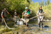
aes_036.jpg | Lookout Creek Sampling 2019 | Dave Leer, Rylee Rawson, Ivan Arismendi, and Najma Ain, electroshocking for fish and salamanders |
||
|
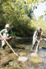
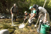
aes_037.jpg | Lookout Creek Sampling 2019 | Ivan Arismendi, left, and undergraduate stduent Najma Ain, catch fish in Lookout Creek |
||
|
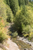
aes_038.jpg | Lookout Creek Sampling 2019 | Dave Leer, Rylee Rawson, Ivan Arismendi, and Najma Ain, electroshocking for fish and salamanders |
||
|
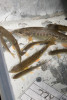
aes_048.jpg | Lookout Creek Sampling 2019 | Mainstem Lookout Creek, below the confluence with McRae Creek, in the HJ Andrews Experimental Forest. In the photo are two field technicians who are sampling gut content of fish and salamanders. |
||
|
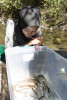
aes_047.jpg | Lookout Creek Sampling 2019 | Cutthroat trout |
||
|
aes_046.jpg | Lookout Creek Sampling 2019 | Undergraduate student, Najma Ain, looks into a tub containing cutthroat trout of various sized. Researchers count and photograph the fish and return them to the stream. |
||
|
aes_045.jpg | Lookout Creek Sampling 2019 | Each sample group of fish is photographed, with an identification card, and a ruler. Later, researchers use the ruler and special software to calculate the length of each fish in the photograph. |
||
|
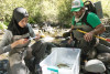
aes_044.jpg | Lookout Creek Sampling 2019 | Each sample group of fish is photographed, with an identification card, and a ruler. Later, researchers use the ruler and special software to calculate the length of each fish in the photograph. |
||
|
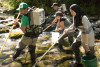
aes_042.jpg | Lookout Creek Sampling 2019 | Undergraduate student Najma Ain, left, prepares a data card for the fish sample |
||
|
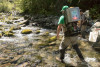
aes_041.jpg | Lookout Creek Sampling 2019 | Stream Ecology | Ivan Arismendi (Assistant Professor, OSU) with Dave Leer (CreekWalker Photography) and OSU undergraduate students Najma Ain and Rylee Rawson electroshocking for fish and salamanders in Lookout Creek. |
|
|
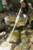
aes_040.jpg | Lookout Creek Sampling 2019 | Ivan Arismendi electroshocking for fish and salamanders in Lookout Creek |
||
|
aes_039.jpg | Lookout Creek Sampling 2019 | Undergraduate student Najma Ain, using a net to capture fish in Lookout Creek |
||
|
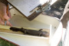
aes_025.jpg | Lookout Creek Sampling 2019 | Stream Ecology | A coastal giant salamander being measured for length in the left bin, and the sculpin that was in the salamander's gut in the right bin |
|
|
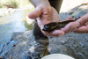
aes_024.jpg | Lookout Creek Sampling 2019 | Stream Ecology | Coastal giant salamander being measured for length |
|
|
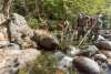
aes_010.jpg | Lookout Creek Sampling 2019 | Stream Ecology | Coastal giant salamander |
|
|
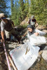
aes_005.jpg | Lookout Creek Sampling 2019 | Stream Ecology | Dave Leer, Najma Ain, and Rylee Rawson electroshocking in Lookout Creek |
|
|
aes_006.jpg | Lookout Creek Sampling 2019 | Stream Ecology | Fish and salamanders are collected into a temporary bin where they are measured before being released back into the stream. |
|
|
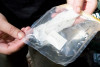
aes_012.jpg | Lookout Creek Sampling 2019 | close up of a sample bag containing gut contents from a cutthroat trout |
||
|
aes_007.jpg | Lookout Creek Sampling 2019 | Fish and salamanders are collected into a temporary bin where they are measured before being released back into the stream. |
||
|
aes_008.jpg | Lookout Creek Sampling 2019 | Dave Leer, Najma Ain, and Rylee Rawson survey the fish and salamanders |
||
|
aes_009.jpg | Lookout Creek Sampling 2019 | Stream Ecology | Coastal giant salamander, underside |
|
|
aes_011.jpg | Lookout Creek Sampling 2019 | Gwen Bury displays a sample bag containing gut contents of a cutthroat trout |
||
|
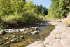
aes_013.jpg | Lookout Creek Sampling 2019 | Mainstem Lookout Creek, below the confluence with McRae Creek, in the HJ Andrews Experimental Forest |
||
|
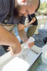
aes_014.jpg | Lookout Creek Sampling 2019 | Theo Nuss washes out the gut contents of a cutthroat trout by gastric lavage |
||
|
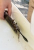
aes_022.jpg | Lookout Creek Sampling 2019 | Stream Ecology | This coastal giant salamander had a large fish, a sculpin, in its stomach. The fish came out during the gastric lavage procedure. |
|

|
aes_021.jpg | Lookout Creek Sampling 2019 | Stream Ecology | OSU post-doc Gwen bury with a coastal giant salamander. |
|
|
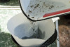
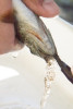
aes_020.jpg | Lookout Creek Sampling 2019 | Gut content is put through a coffee filter and the entire filter is kept to analyze all particulates later |
||
|
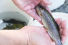
aes_019.jpg | Lookout Creek Sampling 2019 | A cutthroat trout having its gut contents washed out with a stream of water. The procedure is not harmful and the trout is released back into the stream afterwards. |
||
|
aes_018.jpg | Lookout Creek Sampling 2019 | A cutthroat trout |
||

|
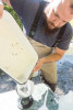
aes_016.jpg | Lookout Creek Sampling 2019 | Gwen Bury records data on length of a cutthroat trout |
||
|
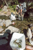
aes_015.jpg | Lookout Creek Sampling 2019 | After a gastric lavage, the gut contents are put through a coffee filter, to catch the particulates. The entire filter is saved in a sample bag for later analysis. |
||
|
aes_004.jpg | Lookout Creek Sampling 2019 | Stream Ecology | Dave Leer, Najma Ain, and Rylee Rawson electroshocking for fish and salamanders in Lookout Creek. The bucket in the foreground has cutthtroat trout. |
|
|
aes_055.jpg | Lookout Creek Sampling 2019 | Stream Ecology | A photo of McRae Creek, close to its confluence with larger Lookout Creek. |
|
|
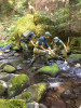
aes_054.jpg | Lookout Creek Sampling 2019 | Stream Ecology | OSU graduate students Emilee Mowlds and Francisco Pickens with undergraduate student Erik Swanson electrofishing for stream vertebrates in upper Lookout Creek. |
|
|
aes_053.jpg | Lookout Creek Sampling 2019 | Lower Lookout below the headquarters. |
||
|
aes_052.jpg | Lookout Creek Sampling 2019 | Lower Lookout below the headquarters. |
||
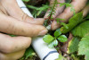
|
aer_045.jpg | Forests of Oregon Elevation Gradient (FOREG) 2019 | Wrapping a metal identification tag around the stem of a western red cedar seedling |
||
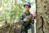
|
aer_055.jpg | Forests of Oregon Elevation Gradient (FOREG) 2019 | Emily Dewald-Wang holds a PVC pipe which is the target for the laser survey tool (total station). She calls out the species, size, and condition. The data are recorded into a tablet and then the tree's location is mapped with the total station laser. |
||
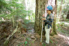
|
aer_053.jpg | Forests of Oregon Elevation Gradient (FOREG) 2019 | Emily Dewald-Wang holds a PVC pipe which is the target for the laser survey tool (total station). She calls out the species, size, and condition. The data are recorded into a tablet and then the tree's location is mapped with the total station laser. |
||
|
aer_051.jpg | Forests of Oregon Elevation Gradient (FOREG) 2019 | A 1m square plot within the larger plot FOREG31 |
||
|
aer_005.jpg | Forests of Oregon Elevation Gradient (FOREG) 2019 | A plant marked with one of the metal identification bands |
||
|
aer_006.jpg | Forests of Oregon Elevation Gradient (FOREG) 2019 | Joseph LaManna, lead on the project, inspects plants within a 1m-square plot |
||
|
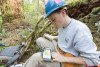
aer_007.jpg | Forests of Oregon Elevation Gradient (FOREG) 2019 | Liam Engel enters data into a tablet |
||
|
aer_008.jpg | Forests of Oregon Elevation Gradient (FOREG) 2019 | Matt Reala notes the measurement height on a PVC pipe that will be used with the survey tool to map trees |
||
|
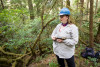
aer_010.jpg | Forests of Oregon Elevation Gradient (FOREG) 2019 | Maddie Sutton surveys vegetation within the plot |
||
|
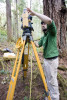
aer_011.jpg | Forests of Oregon Elevation Gradient (FOREG) 2019 | Joseph LaManna calibrates the laser survey tool (total station), which is used to map every stem larger than 1 cm diameter within the plot |
||
|
aer_012.jpg | Forests of Oregon Elevation Gradient (FOREG) 2019 | A view within plot FOREG02, which contains Reference Stand 2. |
||
|
aer_013.jpg | Forests of Oregon Elevation Gradient (FOREG) 2019 | A view within plot FOREG02, which contains Reference Stand 2. |
||
|
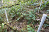
aer_014.jpg | Forests of Oregon Elevation Gradient (FOREG) 2019 | Within each larger plot there are a series of 1m-square plots within which every stem is inventoried and recorded and within which all herbaceous plants are surveyed |
||
|
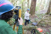
aer_015.jpg | Forests of Oregon Elevation Gradient (FOREG) 2019 | Joseph LaManna (left) and Maddie Sutton (right) measure and record data on plant size and location |
||
|
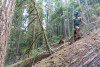
aer_016.jpg | Forests of Oregon Elevation Gradient (FOREG) 2019 | Matt Reala climbs through the plot and notes size, condition, and location of each stem >1cm in diameter |
||
|
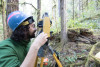
aer_017.jpg | Forests of Oregon Elevation Gradient (FOREG) 2019 | Joseph LaManna uses a laser survey tool (total station) to precisely map exact locations of stems within a plot |
||
|
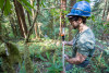
aer_018.jpg | Forests of Oregon Elevation Gradient (FOREG) 2019 | Matt Reala holds a PVC pipe with reflective target and rod level, used as the target for the laser survey tool (total station) in mapping stem distance and location |
||
|
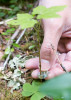
aer_004.jpg | Forests of Oregon Elevation Gradient (FOREG) 2019 | One of the numbered metal identification bands used to mark any woody plants within each 1m-square plot |
||
|
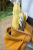
aer_003.jpg | Forests of Oregon Elevation Gradient (FOREG) 2019 | Tools of the trade |
||
|
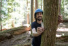
aer_052.jpg | Forests of Oregon Elevation Gradient (FOREG) 2019 | Joseph LaManna notes that trees can have two tags where the new FOREG plots and the old Reference Stands overlap. The two studies are planned to dovetail and complement each other (e.g. measurements will be taken at both nails in future years). |