
A three-level hydro-climatological network for data monitoring was established in 1994. The networks at each level are nested to form a coordinated program of data acquisition and measurement. The first-level in this top-down approach consists of Benchmark Meteorological Stations (BMS). The BMS are designed to represent the environment across the H.J. Andrews Experimental Forest. These stations are intended to provide complete, long-term, high temporal resolution, meso-scale hydroclimatological data. The location of the BMS network is based on factors such as elevation, aspect, vegetation gradients, and accessibility. Collected meteorological parameters are generally standardized across the BMS as well as methods and instrumentation.
Real-time Meteorological Stations
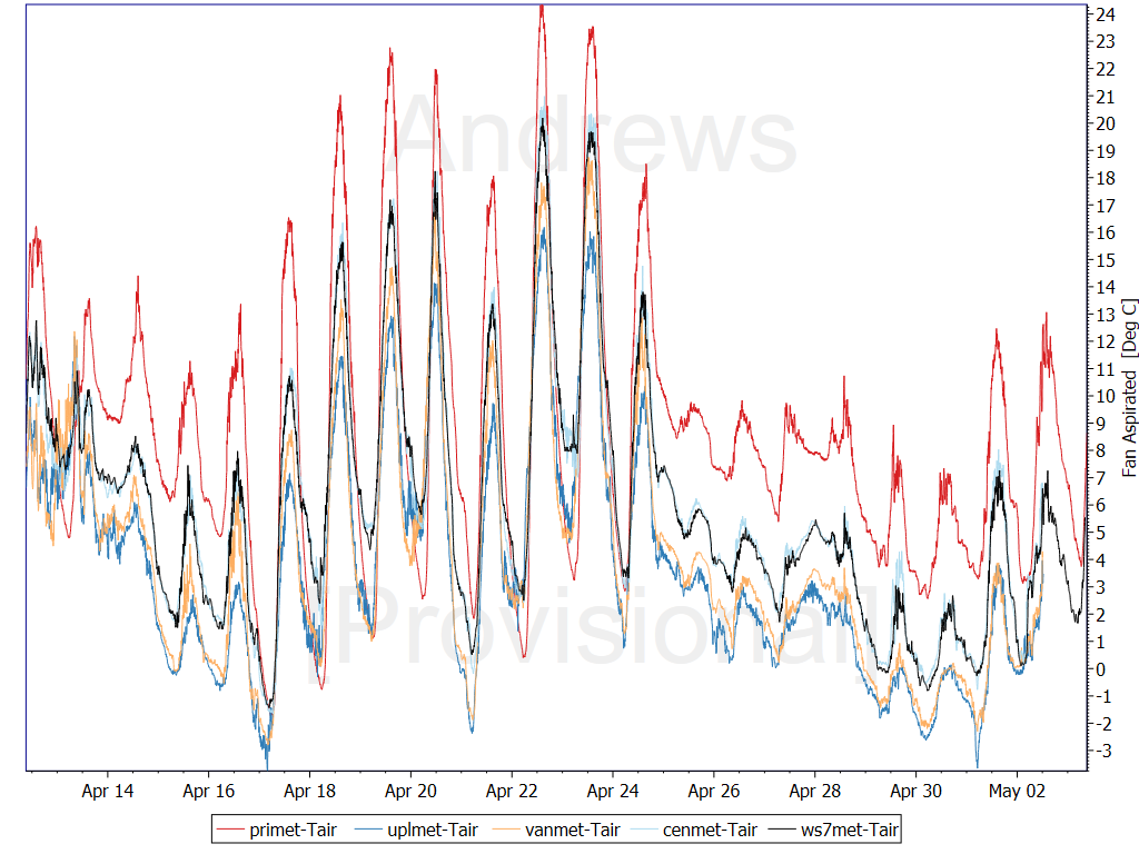
350cm Air Temperature (Fan-aspirated)
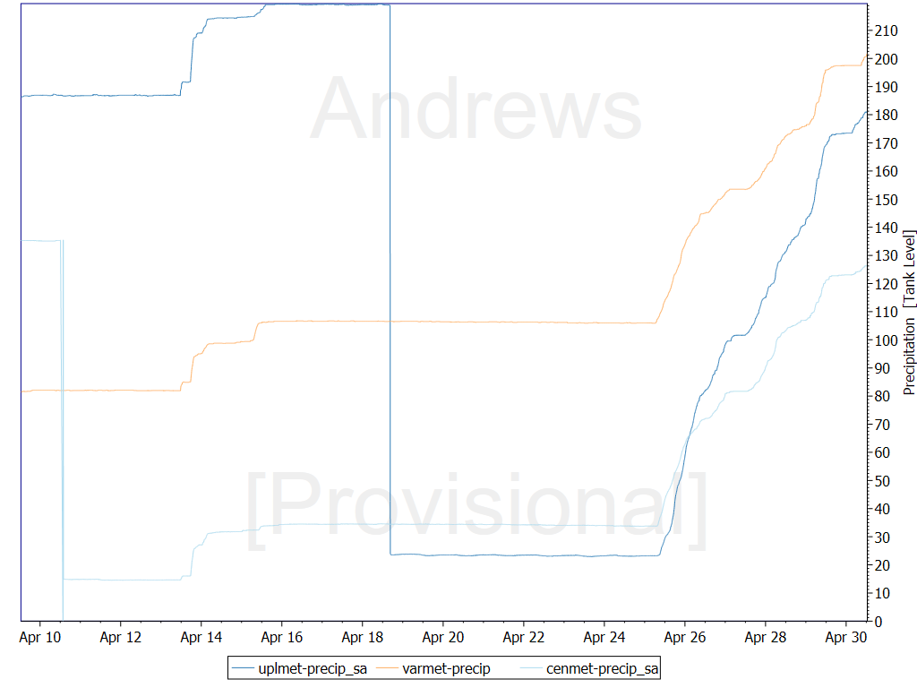
Precipitation (Stand-Alone)
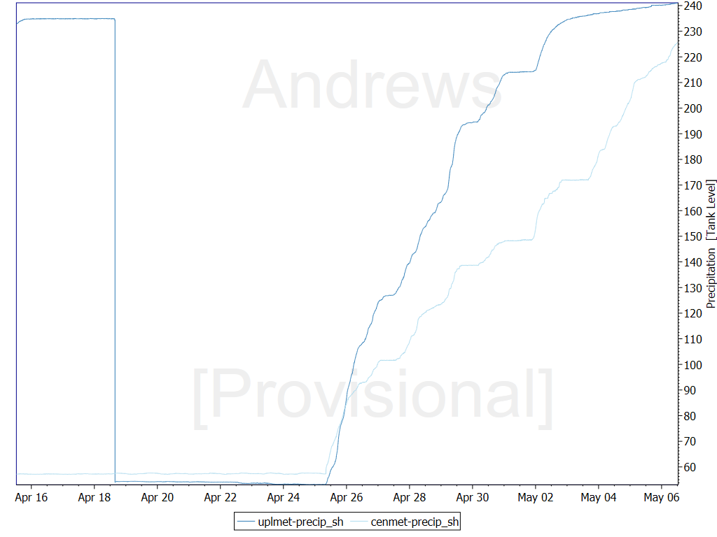
Precipitation (Shelter)
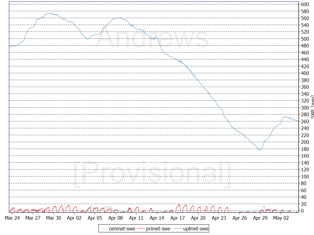
SWE
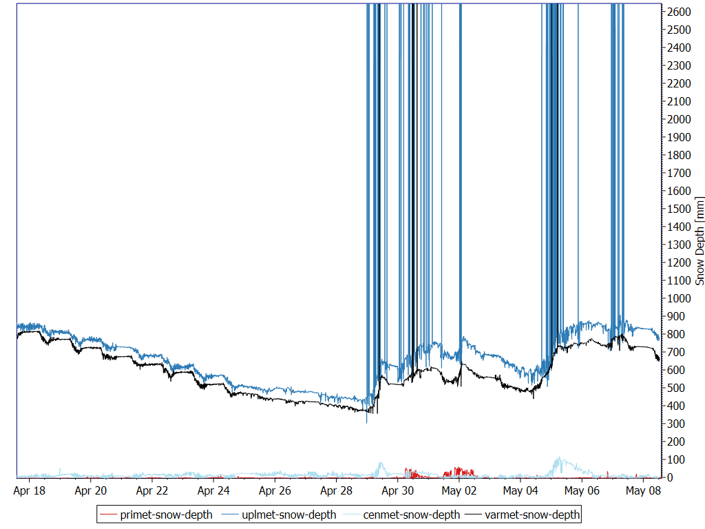
Snow Depth
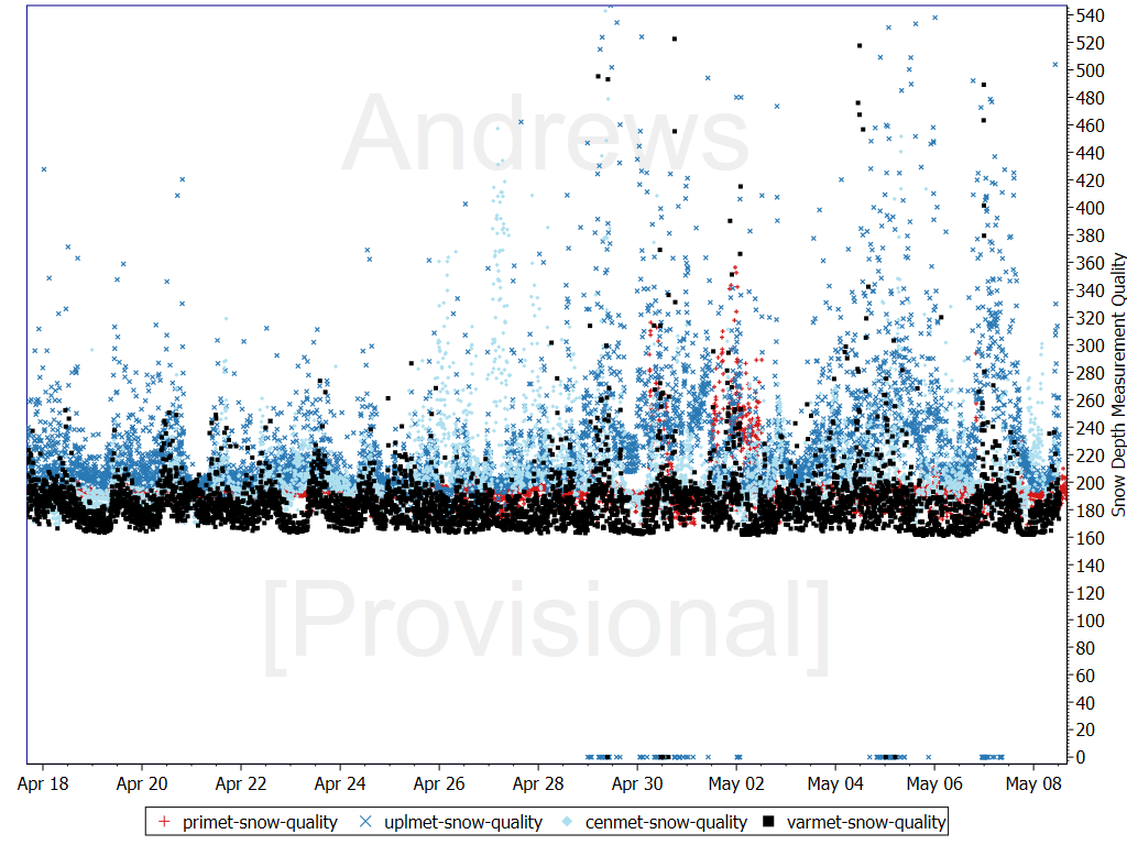
Snow Depth Measurement Quality
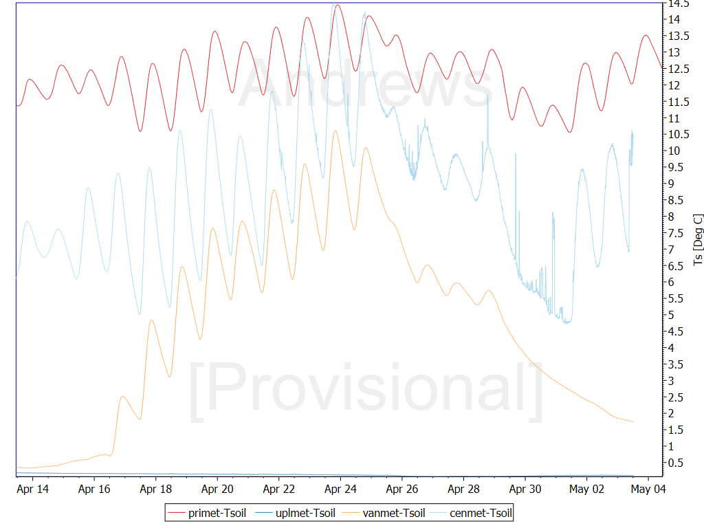
10cm Soil Temperature
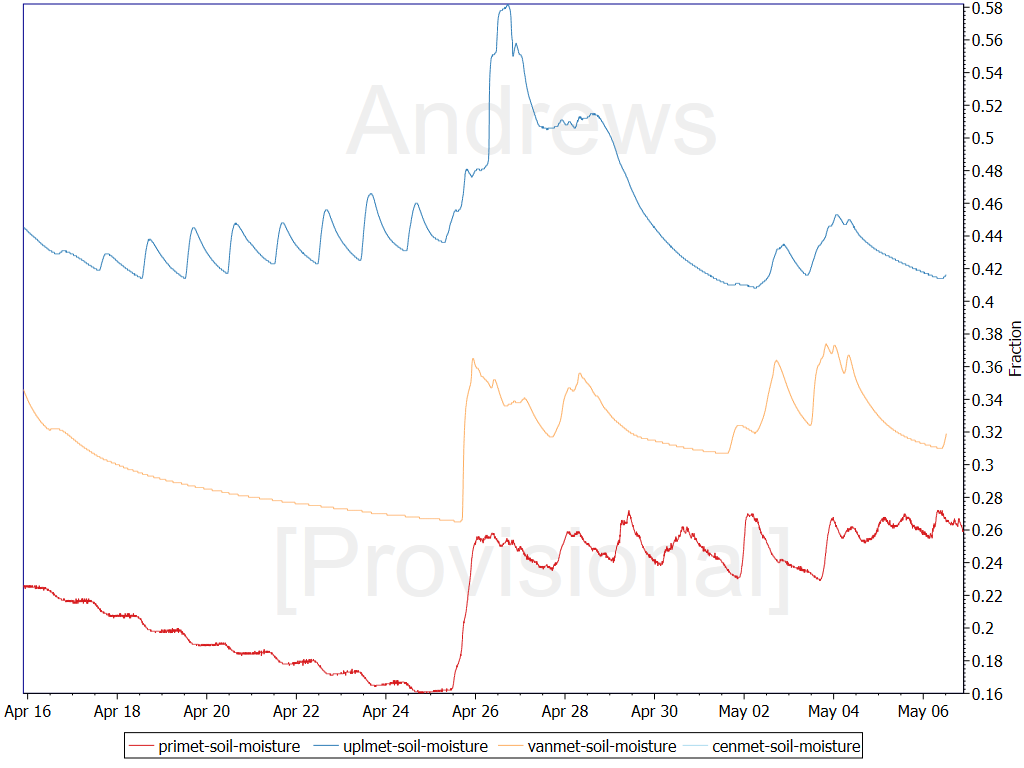
10cm Soil Moisture
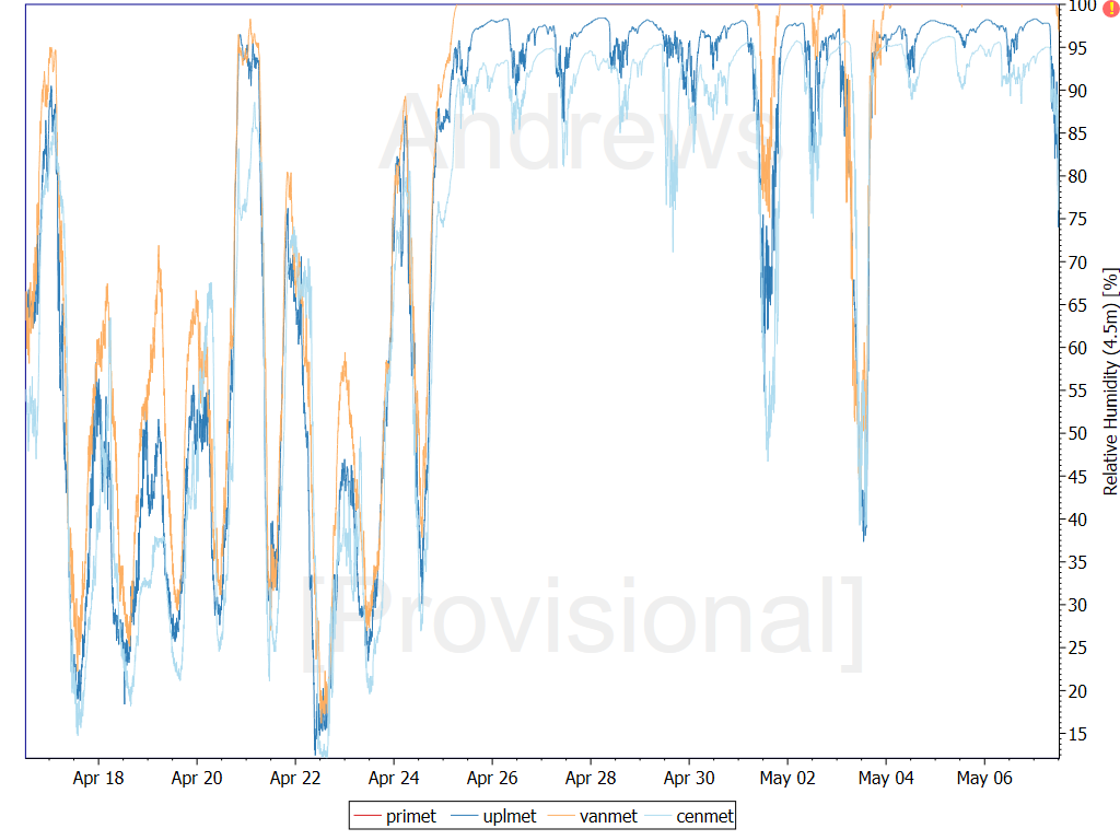
450cm Relative Humidity
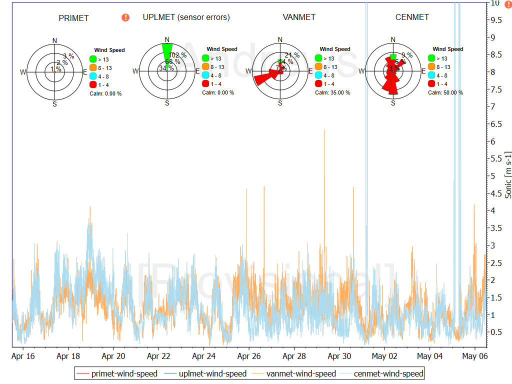
10m Sonic Wind Speed
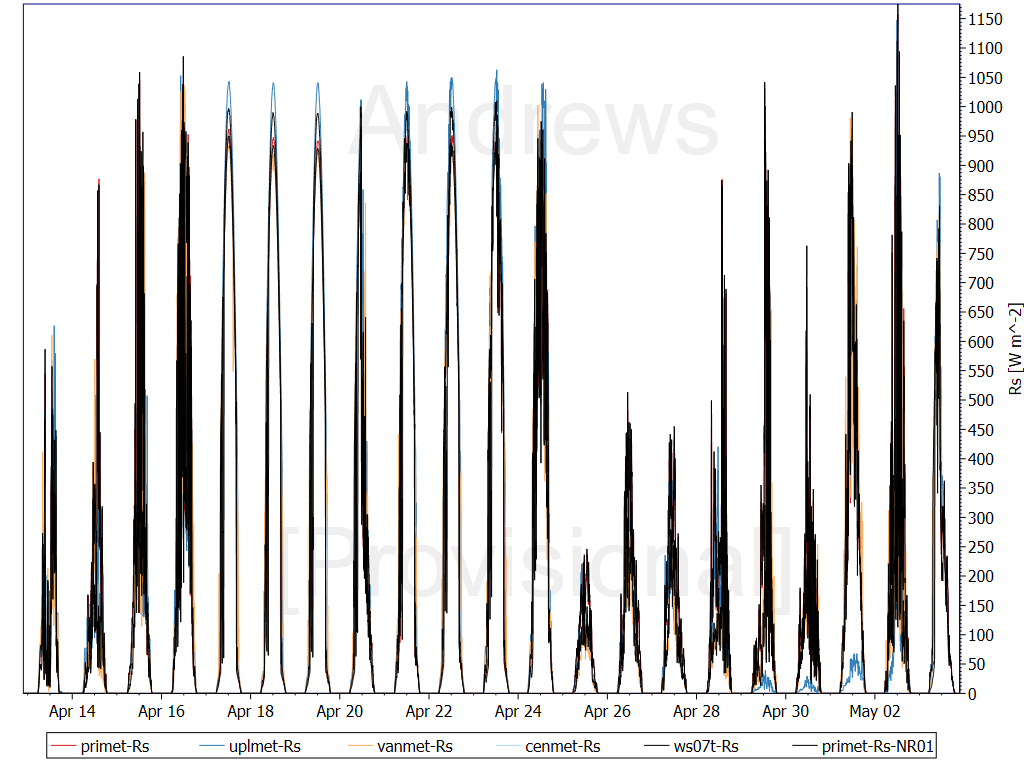
Solar Radiation
Caution: These are provisional real-time data that have not been quality checked! These data will change.