Home
Donate
  • Home
  • About the Forest
    • History
      • Human History
      • Program History
      • Lookout Fire Timeline 2023
    • Image Galleries
      • Image Search
    • Visit the Forest
    • Location & Directions
    • News and Events
    • Headquarters Facilities and Reservations
      • Reservations and Fees
    • Webcams
    • Fast Facts

    Recent News & Events

    New Book - Feathered Forest: Aloft with Birds in Ancient Trees
    Job opp in Hydrologic Research
    HJA and post-fire research featured on KLCC Radio
    View All
  • Research
    • Research Projects
    • Conducting Research
      • Safety and Use Procedures
      • Research Site Use Proposal
    • Research Infrastructure
      • Meteorological Stations
      • Experimental Watersheds and Gauging Stations
      • Permanent Vegetation Plots
      • Wireless Communication
    • Research Highlights

    Recent Research Highlight

    Lookout Fire 2023
    Low-intensity wildfire in old-growth forest
  • Data
    • Local Site Data Catalog
    • Andrews EDI Data Catalog
    • Real-Time Data
      • Provisional Data Portal
      • Meteorological Stations (elevation, meters)
        • Primary Met (430m)
        • Current Weather Summary
        • Central Met (1020m)
        • NADP-OR10 NOAHIV Precipitation; elev 430m
        • Upper Lookout Met (1295m)
        • Vanilla Leaf Met (1275m)
        • Vanilla Leaf Meadow (1315m)
        • Watershed 7 Tower (998m)
      • Stream Gauging Stations (watershed area, ha)
        • Watershed 1 (96ha)
        • Watershed 2 (60ha)
        • Watershed 3 (101ha)
        • Watershed 6 (13ha)
        • Watershed 7 (15ha)
        • Watershed 8 (21ha)
        • Watershed 9 (8.4ha)
        • Watershed 10 (10ha)
        • Mack Creek (1436ha)
        • Lookout Creek (6232ha)
      • Other Stations and Diagnostics
        • Discovery Tree Met
        • Stream Carbon Team
        • Met Station Diagnostics
        • Air Temp Scatter Plots
        • Stream Gauge Diagnostics
    • Submitting Data
    • Data Stewardship
      • Data Access Policy
      • Information Management
      • LTER Network Resources
    • Maps and Aerial Imagery
    • Acknowledgements

    See Real-Time Data

    Real-Time Data Menu

    • Provisional Data Portal
    • Meteorological Stations (elevation, meters)
      • Primary Met (430m)
      • Current Weather Summary
      • Central Met (1020m)
      • NADP-OR10 NOAHIV Precipitation; elev 430m
      • Upper Lookout Met (1295m)
      • Vanilla Leaf Met (1275m)
      • Vanilla Leaf Meadow (1315m)
      • Watershed 7 Tower (998m)
    • Stream Gauging Stations (watershed area, ha)
      • Watershed 1 (96ha)
      • Watershed 2 (60ha)
      • Watershed 3 (101ha)
      • Watershed 6 (13ha)
      • Watershed 7 (15ha)
      • Watershed 8 (21ha)
      • Watershed 9 (8.4ha)
      • Watershed 10 (10ha)
      • Mack Creek (1436ha)
      • Lookout Creek (6232ha)
    • Other Stations and Diagnostics
      • Discovery Tree Met
      • Stream Carbon Team
      • Met Station Diagnostics
      • Air Temp Scatter Plots
      • Stream Gauge Diagnostics
  • Publications
    • Access Zotero Library
    • Submit Publication
    • Newsletter

    Search Andrews Publications

  • Outreach
    • Research Management Partnership
    • Education
      • Grades K-12
      • Undergraduate
      • Graduate
      • Continuing Education
    • Arts and Humanities

    Our work benefits society through STEM education, public engagement, enhanced research infrastructure, and partnerships with federal land managers and local community organizations and landowners.

  • About Us
    Fire History Project 2026

    We are ecosystem scientists, students, educators, natural resource managers, writers, artists, musicians, and photographers.  Our mission is to support research on forests, streams, and watersheds, and to foster strong collaboration among ecosystem science, education, natural resource management, and the humanities.

    • Contacts
    • Opportunities
    • Personnel Directory
Donate

Main menu

  • Data
    • Local Site Data Catalog
    • Andrews EDI Data Catalog
    • Real-Time Data
      • Provisional Data Portal
      • Meteorological Stations (elevation, meters)
        • Primary Met (430m)
        • Current Weather Summary
        • Central Met (1020m)
        • NADP-OR10 NOAHIV Precipitation; elev 430m
        • Upper Lookout Met (1295m)
        • Vanilla Leaf Met (1275m)
        • Vanilla Leaf Meadow (1315m)
        • Watershed 7 Tower (998m)
      • Stream Gauging Stations (watershed area, ha)
        • Watershed 1 (96ha)
        • Watershed 2 (60ha)
        • Watershed 3 (101ha)
        • Watershed 6 (13ha)
        • Watershed 7 (15ha)
        • Watershed 8 (21ha)
        • Watershed 9 (8.4ha)
        • Watershed 10 (10ha)
        • Mack Creek (1436ha)
        • Lookout Creek (6232ha)
      • Other Stations and Diagnostics
        • Discovery Tree Met
        • Stream Carbon Team
        • Met Station Diagnostics
        • Air Temp Scatter Plots
        • Stream Gauge Diagnostics
    • Submitting Data
    • Data Stewardship
      • Data Access Policy
      • Information Management
      • LTER Network Resources
    • Maps and Aerial Imagery
    • Acknowledgements

Did You Find What You Needed?

We'd love to know how your experience with the Andrews Forest data catalog went - whether you found exactly what you were looking for or hit a dead end. Your feedback helps us improve data discovery and access.

Share Your Feedback

Breadcrumb

  1. Data
  2. Real-Time Data
  3. Meteorological Stations (elevation, meters)

Central Meteorological Station (CENMET); elev 1020m

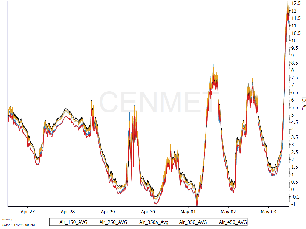
Air Temperature

Air temperature at Central Met, © HJ Andrews, LTER (AND), OSU

Precipitation

Precipitation at Central Met, © HJ Andrews, LTER (AND), OSU

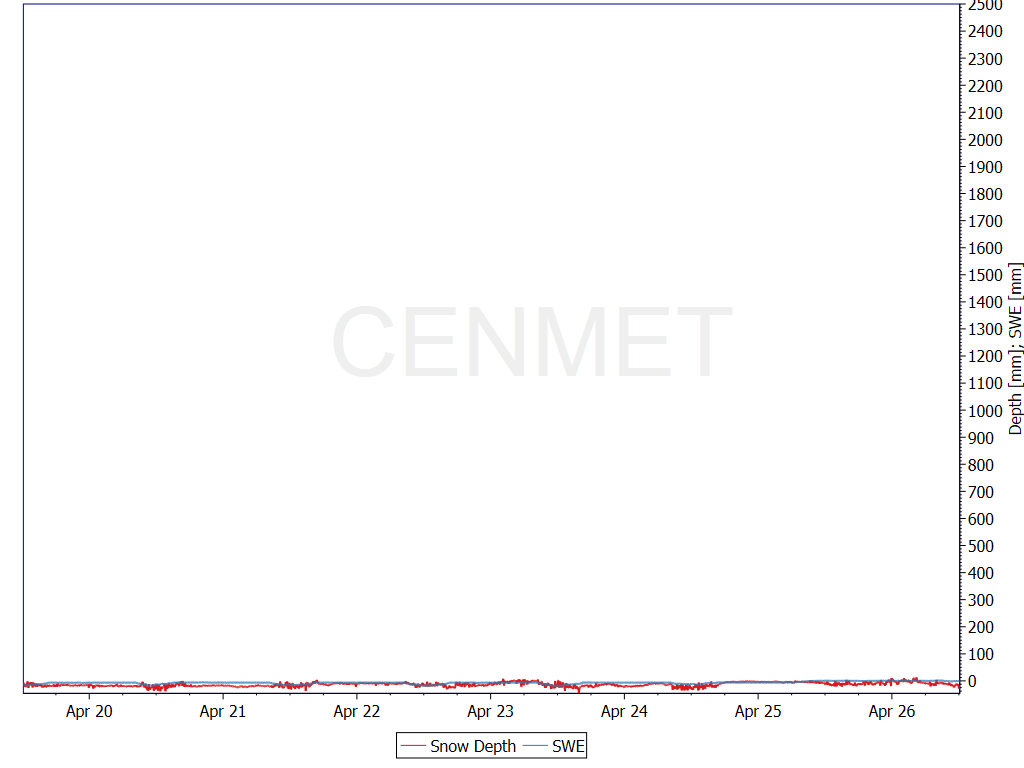
SWE/Depth

SWE and snow depth at Central Met, © HJ Andrews, LTER (AND), OSU

Soil Temperature

Soil temperature at Central Met, © HJ Andrews, LTER (AND), OSU

Soil Moisture

Soil moisture at Central Met, © HJ Andrews, LTER (AND), OSU

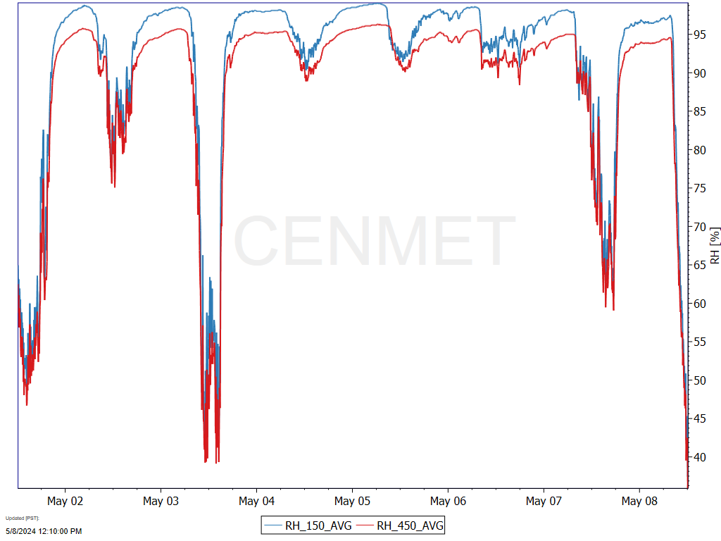
Relative Humidity

Relative humidity at Central Met, © HJ Andrews, LTER (AND), OSU

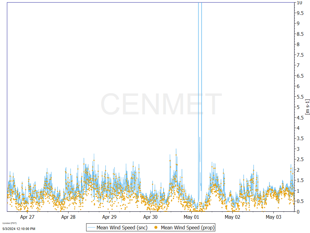
Wind Speed

Wind speed at Central Met, © HJ Andrews, LTER (AND), OSU

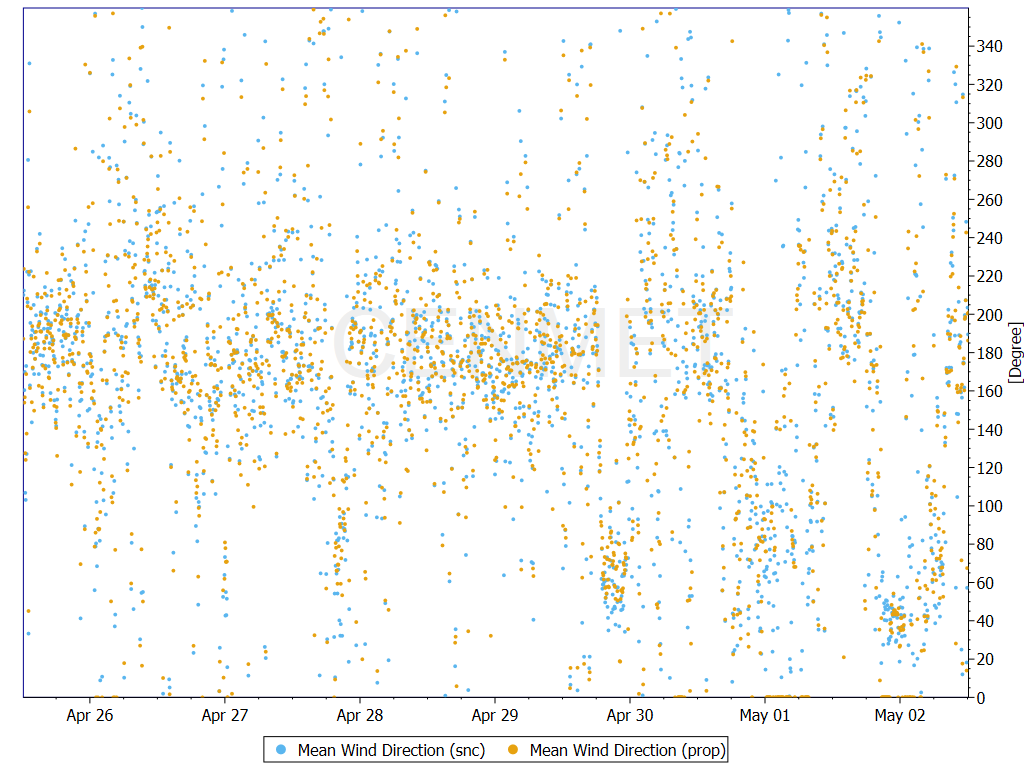
Wind Direction

Wind direction at Central Met, © HJ Andrews, LTER (AND), OSU

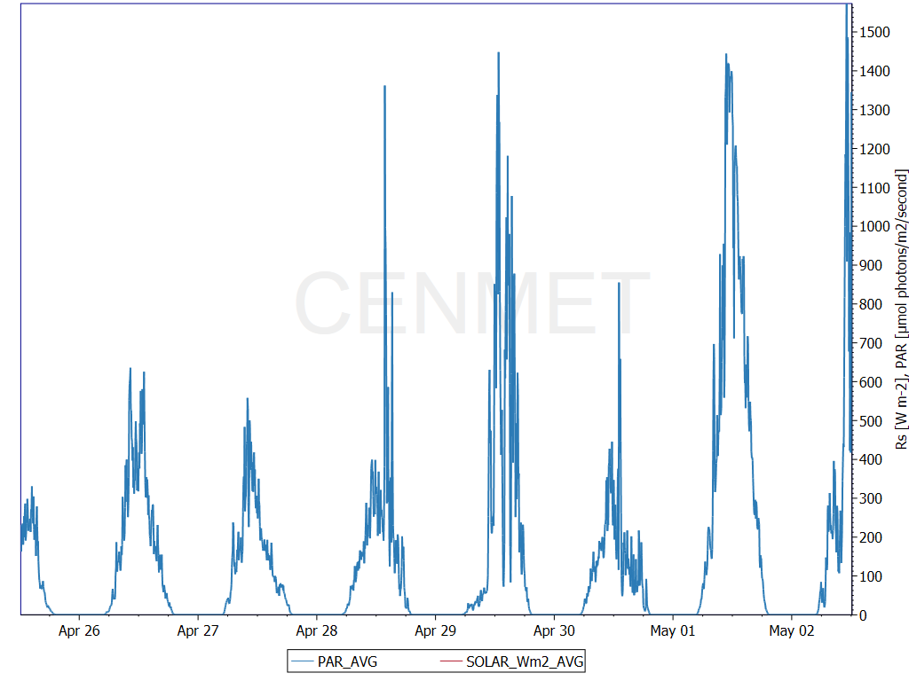
Solar

Solar radiation at Central Met, © HJ Andrews, LTER (AND), OSU

Caution: These are provisional real-time data that have not been quality checked! These data will change.

Collaborative Ecosystem Research

The H.J. Andrews Experimental Forest and Long-Term Ecological Research site is administered cooperatively by the USDA Forest Service's Pacific Northwest Research Station, Oregon State University, and the Willamette National Forest. Funding comes from the National Science Foundation, Pacific Northwest Research Station, Oregon State University and the College of Forestry, charitable support, and other sources. The H.J. Andrews Experimental Forest Long-Term Ecological Research (LTER) program is one of 27 major ecosystem research sites funded through the National Science Foundation. The site is one of 84 USDA Forest Service Experimental Forests and Ranges.

  • OSU
  • US Forest Service Logo
  • LTER Network Logo
  • NSF Logo

The H.J. Andrews Experimental Forest is part of the Long-Term Ecological Research (LTER) Network established by the National Science Foundation.

Link to other LTER Network Site Profiles.

H.J. Andrews Experimental Forest Logo

Donate 

Footer Menu

  • Disclaimers
  • Contact Us
  • Home
  • Acknowledgements

Copyright © 2011–2026 Andrews Forest Program. All rights reserved. Sign In