
Image Search
| Thumbnail | Media name | Gallery | Keyword Tags | Caption | Photographed date Sort ascending |
|---|---|---|---|---|---|
|
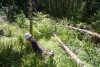
aew_055.jpg | Drought Experiment 2021 | Catalina Segura in a riparian canopy gap at McRae Trib East (McTE) that was implemented in 2017 to mimic old-growth canopy gaps that increase light to the streambed and promote aquatic food web resources |
||
|
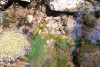
aew_054.jpg | Drought Experiment 2021 | Filamentous algae in the stream |
||
|
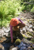
aew_053.jpg | Drought Experiment 2021 | Allison Swartz inspecting filamentous algae from the stream bed |
||
|
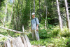
aew_052.jpg | Drought Experiment 2021 | Dana Warren in a riparian canopy gap at McRae Trib East (McTE) that was implemented in 2017 to mimic old-growth canopy gaps that increase light to the streambed and promote aquatic food web resources |
||
|
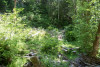
aew_051.jpg | Drought Experiment 2021 | A riparian canopy gap at McRae Trib East (McTE) that was implemented in 2017 to mimic old-growth canopy gaps that increase light to the streambed and promote aquatic food web resources |
||
|
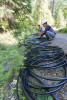
aew_007.jpg | Drought Experiment 2021 | Catalina Segura (front) and Allison Swartz (back) work on coils of tubing used to warm the streamwater |
||
|
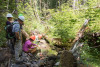
aew_050.jpg | Drought Experiment 2021 | Allison Swartz inspecting filamentous algae from the stream bed |
||
|
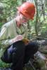
aew_037.jpg | Drought Experiment 2021 | Keeley MacNeill records water temperature |
||
|
aew_036.jpg | Drought Experiment 2021 | Keeley MacNeill and Allison Swartz measure temperature at the outflow of the tubes that were heating in the sun |
||
|
aew_035.jpg | Drought Experiment 2021 | the outflow of the tubes that are delivering diverted water and warmed water from upstream |
||
|
aew_034.jpg | Drought Experiment 2021 | Dana Warren takes a break from installing and inspecting tubing in the streambed |
||
|
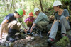
aew_033.jpg | Drought Experiment 2021 | Stream Ecology | Melissa Mauk, Keeley MacNeill, Allison Swartz, Dana Warren, Catalina Segura |
|
|
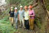
aew_032.jpg | Drought Experiment 2021 | Stream Ecology | Melissa Mauk, Keeley MacNeill, Allison Swartz, Dana Warren, Catalina Segura |
|
|
aew_031.jpg | Drought Experiment 2021 | Melissa Mauk, Catalina Segura, Dana Warren, Keeley MacNeill, Allison Swartz |
||
|
aew_030.jpg | Drought Experiment 2021 | A red-legged frog (Rana aurora) |
||
|
aew_029.jpg | Drought Experiment 2021 | A red-legged frog (Rana aurora) |
||
|
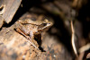
aew_028.jpg | Drought Experiment 2021 | A red-legged frog (Rana aurora) |
||
|
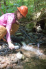
aew_038.jpg | Drought Experiment 2021 | Allison Swartz measures stream temperature from coils of tubing for the warming experiment |
||
|
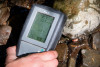
aew_039.jpg | Drought Experiment 2021 | Stream temperature and specific conductivity meter used to measure warming from coils of tubing for the warming experiment and travel time through the tubing |
||
|
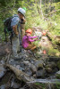
aew_049.jpg | Drought Experiment 2021 | Inspecting filamentous algae on the stream bed that only grows in high light conditions |
||
|
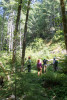
aew_048.jpg | Drought Experiment 2021 | At McRae Tributary East, Dana Warren and crew inspect a riparian area where trees were removed in 2017 to increase the amount of sunlight to the streambed |
||
|
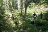
aew_047.jpg | Drought Experiment 2021 | At McRae Tributary East, Dana Warren and crew inspect a riparian area where trees were removed in 2017 to increase the amount of sunlight to the streambed |
||
|
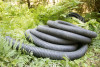
aew_046.jpg | Drought Experiment 2021 | Large tubing was used to divert water from upstream; small tubing was used to divert and warm water from upstream |
||
|
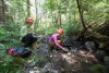
aew_045.jpg | Drought Experiment 2021 | Stream Ecology | Keeley MacNeill and Allison Swartz measure temperature at the outflow of the tubes that were heating in the sun |
|
|
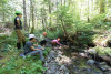
aew_044.jpg | Drought Experiment 2021 | Field crew for the pilot test of the dewatering experiment July 2021 |
||
|
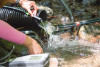
aew_043.jpg | Drought Experiment 2021 | Allison Swartz measures stream temperature from coils of tubing for the warming experiment |
||
|
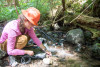
aew_042.jpg | Drought Experiment 2021 | Allison Swartz measures stream temperaturefrom coils of tubing for the warming experiment |
||
|
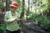
aew_041.jpg | Drought Experiment 2021 | Keeley MacNeill recording stream temperature data |
||
|
aew_040.jpg | Drought Experiment 2021 | Allison Swartz measures stream temperature from coils of tubing for the warming experiment |
||
|
aew_027.jpg | Drought Experiment 2021 | A red-legged frog (Rana aurora) |
||
|
aew_021.jpg | Drought Experiment 2021 | Large tubing was used to divert water from upstream; small tubing was used to divert and warm water from upstream |
||
|
aew_014.jpg | Drought Experiment 2021 | A large tube is used to divert water, bypassing a section of the stream to create drought conditions |
||
|
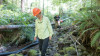
aew_015.jpg | Drought Experiment 2021 | Keeley MacNeill and undergraduate student Melissa Mauk |
||
|
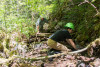
aew_026.jpg | Drought Experiment 2021 | Dana Warren and Melissa Mauk Check that the large tube is delivering water |
||
|
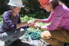
aew_025.jpg | Drought Experiment 2021 | Catalina Segura and Allison Swartz manage the many coils and meters of tubing and hoses |
||
|
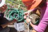
aew_024.jpg | Drought Experiment 2021 | hoses and fittings |
||
|
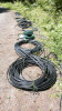
aew_023.jpg | Drought Experiment 2021 | coils of tubing in the sun warm the stream water |
||
|
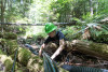
aew_022.jpg | Drought Experiment 2021 | Undergraduate student Melissa Mauk works on managing the tubing for the experiment |
||
|
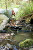
aew_017.jpg | Drought Experiment 2021 | Dana Warren inspects the outflow of the tubes that are delivering diverted water and warmed water from upstream |
||
|
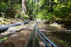
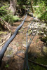
aew_020.jpg | Drought Experiment 2021 | Large tubing was used to divert water from upstream; small tubing was used to divert and warm water from upstream |
||
|
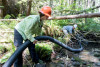
aew_019.jpg | Drought Experiment 2021 | Large tubing was used to divert water from upstream; small tubing was used to divert and warm water from upstream |
||
|
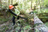
aew_013.jpg | Drought Experiment 2021 | Stream Ecology | A large tube is used to divert water, bypassing a section of the stream to create drought conditions |
|
|
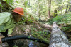
aew_011.jpg | Drought Experiment 2021 | A large tube is used to divert water, bypassing a section of the stream to create drought conditions |
||
|
aew_010.jpg | Drought Experiment 2021 | A large tube is used to divert water, bypassing a section of the stream to create drought conditions |
||
|
aew_016.jpg | Drought Experiment 2021 | Dana Warren in the with the large tubing used to divert water past a reach of the stream |
||
|
aew_018.jpg | Drought Experiment 2021 | the outflow of the tubes that are delivering diverted water and warmed water from upstream |
||
|
aew_012.jpg | Drought Experiment 2021 | A large tube is used to divert water, bypassing a section of the stream to create drought conditions |
||
|
aew_008.jpg | Drought Experiment 2021 | Allison Swartz and the coils of tubing for the warming experiment |
||
|
aew_009.jpg | Drought Experiment 2021 | Dana Warren in the streambed |
||
|
afq_016.JPEG | Scenery and nature photos 2022-2023 | Sunrise at a bird survey point near Saddle Creek |
||
|
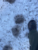
afq_015.JPEG | Scenery and nature photos 2022-2023 | Black bear tracks in the spring snowpack near UPLMET station. |
||
|
afq_013.JPEG | Scenery and nature photos 2022-2023 | Firs and Usnea in the morning fog on Lookout Mountain |
||
|
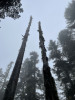
afq_012.JPEG | Scenery and nature photos 2022-2023 | Snags in the morning fog on Lookout Mountain Trail. |
||
|
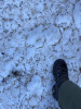
afq_011.JPEG | Scenery and nature photos 2022-2023 | Mountain lion tracks in the spring snowpack near Carpenter Mountain |
||
|
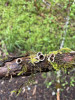
afq_010.JPEG | Scenery and nature photos 2022-2023 | Bird's nest fungus on decaying branch. |
||
|
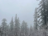
afq_009.JPEG | Scenery and nature photos 2022-2023 | Fog and frozen alder twigs near Carpenter Mountain |
||
|
afq_008.JPEG | Scenery and nature photos 2022-2023 | Spring snowpack near Carpenter Mountain. |
||
|
aev_048.jpg | Holiday Farm Fire October 2020 | Completed repair of dozer line along 1507 road. Soils, branches and tree boles pushed out of way by dozer were pulled back onto line by an excavator. |
||
|
aev_047.jpg | Holiday Farm Fire October 2020 | Repair work with heavy equipment on dozer line on 1507 road |
||
|
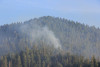
aev_046.jpg | Holiday Farm Fire October 2020 | Smoke and evidence of browned tree crowns on the slope of Watershed 2 |
||
|
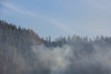
aev_045.jpg | Holiday Farm Fire October 2020 | Smoke and evidence of browned tree crowns on the slope of Watershed 2 |
||
|
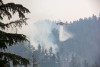
aev_044.jpg | Holiday Farm Fire October 2020 | Smoke and evidence of browned tree crowns on the slope of Watershed 2 |
||
|
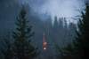
aev_042.jpg | Holiday Farm Fire October 2020 | Air Crane drops water over hot spots in Watershed 2. Taken from top of USGS Debris Flume. |
||
|
aev_043.jpg | Holiday Farm Fire October 2020 | Night time image of hot spot of fire in Watershed 2 |
||
|
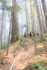
aev_007.jpg | Holiday Farm Fire October 2020 | Fire hand line and hose on a slope of WS2 |
||
|
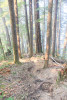
aev_008.jpg | Holiday Farm Fire October 2020 | Fire hand line and hose on a slope of WS2 |
||
|
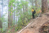
aev_009.jpg | Holiday Farm Fire October 2020 | USFS Resource Advisor flags watershed 2 trail crossing along the handline in WS2 |
||
|
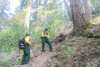
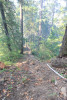
aev_011.jpg | Holiday Farm Fire October 2020 | USFS staff survey along the handline in WS2 |
||
|
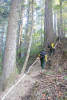
aev_010.jpg | Holiday Farm Fire October 2020 | Fire hand line and hose on a slope of WS2 |
||
|
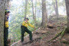
aev_012.jpg | Holiday Farm Fire October 2020 | Fire hand line and hose on a slope of WS2 |
||
|
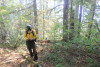
aev_013.jpg | Holiday Farm Fire October 2020 | USFS staff survey along the handline in WS2 |
||
|
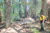
aev_015.jpg | Holiday Farm Fire October 2020 | USFS Resource Advisor surveys along the handline in WS2. PVC post marking vegetation plot in background |
||
|
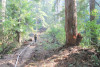
aev_016.jpg | Holiday Farm Fire October 2020 | USFS staff survey along the handline in WS2. Note the tags on the nearby trees, indicating that the fire line went through one of the vegetation plots, used since the 1950s to track plant growth and mortality. |
||
|
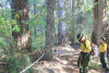
aev_017.jpg | Holiday Farm Fire October 2020 | Fire hand line and hose on a slope of WS2 |
||
|
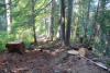
aev_014.jpg | Holiday Farm Fire October 2020 | USFS staff survey along the handline in WS2. Note the tags on the nearby trees, indicating that the fire line went through one of the vegetation plots, used since the 1950s to track plant growth and mortality. |
||
|
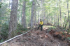
aev_018.jpg | Holiday Farm Fire October 2020 | Fire hand line and hose on a slope of WS2. Snags and other hazardous trees were cut along handline. |
||
|
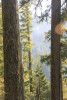
aev_019.jpg | Holiday Farm Fire October 2020 | Fire hand line and hose on a slope of WS2 |
||
|
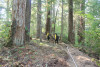
aev_035.jpg | Holiday Farm Fire October 2020 | Smoke from hotspot in WS2 above gaging, taken from handline |
||
|
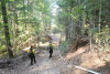
aev_034.jpg | Holiday Farm Fire October 2020 | Fire hand line and hose on a slope of WS2. USFS Resource Advisors. |
||
|
aev_033.jpg | Holiday Farm Fire October 2020 | Returning downslope along dozer line from road 465 along ridge bounding WS2 and WS3. USFS Resource Advisors. |
||
|
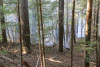
aev_032.jpg | Holiday Farm Fire October 2020 | Active fire in the upper portion of WS2 just below upper trail, low severity ground fire |
||
|
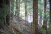
aev_031.jpg | Holiday Farm Fire October 2020 | Active fire in the upper portion of WS2 just below upper trail, low severity ground fire. A few hours after photo taken the fire reached the trail, but was held in check by crews using fire hose supplied by frequent trips from tender trucks. |
||
|
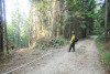
aev_029.jpg | Holiday Farm Fire October 2020 | Fire dozer line in Watershed 2, where it meets the 465 Road |
||
|
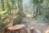
aev_027.jpg | Holiday Farm Fire October 2020 | Fire dozer line in Watershed 2. Large snag in left foreground was cut for safety. |
||
|
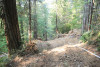
aev_026.jpg | Holiday Farm Fire October 2020 | Fire dozer line in Watershed 2 |
||
|
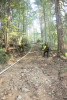
aev_025.jpg | Holiday Farm Fire October 2020 | Fire dozer line in Watershed 2 |
||
|
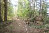
aev_023.jpg | Holiday Farm Fire October 2020 | Fire dozer line in Watershed 2. Root wad and upturned soil in foreground on right from tree pushed over by dozer |
||
|
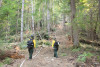
aev_022.jpg | Holiday Farm Fire October 2020 | Fire dozer line in Watershed 2. Disturbance to soil and vegetation is much more significant along dozer line than handline, but it also makes a more effective fire break. |
||
|
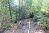
aev_021.jpg | Holiday Farm Fire October 2020 | Fire dozer line in Watershed 2 near road 455. |
||
|
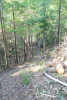
aev_020.jpg | Holiday Farm Fire October 2020 | Fire dozer line in just above 455 road at edge of Watershed 2. Dozer line runs from 465 to 455 roads, at which point even steeper terrain forced crews to use handline the rest of the way downslope to road 302 |
||
|
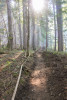
aev_030.jpg | Holiday Farm Fire October 2020 | Fire hand line in the upper area of Watershed 2 follows the upper watershed 2 trail for ca. 1/4 mile. Then handline cuts upslope to connect with a dozer line off of road 2633. |
||
|
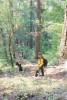
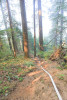
aev_036.jpg | Holiday Farm Fire October 2020 | Fire hand line and hose on a slope of WS2. USFS Resource Advisors. |
||
|
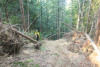
aev_006.jpg | Holiday Farm Fire October 2020 | Fire hand line and hose on a slope of WS2 |
||
|
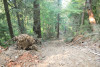
aev_028.jpg | Holiday Farm Fire October 2020 | This was an accidental beginning of the dozer line at junction with 465 road. Operator likely mistook this for the main side ridge. After opening ca. 60 feet the dozer backtracked and began the actual fire line running down side ridge to road 455. |
||
|
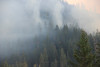
aev_024.jpg | Holiday Farm Fire October 2020 | Fire dozer line in Watershed 2. This particularly steep section would be vulnerable to serious erosion without subsequent waterbarring and repair work. |
||
|
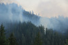
aev_041.jpg | Holiday Farm Fire October 2020 | smoke on the landscape, from fire in Watershed 2 |
||
|
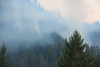
aev_040.jpg | Holiday Farm Fire October 2020 | smoke on the landscape, from fire in Watershed 2 |
||
|
aev_039.jpg | Holiday Farm Fire October 2020 | smoke on the landscape, from fire in Watershed 2. Taken from 130 road radio tower |
||
|
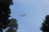
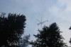
aev_038.jpg | Holiday Farm Fire October 2020 | Air Crane used for water drops over hot spots in Watershed 2 |
||
|
aev_037.jpg | Holiday Farm Fire October 2020 | Air Crane used for water drops over hot spots in Watershed 2 |
||
|
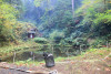
aev_001.jpg | Holiday Farm Fire October 2020 | Watershed 2 gage house and sediment basin, with firehose in the foreground |
||

|
aev_002.jpg | Holiday Farm Fire October 2020 | Watershed 2 gage house with fire hose going up the slope toward the active fire area |
||
|
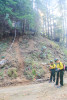
aev_003.jpg | Holiday Farm Fire October 2020 | Fire hand line and fire hose moving up the slope in WS2, from the 302 Road. USFS Resource Advisors in foreground. |
||
|
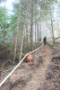
aev_004.jpg | Holiday Farm Fire October 2020 | Fire hand line and fire hose traversing up slope in WS2, from the 302 Road. |
||
|
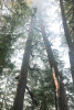
aev_005.jpg | Holiday Farm Fire October 2020 | Snags create concerns for the safety of fire crews working the area |
||

|
aeu_111.jpg | Holiday Farm Fire September 2020 | Panorama of Blue River Valley |
||
|
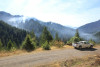
aeu_112.jpg | Holiday Farm Fire September 2020 | Looking down into the Andrews Forest from the 130 road where smoke rises from Watershed 2 |
||
|
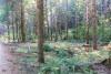
aeu_114.jpg | Holiday Farm Fire September 2020 | Hand line cut along the entrance driveway to headquarters |
||
|
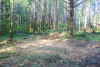
aeu_115.jpg | Holiday Farm Fire September 2020 | Hand line cut along the entrance driveway to headquarters |
||
|
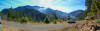
aeu_113.jpg | Holiday Farm Fire September 2020 | Panorama from the 130 road, looking into the Lookout Creek watershed where smoke rises from Watershed 2 |
||
|
aeu_116.jpg | Holiday Farm Fire September 2020 | Hand line and cut trees behind the office building at headquarters |
||
|
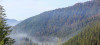
aeu_110.jpg | Holiday Farm Fire September 2020 | Looking down the Lookout and Blue River Valleys, with areas of dead trees and smoke on the Mona side |
||
|
aeu_109.jpg | Holiday Farm Fire September 2020 | Smoke from hot spots of fire in Watershed 2 |
||
|
aeu_108.jpg | Holiday Farm Fire September 2020 | Smoke from hot spots of fire in Watershed 2 |
||
|
aeu_119.jpg | Holiday Farm Fire September 2020 | PRIMET climate station in foreground, smoke rising from old growth stand in between WS1 and WS2 in background |
||
|
aeu_107.jpg | Holiday Farm Fire September 2020 | Smoke from hot spots of fire in Watershed 2 |
||
|
aeu_120.jpg | Holiday Farm Fire September 2020 | PRIMET climate station in foreground, smoke rising from old growth stand in between WS1 and WS2 in background |
||
|
aeu_121.jpg | Holiday Farm Fire September 2020 | An Air-Crane Helicoptor, 3AC, dumps water over hot spots in Watershed 2. Photo taken from PRIMET at headquarters. |
||
|
aeu_122.jpg | Holiday Farm Fire September 2020 | An Air-Crane Helicoptor, 3AC, dumps water over hot spots in Watershed 2, PRIMET in foreground |
||

|
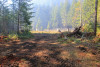
aeu_118.jpg | Holiday Farm Fire September 2020 | Panorama of dozer line around headquarters and the PRIMET climate station |
||
|
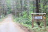
aeu_117.jpg | Holiday Farm Fire September 2020 | Dozer line around headquarters and the PRIMET climate station |
||
|
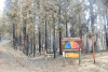
aeu_091.jpg | Holiday Farm Fire September 2020 | small branches piles, as part of fire line cutting, along driveway of headquarters |
||
|
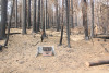
aeu_105.jpg | Holiday Farm Fire September 2020 | Area of high severity fire, along the 15 road (outside of the Andrews Forest), close to the junction with HWY126 |
||
|
aeu_100.jpg | Holiday Farm Fire September 2020 | Electric utility box along the 15 Road between highway 126 and the saddle dam. Power was lost along the 15 road and HWY126. |
||
|
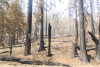
aeu_101.jpg | Holiday Farm Fire September 2020 | Area of high severity fire, along the 15 road (outside of the Andrews Forest), close to the junction with HWY126. This area of USFS land was thinned with underburning ca. five years earlier |
||
|
aeu_102.jpg | Holiday Farm Fire September 2020 | Area of high severity fire, along the 15 road (outside of the Andrews Forest), close to the junction with HWY126 |
||
|
aeu_084.jpg | Holiday Farm Fire September 2020 | Fire crew cuts fire line around headquarters, just behind assembly area |
||

|
aeu_103.jpg | Holiday Farm Fire September 2020 | Area of high severity fire, along the 15 road (outside of the Andrews Forest), close to the junction with HWY126 |
||
|
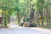
aeu_082.jpg | Holiday Farm Fire September 2020 | Dangle head processor removes small trees along driveway of headquarters |
||
|
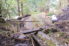
aeu_081.jpg | Holiday Farm Fire September 2020 | Burned footbridge, railing, and sediment basin of Watershed 9 |
||
|
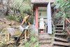
aeu_080.jpg | Holiday Farm Fire September 2020 | Gage house and wier of Watershed 9. Greg Downing clearing ash and debris from flume to prepare for water sample collection. |
||
|
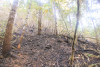
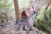
aeu_079.jpg | Holiday Farm Fire September 2020 | Burned slope in Watershed 9, upslope of gagehouse on "river left" |
||
|
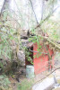
aeu_078.jpg | Holiday Farm Fire September 2020 | Tree fallen on top of Watershed 9 gage house. Burned sediment basin in the background, left. |
||
|
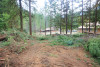
aeu_077.jpg | Holiday Farm Fire September 2020 | Tree fallen on top of Watershed 9 gage house |
||
|
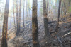
aeu_085.jpg | Holiday Farm Fire September 2020 | Fire line behind apartment buildings at the headquarters |
||
|
aeu_071.jpg | Holiday Farm Fire September 2020 | Phenology Core Site 1, on the north-facing slope of Watershed 1. Tree tags and dendrometer bands in the background. |
||
|
aeu_090.jpg | Holiday Farm Fire September 2020 | Fire line along driveway of headquarters |
||
|
aeu_092.jpg | Holiday Farm Fire September 2020 | Firehawk helicoptor over Watershed 2 |
||
|
aeu_093.jpg | Holiday Farm Fire September 2020 | Smoke from hot spots of fire in Watershed 2 |
||
|
aeu_089.jpg | Holiday Farm Fire September 2020 | Fire line around PRIMET station |
||
|
aeu_095.jpg | Holiday Farm Fire September 2020 | Smoke from hot spots of fire in Watershed 2 |
||
|
aeu_096.jpg | Holiday Farm Fire September 2020 | Firehawk helicoptor drops water over hot spots in Watershed 2 |
||
|
aeu_097.jpg | Holiday Farm Fire September 2020 | Firehawk helicoptor drops water over hot spots in Watershed 2 |
||
|
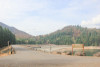
aeu_098.jpg | Holiday Farm Fire September 2020 | Looking over the Blue River Reservoir to patchy burn in the Mona area, from the 15 Road at site of 2011 landslide. |
||
|
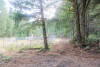
aeu_099.jpg | Holiday Farm Fire September 2020 | Looking west over the Blue River dam, at areas that had high severity fire |
||
|
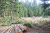
aeu_088.jpg | Holiday Farm Fire September 2020 | Dozer line around PRIMET climate station |
||
|
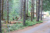
aeu_087.jpg | Holiday Farm Fire September 2020 | Small trees cut and dozer line around PRIMET climate station |
||
|
aeu_086.jpg | Holiday Farm Fire September 2020 | Fire crews cut hand line along driveway at headquarters |
||
|
aeu_083.jpg | Holiday Farm Fire September 2020 | Fire hose and sprinklers set up around headquarters |
||
|
aeu_076.jpg | Holiday Farm Fire September 2020 | Tree fallen on top of Watershed 9 gage house |