Permanent Plots in the HJ Andrews Experimental Forest
Report Number 2
Reference Stands in or near
H.J. Andrews Experimental Forest
C. T. Dyrness and Steven A. Acker
April 1999
Citation
Link to Andrews Experimental Forest website (http://andrewsforest.oregonstate.edu).
CONTENTS
Citation
Citation: Dyrness C. T.; Acker, Steven A. 1999. Reference Stands
in or near the H.J. Andrews Experimental Forest. Permanent Plots of the Pacific
Northwest. Report Number 2. (http://andrewsforest.oregonstate.edu/pubs/webdocs/reports/permplot.htm)
(
http://andrewsforest.oregonstate.edu/pubs/webdocs/reports/permplot.htm)
Introduction
This report describes key characteristics of 38 permanent
vegetation plots (Reference Stands)
within and around the H. J.
Andrews Experimental Forest, western Oregon. These plots were
established to provide typical examples of many major forest
communities commonly found in the Tsuga heterophylla, transition,
and Abies amabilis zones of Oregon's central-western Cascade
Mountains. The sites serve as references for scientists of many
disciplines in their studies of these and similar forest
communities in the Pacific Norhtwest (Acker et al. 1998).
Location
Thirty of the 38 Reference Stands are located in the H. J. Andrews
Experimental Forest (AEF), a 6,400-ha watershed located in the
central-western Cascade Range of Oregon, approximately 40 miles
east of Eugene. Three Reference Stands are located 4 miles north
of AEF in Wildcat Mountain Research Natural Area (RNA). Three
stands are situated 7 miles west of AEF in the Hagan RNA. One
stand is located 20 miles north of AEF in the Middle Santiam RNA.
And one stand was situated 5.5 miles west of AEF on Cone Creek.
Study Areas
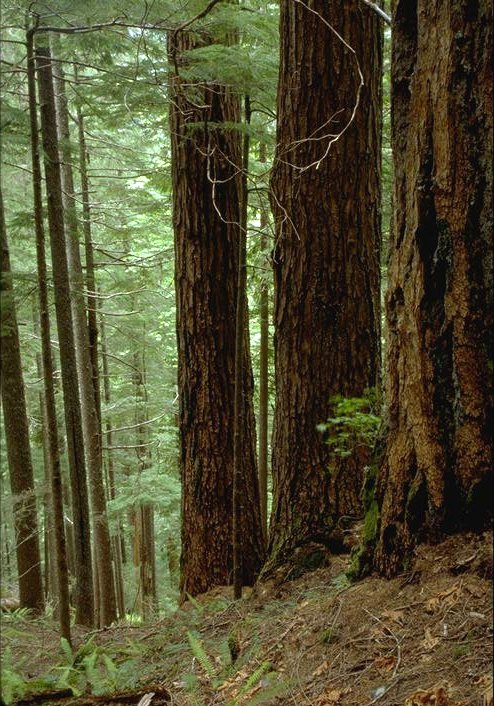
The H.J.Andrews Experimental Forest was established as an
experimental forest in 1948 and is representative of dense
coniferous forests of Douglas-fir, western hemlock, and common true
firs typical of the Western Cascade Range. Forest age is variable
but old-growth stands, with trees older than 400 years, are common.
Phytosociological studies have identified 23 major forest
communities within AEF (Dyrness et al. 1974). Reference Stands
were selected to represent typical examples of many of the
important forest communities which were identified and described by
the phytosociological studies. Forest zones which are well
represented by Reference Stands are the Tsuga heterophylla zone
(from about 500 to 1,000 m in elevation) and Abies amabilis zone
(from about 1,000 to 1,550 m elevation). The AEF encompasses
steep, mountainous terrain with landforms ranging from ridgetops,
smooth and uneven sideslopes, and benches in uplands, to terraces
and flood plains along major streams. Soil parent materials are
largely pyroclastic rocks (tuffs and breccias) at lower elevations
and andesite, aerially deposited volcanic ash, and localized
glacial deposits at higher elevations. Because of the pervasive
infulence of volcanic ash, soils at AEF are uniformly
low in bulk density and therefore very porous.
Reference Stands 13, 14, and 36 are located in Wildcat Mountain
Research Natural Area, established to preserve prime examples of
Abies procera stands on ridgetops in the Western Cascade Range of
Oregon. Elevations range from about 1,160 m to 1,632 m at the top
of Wildcat Mountain. Other tree species present in the Research
Natural Area include Abies amabilis, Tsuga mertensiana, Pinus
monticola, Chamaecyparis nootkatensis, Tsuga heterophylla, and
Pseudotsuga menziesii. The dominant bedrock in the area is
andesite; however, it is overlain by fairly thick deposits of
volcanic ash. Soils are weakly developed primarily from volcanic
ash and are very friable and porous.
Reference Stands 24 and 35 are located in the Hagan Research
Natural Area which includes the north fork of Hagan Creek. R.S. 37
is situated a short distance south of the Research Natural Area on
the south fork of Hagan Creek. The area is dominated by mature
stands of Douglas-fir which came in following a fire in 1855. The
elevation ranges from 520 m at the stream bottom to 1070 m on the
ridgetops. The area is deeply dissected with steep slopes
averaging about 66%. The climate is characteristic of Oregon's
Western Cascade Range, with mild wet winters and relatively dry
summers. Along with Douglas-fir, common tree species in the
Research Natural Area include Tsuga heterophylla, Acer
macrophyllum, Alnus rubra, Castanopsis chrysophylla, and Taxus
brevifolia. Forest communities range from the very wet Tsuga
heterophylla/Oplopanax horridum in riparian areas to Pseudotsuga
menziesii/Holodiscus discolor/grass on very dry sites.
Reference Stand 25 is located in the Middle Santiam Research
Natural Area, made up primarily of forests of old-growth Douglas-
fir and western hemlock occupying the Middle Santiam River
drainage. Slopes in the Research Natural Area are steep and
elevations range from 457 to 1433 m. The Reference Stand, however,
is situated on a terrace adjacent to the river. Bedrock in the
Research Natural Area consists of lava flows, pyroclastic rocks,
and water-reworked volcanic rocks. The area is geomorphologically
active with numerous shallow and deep-seated mass movements.
Climate is maritime, with dry and warm summers and cool and wet
winters. The Research Natural Area has a variety of forest
communities mostly dominated by old-growth Pseudotsuga menziesii
and Tsuga heterophylla except at higher elevations where Abies
amabilis is the dominant tree species.
History of the Reference Stands
The first 19 Reference Stands (RS) were established between 1971
and 1973 as a part of the International Biological Program (Hawk et
al. 1978). With the exception of RS 9, all were originally 0.25 ha
in size. Subsequently, RS 1 through 3 were increased in size to 1
ha and RS 13 to 4.69 ha. Reference Stands 20 through 26 were
established in 1977, RS 27 through 33 in 1978, RS 34 in 1979, RS 35
and 36 in 1980, RS 37 in 1981, and RS 38 was established in 1990.
Stands established after the initial cohort of 19 are, for the most
part, 1 ha in size. Exceptions are RS 32 and 33 (0.25 ha), RS 34
(2.0 ha), RS 35 (2.13 ha), and RS 38 (2.44 ha). Since their
establishment, these stands have all been remeasured at
approximately 5-year intervals until 1989 when remeasurements were
shifted to every 6 years.
Methods
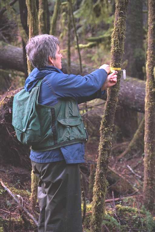
For the original cohort of Reference Stands (1 through 19) the
establishment procedure was described by Hawk et al. (1978). Each
Reference Stand was surveyed and slope-corrected to a 0.25 ha area
(50 x 50 m). Metal stakes were installed at 10-m intervals on the
perimeter of each plot and at the corners of an interior 30 x 30 m
plot. The entire stand was then divided into a 10 x 10 m grid, and
all trees larger than 5 cm dbh (diameter at breast height) were
mapped and tagged with numbered aluminum tags.
Data recorded on each Reference Stand included tree location by X
and Y coordinates, tree tag number, tree species, and dbh in cm.
Vigor, crown condition, and bole condition were also recorded for
each tree. The location of downed logs and dead trees was also
included on maps of each stand. Accuracy of mapped locations of
trees was estimated to be plus or minus 1 m.
Tree saplings (>0.5 m tall, but <5 cm. dbh) were tallied within the
30 x 30 m interior plot by a total count. Tree seedlings (<0.5 m
tall) were tallied in 4, 1 x 30 m strip transects. Cover and
frequency of shrub species were tallied along 60 m of line-
intercept at the top and bottom of each 30 x 30 m plot. Cover and
frequency of herb and moss species were tallied in 60 microplots (2
x 5 dm) placed at 1 m intervals along the two central lines within
the 30 x 30 m plot.
Plots established in 1977 and later (RS 20 - 38) were almost all 1
ha or larger in size at the time of establishment. RS 32 and 33,
0.25 ha in size, were the exceptions. Plots were 100 m x 100 m and
were divided into 4 25 m x 25 m sub-blocks. Upon completion of
surveying outer boundaries, the boundaries of interior 25 x 25 m
blocks were surveyed. Within each of these blocks fine cotton line
was strung in a 5-meter grid pattern. The use of the grid pattern
afforded a maximum of accuracy in mapping with a minimum of
expended time. The tree inventory and mapping followed procedures
used for the original 19 Reference Stands.
Several methods were used to inventory understory vegetation in
Reference Stands 20 through 33. In most stands understory
vegetation was sampled by use of 4 to 7 circular plots. These
plots were 12.6 m in radius and marked in the center by a permanent
metal stake. Shrub and tree sapling cover was measured along 40 m
of line intercept (10 m along each of the 4 cardinal directions).
Forty microplots (2 x 5 dm) were also placed at 1 m intervals along
the 40 m of lines for estimation of herb and moss cover. Each
circular plot also had 4 circular subplots 2 m in radius which were
used to inventory tree seedlings. On several RS understory
vegetation was sampled on only reconnaissance plots. On these
plots crown cover of all plant species was ocularly estimated.
Virtually no understory vegetation information has been collected
on RS 34 through 38.
Remeasurements of Reference Stands were initially carried out at
appoximately 5 year intervals and more recently at 6-year
intervals. At each remeasurement any profound natural or human-
caused disturbance was noted, tagged trees were checked for
mortality, and tagged trees were remeasured. Occasionally tree
heights were measured as well as tree dbh. In addition, canopy
class, overall vigor, and crown ratio were recorded for each tagged
tree. Ingrowth trees (those growing into the 5 cm dbh class) were
also tagged, measured, and brought into the data set. Annual
checks for tree mortality were performed on most stands up until
the early 1990's. Annual mortality checks continue to be made on
RS 34, 35, and 38 (riparian Reference Stands).
Many of the Reference Stands have been equipped with thermographs
which record air temperature and soil temperatures at depths of 10,
20, and 30 cm. These temperature data are available in the AEF
Climatic Data Set. In addition, other information such as snow
depth, litter fall, and phenology has been collected on selected
Reference Stands.
Research Conducted on H. J. Andrews Experimental Forest Reference
Stands
Many research projects have used the AEF Reference Stands as study
areas. Much of the early work in defining and characterizing old-
growth Douglas-fir was carried out on the Reference Stands.
Another tree species which has been intensively studied on the
reference stands is Pacific Yew. Animals which have received
attention included small mammals and northern spotted owl. In
addition, Reference Stands have been extensively used as sites to
determine the environmental characteristics of the major forest
communities of the H. J. Andrews.
Detailed Description of Reference Stands
The Reference Stands, their sizes, and the plant communities they represent
are listed in Table 1.
Detailed descriptions of the vegetation and soils of
the individual Reference Stands are accessible from the links in
Table 1.
Directly Related Publications
Acker, S.A., W.A. McKee, M.E. Harmon, and J.F. Franklin. 1998.
Long-term research on forest dynamics in the Pacific Northwest: a
network of permanent plots. Pp. 93-106 in F. Dallmeier and J.A.
Comiskey, eds. Forest biodiversity in North, Central and South
America, and the Caribbean: Research and monitoring. UNESCO,
Paris.
Busing, R.T., and T.A. Spies. 1995. Modeling the population
dynamics of Pacific yew. Res. Note PNW-RN-515. USDA Pacific
Northwest Research Station, Portland, OR 13 p.
Busing, R.T., C.B. Halpern, and T.A. Spies. 1995. Ecology of
Pacific yew (Taxus brevifolia) in western Oregon and Washington:
the role of old-growth forests. Conservation Biology, in press.
Dyrness, C.T., J.F. Franklin, and W.H. Moir. 1974. A preliminary
classification of forest communities in the central portion of the
western Cascades in Oregon. Coniferous Forest Biome Bull. No. 4.
Univ. of Washington, Seattle. 123 p.
Franklin, J.F., K. Cromack, Jr., W. Denison, A. McKee, C. Maser, J.
Sedell, F. Swanson, and G. Juday. 1981. Ecological
characteristics of old-growth Douglas-fir forests. USFS Gen. Tech.
Rep. PNW-118. USDA Forest Service, PNW Forest and Range Exp. Sta.,
Portland OR. 48 p.
Franklin, J.F., H.H. Shugart, and M.E. Harmon. 1987. Tree death
as an ecological process. BioScience 37: 550-556.
Hawk, G.M., J.F. Franklin, W.A. McKee, and R.B. Brown. 1978. H.J.
Andrews Experimental Forest reference stand system: establishment
and use history. Coniferous Forest Biome Bull. No. 12. Univ. of
Washington, Seattle. 79 p.
Klopsch, Mark Warren. 1985. Structure of mature Douglas-fir
stands in a western Oregon watershed and implications for
interpretation of disturbance history and succession. M.S. Thesis,
OSU Dept. of Forest Science. 52 p.
Old-growth Definition Task Group. 1986. Interim definitions for
old-growth Douglas-fir and mixed-conifer forests in the Pacific
Northwest and California. Res. Note PNW-447. USDA Forest Service,
PNW Research Sta. Portland, OR. 7 p.
Spies, T.A., J.F. Franklin, and M. Klopsch. 1990. Canopy gaps in
Douglas-fir forests of the Cascade Mountains. Can. J. For. Res.
20: 649-658.
Zobel, D.B., A. McKee, G.M. Hawk, and C.T. Dyrness. 1976.
Relationships of environment to composition, structure, and
diversity of forest communities of the central western Cascades of
Oregon. Ecol. Monogr. 46: 135-156.
Other Publications Using Data and/or Sites
Binkley, D., and R.L. Graham. 1981. Biomass, production, and
nutrient cycling of mosses in an old-growth Dougals-fir forest.
Ecology 62: 1387-1389.
Dale, V.H., M. Hemstrom, and J.F. Franklin. 1987. Modeling the
long-term effects of disturbances on forest succession, Olympic
Peninsula, Washington. Can. J. For. Res. 16: 56-67.
Garman, S.L., A.J. Hansen, D.L. Urban, and P.F. Lee. 1992.
Alternative silvicultural practices and diversity of animal habitat
in western Oregon: A computer simulation approach. Pp. 777-781 in
P. Luker, ed., Proc. 1992 Summer Simulation Conference. The
Society for Computer Sumulation, Reno, NV
Garman, S.L., S.A. Acker, J.L. Ohmann, and T.A. Spies. 1995.
Asymptotic height-diameter equations for twenty-four tree species
in western Oregon. Research Contrib. 10, OSU Forest Research Lab.,
Corvallis, OR. 62 p.
Gholz, H.L., F.K. Fitz, and R.H. Waring. 1976. Leaf area
differences associated with old-growth forest communtities in the
western Oregon Cascades. Can. J. For. Res. 6: 49-57.
Gregory, S.V., and L. Ashkenas. 1990. Riparian Management Guide,
Willamette National Forest. USDA Forest Service, Pacific Northwest
Region, Willamette National Forest, Oregon. 119 p.
Gregory, S.V., F.J. Swanson, W.A. McKee, and K.W. Cummins. 1991.
An ecosystem perspective of riparian zones. BioScience 41: 540-557.
Harmon, M.E., and H. Chen. 1991. Coarse woody debris dynamics in
two old-growth ecosystems. BioScience 41: 604-610.
Harmon, M.E., J.F. Franklin, F.J. Swanson, P. Sollins, S.V.
Gregory, J.D. Lattin, N.H. Anderson, S.P. Cline, N.G. Aumen, J.R.
Sedell, G.W. Lienkaemper, K. Cromack, Jr., and K.W. Cummins. 1986.
Ecology of coarse woody debris in temperate ecosystems. Adv. Ecol.
Res. 15: 133-302.
Krankina, O.N., and M.E. Harmon. 1994. The impact of intensive
forest management on carbon stores in forest ecosystems. World
Resource Review 6 (2): 161-177.
Kuiper, L.C. 1988. The structure of natural Douglas-fir forests
in western Washington and western Oregon. Agricultural University
Wageningen Papers 88-5: 1-47.
Lorensen, T., C. Andrus, and J. Runyon. 1994. The Oregon Forest
Pracitices Act Water Protection Rules: scientific and policy
considerations. Oregon Department of Forestry, Forest Pracitices
Policy Unit, Salem, OR. 39 p.+ appendices.
McDade, M.H. 1987. The source area for coarse woody debris in
small streams in western Oregon and Washington. M.S. Thesis, Dept.
of Botany and Plant Pathology, Oregon State Univ., Corvallis.
McDade, M.H., F.J. Swanson, W.A. McKee, J.F. Franklin, and J. Van
Sickle. 1990. Source distances for coarse woody debris entering
small streams in western Oregon and Washington. Can. J. For. Res.
20: 326-330.
Peck, J.E., S.A. Acker, and W.A. McKee. 1995. Autecology of
mosses in mature and old-growth forests in the central Western
Cascades of Oregon. Northwest Science 69: 184-190.
Swanson, F.J., and A. McKee. 1990. Old-growth research at the
H.J. Andrews Experimental Forest. NW Env. J. 6: 420-421.
Swanson, F.J., A. McKee, and S.V. Gregory. 1990. Managing
riparian zones as ecosystems. Watershed Management Council
Newsletter 4(3): 1-5.
Van Sickle, J., and S.V. Gregory. 1990. Modeling inputs of large
coarse debris to streams from falling trees. Can. J. For. Res. 20:
1593-1601.
Wilson, M.V. 1991. Age structure patterns in Abies amabilis
stands of the Cascade Mountains. Amer. Midl. Nat. 125: 331-339.
Literature Cited
Acker, S.A., W.A. McKee, M.E. Harmon, and J.F. Franklin. 1998.
Long-term research on forest dynamics in the Pacific Northwest: a
network of permanent plots. Pp. 93-106 in F. Dallmeier and J.A.
Comiskey, eds. Forest biodiversity in North, Central, and South
America, and the Caribbean: Research and monitoring. UNESCO,
Paris.
Dyrness, C.T., J.F. Franklin, and W.H. Moir. 1974. A preliminary
classification of forest communities in the central portion of the
western Cascades in Oregon. Coniferous Forest Biome Bull. No. 4.
Univ. of Washington, Seattle. 123 p.
Hawk, G.M., J.F. Franklin, W.A. McKee, and R.B. Brown. 1978. H.J.
Andrews Experimental Forest Reference Stand system: establishment
and use history. Coniferous Forest Biome Bull. No. 12. Univ. of
Washington, Seattle. 79 p.