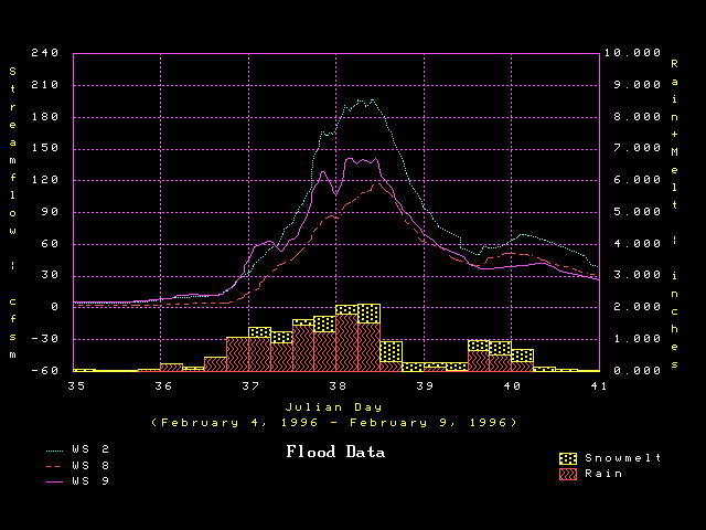
Figure 4.
Flood hydrographs for control (undisturbed) watersheds with rainfall
and snowmelt at 6-hour intervals for the Hi-15 Station (near WS 8).
Streamflow is on an area basis (Cubic feet/second/square mile).
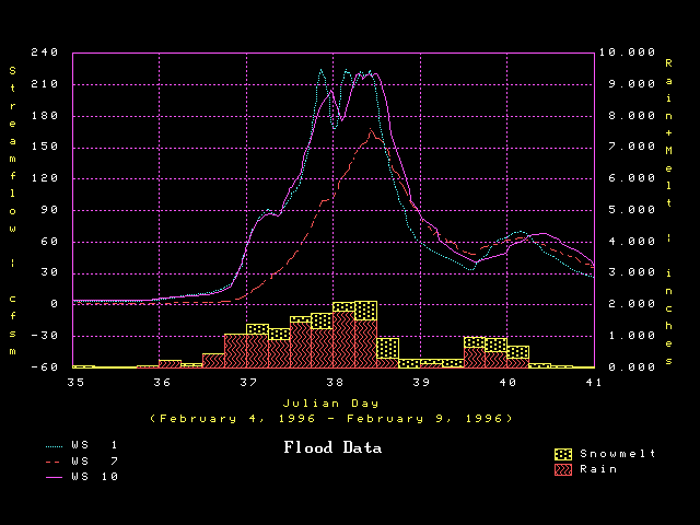
Figure 5.
Flood hydrographs for clearcut logged and revegetating watersheds with
rainfall and snowmelt at 6-hour intervals for the Hi-15 Station (near WS 8).
Streamflow is on an area basis (Cubic feet/second/square mile).