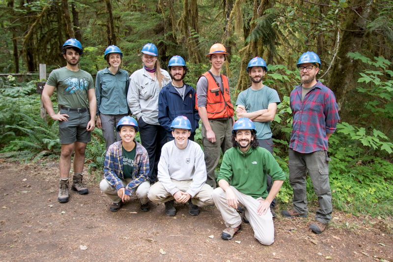
The FOREG crew: (back row:) Matt Reala, Maggie Ross, Maddie Sutton, Ethan Torres, Adam Milenkowic, Aaron Nelson, Adam Carson, (front row:) Emily Dewald-Wang, Liam Engel, Joseph LaManna
Photographed by Lina DiGregorio ..... Date: 7/23/2019 ..... Photo: AER-001
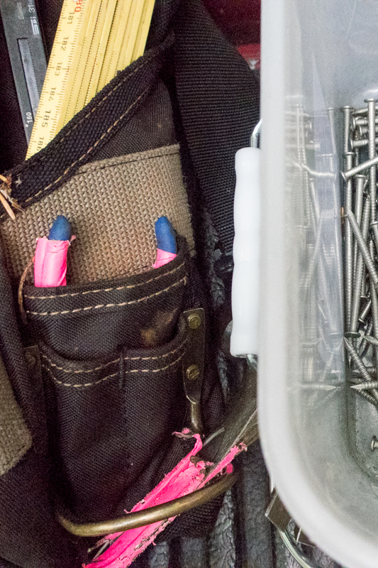
Some of the tools for big plot work: measuring stick, calipers, pliers, nails
Photographed by Lina DiGregorio ..... Date: 7/23/2019 ..... Photo: AER-002
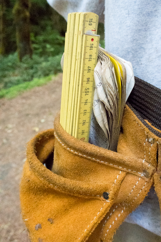
Tools of the trade
Photographed by Lina DiGregorio ..... Date: 7/23/2019 ..... Photo: AER-003

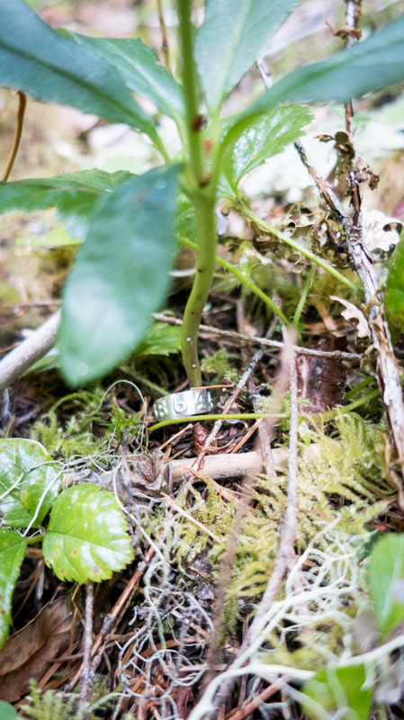
One of the numbered metal identification bands used to mark any woody plants within each 1m-square plot
Photographed by Lina DiGregorio ..... Date: 7/23/2019 ..... Photo: AER-004
A plant marked with one of the metal identification bands
Photographed by Lina DiGregorio ..... Date: 7/23/2019 ..... Photo: AER-005
Joseph LaManna, lead on the project, inspects plants within a 1m-square plot
Photographed by Lina DiGregorio ..... Date: 7/23/2019 ..... Photo: AER-006
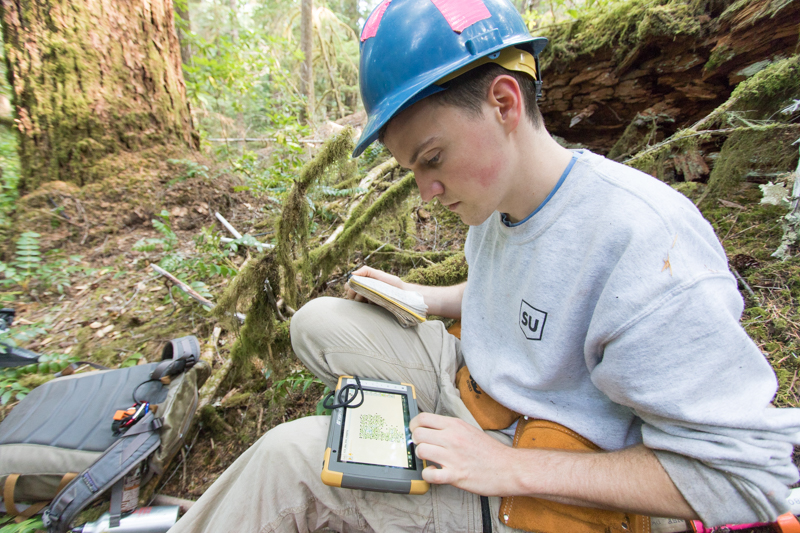
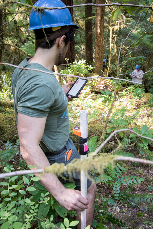
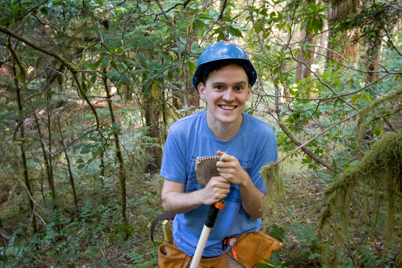
Liam Engel enters data into a tablet
Photographed by Lina DiGregorio ..... Date: 7/23/2019 ..... Photo: AER-007
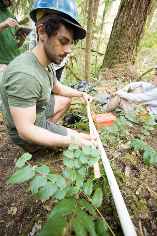
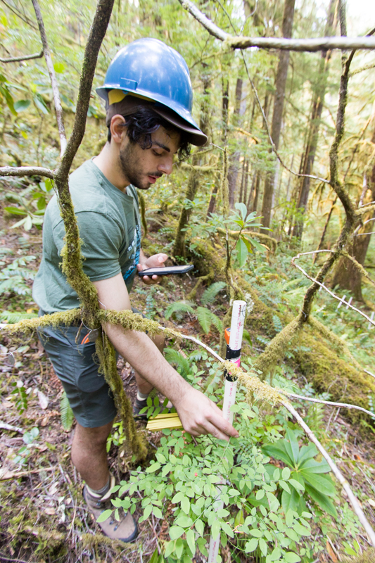
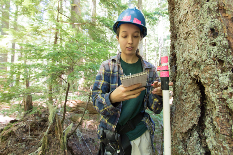
Matt Reala notes the measurement height on a PVC pipe that will be used with the survey tool to map trees
Photographed by Lina DiGregorio ..... Date: 7/23/2019 ..... Photo: AER-008

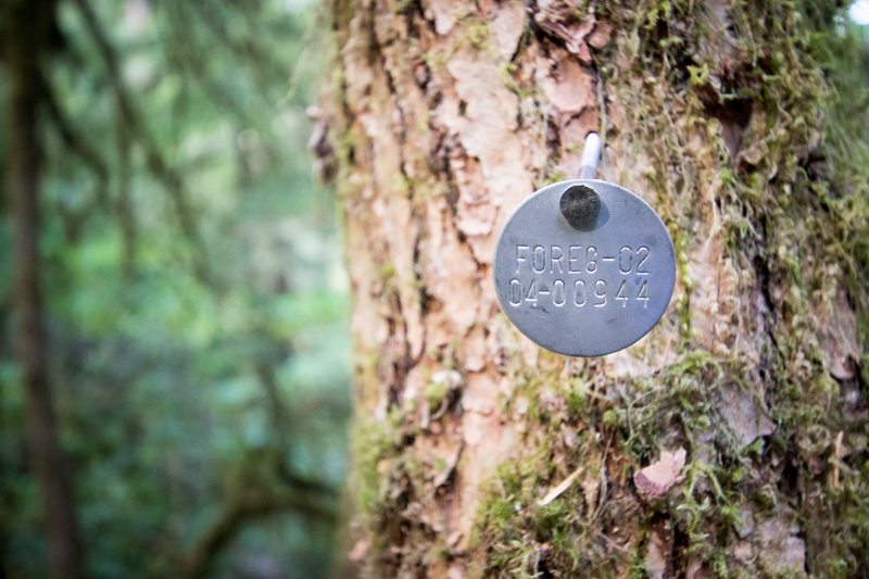
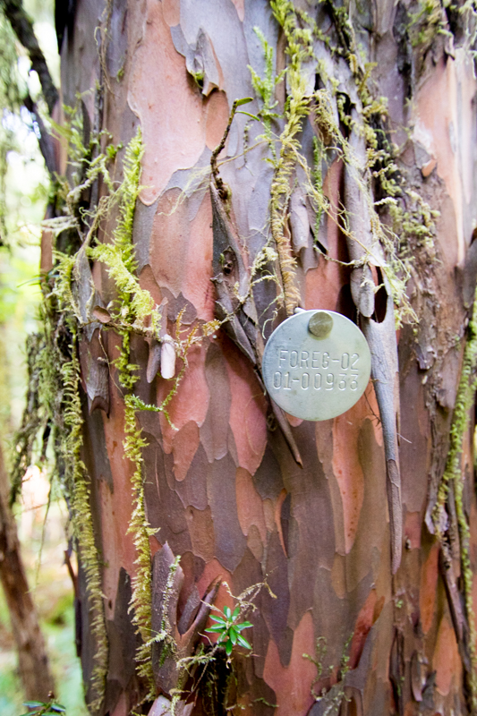
Joseph LaManna shows data from this plot, FOREG02, which contains old Reference Stand 2. The data show every mapped stem and the underlying topography.
Photographed by Lina DiGregorio ..... Date: 7/23/2019 ..... Photo: AER-009

Maddie Sutton surveys vegetation within the plot
Photographed by Lina DiGregorio ..... Date: 7/23/2019 ..... Photo: AER-010
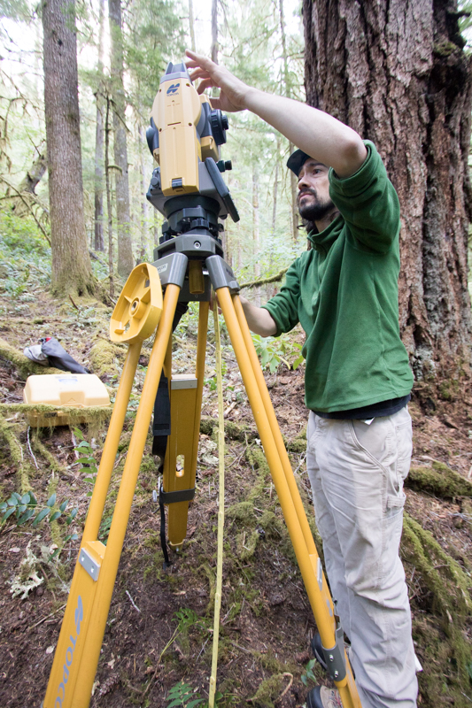
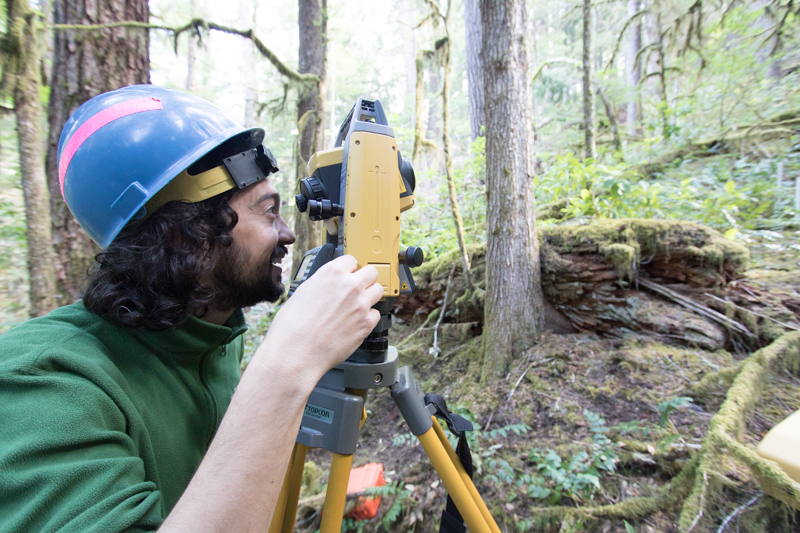
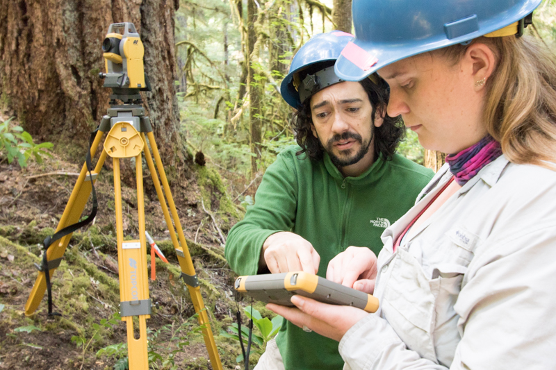
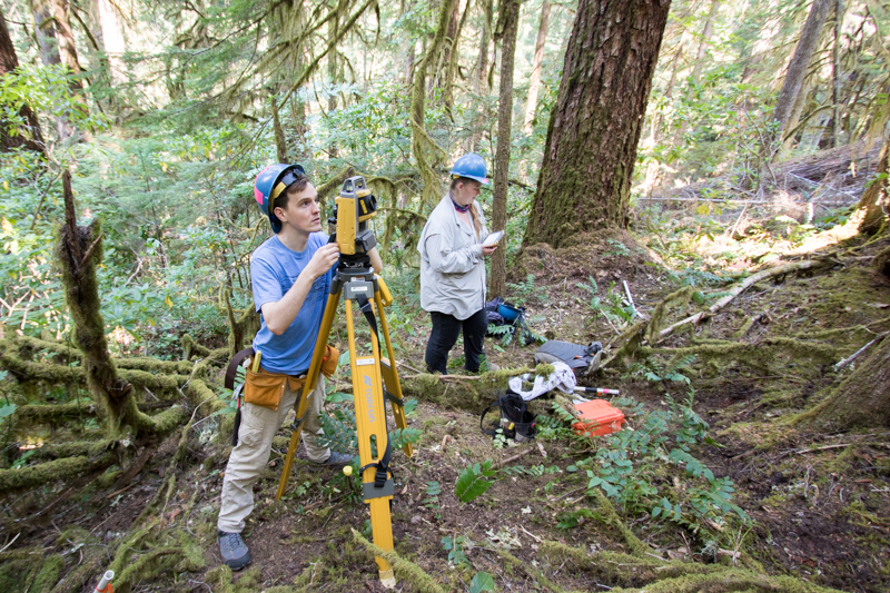
Joseph LaManna calibrates the laser survey tool (total station), which is used to map every stem larger than 1 cm diameter within the plot
Photographed by Lina DiGregorio ..... Date: 7/23/2019 ..... Photo: AER-011
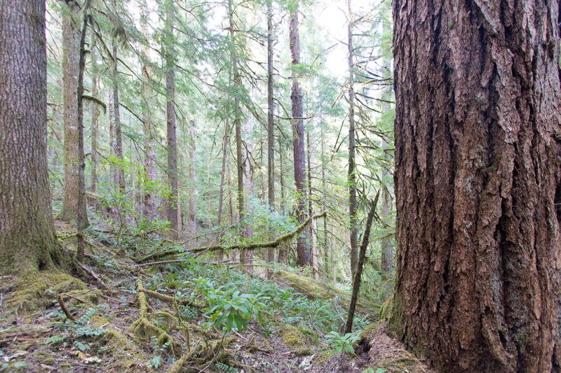
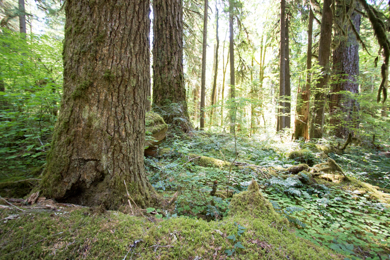
A view within plot FOREG02, which contains Reference Stand 2.
Photographed by Lina DiGregorio ..... Date: 7/23/2019 ..... Photo: AER-012
A view within plot FOREG02, which contains Reference Stand 2.
Photographed by Lina DiGregorio ..... Date: 7/23/2019 ..... Photo: AER-013
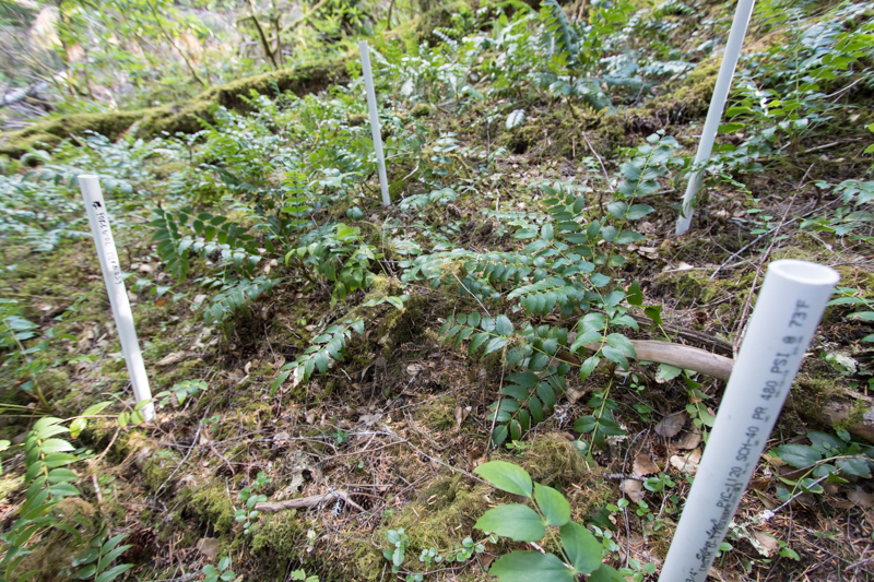
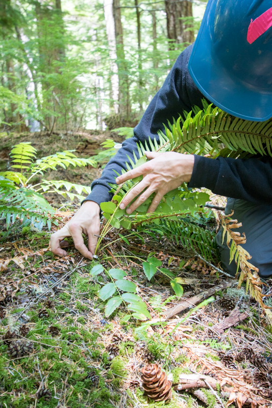
Within each larger plot there are a series of 1m-square plots within which every stem is inventoried and recorded and within which all herbaceous plants are surveyed
Photographed by Lina DiGregorio ..... Date: 7/23/2019 ..... Photo: AER-014

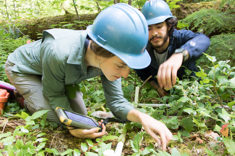
Joseph LaManna (left) and Maddie Sutton (right) measure and record data on plant size and location
Photographed by Lina DiGregorio ..... Date: 7/23/2019 ..... Photo: AER-015
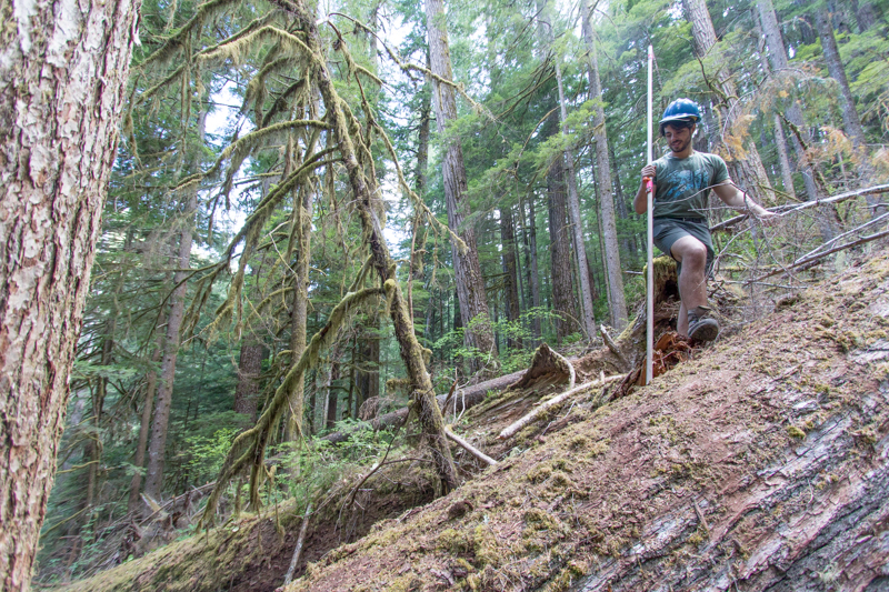
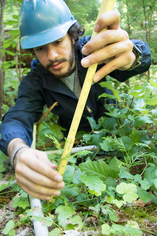
Matt Reala climbs through the plot and notes size, condition, and location of each stem >1cm in diameter
Photographed by Lina DiGregorio ..... Date: 7/23/2019 ..... Photo: AER-016
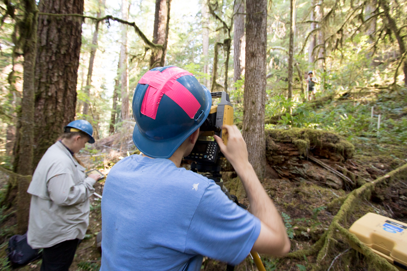
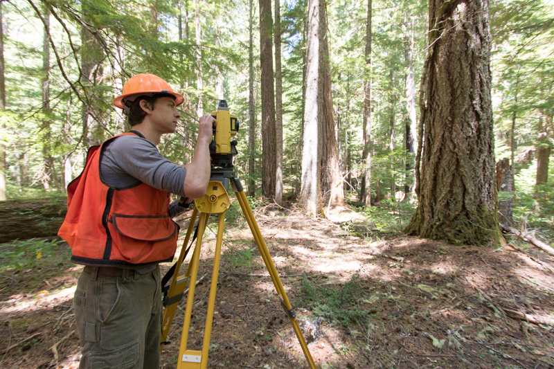
Joseph LaManna uses a laser survey tool (total station) to precisely map exact locations of stems within a plot
Photographed by Lina DiGregorio ..... Date: 7/23/2019 ..... Photo: AER-017
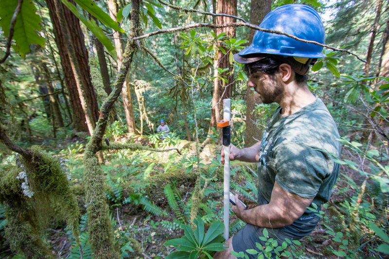
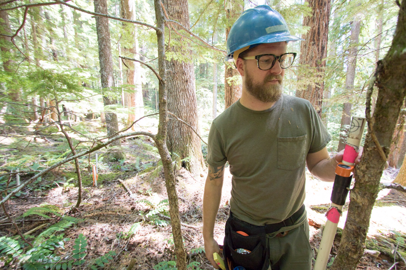
Matt Reala holds a PVC pipe with reflective target and rod level, used as the target for the laser survey tool (total station) in mapping stem distance and location
Photographed by Lina DiGregorio ..... Date: 7/23/2019 ..... Photo: AER-018
Matt Reala holds a PVC pipe with reflective target and rod level, used as the target for the laser survey tool (total station) in mapping stem distance and location
Photographed by Lina DiGregorio ..... Date: 7/23/2019 ..... Photo: AER-019
Matt Reala holds a PVC pipe with reflective target and rod level, used as the target for the laser survey tool (total station) in mapping stem distance and location
Photographed by Lina DiGregorio ..... Date: 7/23/2019 ..... Photo: AER-020
A tree tag, specific to the FOREG study, which provides a unique identifcation number to each tree or large shrub in the plot. This tag is on a western hemlock.
Photographed by Lina DiGregorio ..... Date: 7/23/2019 ..... Photo: AER-021
Joseph LaManna (left) and Maddie Sutton (right) measure and record data on plant size and location
Photographed by Lina DiGregorio ..... Date: 7/23/2019 ..... Photo: AER-022
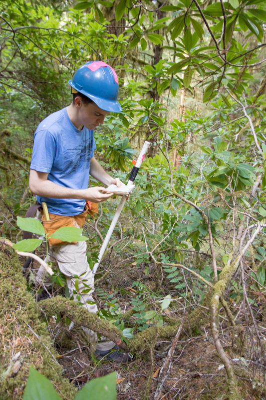
Liam Engel fact checks plants within the plot, to verify data recorded the day prior
Photographed by Lina DiGregorio ..... Date: 7/23/2019 ..... Photo: AER-023
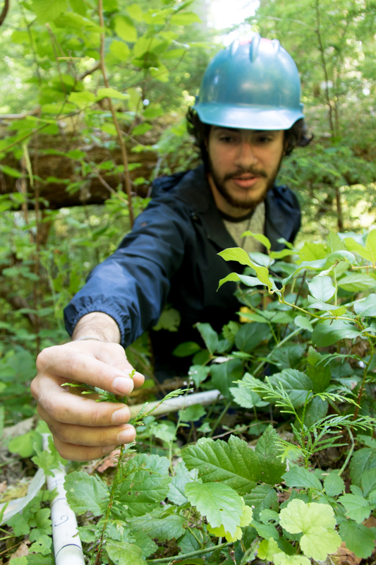
Liam Engel locates trees that will then be mapped with the laser survey tool (total station)
Photographed by Lina DiGregorio ..... Date: 7/23/2019 ..... Photo: AER-024
Liam Engel (left) and Maggie Sutton (right) measure and record data on every plant with a stem diameter larger than 1 cm
Photographed by Lina DiGregorio ..... Date: 7/23/2019 ..... Photo: AER-025
Using the laser survey tool to map exact location of each stem
Photographed by Lina DiGregorio ..... Date: 7/23/2019 ..... Photo: AER-026
A tree tag, specific to the FOREG study, which provides a unique identifcation number to each tree or large shrub in the plot. This tag is on a Pacific yew tree.
Photographed by Lina DiGregorio ..... Date: 7/23/2019 ..... Photo: AER-027
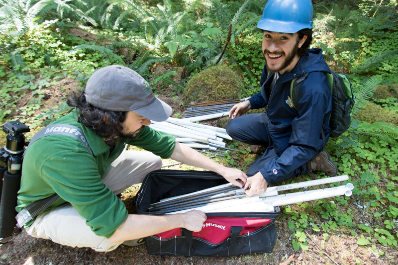
Joseph Lamanna (left) and undergraduate student Ethan Torres pick up supplies they'll need for establishing 1m-square vegetation survey plots
Photographed by Lina DiGregorio ..... Date: 7/23/2019 ..... Photo: AER-028
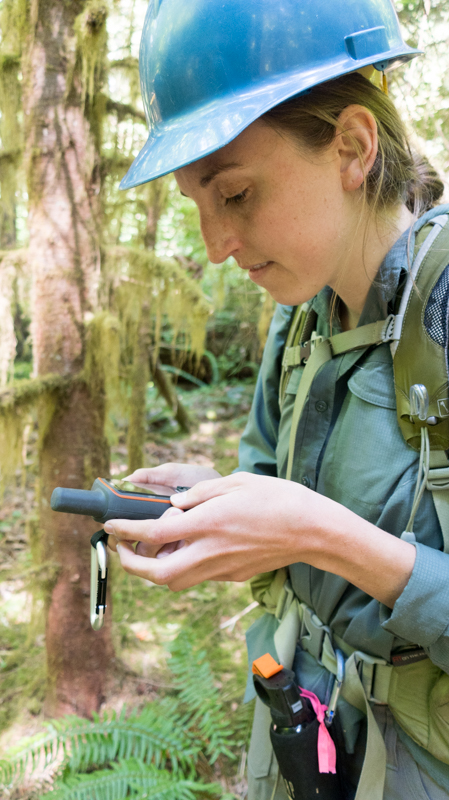
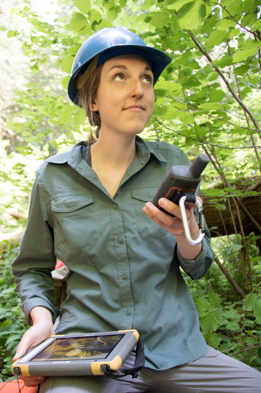
Field crew co-lead Maggie Ross uses a GPS to locate the next 1m-square plot
Photographed by Lina DiGregorio ..... Date: 7/23/2019 ..... Photo: AER-029
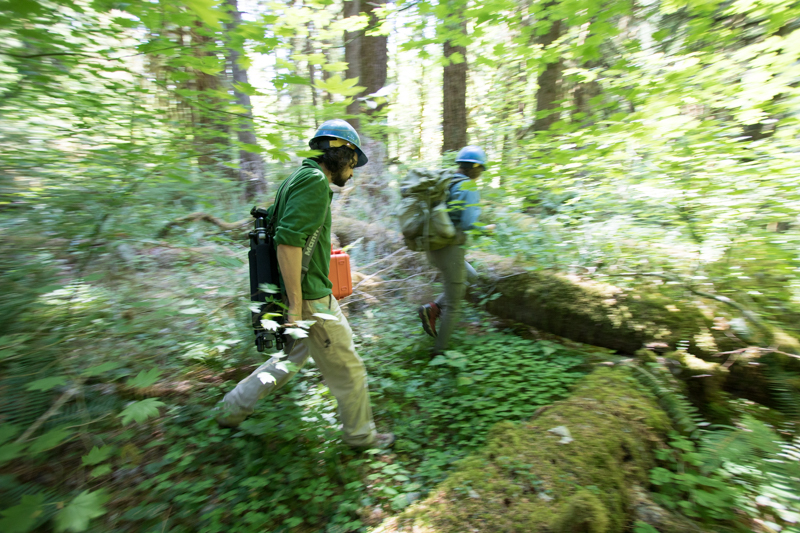
Joseph LaManna and Maggie Ross move through the forest to the next survey plot
Photographed by Lina DiGregorio ..... Date: 7/23/2019 ..... Photo: AER-030
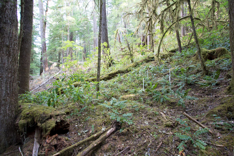
A view within plot FOREG38, which contains Reference Stand 38.
Photographed by Lina DiGregorio ..... Date: 7/23/2019 ..... Photo: AER-031
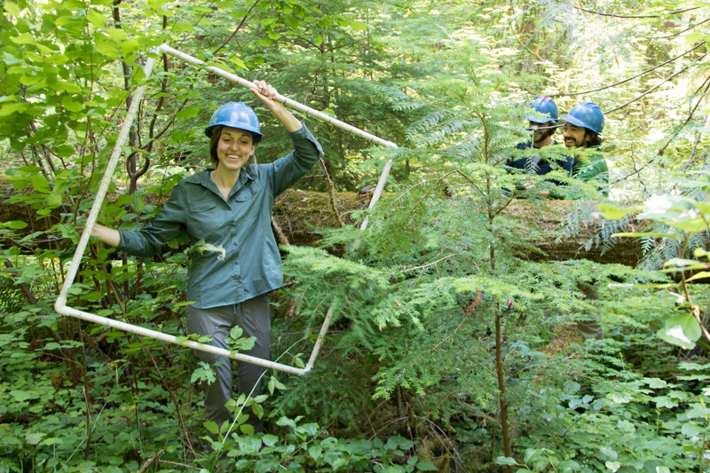
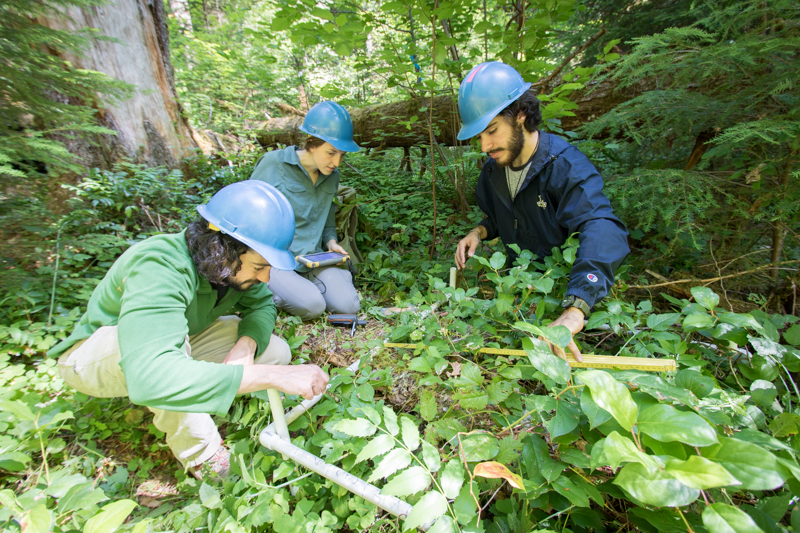
Maggie Ross holds up the frame of the 1m-square. It will be laid down over the ground vegetation, and everything within the frame will be inventoried and recorded
Photographed by Lina DiGregorio ..... Date: 7/23/2019 ..... Photo: AER-032
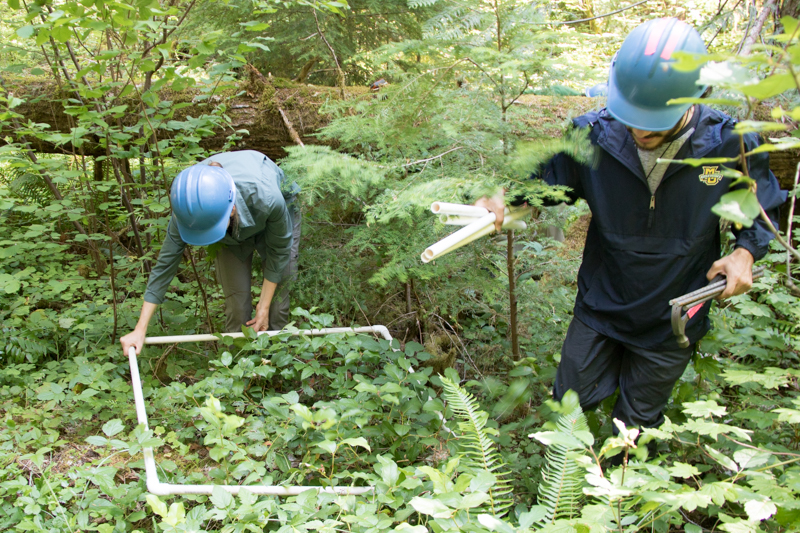
Laying down the 1m-square frame over the ground vegetation. Everything within the frame will be inventoried and recorded
Photographed by Lina DiGregorio ..... Date: 7/23/2019 ..... Photo: AER-033
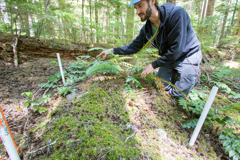
Hammering rebar to anchor the corners of the 1-m square plots. The corners will be flagged and their locations marked with GPS. The plots will be revisited for years to come.
Photographed by Lina DiGregorio ..... Date: 7/23/2019 ..... Photo: AER-034
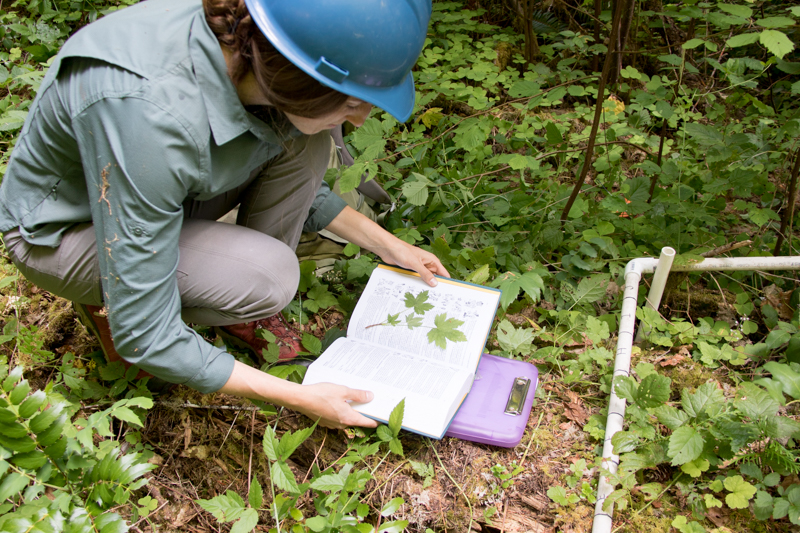
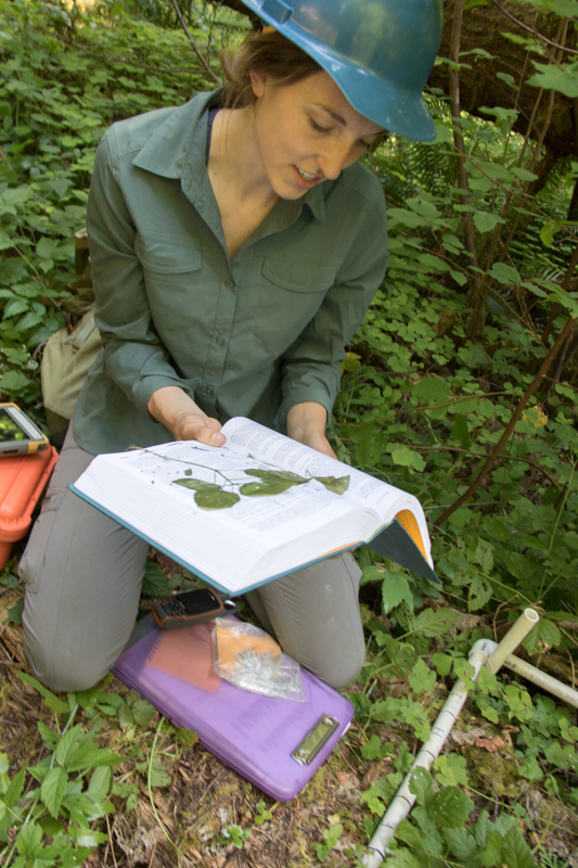
Maggie Ross verifies the identification of a plant using her reference guide
Photographed by Lina DiGregorio ..... Date: 7/23/2019 ..... Photo: AER-035

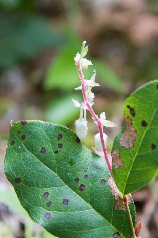
Maggie Ross verifies the identification of a plant (maple-leaf currant) using her reference guide
Photographed by Lina DiGregorio ..... Date: 7/23/2019 ..... Photo: AER-036
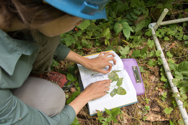
Maggie Ross verifies the identification of a plant using her reference guide
Photographed by Lina DiGregorio ..... Date: 7/23/2019 ..... Photo: AER-037
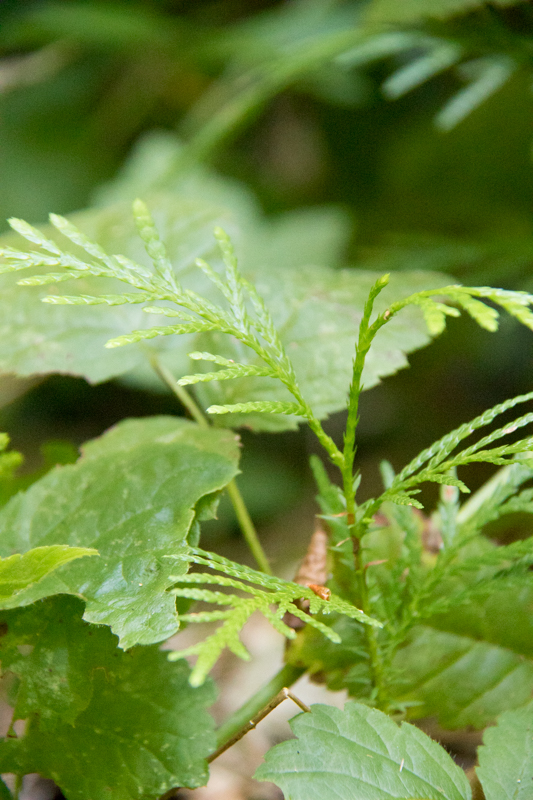
In the center is a small seedling of a cedar tree
Photographed by Lina DiGregorio ..... Date: 7/23/2019 ..... Photo: AER-038
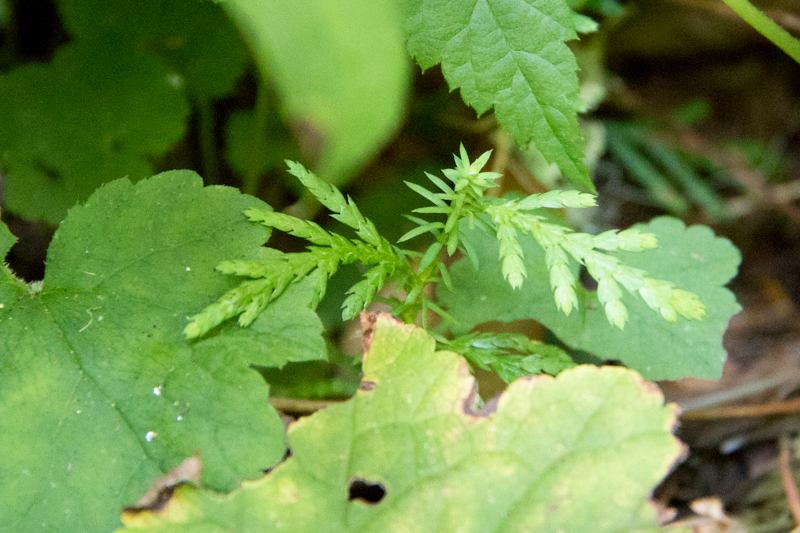
In the center is a small seedling of a cedar tree. Note how the type of leaf changes from main stem to lateral leaves.
Photographed by Lina DiGregorio ..... Date: 7/23/2019 ..... Photo: AER-039
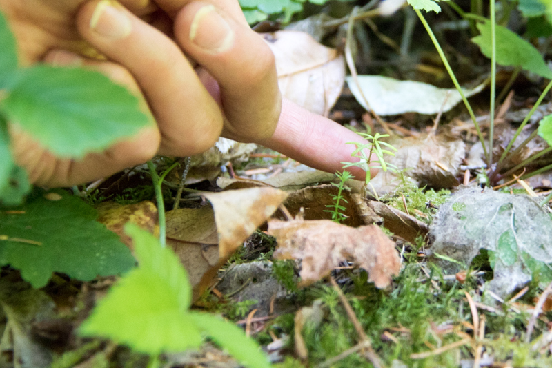
A very small seedling of western hemlock. Each seedling is noted, recorded, measured, and tagged.
Photographed by Lina DiGregorio ..... Date: 7/23/2019 ..... Photo: AER-040
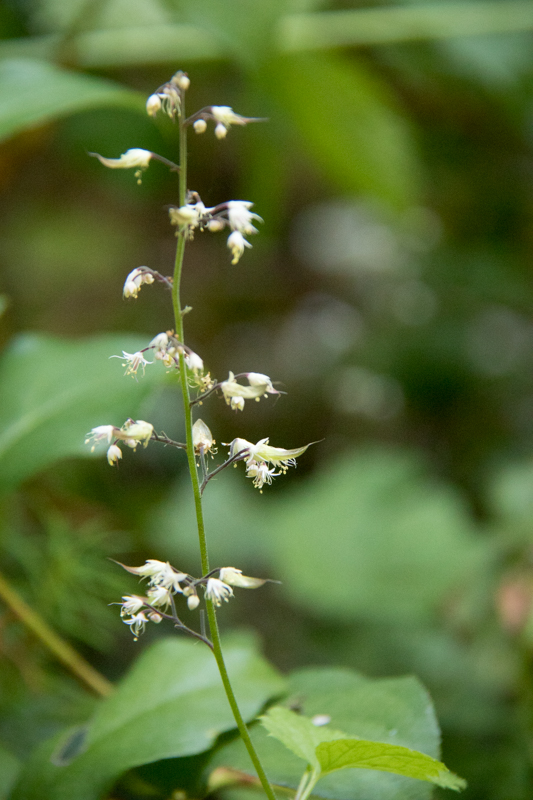
A flower of a tiarella plant within the 1m-square plot
Photographed by Lina DiGregorio ..... Date: 7/23/2019 ..... Photo: AER-041
Maggie Ross verifies the identification of a plant using her reference guide
Photographed by Lina DiGregorio ..... Date: 7/23/2019 ..... Photo: AER-042
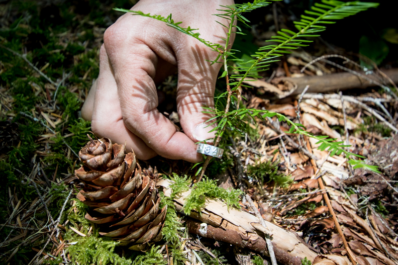
Metal identification tags used to wrap around the stem of each plant within a 1m-square plot
Photographed by Lina DiGregorio ..... Date: 7/23/2019 ..... Photo: AER-043
Maggie Ross uses a GPS to mark the exact location of the new 1m-squared plot
Photographed by Lina DiGregorio ..... Date: 7/23/2019 ..... Photo: AER-044

Wrapping a metal identification tag around the stem of a western red cedar seedling
Photographed by Lina DiGregorio ..... Date: 7/23/2019 ..... Photo: AER-045
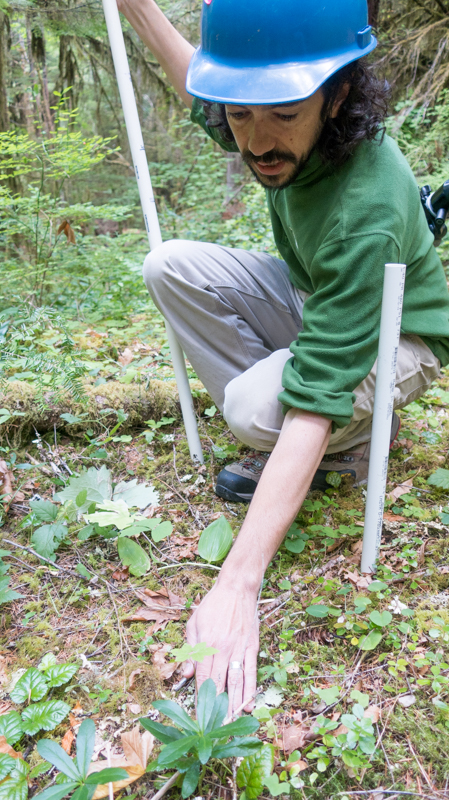
Ethan Torres notes each plant within the 1m square plot
Photographed by Lina DiGregorio ..... Date: 7/23/2019 ..... Photo: AER-046
Ethan Torres measures the height of a seedling
Photographed by Lina DiGregorio ..... Date: 7/23/2019 ..... Photo: AER-047
Maggie Ross and Ethan Torres identify, measure, and record each plant within the 1m square plot
Photographed by Lina DiGregorio ..... Date: 7/23/2019 ..... Photo: AER-048
A close up of salal (Gaultheria shallon)
Photographed by Lina DiGregorio ..... Date: 7/23/2019 ..... Photo: AER-049
Joseph LaManna, Maggie Ross, and Ethan Torres survey every plant within their 1m square plot
Photographed by Lina DiGregorio ..... Date: 7/23/2019 ..... Photo: AER-050
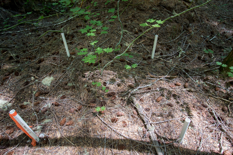
A 1m square plot within the larger plot FOREG31
Photographed by Lina DiGregorio ..... Date: 7/23/2019 ..... Photo: AER-051

Joseph LaManna notes that trees can have two tags where the new FOREG plots and the old Reference Stands overlap. The two studies are planned to dovetail and complement each other (e.g. measurements will be taken at both nails in future years).
Photographed by Lina DiGregorio ..... Date: 7/23/2019 ..... Photo: AER-052

Emily Dewald-Wang holds a PVC pipe which is the target for the laser survey tool (total station). She calls out the species of tree, its size, and its condition. The data are recorded into a tablet and then the tree's location is mapped with the total st
Photographed by Lina DiGregorio ..... Date: 7/23/2019 ..... Photo: AER-053
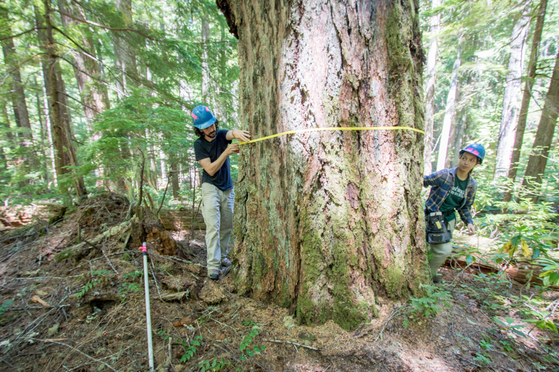
Joseph LaManna and Emily Dewald-Wang measure the diamater of a large Douglas fir tree.
Photographed by Lina DiGregorio ..... Date: 7/23/2019 ..... Photo: AER-054
Emily Dewald-Wang holds a PVC pipe which is the target for the laser survey tool (total station). She calls out the species of tree, its size, and its condition. The data are recorded into a tablet and then the tree's location is mapped with the total st
Photographed by Lina DiGregorio ..... Date: 7/23/2019 ..... Photo: AER-055
Emily Dewald-Wang recording location, species, and condition of a tree within a forest dynamics plot.
Photographed by Lina DiGregorio ..... Date: 7/23/2019 ..... Photo: AER-056
Adam Milenkowic uses the laser survey tool (total station) to measure the exact location of each stem within the plot
Photographed by Lina DiGregorio ..... Date: 7/23/2019 ..... Photo: AER-057

A map of a 12-ha section of FOREG-31 (the megaplot, with a footprint of 25 ha), showing the reference poles from which the total station maps trees and stems. The diagonal-square on the right side of the map is historic Reference Stand 31.
Photographed by Lina DiGregorio ..... Date: 7/23/2019 ..... Photo: AER-058

Adam Milenkowic uses the laser survey tool (total station) to measure exact location of each stem within the plot. Data, called out from a person moving from tree to tree, is recorded in the tablet.
Photographed by Lina DiGregorio ..... Date: 7/23/2019 ..... Photo: AER-059
Adam Carson sets up the target for the laser survey tool (total station).
Photographed by Lina DiGregorio ..... Date: 7/23/2019 ..... Photo: AER-060
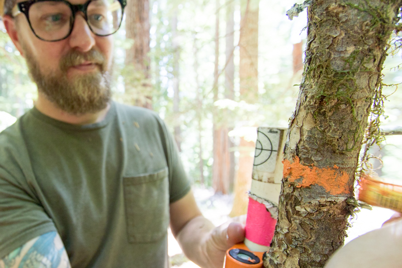
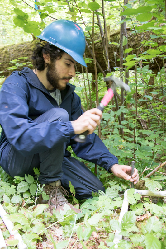
Adam Carson paints an orange ring around a stem to mark measurement height for future censuses.
Photographed by Lina DiGregorio ..... Date: 7/23/2019 ..... Photo: AER-061
Aaron Nelson looks over a 1m square plot within the larger plot FOREG 31
Photographed by Lina DiGregorio ..... Date: 7/23/2019 ..... Photo: AER-062
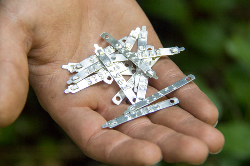
Aaron Nelson displays one of the metal identification tags that is placed around each stem within the 1m square plot
Photographed by Lina DiGregorio ..... Date: 7/23/2019 ..... Photo: AER-063
A metal identification tag, with a unique number, is placed around each stem within each 1m-square plot. Each plant is noted for species, size, location, and will be tracked for years to come.
Photographed by Lina DiGregorio ..... Date: 7/23/2019 ..... Photo: AER-064