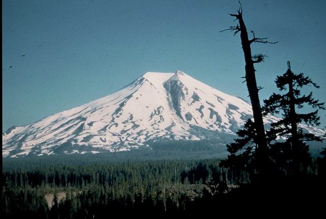
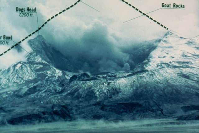
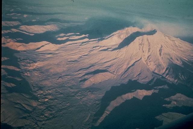
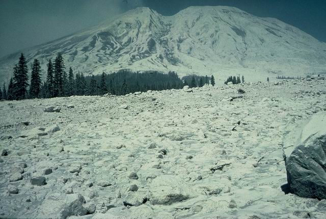
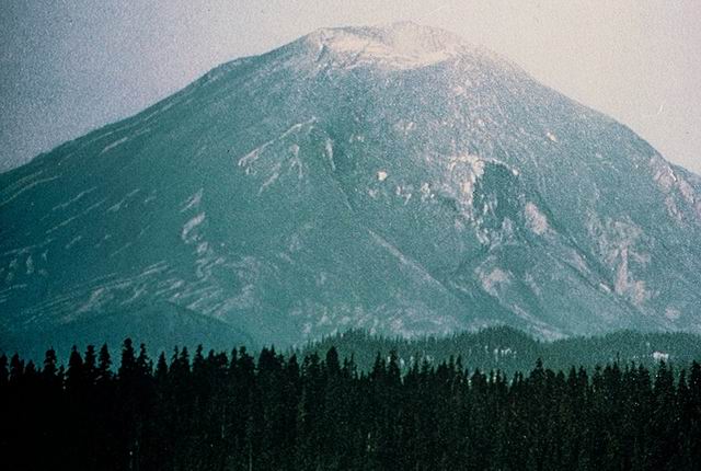
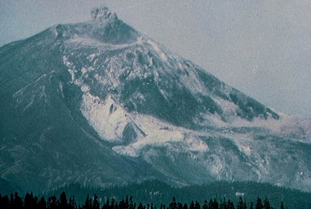
Photographed by Unknown ..... Date: Unknown..... Photo: ABB-001

Summit of Mt. St. Helens with explosion crater and ash on snow
Photographed by C. Rosenfeld ..... Date: 03/27/80 ..... Photo: ABB-002
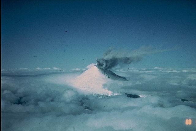
Minor ash eruption
Photographed by C. Rosenfeld ..... Date: 04/10/80 ..... Photo: ABB-003
Pre-May 18, 1980; Phreatic eruption
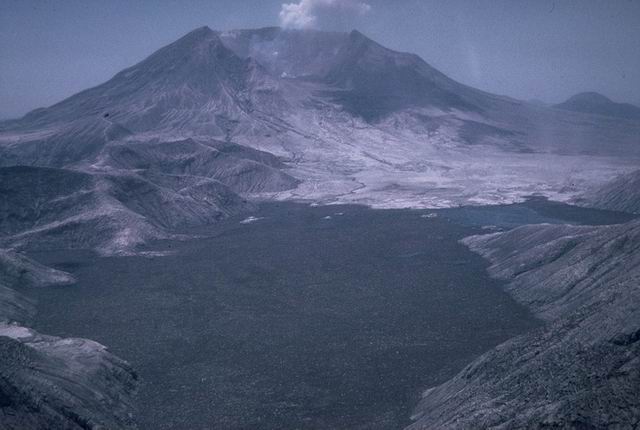
Photographed by C. Rosenfeld ..... Date: 05/01/80 ..... Photo: ABB-004

View of Mt. St. Helens and Muddy River lahar area from SE in declining stages of May 18 eruption.
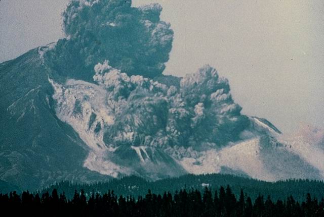
Photographed by C. Rosenfeld ..... Date: 05/01/80 ..... Photo: ABB-005

Vertical eruption column
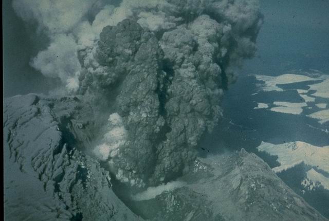
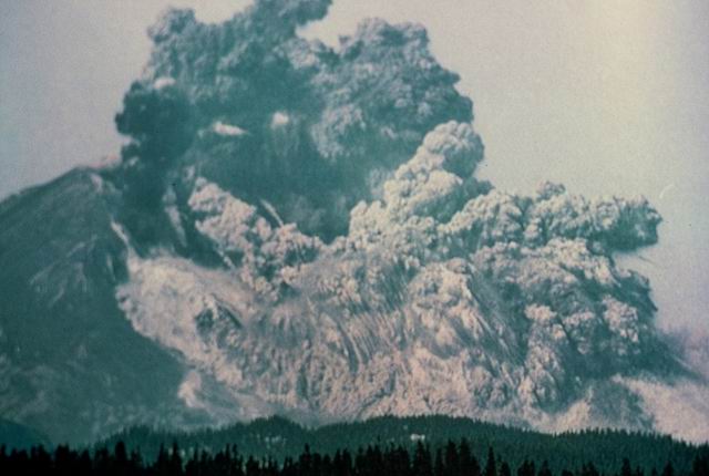
Photographed by C. Rosenfeld ..... Date: 05/18/80 ..... Photo: ABB-006

View of eruption column
Photographed by C. Rosenfeld ..... Date: 05/18/80 ..... Photo: ABB-007

View of eruption column
Photographed by C. Rosenfeld ..... Date: 05/18/80 ..... Photo: ABB-008

Pyroclastic descending flank of Mt. St. Helens
Photographed by C. Rosenfeld ..... Date: 05/18/80 ..... Photo: ABB-009
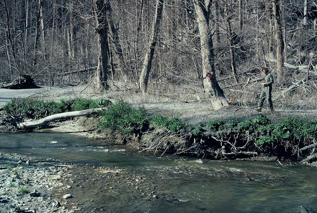
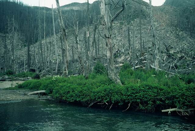
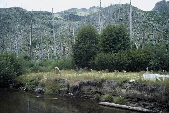
Riparian vegetation recovery
Photographed by Fred Swanson ..... Date: 09/15/80 ..... Photo: ABB-010
Volcano cross-section pre- (sketched) and post- (photo) eruption.
Photographed by Unknown ..... Date: Unknown..... Photo: ABB-011
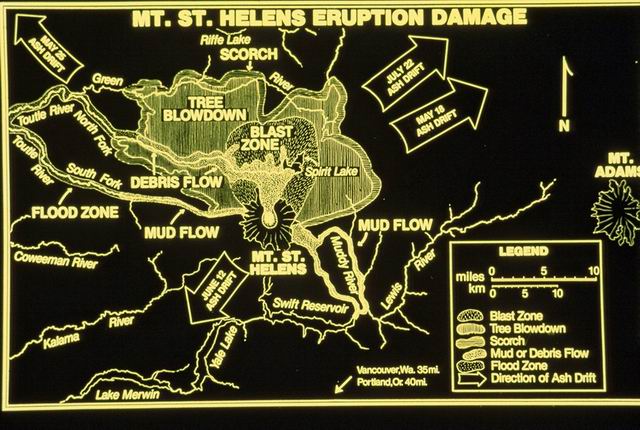
Map of volcanic process impact zones.
Photographed by Unknown ..... Date: Unknown..... Photo: ABB-012
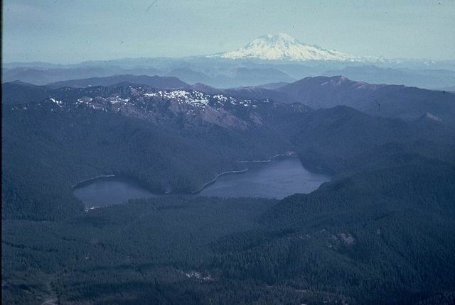
north from mountain before eruption
Photographed by Unknown ..... Date: Unknown..... Photo: ABB-013
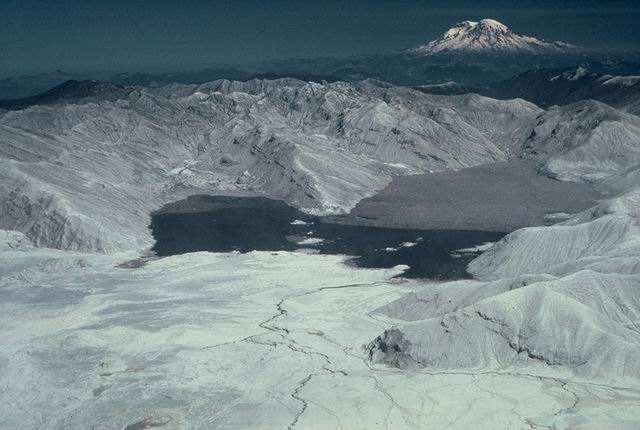
north from mountain after eruption
Photographed by Jerry Franklin ..... Date: 09/27/80 ..... Photo: ABB-014
Base of blast-impacted, shattered tree, near St. Helens Lake
Photographed by Unknown ..... Date: 09/27/80 ..... Photo: ABB-015
Toppled, de-limbed trees NE of volcano
Photographed by Unknown ..... Date: Unknown..... Photo: ABB-016
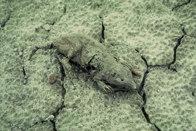
Dead small mammal on tephra deposit
Photographed by Unknown ..... Date: Unknown..... Photo: ABB-017

Dead horse near Polar Star Mine horse camp, Upper Green River.
Photographed by Fred Swanson ..... Date: Unknown..... Photo: ABB-018
Photographed by Unknown ..... Date: Unknown..... Photo: ABB-019
Riparian vegetation recovery
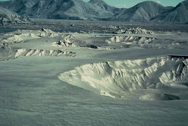
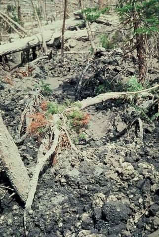
Photographed by Fred Swanson ..... Date: 10/28/81 ..... Photo: ABB-020
East end of Johnston Ridge and phreatic explosion pits in pyroclastic flows.
Photographed by Jerry Franklin ..... Date: 06/20/80 ..... Photo: ABB-021
Phreatic explosion pits in pyroclastic flow deposits north of volcano.
Photographed by Unknown ..... Date: Summer 1980 ..... Photo: ABB-022
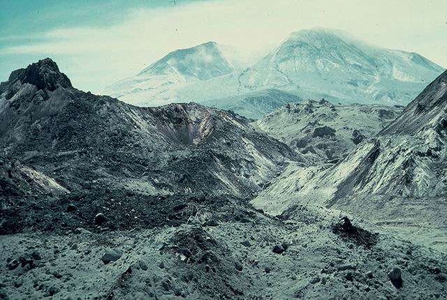
Views of volcano through hummocks on debris avalanche NW of volcano.
Photographed by Unknown ..... Date: Summer 1980 ..... Photo: ABB-023
Hummocky degris avalanche terrain.
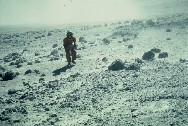
Photographed by Unknown ..... Date: Summer 1980 ..... Photo: ABB-024
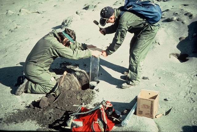
Fio Ugolini and Larry Bliss (UW) sampling soils.
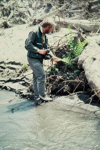
Photographed by Unknown ..... Date: Summer 1980 ..... Photo: ABB-025
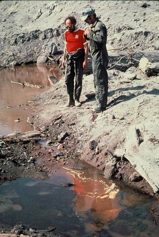
Jim Sedell (USFS-PNW) and John Barros (OSU) inspecting "primordial soup" -- organics-rich water.
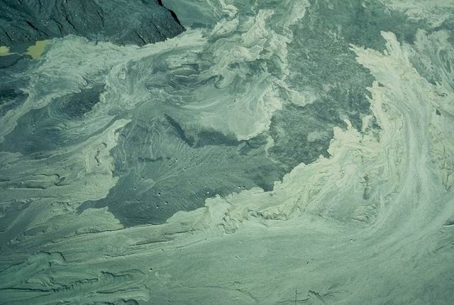
Photographed by Jerry Franklin ..... Date: Summer 1980 ..... Photo: ABB-026

Organic matter accumulations in "primordial soup"
Photographed by Unknown ..... Date: Summer 1980 ..... Photo: ABB-027

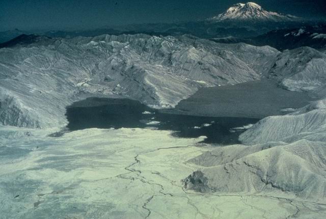
North Coldwater Lake blocked by debris avalanche.
Photographed by Unknown ..... Date: 10/22/80 ..... Photo: ABB-028
Looking across Spirit Lake
Photographed by Unknown ..... Date: Summer 1980 ..... Photo: ABB-029
Hummocky terrain and pond on debris avalanche, North Toutlte River
Photographed by Unknown ..... Date: Summer 1980 ..... Photo: ABB-030
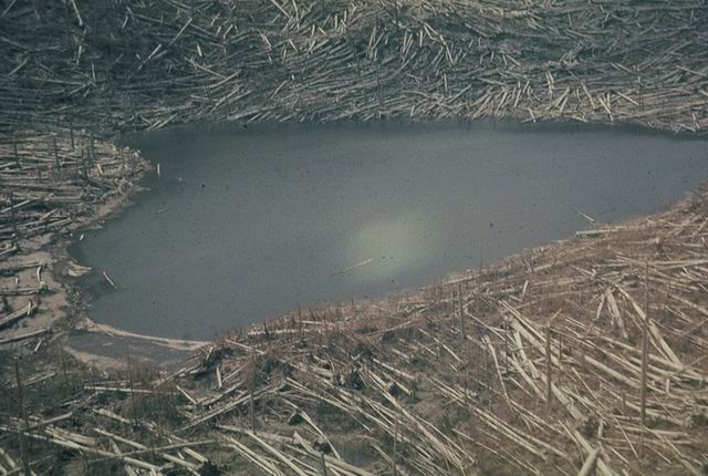
Small Lake in blowdown part of blast zone
Photographed by Unknown ..... Date: Summer 1980 ..... Photo: ABB-031
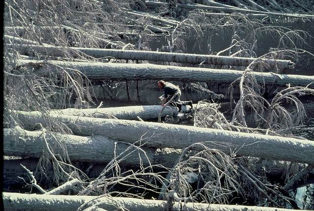
Jim Sedell (USFS-PNW) sampling Ryan Lake from blowndown trees.
Photographed by Sarah Greene ..... Date: Summer 1980 ..... Photo: ABB-032

Sampling a lake in ashfall zone NE of Mt. St. Helens.
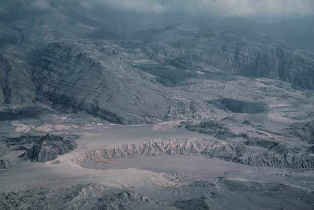
Photographed by Unknown ..... Date: Summer 1980 ..... Photo: ABB-033
Pyroclastic flow deposits (light color) on debris avalanch deposits (darker gray).
Photographed by Unknown ..... Date: Summer 1980 ..... Photo: ABB-034

Steam emissions from Mt. St. Helens crater.
Photographed by Unknown ..... Date: Summer 1980 ..... Photo: ABB-035
Scientist returning to helicopter parked on pyroclastic flow deposits north of crater.
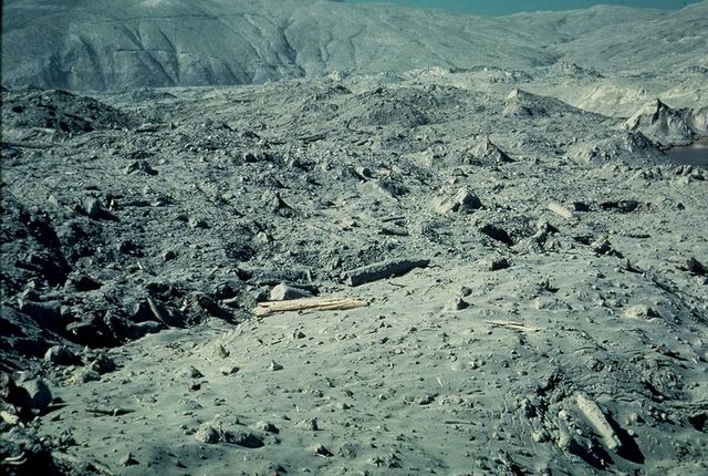
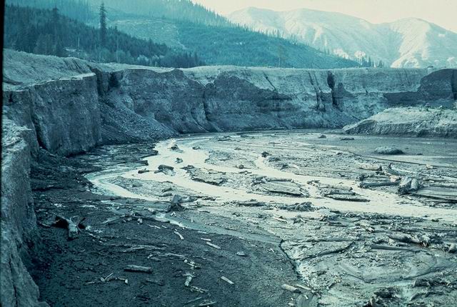
Photographed by Unknown ..... Date: Summer 1980 ..... Photo: ABB-036
View up Lahar area SE of Mt. St. Helens.
Photographed by Unknown ..... Date: Summer 1980 ..... Photo: ABB-037
???? Smith Creek area east of Mt. St. Helens.
Photographed by Unknown ..... Date: Summer 1980 ..... Photo: ABB-038
???? Smith Creek area east of Mt. St. Helens.
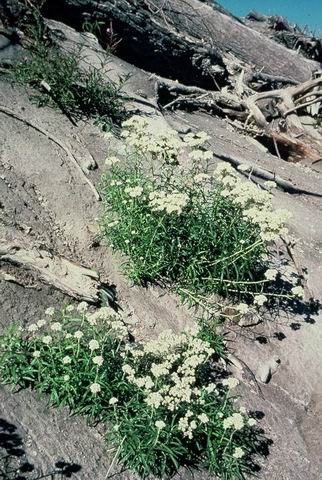
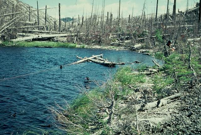
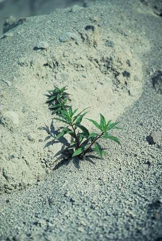
Photographed by Unknown ..... Date: Summer 1980 ..... Photo: ABB-039
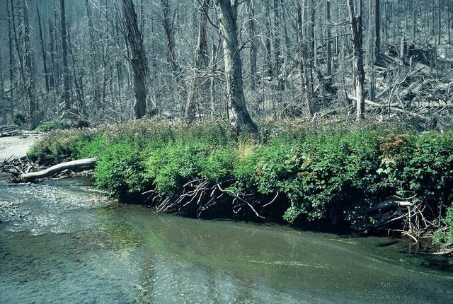
Riparian vegetation recovery
Photographed by Fred Swanson ..... Date: 08/01/82 ..... Photo: ABB-040
"Bayonet" trees in mudflow zone, N. Fork Toutle River. Trees sharpened by mudflow abrasion.
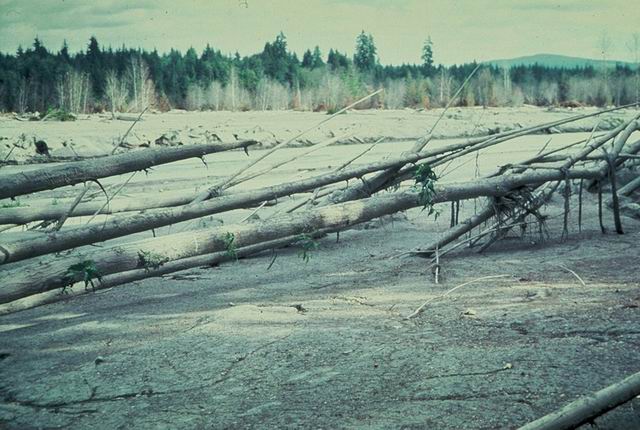
Photographed by Fred Swanson ..... Date: Unknown..... Photo: ABB-041

Down trees on divide on east side of Smith Creek looking toward Mt. St. Helens.
Photographed by Jerry Franklin ..... Date: 06/17/80 ..... Photo: ABB-042
Riparian vegetation recovery
Photographed by Fred Swanson ..... Date: 06/28/83 ..... Photo: ABB-043
Looking down Clearwater Creek and valley from Upper bridge with down tree zone (foreground) and standing dead (distance).
Photographed by Unknown ..... Date: Summer 1980 ..... Photo: ABB-044
Stream in zone of blowdown and scattered standing dead; Probably Clearwater Creek
Photographed by Unknown ..... Date: Summer 1980 ..... Photo: ABB-045
Jim Sedell and Fred Swanson in mixed standing and blowndown in forest - blast zone
Photographed by Jerry Franklin ..... Date: Summer 1980 ..... Photo: ABB-046
East side Smith Creek; pre-eruption clearcut area in blast zone.
Photographed by Jerry Franklin ..... Date: Summer 1980 ..... Photo: ABB-047
2 cm silty-sandy tephra over pumice airfall (~20 cm) over darker gray sandy blast deposits; Clearwater
Photographed by Jerry Franklin ..... Date: 06/17/80 ..... Photo: ABB-048
Fungal or dried-up algal material in blast deposit depression.
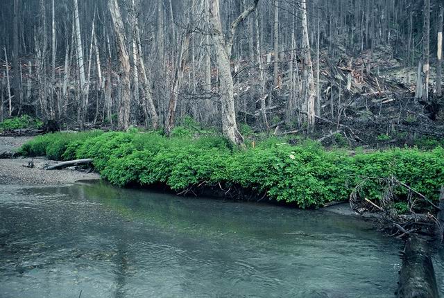
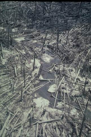
Photographed by Unknown ..... Date: Summer 1980 ..... Photo: ABB-049
Riparian vegetation recovery; just downstream of Middle Clearwater Bridge.
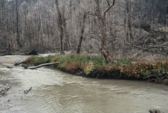
Photographed by Fred Swanson ..... Date: 07/01/85 ..... Photo: ABB-050
Trillium emerging through blast deposits broken up by melting of snow.
Photographed by Jerry Franklin ..... Date: 06/17/80 ..... Photo: ABB-051
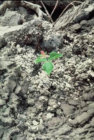
Close up of #51 - Trillium flowering
Photographed by Jerry Franklin ..... Date: 06/17/80 ..... Photo: ABB-052

Tip up mound with sprouting surviving plants in blast zone.
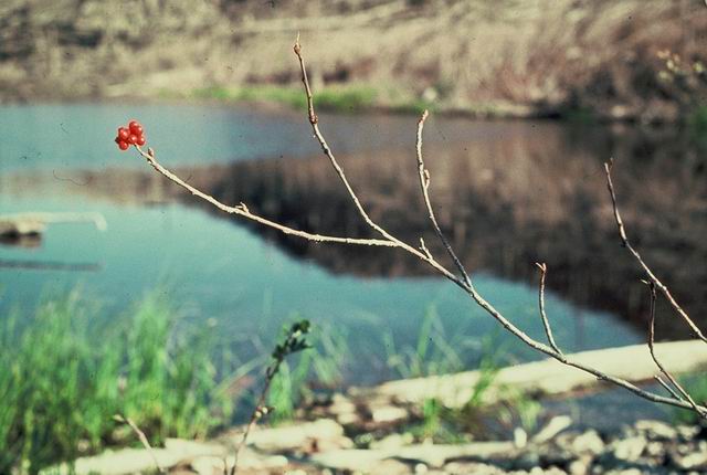
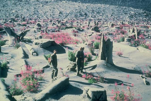
Photographed by Jerry Franklin ..... Date: Summer 1980 ..... Photo: ABB-053
Pearly Everlasting flowering in blast zone near Curtis Lake.
Photographed by Jerry Franklin ..... Date: 09/23/80 ..... Photo: ABB-054
Small, understory conifer partially emerging from melting snow bank and blast zone deposits.
Photographed by Unknown ..... Date: Summer 1980 ..... Photo: ABB-055
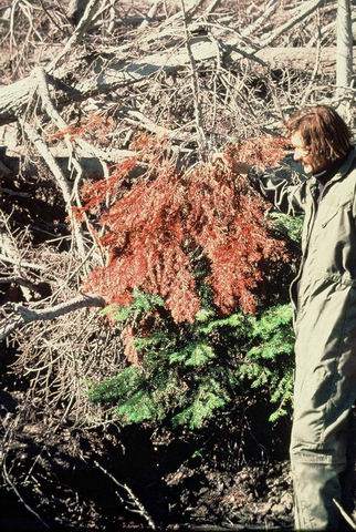
Will Moir by three level fir; west side Meta Lake. Top third defoliated by blast, middle third has brown foliage from quick exposure when blast deposits melted snow, bottom third has green foliage from slow snow melt under insulation of cooled blast deposits.
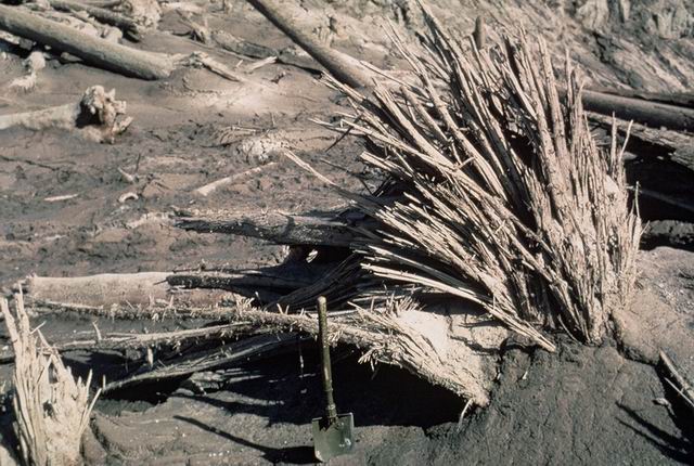
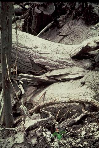
Photographed by Fred Swanson ..... Date: 09/15/80 ..... Photo: ABB-056
Surviving ferns growing on streamside tip-up mound in blast zone.
Photographed by Unknown ..... Date: Summer 1980 ..... Photo: ABB-057
Lake and shoreline in mixed downtree and standing dead in blast zone. Some revegetation from snow cover survival.
Photographed by Unknown ..... Date: Summer 1980 ..... Photo: ABB-058
Surviving Carex emerging from beneath about 10 cm of airfall tephra.
Photographed by Jerry Franklin ..... Date: Summer 1980 ..... Photo: ABB-059
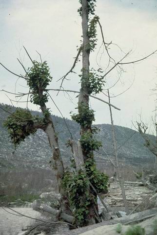
Sprouting of blast-damaged, de-limbed broadleaf maple tree on north edge of blast zone.
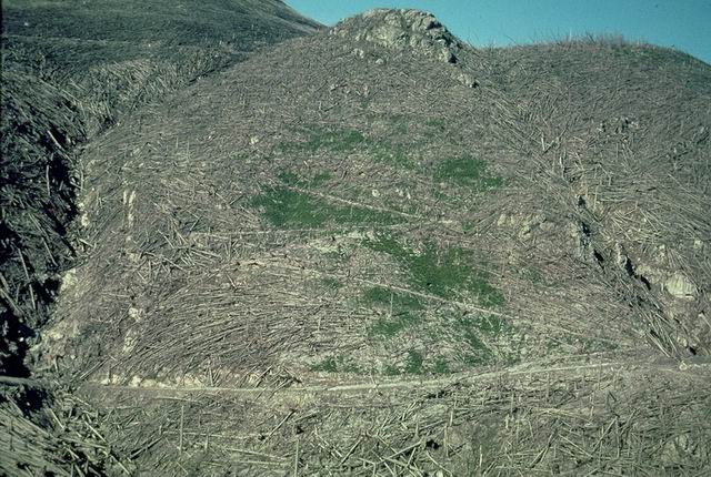
Photographed by Fred Swanson ..... Date: 08/01/80 ..... Photo: ABB-060
Berries on Mountain Ash shrub (survivor under snow cover) on shore of Meta Lake in blast zone.
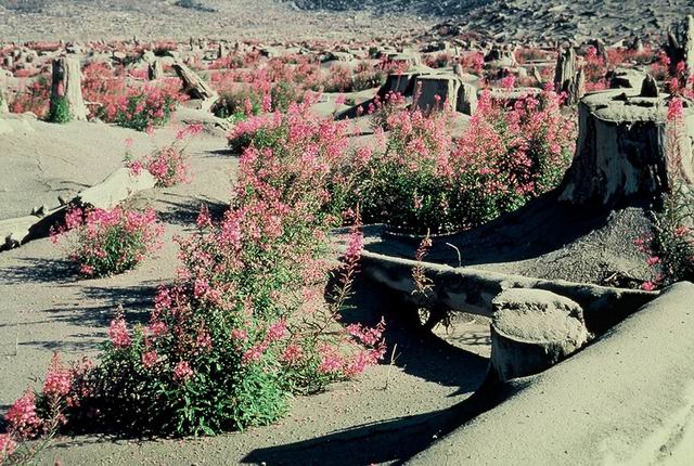
Photographed by Fred Swanson ..... Date: Summer 1980 ..... Photo: ABB-061
Fireweed (Epilobium) on debris avalanceh deposit (?)
Photographed by Unknown ..... Date: Summer 1980 ..... Photo: ABB-062
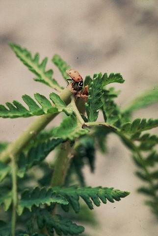
Bug on fern
Photographed by Unknown ..... Date: Summer 1980 ..... Photo: ABB-063
Fireweed in flower in pre-eruption clearcut; Clearwater valley floor.
Photographed by Unknown ..... Date: Summer 1980 ..... Photo: ABB-064
Revegetation in pre-eruption clearcut area; north side of North Fork Toutle River.
Photographed by Unknown ..... Date: Summer 1980 ..... Photo: ABB-065
Pre-eruption clearcut and down tree areas in blast zone.
Photographed by Unknown ..... Date: Summer 1980 ..... Photo: ABB-066
Fireweed in pre-eruption clearcut; Clearwater valley floor (?)
Photographed by M. Hermstrom ..... Date: 09/15/80 ..... Photo: ABB-067
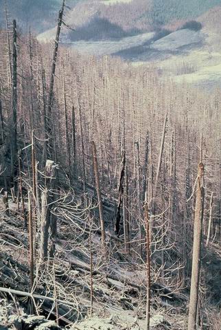
Standing dead in west side of Clearwater Creek looking NNE west side upper Bean Creek drainage.
Photographed by Jerry Franklin ..... Date: 06/17/80 ..... Photo: ABB-068
Standing dead zone; east side Clearwater valley.
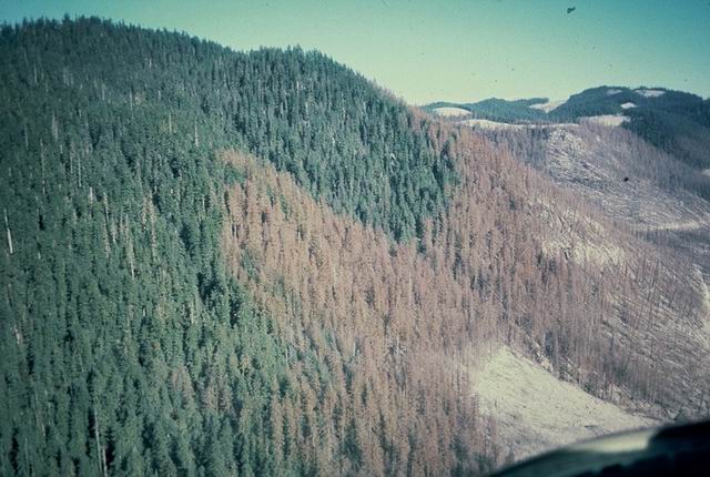
Photographed by Joe Means ..... Date: 10/03/80 ..... Photo: ABB-069
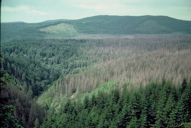
Standing dead zone in Weyerhauser Co. douglas-fir plantations NW of Mt. St. Helens.
Photographed by Unknown ..... Date: Summer 1980 ..... Photo: ABB-070

View of ash-coated forest NE of Mt. St. Helens from the air.
Photographed by Unknown ..... Date: 06/01/80 ..... Photo: ABB-071
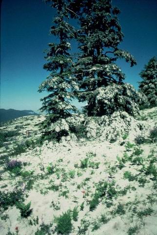
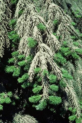
Airfall ash on trees and upper elevation meadow; NE of volcano.
Photographed by Unknown ..... Date: Summer 1980 ..... Photo: ABB-072
Confier saplings bend by ash from June 1980 eruption.
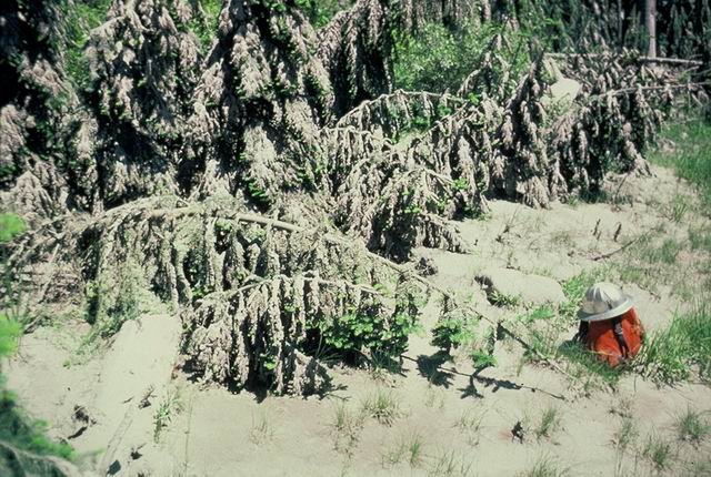
Photographed by Fred Swanson ..... Date: 07/02/80 ..... Photo: ABB-073
Ash-coated foliage with needle crop of 1980 just emerging.
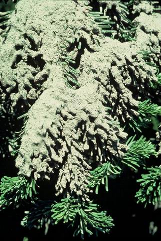
Photographed by Unknown ..... Date: Summer 1980 ..... Photo: ABB-074
Ash-coated foliage with needle crop of 1980 just emerging.
Photographed by Jerry Franklin ..... Date: 07/02/80 ..... Photo: ABB-075
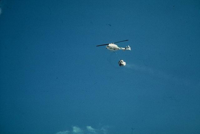
Helicopter spraying grass seed for erosion control NE of Mt. St. Helens.
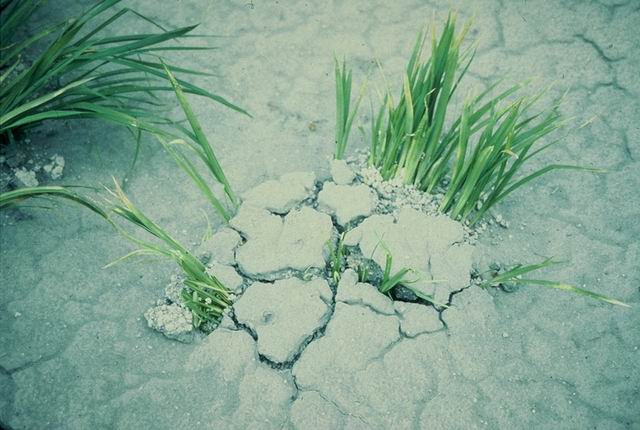
Photographed by Unknown ..... Date: Summer 1980 ..... Photo: ABB-076

Grass seed (applied for erosion control) sprouting in dessication crack in 1980 tephra deposits; cutaway view.
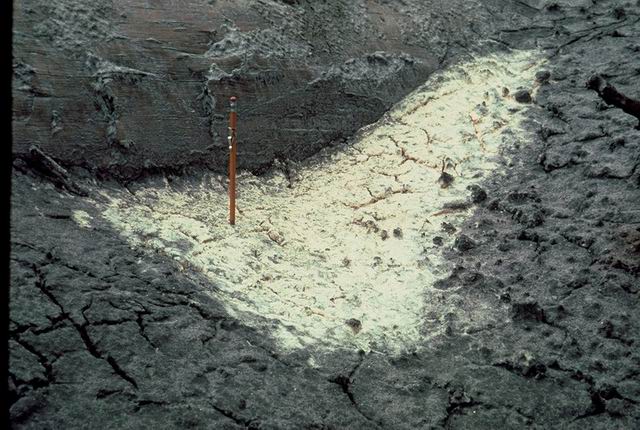
Photographed by Unknown ..... Date: Summer 1980 ..... Photo: ABB-077

Grass seed sprouting in dessication cracks in 1980 tephra.
Photographed by Unknown ..... Date: Summer 1980 ..... Photo: ABB-078

Mt. St. Helens at sunset.
Photographed by Unknown ..... Date: Summer 1980 ..... Photo: ABB-079
Riparian revegetation.
Photographed by Fred Swanson ..... Date: 08/01/94 ..... Photo: ABB-080
Frame b; pre-eruption of Gary Rosenquist photo sequence analyzed by Barry Voight in paper in USGS Prof. Paper 1250.
Photographed by Gary Rosenquist ..... Date: 05/18/80 ..... Photo: ABB-081
Frame g, h, or i of Rosenquist sequence interpreted by Barry Voight in USGS Prof. Paper 1250.
Photographed by Gary Rosenquist ..... Date: 05/18/80 ..... Photo: ABB-082
Frame n of Rosenquist sequence interpreted by Barry Voight in USGS Prof. Paper 1250.
Photographed by Gary Rosenquist ..... Date: 05/18/80 ..... Photo: ABB-083
Frame r of Rosenquist sequence interpreted by Barry Voight in USGS Prof. Paper 1250.
Photographed by Gary Rosenquist ..... Date: 05/18/80 ..... Photo: ABB-084
Photographed by Unknown ..... Date: 05/18/80 ..... Photo: ABB-085
same as #41
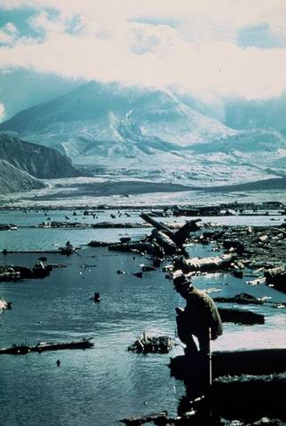
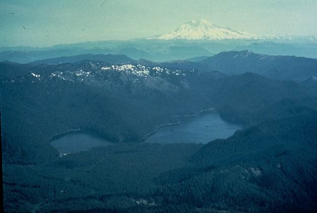
Photographed by Unknown ..... Date: Unknown..... Photo: ABB-086
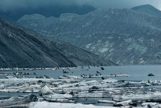
Spirit Lake with floating log mat.
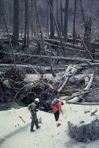
Photographed by Fred Swanson ..... Date: 06/28/83 ..... Photo: ABB-087
Tom Dunne (UW) on down timber in Lower Schulz Creek area north of Mt. St. Helens.
Photographed by Fred Swanson ..... Date: 08/01/80 ..... Photo: ABB-088
Debris avalanche deposits blocking South Coldwater Creek forming lake and North Coldwater.
Photographed by Fred Swanson ..... Date: 07/01/80 ..... Photo: ABB-089

Helicopter over logs past of North Toutle River mudflow (lahar) logs cut to length from Weyerhaeuser log decks.
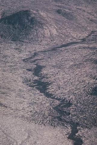
Photographed by media ..... Date: 05/18/80 ..... Photo: ABB-090
North Fork Toutle eroding into debris avalanche hummock near Elk Rock.
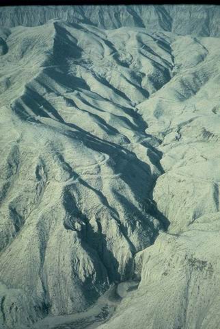
Photographed by Fred Swanson ..... Date: 06/01/82 ..... Photo: ABB-091
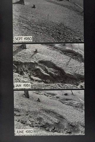
Chronosequence of gully formation 1980-1981. 9/80, 1/81, 6/81
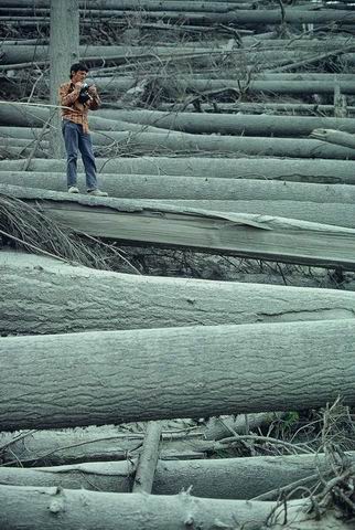
Photographed by Fred Swanson ..... Date: 9/80-6/81 ..... Photo: ABB-092

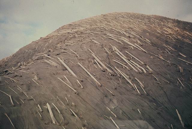
Toppled native (?) forest.
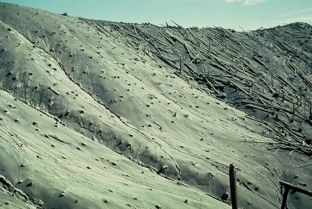
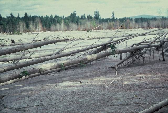
Photographed by Fred Swanson ..... Date: Summer 1980 ..... Photo: ABB-093

Airfall ash in forest and clearcut NE of Mt. St. Helens; near Elk Pass.
Photographed by Fred Swanson ..... Date: Summer 1980 ..... Photo: ABB-094
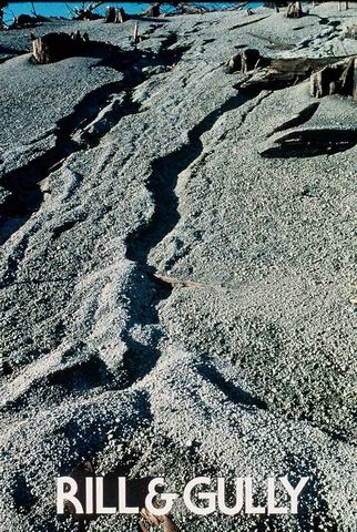
Small rills, gullies, depositional fan in area of blast and pumice tephra fall NE of Mt. St. Helens in pre-eruption clearcut.
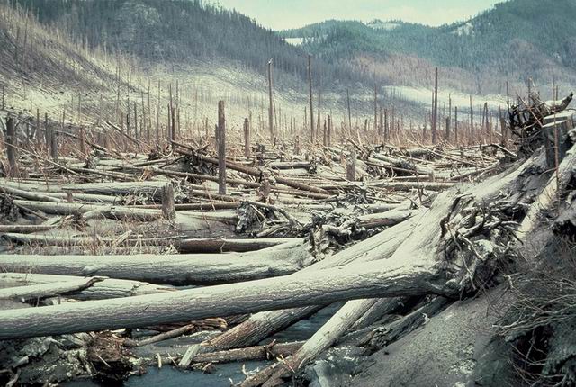
Photographed by Fred Swanson ..... Date: 1981?? ..... Photo: ABB-095
Blast-toppled forest along upper Green River; look to south up drainage.
Photographed by Jerry Franklin ..... Date: 07/25/80 ..... Photo: ABB-096
same as #14
Photographed by Unknown ..... Date: Unknown..... Photo: ABB-097
same as #13
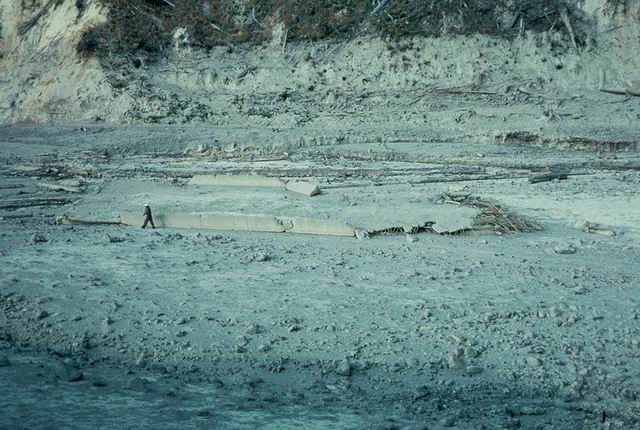
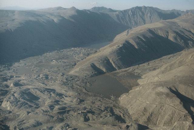
Photographed by Unknown ..... Date: Unknown..... Photo: ABB-098
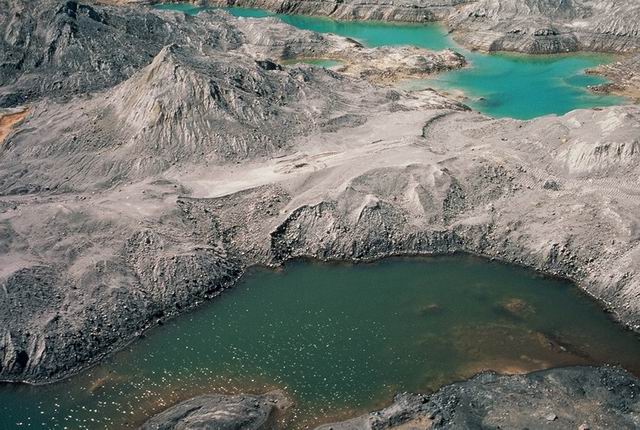
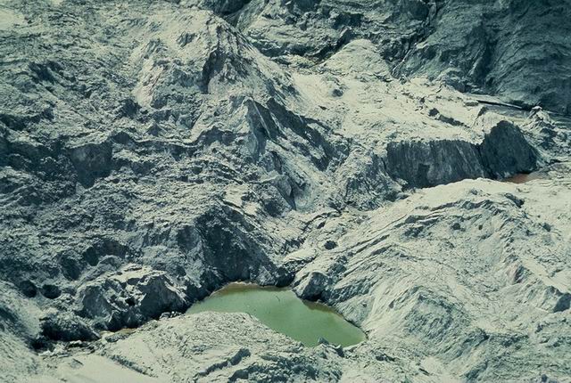
Ponds on degris avalanche.
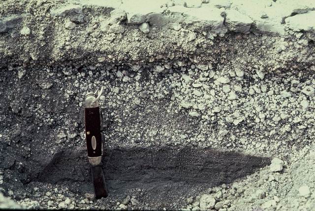
Photographed by Unknown ..... Date: 08/01/83 ..... Photo: ABB-099

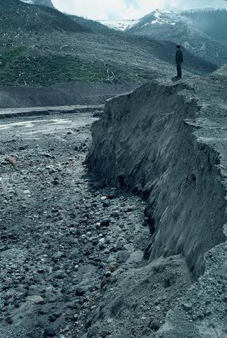
Gully wall section showing stratigraphy of pre-1980 tephra (airfall ash) deposits near Quartz Creek NE of Mt. St. Helens.
Photographed by Joe Means ..... Date: 05/29/81 ..... Photo: ABB-100