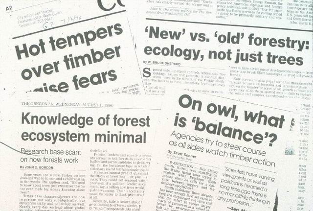
Newspaper and magazine articles reflect some aspects of the social relevance of the work at the Andrews Forest over the years. Articles in local, regional, national (including NY Times) highlight the science and it relevance to natural resource management, including the Forest Service's commitment to ecosystem management, formulation and implementation of the Northwest Forest Plan, and other issues concerning forest and watershed management.
Photographed by Fred Swanson ..... Date: 1992 ..... Photo: AAY-001
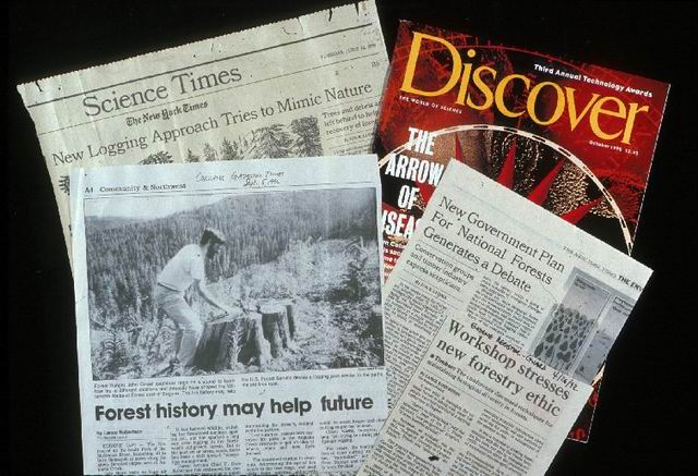
Newspaper and magazine articles reflect some aspects of the social relevance of the work at the Andrews Forest over the years. Articles in local, regional, national (including NY Times) highlight the science and it relevance to natural resource management, including the Forest Service's commitment to ecosystem management, formulation and implementation of the Northwest Forest Plan, and other issues concerning forest and watershed management.
Photographed by Fred Swanson ..... Date: 09/28/1992 ..... Photo: AAY-002
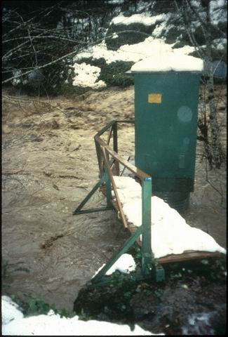
Flood of Feb. 1996 at Lookout Creek stream gage was a central theme of LTER4 work in which we examined interactions of a major (ca. 50-yr return period) flood with a managed landscape in terms of effects on streamflow, stream and riparian ecosystems, road networks, sediment production and routing. (key publications: Swanson et al 1998. BioScience; Johnson et al. 2000. Hydrological. Processes; Wemple et al. 2001. Earth Surface Processes and Landforms)
Photographed by Al Levno ..... Date: Feb 1996 ..... Photo: AAY-003
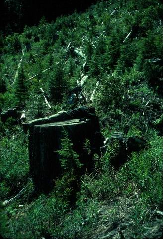
Wildfire history has been reconstructed by counting tree rings to estimate dates of establishment and scarring events. This picture shows field counting of growth rings on a Douglas fir stump about 650 yrs old north of Wildcat RNA.
Photographed by Fred Swanson ..... Date: October 1976..... Photo: AAY-004
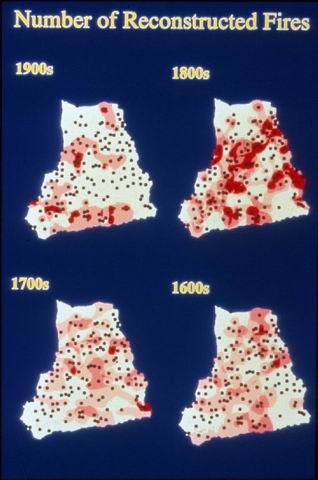
Tree- and site-scale interpretations of fire occurrence are compiled to develop a landscape-scale interpretation of fire history and disturbance regime. This map from Pete Weisberg's PhD (1998) shows study sites (dots) in Blue River area with darker red representing more numerous fires. Fires were more frequent on doughtier aspects and in the 1500s and 1800s when apparently climate was more favorable for fire.
Photographed by Peter Weisberg ..... Date: 1998 ..... Photo: AAY-005
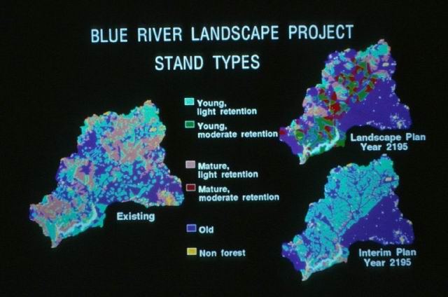
Historical disturbance regimes (a representation of the historical range of variability) has been used in development of an innovative landscape management plan for the 24,000-ha Blue River watershed. The plan includes reserves for species of critical interest and riparian areas and cutting frequency and severity keyed to historical fire regimes. The plan is modeled 200 yrs into the future and compared with the Northwest Forest Plan, which is based strongly on conservation biology principles. (key reference: Cissel et al. 1999. Ecological Applications)
Photographed by John Cissel ..... Date: 1999 ..... Photo: AAY-006
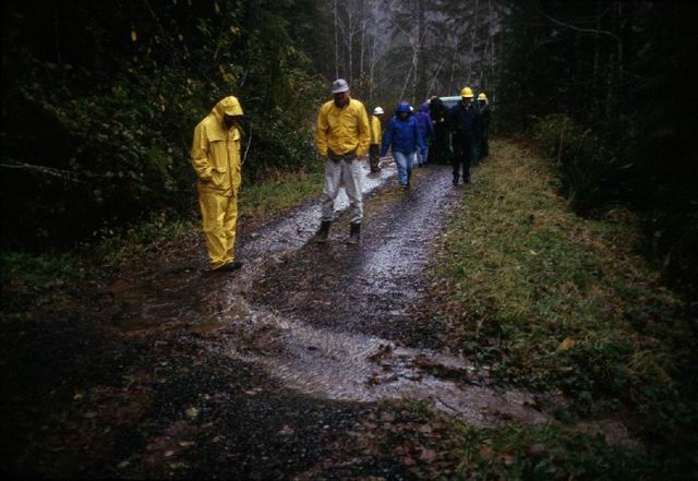
Road networks have been an important theme of Andrews Forest research in terms of effects on movement of water and sediment, and establishment and spread of exotic plants.
Photographed by Fred Swanson ..... Date: Winter 1998 ..... Photo: AAY-007
The work on road and stream networks includes considering interactions between road and stream networks and between road networks and adjacent vegetation patchworks.
Photographed by Julia Jones ..... Date: 1996 ..... Photo: AAY-008
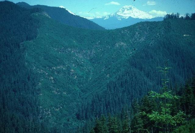
Experimental Watershed 1 was clearcut in 1962-1966 and burned in 1967. Note shrub and tree recovery in uplands and alder in riparian areas. Control Watershed 2 is located just to the left (east), contains 500-yr old conifer forest, as did Watershed 1 before treatment. (key publications: Halpern 19__. Ecology; Jones and Grant. 1996. Water Resources Research)
Photographed by Fred Swanson ..... Date: August 1991 ..... Photo: AAY-009
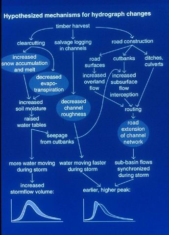
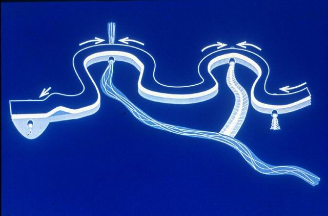
Hypothetical effects of forest disturbance and roads on peak streamflow.
Photographed by Julia Jones ..... Date: Jan 1996 ..... Photo: AAY-010
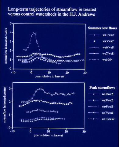
Trajectories of change in peak and low streamflows in treated versus control watersheds (WS) pairs in the Andrews Forest. Current studies examine controls of vegetation on flow. (key publication: Jones. 2000. Water Resources Research)
Photographed by Julia Jones ..... Date: Jan 1996 ..... Photo: AAY-011