
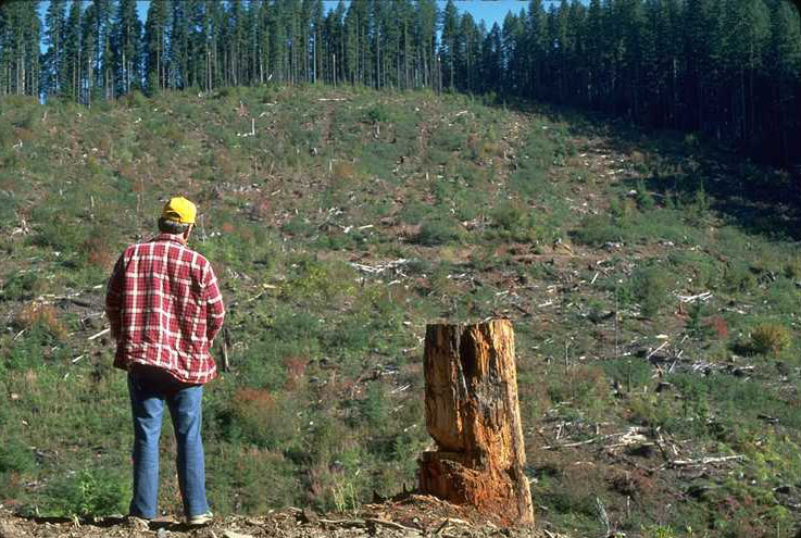
Aerial view of Unit L103 shortly after logging was completed in 1952.
Photographed by unknown ..... Date: 1952? ..... Photo: AAR-001

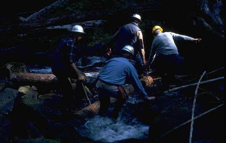
Salvage logging of blowdown near Unit 5-D (L-???). Half track loading a short logger. Bill Lewis is doing the log branding.
Photographed by CB ? ..... Date: 9/10/53 ..... Photo: AAR-002
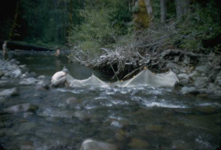
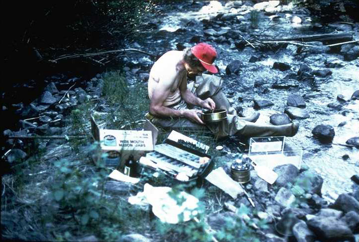
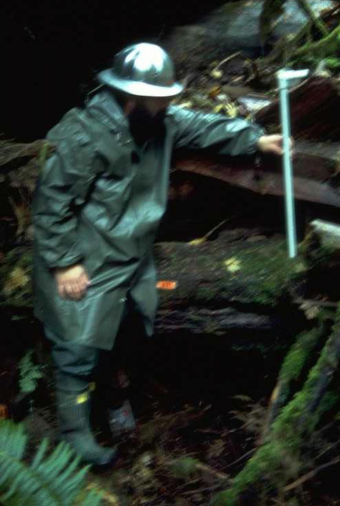
Early Andrews fish research. Seining hole on Lookout Creek (just below the concrete bridge) to determine trout populations.
Photographed by unknown ..... Date: 8/1955 ..... Photo: AAR-003
Upper Blue River Gaging Station established in the early 1950's as part of the Army Corps of Engineers Snow Study. This gaging station was the lower one of three stations established on Blue River. Other stations were established at the confluence of Blue River with Mann Creek and Wolf Creek. This station was abandoned by the Corps in 1957 and early researchers at the Andrews Forest took it over and maintained records from it until the flood of 1965 destroyed the station. This is labeled WS 5 in the Andrews data banks.
Photographed by Jack Rothacker ..... Date: 8/1957 ..... Photo: AAR-004
Upper Blue River Gaging Station established in the early 1950's as part of the Army Corps of Engineers Snow Study. This gaging station was the lower one of three stations established on Blue River. Other Stations were established at the confluence of Blue River with Mann Creek and Wolf Creek. This station was abandoned by the Corps in 1957 and early researchers at the Andrews Forest took it over and maintained records from it until the flood of 1965 destroyed the station. This is labeled WS 5 in the Andrews data banks.
Photographed by Jack Rothacker ..... Date: 3/1958 ..... Photo: AAR-005
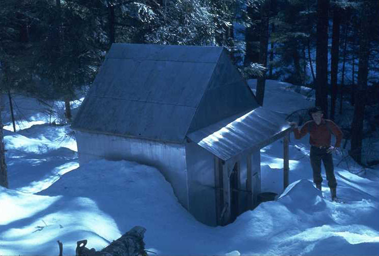
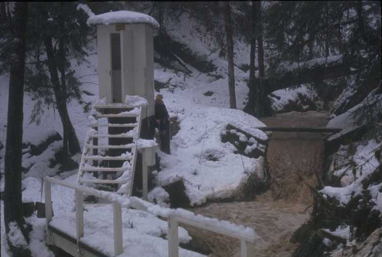
Upper Blue River Gaging Station established in the early 1950's as part of the Army Corps of Engineers Snow Study. This gaging station was the lower one of three stations established on Blue River. Other Stations were established at the confluence of Blue River with Mann Creek and Wolf Creek. This station was abandoned by the Corps in 1957 and early researchers at the Andrews Forest took it over and maintained records from it until the flood of 1965 destroyed the station. This shelter was used as a satellite cabin for the early snow study researchers. The main cabin was built at the confluence of Mann and Wolf Creeks with Blue River some seven miles up stream. The early researchers would snow shoe down to this shelter via the Blue River trail and spend the night here. The cabin, 8'x8,' contained two bunks and a small wood stove. The materials for its construction were hauled in by pack train from the Santiam Highway as there was no access from Blue River at that time. The shelter was still standing the summer of 1998. Dick Fredriksen is the PNW researcher in the photo.
Photographed by Jack Rothacker ..... Date: 3/1964 ..... Photo: AAR-006
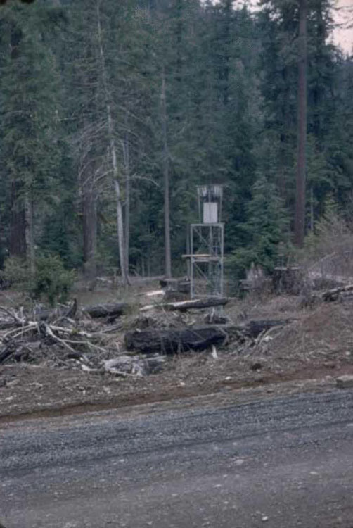
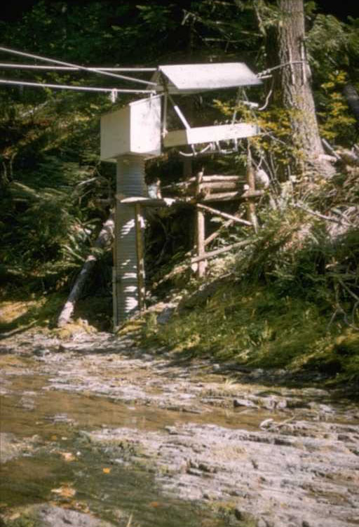
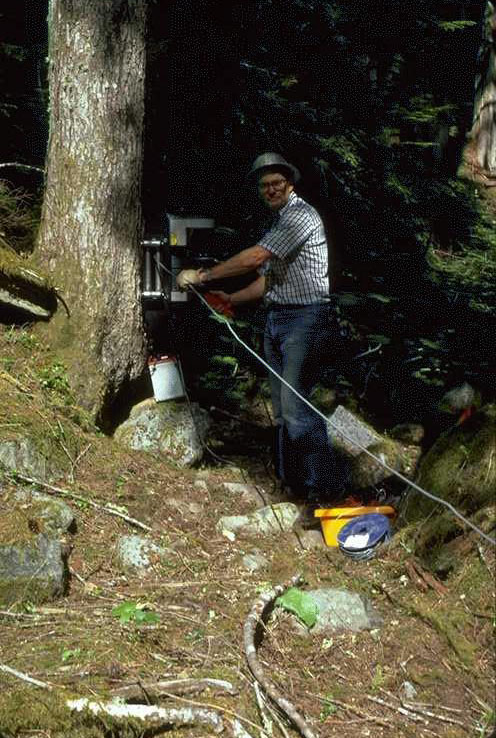
This Leupold & Stevens Q-12 recording snow and rain gage was the first recording gage established on the Andrews forest. It was located at the confluence of Rd 1506 and 304. Precip records from this gage at this location began December 1, 1951, and continued until the end of September 1959. In January 1962 the gage was reestablished at the Saddle near the top of WS 1 where it produced records until 1965 . It was then moved to the Hi - 15 Met. Station site where it ran from September 1963 until October 1975. After that the gage was moved to the South Umpqua Experimental Forest and installed on July 28, 1976. It produced records there until January 13, 1981. The Gage was retired after that date.
Photographed by Jack Rothacker ..... Date: 1957 ..... Photo: AAR-007
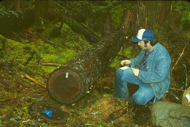
Jack Rothacker making stream discharge measurements at one of the three small watersheds (WS 1,2,3) . Jack is using the velocity head rod to make the discharge measurement. This method was used to calibrate these 120 degree trapezoidal flumes.
Photographed by Dick Fredriksen ..... Date: 8/1969 ..... Photo: AAR-008

The Lucky Boy Burn occurred on the West side of the present Blue River Reservoir above the Saddle Dam. This was the site of the Lucky Boy Cabin established by the Boy Scouts in the early 50's. The fire occurred in the late 50's and erosion from this site was of great concern to early Andrews researchers. Jack Rothacker is standing in one of the gullies created by erosion resulting from the fire. The Lucky Boy Cabin can be seen in the background just on the other side of Blue River. This photo was taken before Blue River Reservoir was constructed.
Photographed by Dick Fredriksen ..... Date: 1962 ..... Photo: AAR-009

Jack Rothacker describing research program to League of Women Voters on a Tour of the Andrews. Photo was taken from Lookout Point, Unit 1-I.
Photographed by unknown ..... Date: 6/1960 ..... Photo: AAR-010
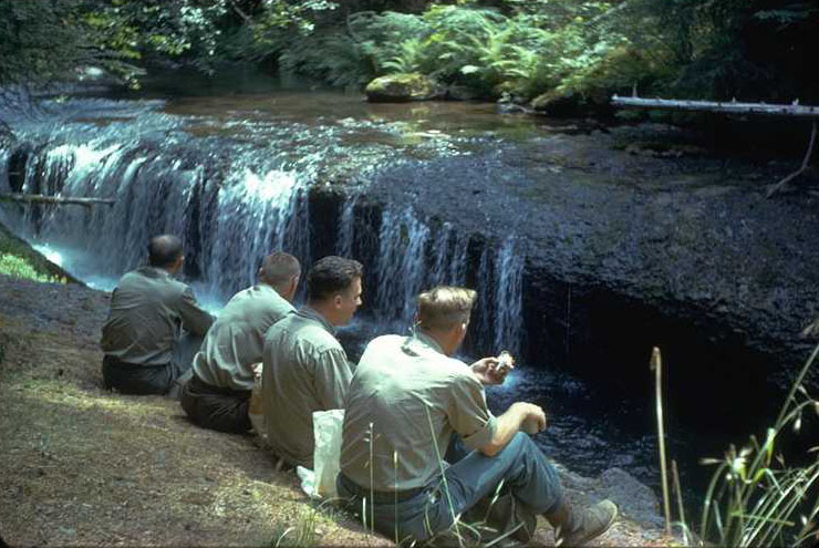
From left to right: Jerry Dunford, PNW Watershed Assistant Director; Jack Rothacker, PNW Watershed Project Leader; Ted Dyrness, PNW Soil Scientist; and Dick Fredriksen, PNW Soil Scientist having lunch by the old swimming hole on Lookout Creek just above WS 3 confluence. 1963.
Photographed by unknown ..... Date: 8/63 ..... Photo: AAR-011

George Brown as a graduate student in 1963 taking V-notch depth readings with a plastic depth gage at one of the Coyote Creek wiers on the South Umpqua Expermental Forest. George was the OSU Dean of Forestry from the early 90's until he retired in August of 1999.
Photographed by Jack Rothacker ..... Date: 7/1964 ..... Photo: AAR-012
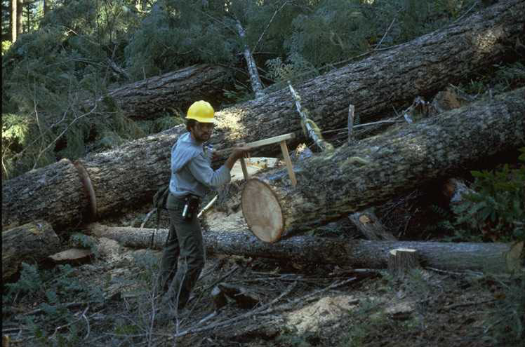
Dick Fredriksen at plot 9 Unit L 141. This photo was taken October 1963 shortly after logging and slash burning were completed on WS 3. Two soil moisture transects were established in WS 3 before logging. One transect was logged, the other remained in the undisturbed timbered area.
Photographed by Jack Rothacker ..... Date: 10/26/63 ..... Photo: AAR-013
Al Levno at the Soil Moisture Study site on WS 3, plot 1, transect 1, Unit L 141. This photo was taken in 1964 shortly after logging and slash burning were completed on WS 3. Two soil moisture transects were established in WS 3 before logging. Transect 2 was logged. Transect 1 remained undisturbed in the timbered area.
Photographed by Dick Fredriksen ..... Date: 1964 ..... Photo: AAR-014

Al Levno at the Soil Moisture Study site on WS 3, plot 9, transect 2, Unit L 141. This photo was taken in 1966 after logging and slash burning were completed on WS 3. Two soil moisture transects were established in WS 3 before logging. Transect 2 was logged. Transect 1 remained undisturbed in the timbered area. Levno is using the new Troxler Neutron Scaler purchased for use on the soil moisture strudy.
Photographed by Dick Fredriksen ..... Date: 3/1966 ..... Photo: AAR-015
B/W negative of the WS 3 first gaging station constructed at WS 3 before the December 1964 flood.
Photographed by Dick Fredriksen ..... Date: 3/18/58 ..... Photo: AAR-016
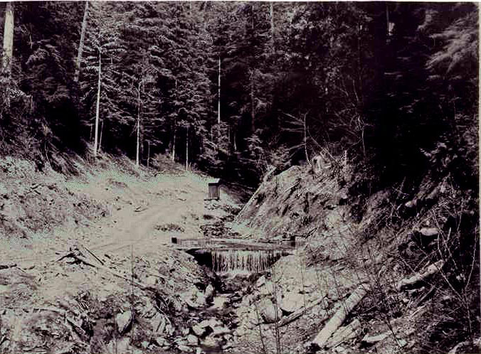
WS 3, 120 degree trapezoidal flume with some of the gage house on left side. Photo taken from the original trail constructed on the right side of the canyon. The foot bridge was necessary to cross the stream in order to reach the gaging station. This picture was taken in 1959 during one of the first storms occurring after road construction higher in the watershed.
Photographed by Dick Fredriksen ..... Date: 1959 ..... Photo: AAR-017
This is the first sediment basin constructed below the gaging station at WS 3 . It was constructed in 1956 and was used to measure bedload accumulation until it was destroyed during the December 1964 debris avalanches.
Photographed by Jack Rothacker ..... Date: 8/60 ..... Photo: AAR-018
WS 3's initial gaging station shortly before it was destroyed by a debris flow during the Christmas Flood of 1964. Al Levno can be seen making a routine check behind the gaging station.
Photographed by Dick Fredriksen ..... Date: 12/20/64 ..... Photo: AAR-019

Sediment basin at WS 3 on December 20, 1964, shortly before it was buried beneath 30 feet of debris 24 hours later during the Christmas Flood of 1964.
Photographed by Dick Fredriksen ..... Date: 12/20/64 ..... Photo: AAR-020
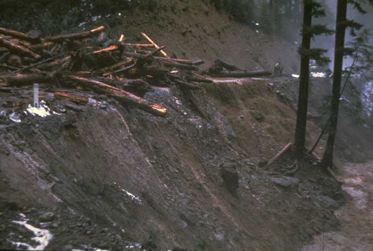
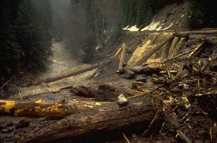
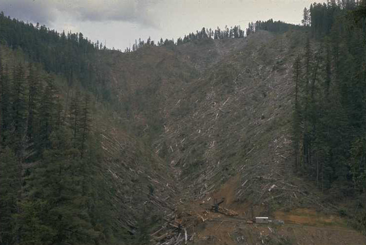
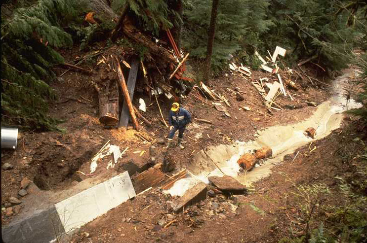
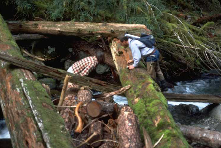
This photo shows the accumulation of logs and debris that piled up on the road below the WS 3 Gaging Station during the Christmas Flood of 1964. There were at least 3 different torrents that came down the channel during this storm. The first torrent consisted mainly of supersaturated soil and logs. It was mostly contained within the area behind the fill. The second slide, consisting of the same type of material, occurred some 15 to 20 hours later. This pulse came down on top of the already-filled channel and spilled over the road into Lookout Creek. The last slide, consisting mostly of gravel and rock, came to rest on top of the previous slides. This one did not spill over the road to the extent of the second pulse, possibly due to its smaller size and the heaviness of the the material. The amount of material which went over the road bank would probably amount to one-fourth of the material in the channel. A rough estimate of material deposited in the channel was about 27,000 yds. (Taken from the Report of the 1965 Survey of Sediment at Watersheds 1, 2, and 3). This photo was taken after the second pulse.
Photographed by Dick Fredriksen ..... Date: 12/20/64 ..... Photo: AAR-021
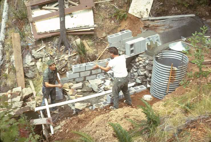
WS 3 flume was buried under some 14ft of debris material during the Christmas Flood of 1964. It took a couple of bull dozers about two weeks to clear out the channel and dig down to the old flume. The gage house, of course, was carried away by the debris torrent. The flume was salvaged with only the lower left quarter of the concrete portion broken off. The original flume was repaired and a new gage house was constructed in August of 1966.
Photographed by Dick Fredriksen ..... Date: 8/68 ..... Photo: AAR-022
B/W negative of the second sediment basin constructed in the WS 3 channel below the gaging station. This basin was constructed in December of 1965 by setting two cedar logs across the channel and fastening 3x12 inch planks in a vertical position to the upstream side of the logs. In 1966, retaining walls were built along the sides of the basin and another layer of 3x12 planks were nailed to the face of the dam.
Photographed by Ross Mersereau ..... Date: 3/69 ..... Photo: AAR-023
This debris flow occurred on WS 3 during the flood of February 1996. It occurred between 5PM and 9PM on February 6th when heavy rain fell on 12 inches of fresh snow in the area. This torrent consisted mostly of gravel and stones with a much fewer number of logs and woody debris than came down channel during the 1964 storm. A few logs and and some material did slop over the road fill and ran into Lookout Creek but not to the extent of that in 1964. The estimated amount of material deposited in the channel behind the road fill was approx. 2,000 cu yds. The gaging station was again carried away by the debris torrent and the A-35 Stevens Recorder was found in Lookout Creek down stream near the HJA compound. The flume was again found under 14ft of material after considerable digging with an excavator.
Photographed by Al Levno ..... Date: 2/7/96 ..... Photo: AAR-024
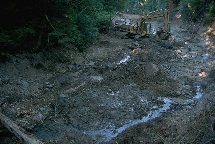
Contractor's excavator working on the WS 3 debris material deposited by the '96 flood. Debris from the stream channel was removed to a point some 50 yds above the gaging station. The flume was uncovered from about 14' of deposited material, and the road and gaging station site were reestablished. Space for a new sediment basin was excavated; and, new fill and a larger culvert were installed at the road site along Lookout Creek.
Photographed by Al Levno ..... Date: 7/96 ..... Photo: AAR-025
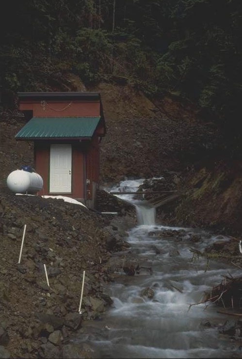
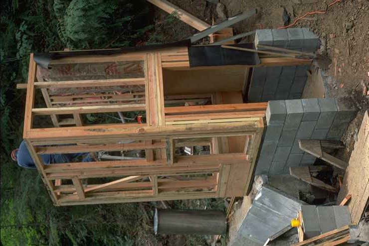
The second reconstruction of the WS 3 gage house was accomplished during the summer of '97. This house was designed with the help of a contracted engineer and constructed "in house" by Andrews' personnel. The house was built as a break away structure that, if swept away by another debris torrent, would detach from the foundation and stilling wells without destroying them. This structure was also designed on a much larger scale to accomodate two types of water sampling equipment: Isco and the Fredriksen Proportional Sampler; two types of water level recorders; a telemetering radio system; and, a propane heater used to keep the water samplers from freezing.
Photographed by Al Levno ..... Date: 11/31/98 ..... Photo: AAR-026

WS 3 sediment basin was reconstructed after debris torrent form the '96 flood destroyed and buried the last basin. This new basin was designed and built to allow for the measurement and cleaning of bedload after individual storms during the winter. Previous basins were measured and cleaned only on an annual basis during periods of low flow in the summer months. The new basin is equipped with a bypass which allows for the diversion on moderate winter flows so the basin can be pumped of excess water, the bedload material can be measured and then removed with excavator and dump trucks. The concrete lined basin also allows for measurment and clearing of small deposits of bedload such as a few wheelbarrow loads if that type accuracy is needed to acess small storm deposition. This photo showes the excavation of a basin full of material coming from a recent storm in December.
Photographed by Greg Downing ..... Date: 1/14/99 ..... Photo: AAR-027
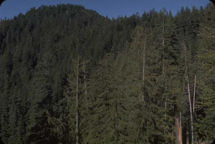
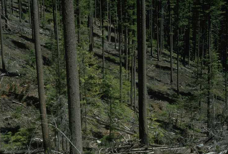
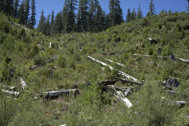
This photo, taken from the Lucky Boy Burn Spot Fire Unit (end of RD 202), looks across the watershed from a point on the south side near the top of the watershed. This watershed, before logging, was covered with a rather desiccant stand of Old Growth Douglas Fir.
Photographed by Dick Fredriksen ..... Date: 7/62 ..... Photo: AAR-028
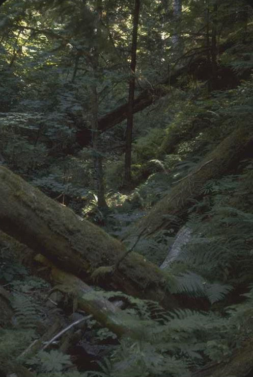
WS 1 stream channel before logging. This photo was taken at station 35+00 upstream from the gage house.
Photographed by Dick Fredriksen ..... Date: 1962 ..... Photo: AAR-029

Jacob Wyssen, owner of the Swiss-based Wyssen Skyline Crane Co. This company designed and built a 5-ton crane to handle the large trees growing here in the Northwest. The company contracted to harvest WS1 through a special negotiated timber sale contract with the Willamette National Forest. The Research objectives were to harvest this entire 237 acre watershed with this experimental skyline system, designed to harvest large, steep, forested areas without the necessity of the roads required with the current Northwest High Lead system of logging. Watershed 1 was to be completely clearcut without roads as a comparison with the treament on Watershed 3 which was to be 1/3 of the watersed harvested using a conventional High Lead logging system with roads.
Photographed by Dick Fredriksen ..... Date: 8/62 ..... Photo: AAR-030
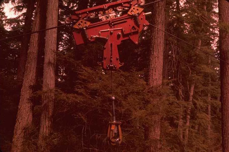
Side view of the Wyssen Skyline Crane carriage specially designed to lift the huge old growth logs found in our Northwest forests. At times, large hemlock logs that were somewhat water logged from lying in the stream channel had to be cut to 8' lengths in order to be lifted and moved by the system. Limitations like this increased the harvest time of this watersed substantially.
Photographed by Dick Fredriksen ..... Date: 8/62 ..... Photo: AAR-031
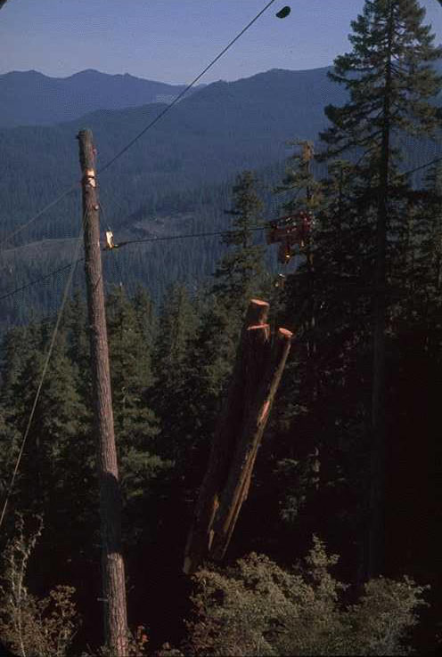
Wyssen Skyline Crane lifting a turn of logs up hill to the middle support tree where the logs would be locked to the carriage and moved down hill to the landing at the bottom of the Watershed .
Photographed by Dick Fredriksen ..... Date: 8/62 ..... Photo: AAR-032
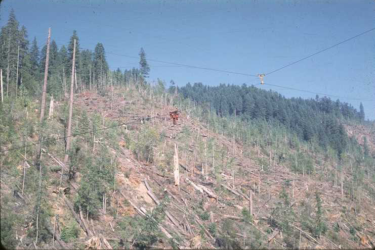
WS 1 with harvesting about three-quarters completed by the Wyssen Skyline Crane system. Photo shows the carriage with a turn of logs being lifted to it for transport down the skyline to a landing at the bottom of the watershed. Late in the logging process the intermediate support tree system of suspending the skyline as shown in photo 32 was deemed too slow and new crossing lines (that needed to be shipped from Switzerland) were installed to cross the watershed from ridge to ridge at three locations from top to bottom. This then was the new system used to hang the skyline from. These crossing lines can be seen at the top of the photo.
Photographed by Dick Fredriksen ..... Date: 9/64 ..... Photo: AAR-033
WS 1 from Mona Creek Road across the valley. Watershed is approximately three quarters logged. The landing to which all the logs were yarded is at the bottom of the Watershed. Log loader, tool shed and diesel tank are also located here.
Photographed by Dick Fredriksen ..... Date: 6/64 ..... Photo: AAR-034
WS 1 stream after timber felling and yarding but before slash burning. Stream was choked with logging debris from the skyline yarding operation which contributed to the inordinate amount of logs and slash that were deposited in the stream.
Photographed by Dick Fredriksen ..... Date: 6/64 ..... Photo: AAR-035

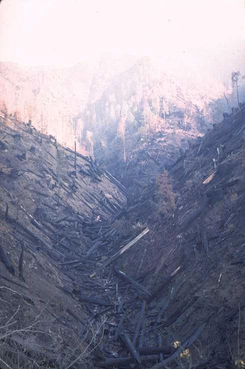
Slash burning on WS 1 took place on 10/17/1966. Forest Service crews with drip torches started at the top of the watershed and worked their way back and forth across the watershed lighting small strips of slash and brush as they worked their way down to the landing at the bottom of the watershed. The next morning at 8:30 AM when this photo was taken a heavy cloud of smoke still hung over the area.
Photographed by Jack Rothacker ..... Date: 10/18/66 ..... Photo: AAR-036
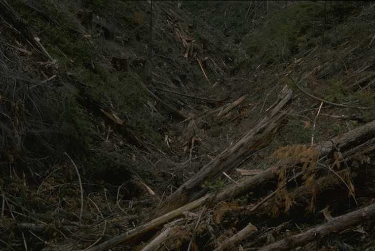
The WS 1 stream channel still remained heavily choked with logs after the slash burn (large logs generally don't burn well during a slash burn). There were far more logs in the channel now than were there before the logging operation and it was decided to use KV dollars to clean the introduced logs from the channel. (see photo 38)
Photographed by Jack Rothacker ..... Date: 11/66 ..... Photo: AAR-037

WS 1 stream channel was cleaned by hand shortly following the slash burring operation. Loggers doing the work were told to cut only the logs introduced in the channel by the logging and leave the natural debris in the stream. They obviously didn't get all these instructions and pretty well cut most of the logs in the lower part of the stream channel into 18 to 20 inch rounds. They split the rounds into stove-wood-sized pieces and left them to rot or be washed out by high water. After the loggers received additional instructions, they left many more logs further up the stream channel.
Photographed by Jack Rothacker ..... Date: 11/66 ..... Photo: AAR-038
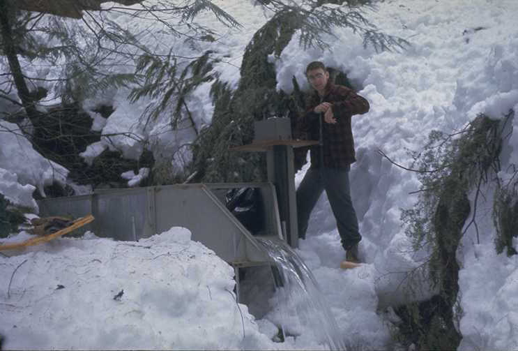
WS 7 was the first watershed to receive a gaging in station in the Hi-15 three experimental watershed set which includes WS 6, 13 ha., WS 7, 15.4 ha. and WS 8, 21.4 ha. These watersheds are located on a S. aspect at around 1,000 meters elevation. They contain 130 year old Douglas Fir. An H-flume was installed at WS 7 in 1963, and a FW-1 recorder with a 7 day chart was used to measure water level. We soon learned that during snow storms at this elevation large chunks of snow would fall from the trees bombing the pool inside the H-flume. These bombings splashed water all over the place, throwing the pens off the recorder and plugging up the flume. Shelters were built over these H-flume installations shortly after they were installed. Al Levno is pictured here making a check at the installation during the first winter after construction in 1964. Snow shoeing was the only way to reach these watersheds during periods after heavy snowfall in the early days of the study.
Photographed by Dick Fredriksen ..... Date: 1964 ..... Photo: AAR-039
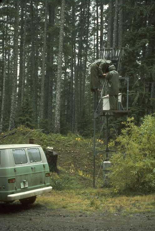
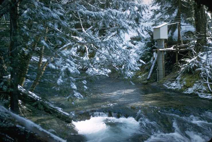
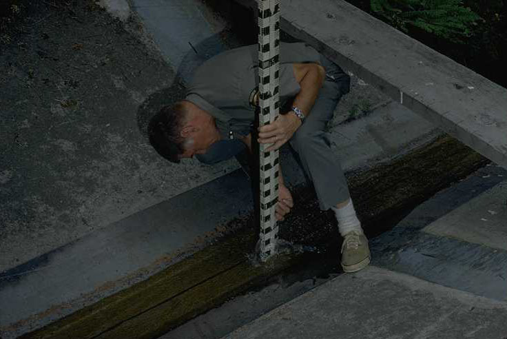
The Leupold & Stevens Q- 12 Snow and Rain Gage was moved to the site of the current Hi- Met Station (on the road below the WS 7 Gaging Station) in September of 1963 where it ran until October of 1975. Two unidentifiable researchers are huddled over the gage trying to keep the record dry while they change the chart during a rainstorm.
Photographed by Erv Bergiund ..... Date: 10/75 ..... Photo: AAR-040
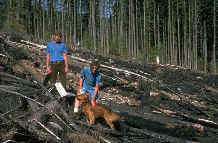
Photo shows WS 6 just after logging and slash burning, June 29, 1975. The 13 ha. watershed was entirely clearcut with 90% of the logs yarded up hill by a high lead cable system. The other 10 % were yarded by tractor. Ray Beug and Steve Running with Rusty are seen in the photo.
Photographed by Bill Emmingham ..... Date: 6/30/75 ..... Photo: AAR-041
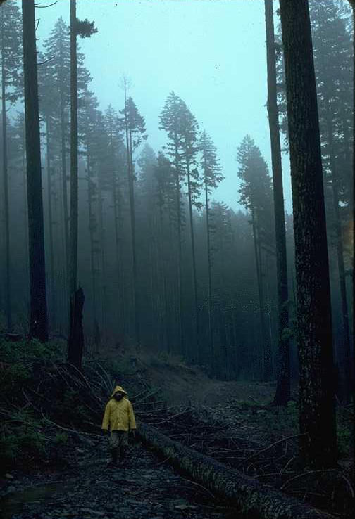
George Lienkaemper, walking through the fog in WS 7 shelterwood cut.
Photographed by Al Levno ..... Date: 2/19/81 ..... Photo: AAR-042
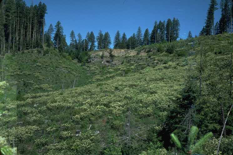
Ceanothus velutinus in full bloom on WS 6 eight years following treatment and slash burning.
Photographed by Dick Fredriksen ..... Date: 6/83 ..... Photo: AAR-043
Shelterwood cutting on WS 7 (15.4 ha) removed 60% of the total basal tree volume in 1974. Temporary spur roads were constructed across the middle of the watershed on down the Southwest ridge of the watershed. Logs in the upper 60% of the watershed were yarded by tractor. Skid trails were not preplanned, but operators were instructed for safety reasons to yard downhill to the upper spur road. Logs in the lower 40% of the watershed were yarded partially suspended by a skyline cable system. Broad cast burning occurred only in the lower half of the watershed in 1975.
Photographed by Al Levno ..... Date: 7/76 ..... Photo: AAR-044
The WS 7 leave trees from the shelterwood cut made 10 years earlier were removed in 1984 and the slash resulting from the logging was piled and burned the same year. Ross Mersereau seen here in the photo is standing on the Southwest ridge looking across WS 7 at the results of the recent leave tree removal.
Photographed by Al Levno ..... Date: 9/84 ..... Photo: AAR-045

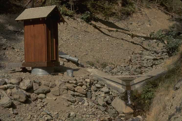
WS 7 gaging Station taken from upstream. Photo shows the new trapezoid flume installed during the summer of 1997. Gage house on the left is heated and has a lantern powered by propane. Instruments here are a digital and analog streamflow recorders.
Photographed by Al Levno ..... Date: 12/18/98 ..... Photo: AAR-046
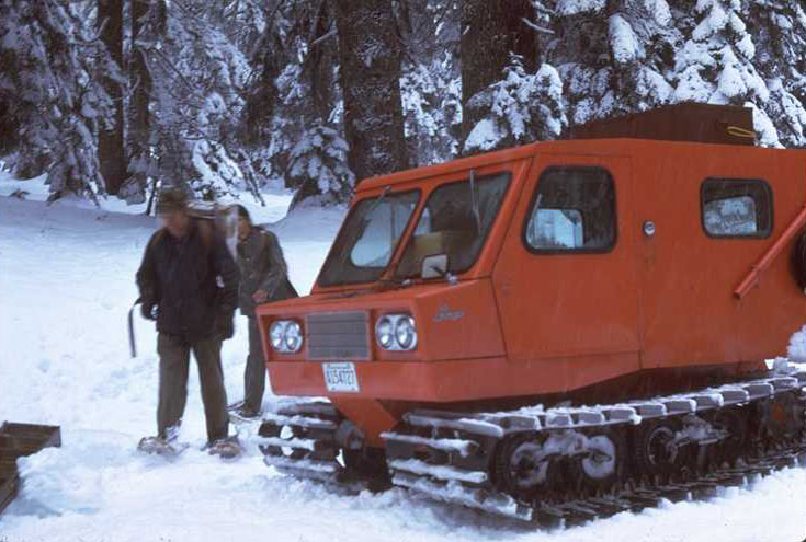
Bill Forester with unidentified companion packing up to snowshoe into winter research area on the Andrews Forest. The Thiokal Imp was the first full-sized snow cat purchased for over-the-snow use on the experimental forest. Bill was the first full-time research technician hired by the early IBP program.
Photographed by Al Levno ..... Date: 4/74 ..... Photo: AAR-047
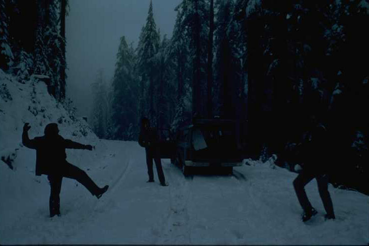
Mike James, Steve Hallgret and an unknown researcher throwing a few snow balls while making a check at HJA , RS 4 during the early IBP days.
Photographed by Bill Emmingham ..... Date: 11/76 ..... Photo: AAR-048
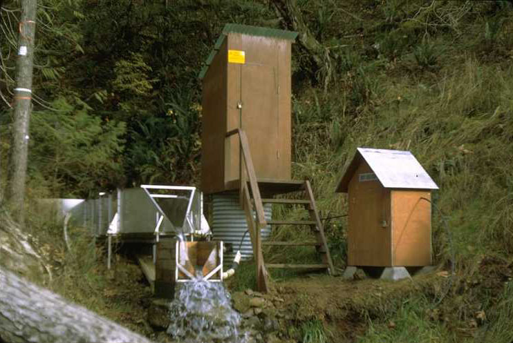
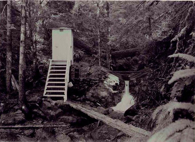
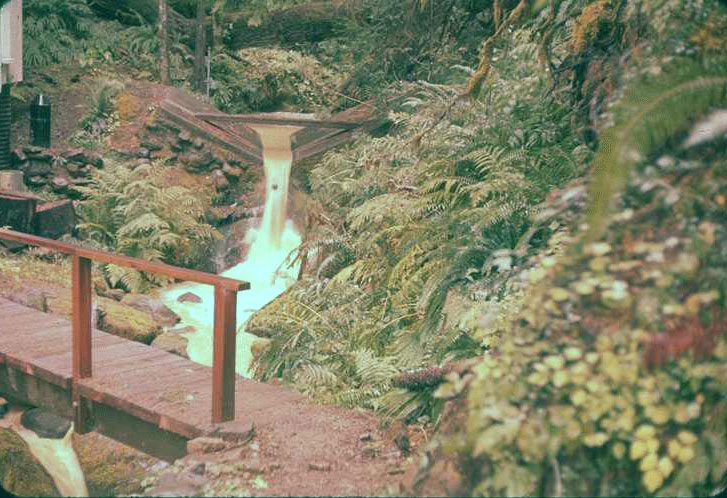
The first WS 9 Gaging Station shortly after construction. WSs 9 and 10 studies were originally planned as short term studies so rather temporary gaging facilities were installed at these sites. Latter, when more long-term research needs were established for these water sheds, the stations were rebuilt. Shown here is the original stainless steel, 1.5ft. H-flume which was plumbed to the stilling well and gage house behind it. The small structure on the right was the sampler house where a Fredriksen proportional sampler was set up. Water samples were collected from the turbulence or mixing box stationed below the H-flume.
Photographed by Dick Fredriksen ..... Date: 4/69 ..... Photo: AAR-049
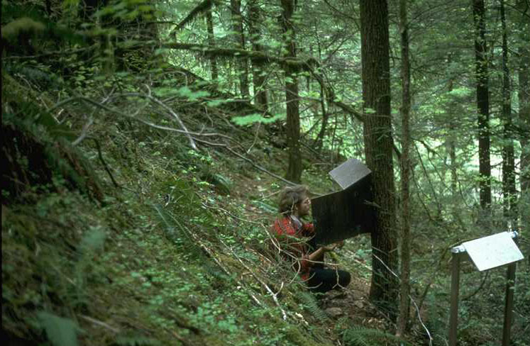
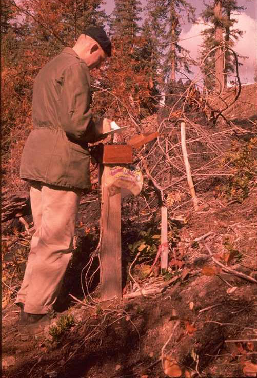
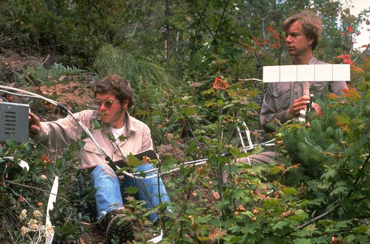
Gabriel Tucker changing the chart on the circular thermograph recorder used to measure soil and air temperature at all the RSs in the Andrews Forest during early days of the IBP program. The shelter which housed the air temperature probe is on the right. The location is RS 9 located on WS 10. The picture was taken on 5/22/1975 before logging took place on the watershed.
Photographed by Bill Emmingham ..... Date: 5/22/75 ..... Photo: AAR-050

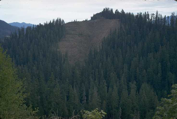
An overview picture of WS 10 taken in June of 1966 before the watershed was logged. The picture was taken from the first logging unit on the Mona Creek Road (FR -1510).
Photographed by Dick Fredriksen ..... Date: 6/66 ..... Photo: AAR-051
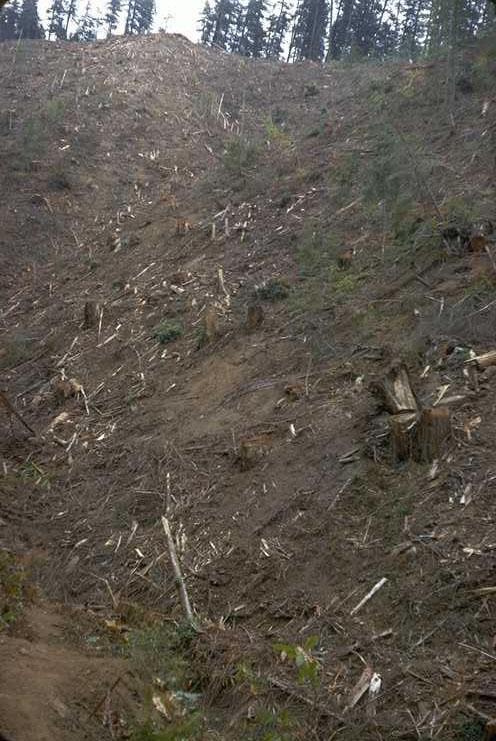
Retake of AAR 051, WS 10 after clearcutting in October of 1975. Photo taken from the first unit on the Mona Creek Road, (FR 1510).
Photographed by Dick Fredriksen ..... Date: 10/75 ..... Photo: AAR-052
WS 10 following logging. Photo is taken looking up the main stream channel toward the headwall and londing at the top of the watershed.
Photographed by Dick Fredriksen ..... Date: 10/75 ..... Photo: AAR-053
During the summer of 1973, the H-flumes at WS 9 &10 were replaced with more substantial 60-degree stainless, trapezoidal flumes and new gage houses that contained space for the water samplers. This gage house was also equipped with a propane heater and the plumbing for the water sampler was built into the flumes' supporting structure to help prevent freezing. Workers in the photo are Von Shroeder, contractor from Springfield hired to construct the gaging station using PNW help and materials, and Ross Mersereau, early Andrews Officer in Charge and Watershed Specialist.
Photographed by Dick Fredriksen ..... Date: 7/73 ..... Photo: AAR-054
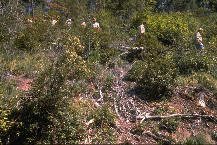
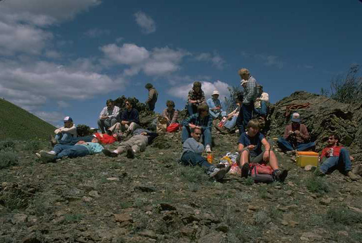
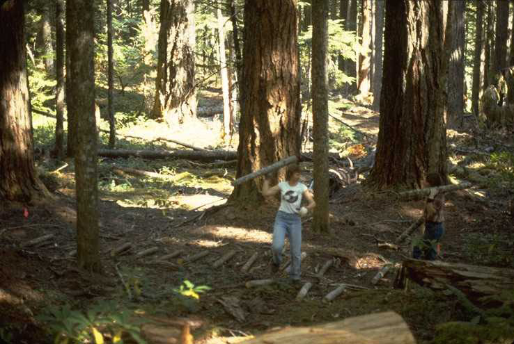
July 16, 1979 was volunteer trail-construction day on WS 10. Close to 30 people from OSU and PNW came to the Andrews on this day to construct trails in WS 10. The trails were needed to direct the many researchers doing research on the watershed. Indiscriminate foot travel on the freshly logged, steep slopes of the watershed was creating excessive erosion and destroying invading vegetation.
Photographed by Bill Emmingham ..... Date: 7/1679 ..... Photo: AAR-055
Steve Hallgren (right) and Dave McNabe on 9/15/75 making porometry measurements on WS 10 during the logging operation.
Photographed by Bill Emmingham ..... Date: 9/15/75 ..... Photo: AAR-057
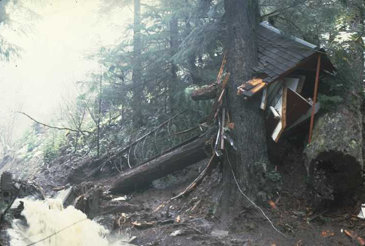
This photo was taken at 10 AM on 2/22/1986, 13 hours after a debris torrent came down the WS 10 stream channel displacing the gage house, filling the sediment basin and depositing an undetermined amount of sediment and debris on the access road and surrounding area. This event occurred 11 years following logging.
Photographed by Al Levno ..... Date: 2/22/86 ..... Photo: AAR-058
This photo was taken at 10 AM on 2/22/1986, 13 hours after a debris torrent came down the WS 10 stream channel displacing the gage house, filling the sediment basin and depositing an undetermined amount of sediment and debris on the access road and surrounding area. This event occurred 11 years following logging. The streamflow recorder with stripchart was found in the debris, upper right of the photo. This provided the exact time and stage reading when the debris flow occurred. Ross Mersereau is examining the destruction resulting from this occurrence.
Photographed by Al Levno ..... Date: 2/22/86 ..... Photo: AAR-059
The second reconstruction of the WS 10 Gage house occurred during the summer of 1986. The flume remained intact except for a few minor dents but the gagehouse, turbulence box and dam at the sediment basin all had to be replaced.
Photographed by Al Levno ..... Date: 9/86 ..... Photo: AAR-060
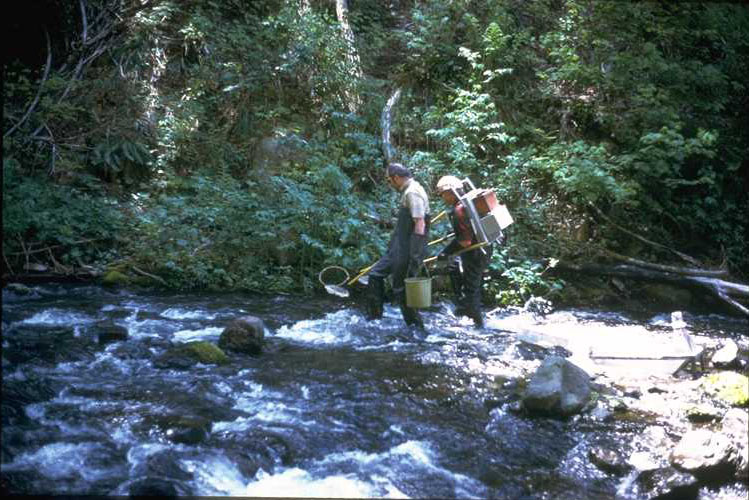
Jim Hall and assistant during a fish shocking survey on Mack Creek in July 1974.
Photographed by Bill Emmingham ..... Date: 7/74 ..... Photo: AAR-061
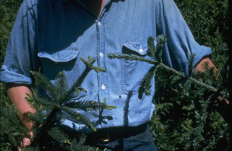
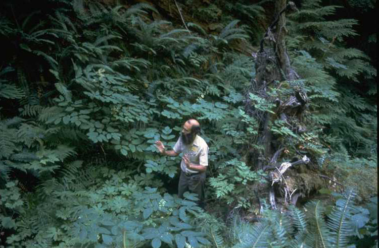
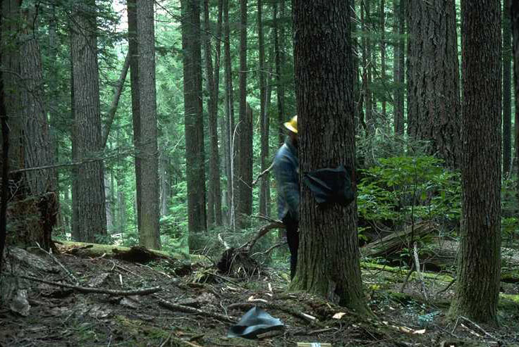
Art McKee making a Silver Fir-Noble Fir comparison, September 1974, on the Andrews Experimental Forest.
Photographed by Bill Emmingham ..... Date: 9/74 ..... Photo: AAR-062
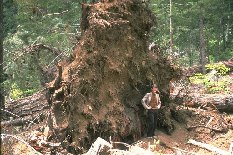
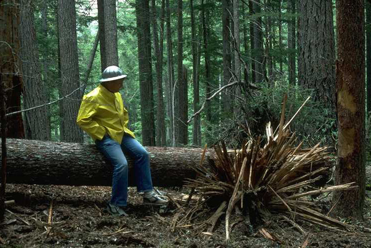
Sune Linder standing beside an Old-Growth Douglas Fir windthrow, September 1976.
Photographed by Bill Emmingham ..... Date: 9/76 ..... Photo: AAR-063
Fred Swanson at the first Ecosystem Management Workshop at WS 2 on the Andrews Experimental Forest, Summer 1979.
Photographed by Bill Emmingham ..... Date: 1979 ..... Photo: AAR-064
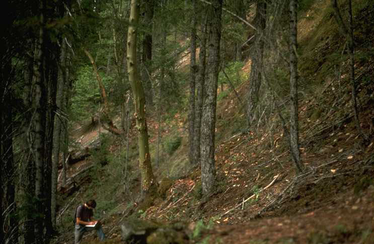
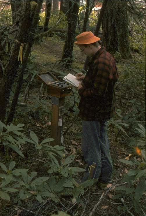
Joe Means taking notes at RS 20, Plot 2, 8/23/77.
Photographed by Bill Emmingham ..... Date: 8/23/77 ..... Photo: AAR-065
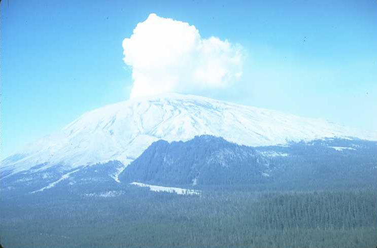
Mt. St. Helens in August 1980, after the eruption on May 20th of that same year.
Photographed by Al Levno ..... Date: 8/80 ..... Photo: AAR-066
George Lienkaemper, Jungle Jim? and Fred Swanson wait for helicopter clearance during effort to establish erosion plots on the volcanic strata after the eruption of Mt. St. Helens.
Photographed by Al Levno ..... Date: 8/80 ..... Photo: AAR-067
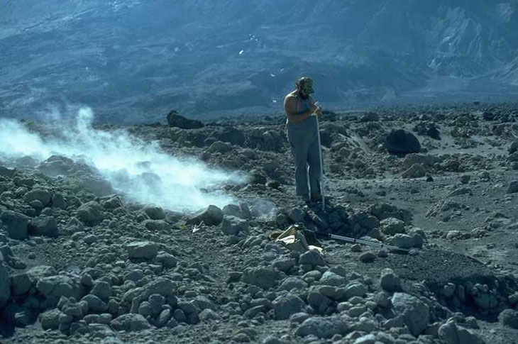
George Lienkaemper taking notes during a photo excursion in the pyroclastic zone of Mt. St. Helens.
Photographed by Al Levno ..... Date: 8/80 ..... Photo: AAR-068
Jim? and Fred Swanson making the initial readings of a set of erosion pins established in August after the eruption of Mt. St. Helens.
Photographed by Al Levno ..... Date: 8/80 ..... Photo: AAR-069
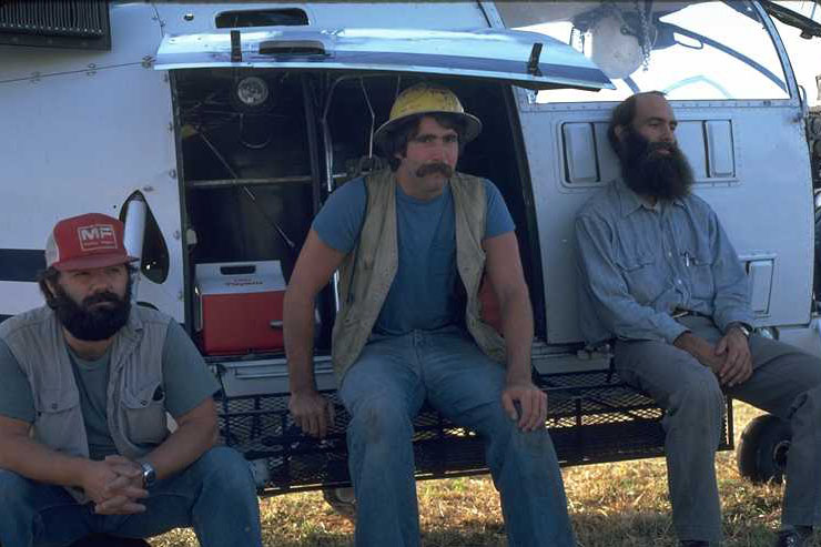
Unknown group during a lunch break, possibly at Carpenter Mt. Saddle in May of 1986.
Photographed by Unknown ..... Date: 5/86 ..... Photo: AAR-070
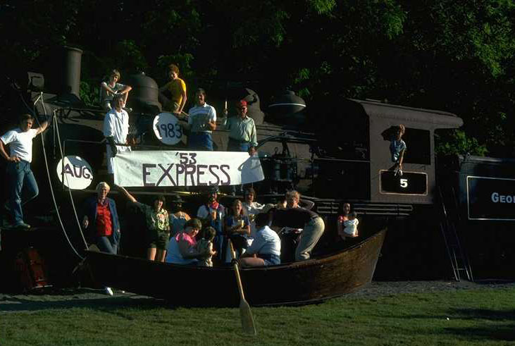
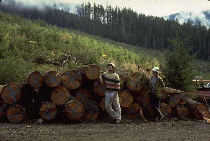
1653 Project Picnic, Aug. 1983. Project members and family met at Avery Park. Logan Norris, at the oars of his drift boat, was project leader at the time.
Photographed by Al Levno ..... Date: 8/83 ..... Photo: AAR-071

Annie Hamilton sampling logs as part of the log decomposition study at Log Decomposition Site #1 HJ Andrews Experimental Forest. Todd Bohle getting dimensions of wood Samples at HJA Headquarters bunk house.
Photographed by Mark Harmon ..... Date: 9/88 ..... Photo: AAR-072
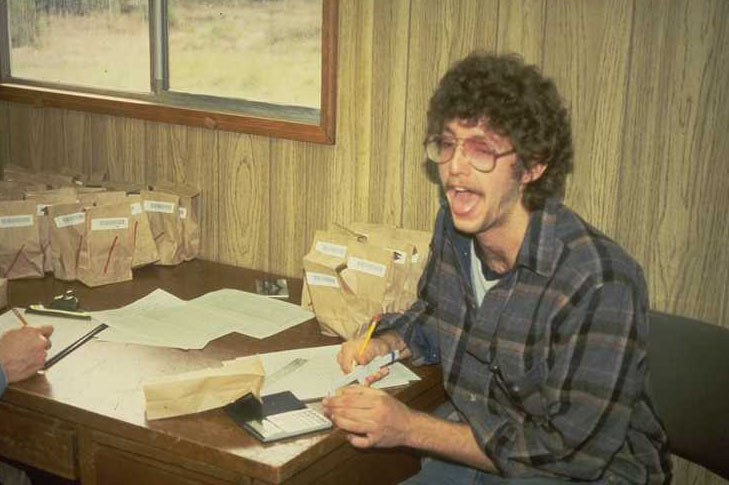
Todd Bohle getting dimensions of wood Samples at HJA Headquarters Bunk House.
Photographed by Mark Harmon ..... Date: 9/86 ..... Photo: AAR-073

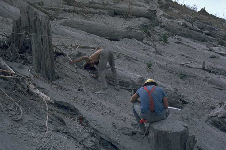
Randy Wildman and others loading logs onto a slack line carriage as part of the stream/upland decomposition comparison study.
Photographed by Mark Harmon ..... Date: 7/85 ..... Photo: AAR-074
Mark Harmon and others placing logs in Lookout Creek as part of the Stream/Upland Decomposition Comparison Study.
Photographed by Mark Harmon ..... Date: 7/85 ..... Photo: AAR-075
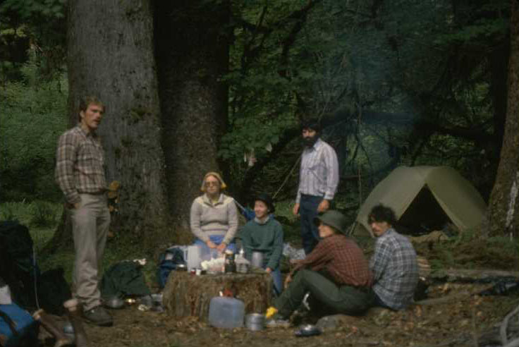
Volunteer crew used to make the first measurement on the South Fork of the Hoh River Reference Stands. Crew members, left to right: Carl, Patty, Jenifer, Mark, Eve, and Steve.
Photographed by Mark Harmon ..... Date: 7/84 ..... Photo: AAR-076
Jack Booth on the electric winch used to lift the slack line as part of the Stream/Upland Decomposition Comparison Study.
Photographed by Mark Harmon ..... Date: 7/85 ..... Photo: AAR-077
Janice Harman and Randy Wildman searching for tagged logs that were placed in Lookout Creek above the Mack creek Junction as part of the Steam/Upland Decomposition Comparson Study.
Photographed by Mark Harmon ..... Date: 4/86 ..... Photo: AAR-078
Karen Luchessa, John Moreau and a crew of student helpers. This crew placed the logs in the Stream/Upland Decomposition Comparison Study. The crew is gathered on the steps of the old McRae trailer on the HJA Headquarters Site.
Photographed by Mark Harmon ..... Date: 6/85 ..... Photo: AAR-079
Part of a tour to the Blue River District organized to set up CWD standards. Members gathered at a yum pile are: (left to right) Phil Sollins, unknown, unknown, unknown, Vince Puleo, and Jim Trappe.
Photographed by Mark Harmon ..... Date: 6/85 ..... Photo: AAR-080
Unit L521 on the Andrews Experimental forest was the unit agreed by everyone as having enough CWD. Steve Ubanks then had this unit sampled. The rest was history!
Photographed by Mark Harmon ..... Date: 6/85 ..... Photo: AAR-081

Greg Koerper and assistant at Sequsia National Park weighing sampes of Salix to determine diameter-biomass releationships. 9/82.
Photographed by Mark Harmon ..... Date: 9/82 ..... Photo: AAR-082
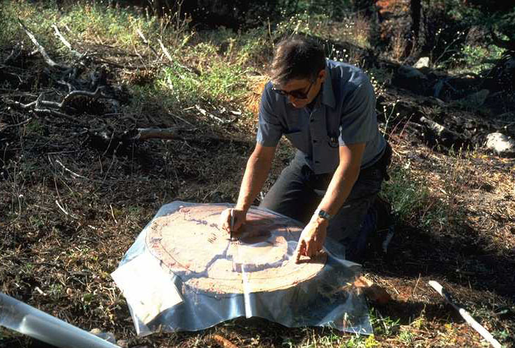
Jack Booth, on the Sequoia Pulse, using plastic overlays on log cross-sections to trace patterns of decay, heartwood, sapwood, insect galleries, etc. (9/82)
Photographed by Mark Harmon ..... Date: 9/82 ..... Photo: AAR-083

Jay Sexton using a chainsaw to remove cross sections from a Douglas fir log in the H.J. Andrews Experimental Forest Log Decomposition Study Site 1. (9/88)
Photographed by Mark Harmon ..... Date: 9/88 ..... Photo: AAR-084
Unknown person setting off the charge. Explosives were tied to a 40cm. Tshe using inner tubes on HJA Decomposition Site 2. (6/84). (See also, AAR 086)
Photographed by Mark Harmon ..... Date: 6/84 ..... Photo: AAR-085
Art McKee viewing the results of a test of explosives to fell trees. A 40 cm. Tshe after explosive charge was taped to the tree. Log Decopsition Site 4 on the H.J. Andrews Experimental Forest.
Photographed by Mark Harmon ..... Date: 6/84 ..... Photo: AAR-086
Steve Carpenter doing a fungal production survey as part of the log decomposition study. HJA Log Decomposition study.
Photographed by Mark Harmon ..... Date: 12/88 ..... Photo: AAR-087
Janice Harmon (left) and Gail Baker placing branches on HJA Log Decomposition Site 5 as part of the log decomposition study.
Photographed by Mark Harmon ..... Date: 9/85 ..... Photo: AAR-088
John Moreau cutting wood samples from disks for density sampling on the Log Decomposition Study. Picture taken at the HJA Headquarters site on 12/85.
Photographed by Mark Harmon ..... Date: 12/85 ..... Photo: AAR-089
John Moreau cutting a strip from a wood disk to determine density as part of the log decomposition study. H.J. Andrews Headquarters site 12/85.
Photographed by Mark Harmon ..... Date: 12/85 ..... Photo: AAR-090
Janice Harmon weighing samples as part of the log decomposition study. Photo was taken at the HJA Headquaters bunkhouse by Mark Harmon on 3/86.
Photographed by Mark Harmon ..... Date: 3/86 ..... Photo: AAR-091
Don Kniley using calipers to get the dimensions of wood samples as part of the log decomposition study. Photo was taken 3/86 at the HJA Headquarters bunkhouse.
Photographed by Mark Harmon ..... Date: 3/86 ..... Photo: AAR-092
Gail Baker removing bark from a log cross-section as part of the log decomposition study. Photo taken 3/86 at the Andrews Headquarter bunkhouse.
Photographed by Mark Harmon ..... Date: 3/86 ..... Photo: AAR-093
Jan Harmon and Todd Bohle weighing samples as part of the log decomposition study. Photo taken 3/86 at the HJA Headquarters Site.
Photographed by Mark Harmon ..... Date: 3/86 ..... Photo: AAR-094
Bob Amen checking logs for diamenter, damage and rot as part of the log decomposition study. Photo was taken at the HJA, Hi-15 log decomposition study site in 9/85.
Photographed by Mark Harmon ..... Date: 9/85 ..... Photo: AAR-095
Todd Bohle (left) and unknown helper at log deck of Psme logs ready for placement as part of the log decomposition study. Photo taken at the HJA Hi-15 Log Decomposition Study Site in 9/85.
Photographed by Mark Harmon ..... Date: 9/85 ..... Photo: AAR-096

Sarah Greene directing the placement of a log on netting as part of the log decomposition study. Photo taken at HJA Log Decomposition Site #3. in 9/85.
Photographed by Mark Harmon ..... Date: 9/85 ..... Photo: AAR-097
Norm Anderson on Butcher Creek collecting insects before DDT spraying for Tussock Moths.
Photographed by Bill Frost ..... Date: 6/74 ..... Photo: AAR-098
Photographed by Stan Gregory ..... Date: Unknown..... Photo: AAR-099
George Lienkaemper tagging logs as part of the log tagging study on Mack Creek. Photo taken at HJA Mack Creek in 10/87.
Photographed by Stan Gregory ..... Date: 10/87 ..... Photo: AAR-100