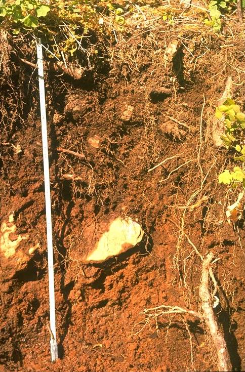
Soil profile from pit along middle road of WS 3.
Photographed by J. Rothacher ..... Date: 08/63 ..... Photo: AAE-001
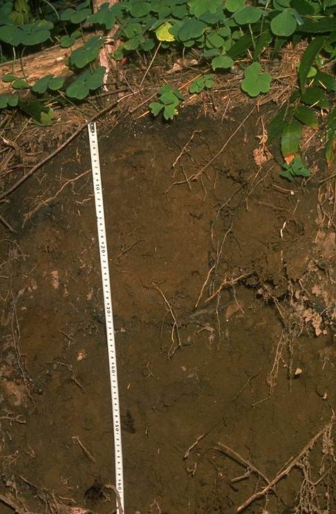
Photographed by R.L. Fredriksen ..... Date: 08/63 ..... Photo: AAE-002
silty clay texture from pit on WS 10 circa 1960's
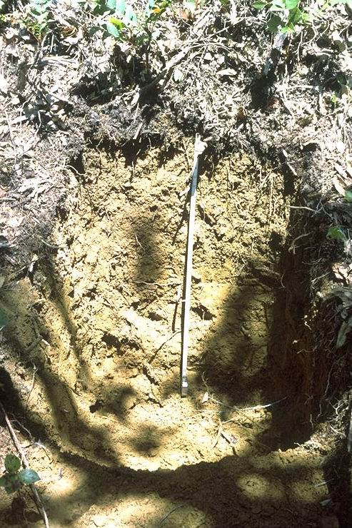
Photographed by R.L. Fredriksen ..... Date: Unknown..... Photo: AAE-003

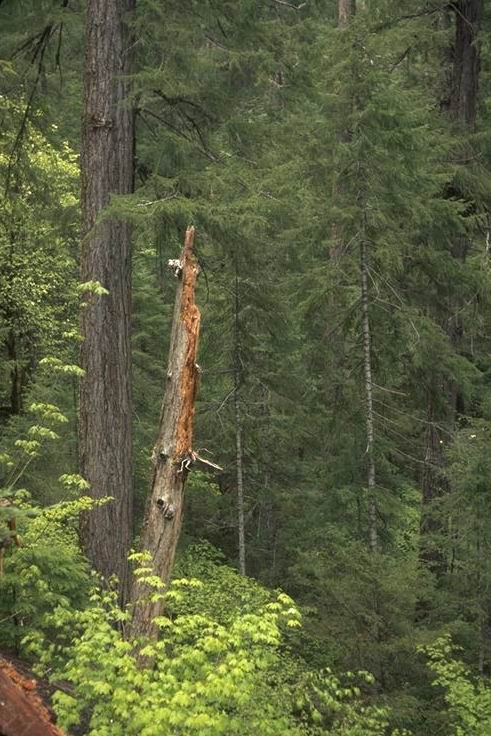
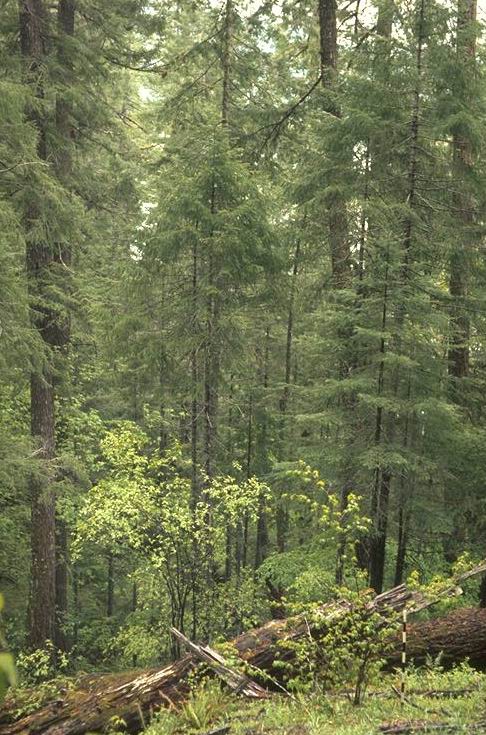
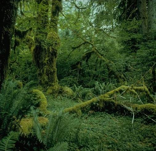
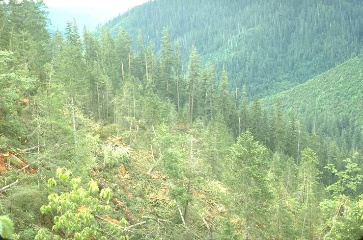
before logging
Photographed by Franklin/Dyrness ..... Date: 05/71 ..... Photo: AAE-004
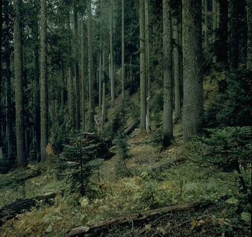
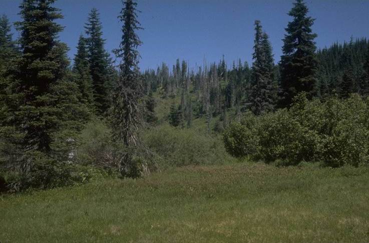
All aged old growth
Photographed by Franklin/Dyrness ..... Date: 05/71 ..... Photo: AAE-005
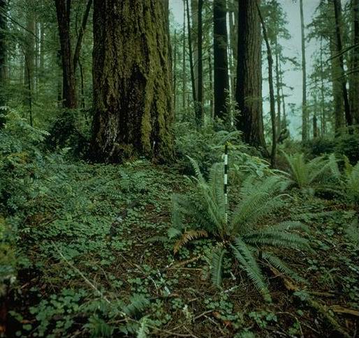
All aged Douglas Fir
Photographed by Franklin/Dyrness ..... Date: 05/71 ..... Photo: AAE-006
Photographed by Franklin/Dyrness ..... Date: 05/71 ..... Photo: AAE-007
Photographed by Franklin/Dyrness ..... Date: 05/71 ..... Photo: AAE-008
Forest dominated by ABPR, Wildcat Research Natural Area 1970's
Photographed by Franklin/Dyrness ..... Date: 1970's ..... Photo: AAE-009
Twin Creek RNA, Hoh River, Olympic Rain Forest 1970's
Photographed by Franklin/Dyrness ..... Date: 1970's ..... Photo: AAE-010
Photographed by J. Rothacher ..... Date: 08/64 ..... Photo: AAE-011
Cherry Creek RNA
Photographed by Franklin/Dyrness ..... Date: 06/73 ..... Photo: AAE-012
Blue River Gaging Station
Photographed by J. Rothacher ..... Date: 08/65 ..... Photo: AAE-013
Lookout Creek
Photographed by R.L. Fredriksen ..... Date: 08/65 ..... Photo: AAE-014
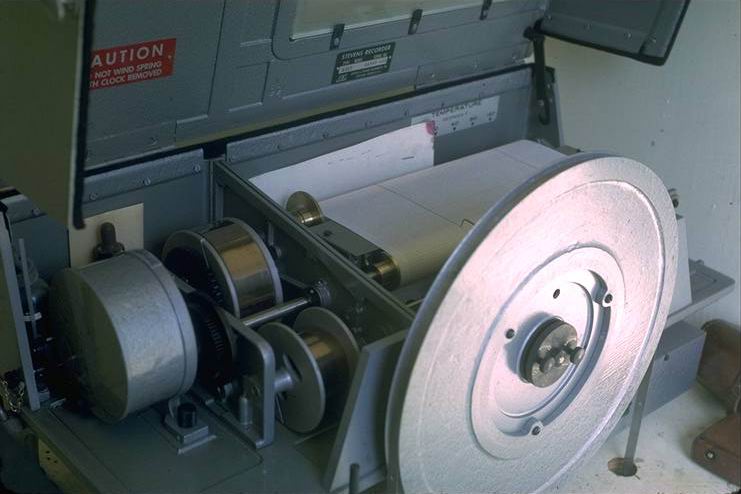
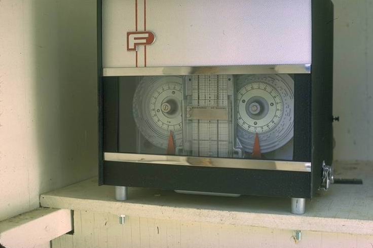
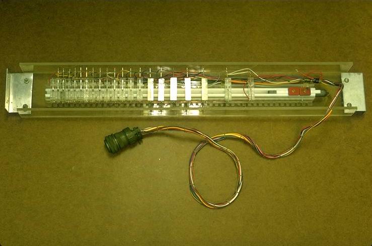
Developed by R.L. Fredriksen Proportional sampler interval timing unit.
Photographed by R.L. Fredriksen ..... Date: 02/68 ..... Photo: AAE-015
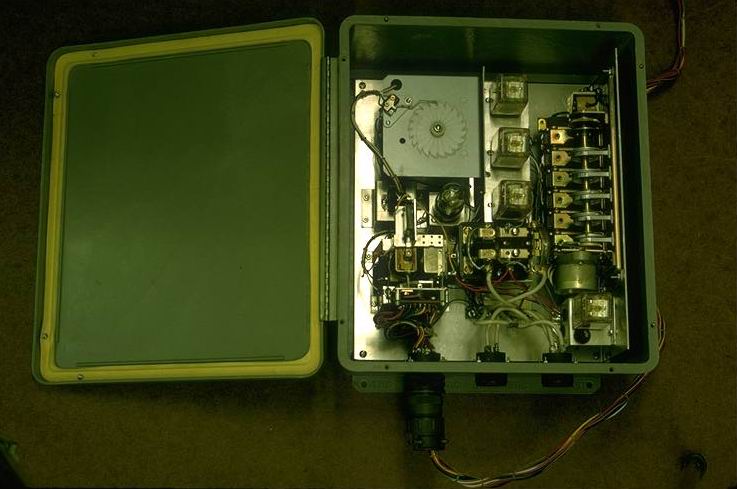
Developed by Tom Hubbard (pictured). S. Umpqua Exper. Forest
Photographed by J. Rothacher ..... Date: 05/66 ..... Photo: AAE-016
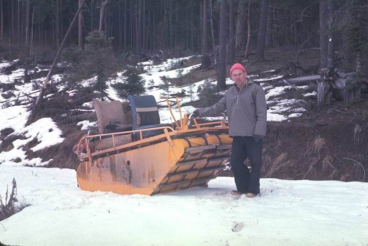
Weasel used as sno cat on Bull Run City Watershed. Used to service Fox Creek Exper. watersheds during early 1960's.
Photographed by J. Rothacher ..... Date: 11/66 ..... Photo: AAE-017
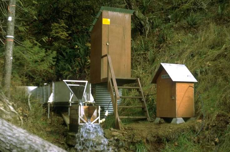
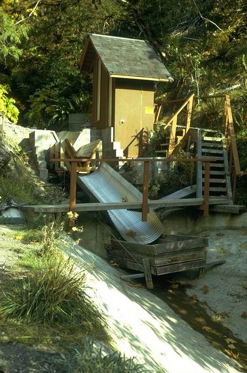
Magnet attached to counterweight closes reed switches mounted at 20 discharge stages.
Photographed by R.L. Fredriksen ..... Date: 2/68 ..... Photo: AAE-018
Located at upper Blue River gaging station. Installed as part of the Army Corps of Engineer Willamette Snow Study in 1951.
Photographed by J. Rothacher ..... Date: 03/58 ..... Photo: AAE-019

Located at Blue River Gaging station near Tidbits Creek.
Photographed by J. Rothacher ..... Date: 08/65 ..... Photo: AAE-020
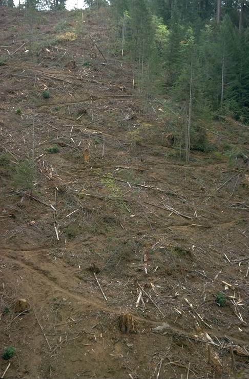
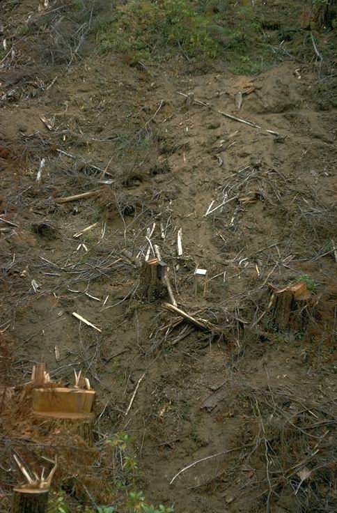
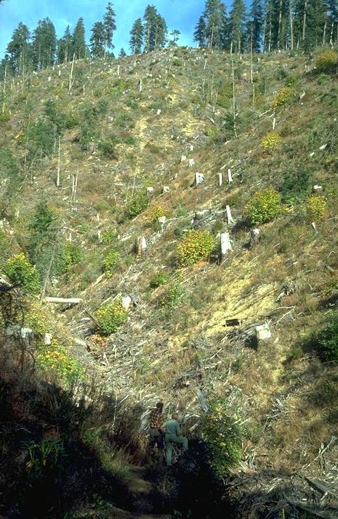
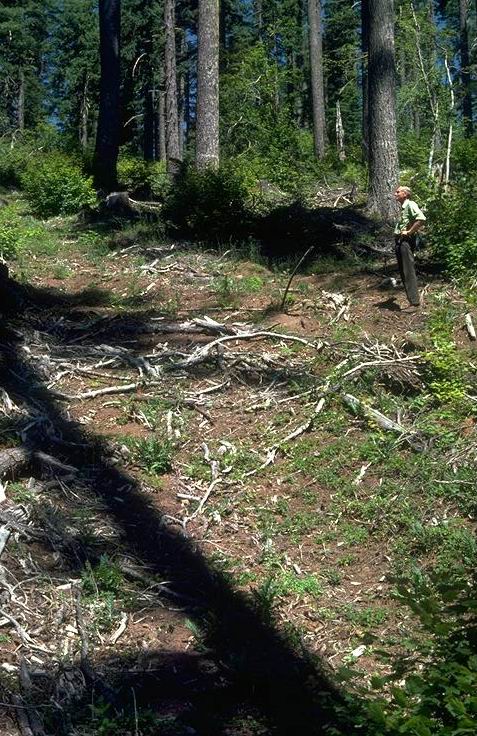
North Aspect of Watershed 10 after clearcutting. Acess trail constructed on slope.
Photographed by R.L. Fredriksen ..... Date: 10/75 ..... Photo: AAE-021

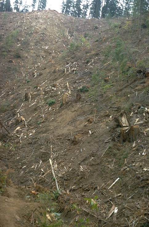
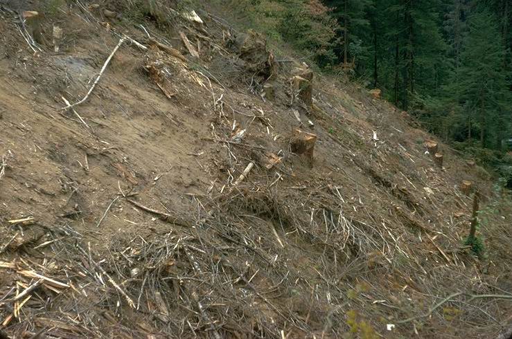
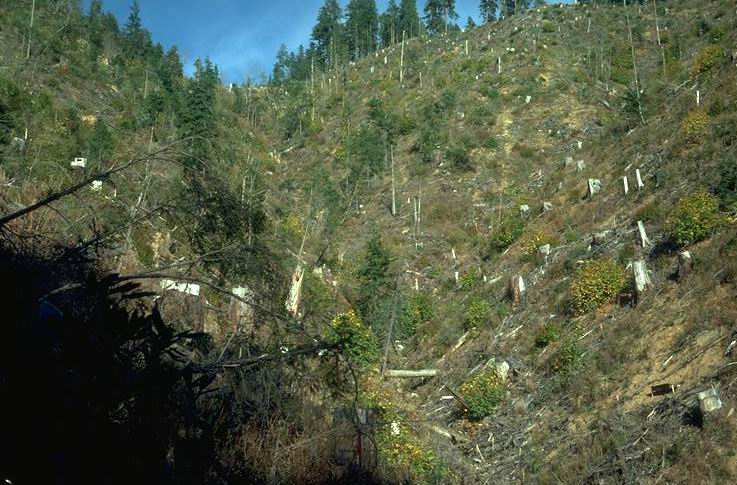
South aspect CACH forest type after clearcutting.
Photographed by R.L. Fredriksen ..... Date: 10/75 ..... Photo: AAE-022
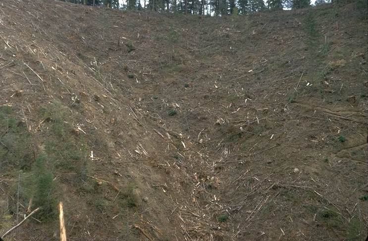
Looking up main creek toward headwall and landing
Photographed by R.L. Fredriksen ..... Date: 10/75 ..... Photo: AAE-023
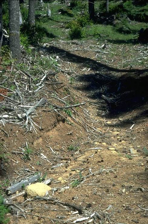
Deeply disturbed soil on lower north aspect from skidding.
Photographed by R.L. Fredriksen ..... Date: 10/75 ..... Photo: AAE-024
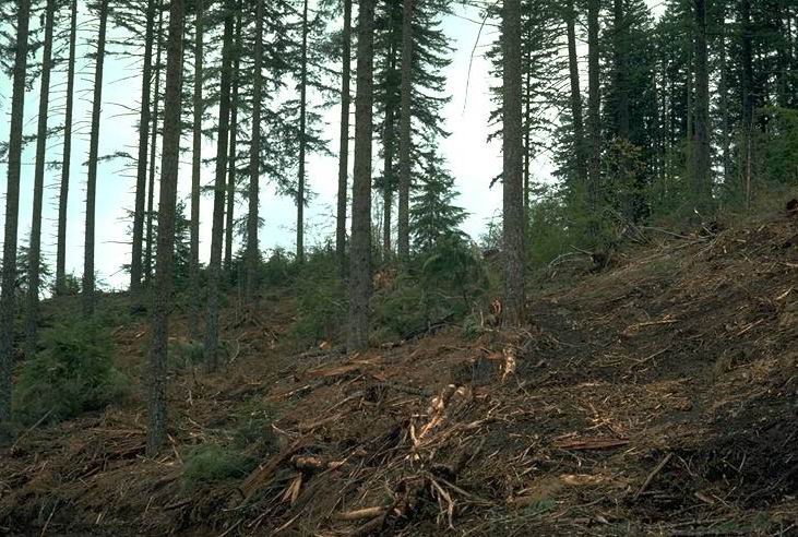
North aspect, after cutting but before yarding.
Photographed by Arthur McKee ..... Date: 06/75 ..... Photo: AAE-025
ACCI-POMU forest type located on lower slope with deep disturbance.
Photographed by R.L. Fredriksen ..... Date: 10/75 ..... Photo: AAE-026

Large logs were removed to reduce fire hazard. Not burned.
Photographed by R.L. Fredriksen ..... Date: 09/78 ..... Photo: AAE-027
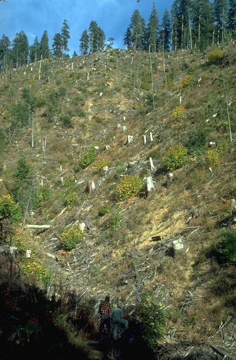
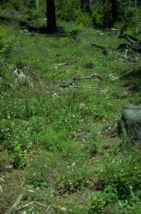
Northwest facing slope 3 years after clearcutting without burning.
Photographed by R.L. Fredriksen ..... Date: 09/78 ..... Photo: AAE-028
Northwest facing slope 3 years after clearcutting without burning.
Photographed by R.L. Fredriksen ..... Date: 09/78 ..... Photo: AAE-029
Headwall right fork.
Photographed by R.L. Fredriksen ..... Date: 10/75 ..... Photo: AAE-030
Large cull logs were removed to control fire hazard -- watershed not burned.
Photographed by R.L. Fredriksen ..... Date: 09/78 ..... Photo: AAE-031
Al Levno making routine inspection of gauging station., Winter.
Photographed by R.L. Fredriksen ..... Date: 1969 ..... Photo: AAE-032

Photo taken from Mona Creek road, across canyon.
Photographed by R.L. Fredriksen ..... Date: 07/66 ..... Photo: AAE-033
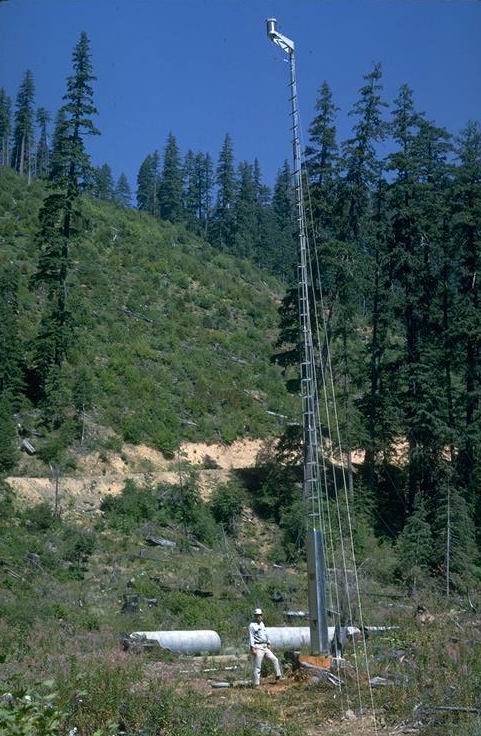
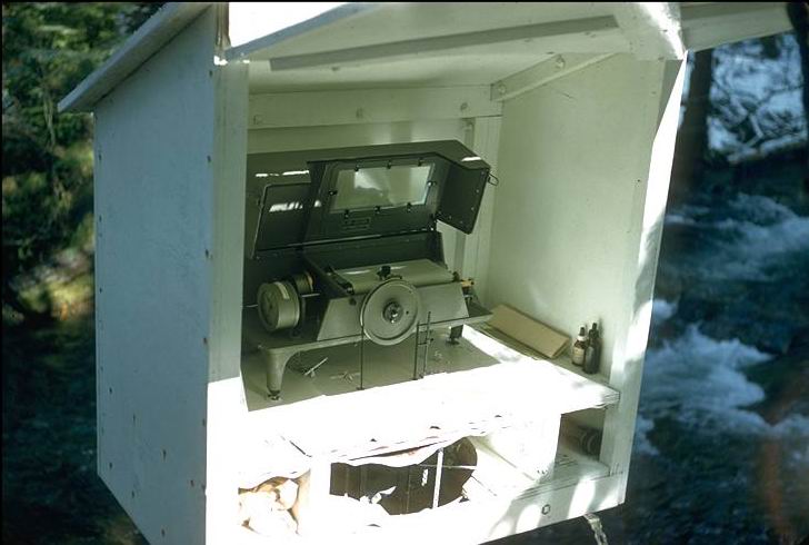
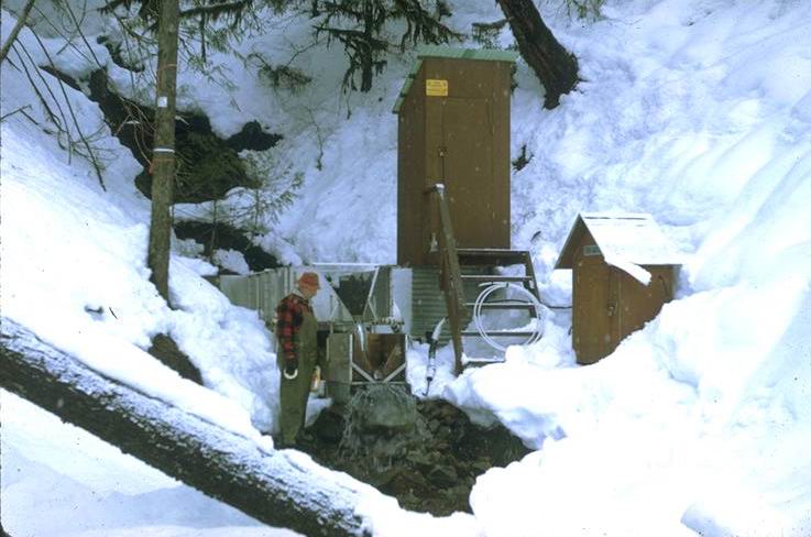
Stainless steel collector located at top of 50 foot tower with the collection container buried below ground at the base of the tower. Al Levno next to tower. Located at the site of the current primary weather station behind administration building.
Photographed by R.L. Fredriksen ..... Date: 11/67 ..... Photo: AAE-034
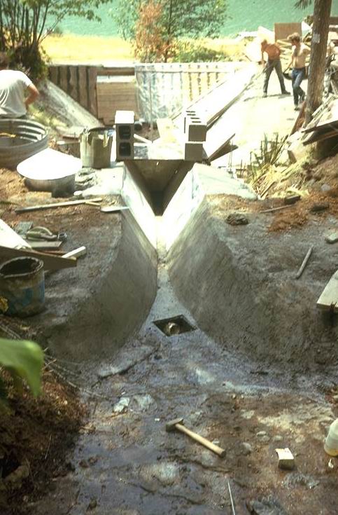
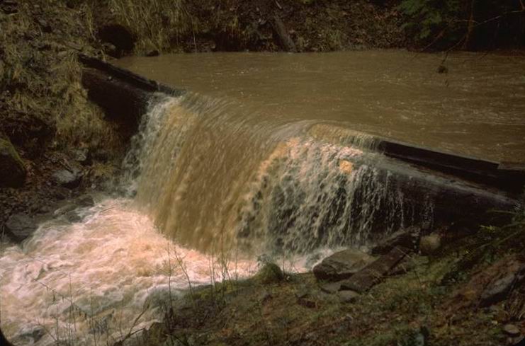
H-flume was replaced with permanent trapezoidal flume
Photographed by R.L. Fredriksen ..... Date: 07/73 ..... Photo: AAE-035
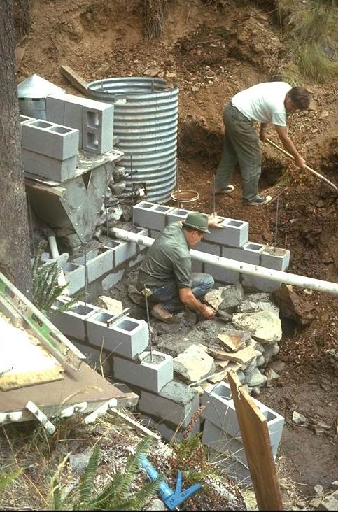
PNW employee Ross Mersereau (right) working with local contractor Charles Vaughn to complete construction.
Photographed by R.L. Fredriksen ..... Date: 07/73 ..... Photo: AAE-036
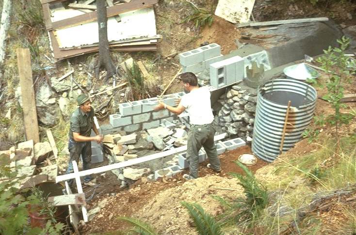
PNW employee Ross Mersereau (right) working with local contractor Charles Vaughn to complete construction.
Photographed by R.L. Fredriksen ..... Date: 07/73 ..... Photo: AAE-037
H flume was used as a water measurement device during the initial years and was replaced with a trapezoidal flume in July 1973. Photo taken Spring 1969.
Photographed by R.L. Fredriksen ..... Date: 1969 ..... Photo: AAE-038
Trapezoidal flume with a gunite sediment basin connected by a half round culvert.
Photographed by R.L. Fredriksen ..... Date: 11/76 ..... Photo: AAE-039
Tractor logged portion above road. Taken Fall 1974.
Photographed by R.L. Fredriksen ..... Date: 1974 ..... Photo: AAE-040
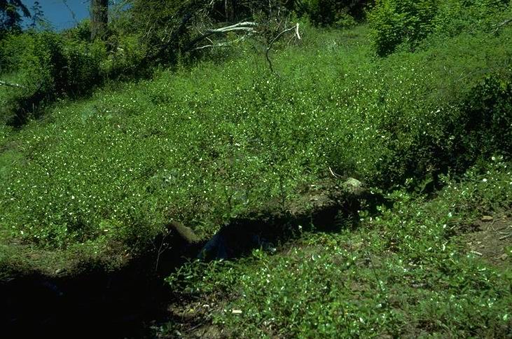
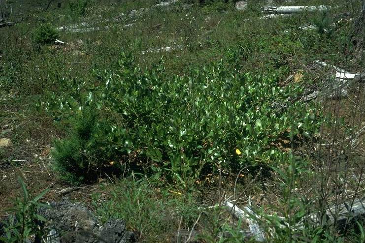
Ceanothus velutinas (snow brush ceanothus) on unburned tractor skid roads, upper portion of watershed.
Photographed by R.L. Fredriksen ..... Date: 07/78 ..... Photo: AAE-041
Tractor skid road. Taken Summer 1978. Richard Fredriksen in the photo.
Photographed by R.L. Fredriksen ..... Date: 08/78 ..... Photo: AAE-042
The tractor road in upper portion of watershed shows no evidence of accelerated erosion.
Photographed by R.L. Fredriksen ..... Date: 08/78 ..... Photo: AAE-043
15 year old stand of snow brush ceanothus on divide ridge between Watersheds 6 and 7 adjacent to the old landing.
Photographed by R.L. Fredriksen ..... Date: 07/78 ..... Photo: AAE-044
Four year old snowbrush ceanothus seedlings on unburned cat roads in upper WS 7.
Photographed by R.L. Fredriksen ..... Date: 07/78 ..... Photo: AAE-045
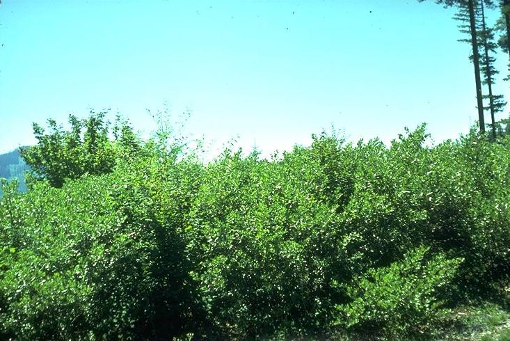
Ceanothus velutinas shrub
Photographed by R.L. Fredriksen ..... Date: 08/78 ..... Photo: AAE-046

Ceanothus velutinas shrub
Photographed by R.L. Fredriksen ..... Date: 08/78 ..... Photo: AAE-047
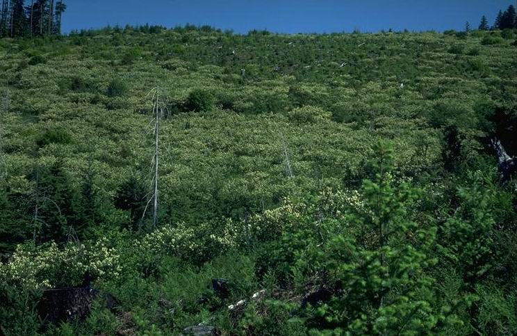
Ceanothus in full bloom, covering most of Watershed 6. Picture taken from the viewpoint lower road just entering watershed.
Photographed by R.L. Fredriksen ..... Date: 06/83 ..... Photo: AAE-048
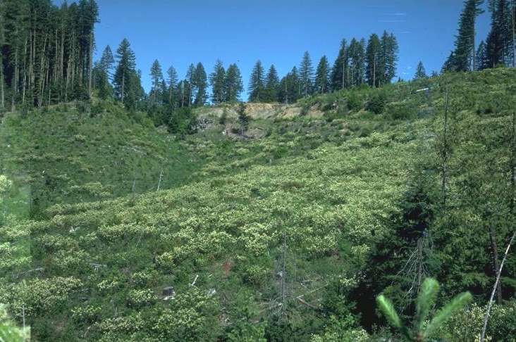
Ceanothus in full bloom, covering most of Watershed 6. Picture taken from the viewpoint lower road just entering watershed.
Photographed by R.L. Fredriksen ..... Date: 06/83 ..... Photo: AAE-049
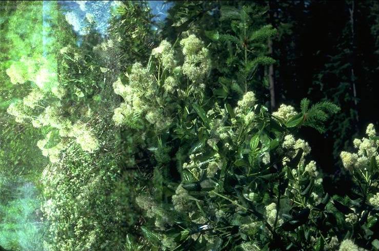
Blossoms of ceanothus.
Photographed by R.L. Fredriksen ..... Date: 06/83 ..... Photo: AAE-050
Major stream channel, Watershed 3, after initial construction, and before 1964 debris avalanche.
Photographed by Jack Rothacher ..... Date: 08/60 ..... Photo: AAE-051
Major stream channel, Watershed 3 after reconstruction, following 1964 debris avalanche.
Photographed by Ross Mersereau ..... Date: 07/68 ..... Photo: AAE-052
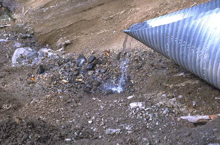
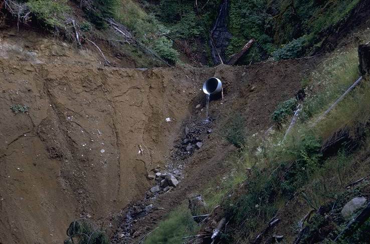
Culvert spilling on fill after reconstruction, due to complete failure after 1964 flood.
Photographed by Ross Mersereau ..... Date: 07/68 ..... Photo: AAE-053
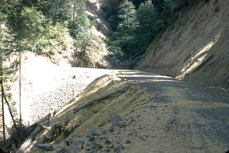
This is the destruction of the reconstructed road, following the 1964 flood. North side of stream crossing. Photo taken summer following winter re-slide.
Photographed by Jack Rothacher ..... Date: 07/13/71 ..... Photo: AAE-054
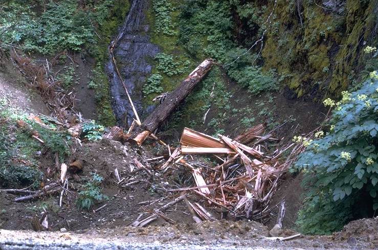
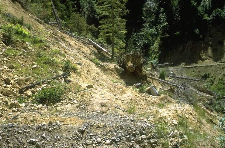
Debris left above culvert after the road reconstruction, following the 1964 flood.
Photographed by Ross Mersereau ..... Date: 07/68 ..... Photo: AAE-055
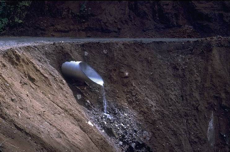
Culvert spilling on fill after reconstruction, due to complete failure after 1964 flood.
Photographed by Ross Mersereau ..... Date: 07/68 ..... Photo: AAE-056
Sediment from road crossing, first summer following road construction.
Photographed by Jack Rothacher ..... Date: 08/60 ..... Photo: AAE-057
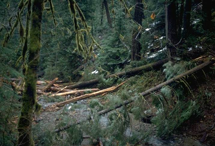
Photo of slide jam from Fredriksen's 1959 publication: "History of Snow and Mud Slide". Slide started from the Watershed 3 middle road trib. just before entering L221.
Photographed by R.L. Fredriksen ..... Date: 08/62 ..... Photo: AAE-058
Watershed 3 stream channel scoured to bedrock, following 1964 debris flow. Stream channel in Unit 9C, above Tributary #1, station 21 + 00.
Photographed by R.L. Fredriksen ..... Date: 08/65 ..... Photo: AAE-059
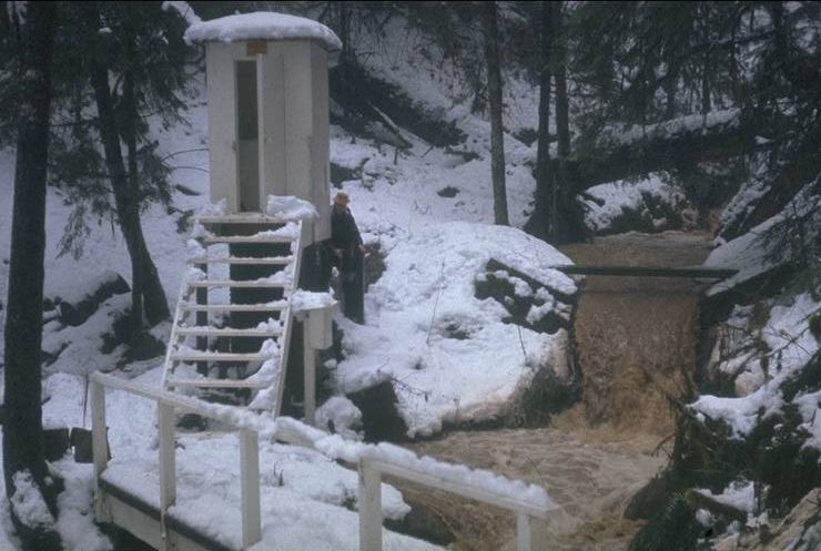
First Watershed 3 gage house destroyed by the 1964 flood. Photo shows peak streamflow with heavy sediment resulting from recent logging of three units located above the gaging station. Al Levno making routine watershed inspection. Water temperature instrument shelter is to the right of the stairs.
Photographed by R.L. Fredriksen ..... Date: 12/20/64 ..... Photo: AAE-060

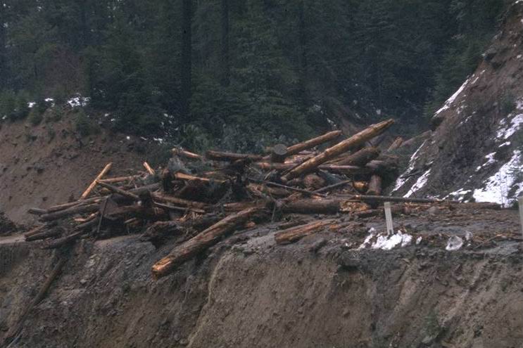
Main slide source area between units 9-D (L221) and 9-E (L222) from Christmas storm 1964 upper road in background.
Photographed by R.L. Fredriksen ..... Date: 04/65 ..... Photo: AAE-061
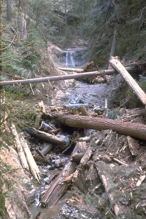
Debris remaining at first major confluence of storm. Site of debris from 1961 slide. See "before" photo CD # E-069. Waterfall is just above unit L141.
Photographed by R.L. Fredriksen ..... Date: 4/65 ..... Photo: AAE-062
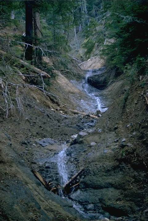
Main creek channel below middle road scoured by slide originating in timbered area between units 9-D and 9-E.
Photographed by R.L. Fredriksen ..... Date: 4/65 ..... Photo: AAE-063

Newly constructed gage house following 1964 flood. Flume site was buried under 10 - 15 feet of debris during the 1964 flood.
Photographed by Al Levno ..... Date: 08/66 ..... Photo: AAE-064

WS 3 on the morning of Dec. 21, 1964. Three slides from the watershed depositied an estimated 50,000 cu. yds of debris behind the road prism at the bottom of the watershed. Photo taken in the morning. See close up photo: CD #E-070.
Photographed by Dick Fredriksen ..... Date: 12/21/64 ..... Photo: AAE-065
Channel at site of previous slide terminus below unit 9-C -- looking downstream.
Photographed by R.L. Fredriksen ..... Date: 4/65 ..... Photo: AAE-066

Christmas storm at the beginning of the rising stage at same time slide #4 & 5 were taken at Watershed 3. Slide shows the amount of snow on the ground before the storm.
Photographed by R.L. Fredriksen ..... Date: 12/20/64 ..... Photo: AAE-067
Watershed 3 This spot was buried beneath 80' of debris 24 hours later.
Photographed by R.L. Fredriksen ..... Date: 12/20/64 ..... Photo: AAE-068
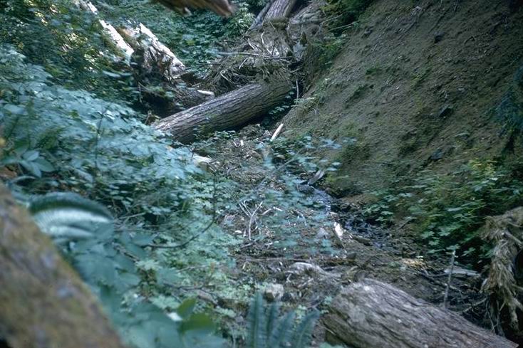
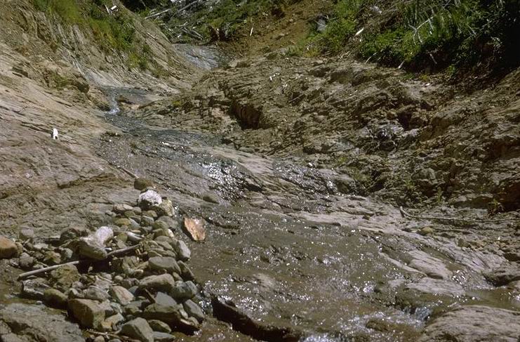
Channel before 1964 flood, and before logging of unit L141, looking at the same waterfall as CD E-062.
Photographed by J. Rothacher ..... Date: 08/60 ..... Photo: AAE-069
WS 3 on the morning of Dec. 21, 1964. Three slides from the watershed deposited an estimated 50,000 cu. yds of debris behind the road prism at the bottom of the watershed. Photo taken in the morning. Close up of CD #E-065.
Photographed by Dick Fredriksen ..... Date: 12/21/64 ..... Photo: AAE-070
Original sediment dam built in 1952 and destroyed by the 1964 flood.
Photographed by J. Rothacher ..... Date: 1963 ..... Photo: AAE-071
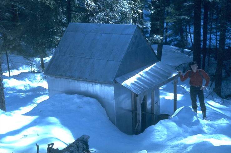
Small aluminum covered shelter built by Army Corps of Engineers during the Willamette Basin Snow Study (1952). The cabin is located half a mile upstream from confluence of Quentin Creek and Blue River, and 7 miles below the Corps main cabin, located at the junction of Mann and Wolf Creek. Material for these cabins was hauled in by horseback, as roads did not exist.
Photographed by Dick Fredriksen ..... Date: 3/64 ..... Photo: AAE-072
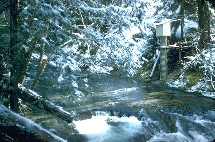
Gaging station established by the Army Corp of Engineers, during the 1952 Willamette Basin Snow Study. PNW maintained streamflow records from this station from 1957 - 65.
Photographed by J. Rothacher ..... Date: 3/58 ..... Photo: AAE-073
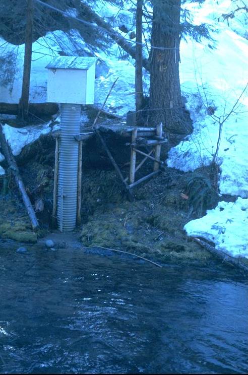
Close up of gaging station.
Photographed by Dick Fredriksen ..... Date: 3/64 ..... Photo: AAE-074
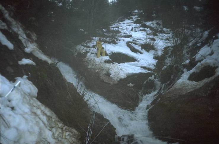
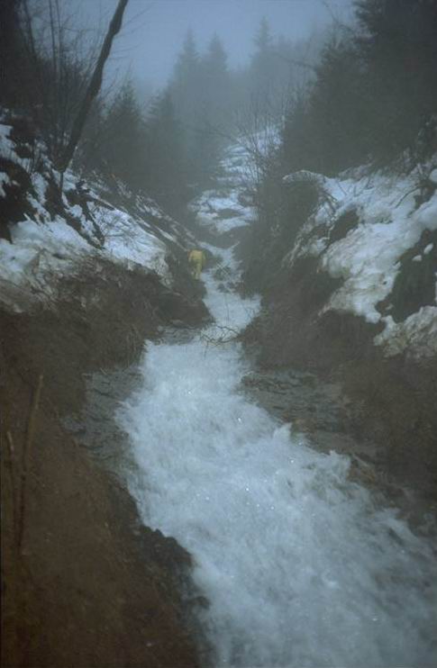
During storm flow in 1961.
Photographed by J. Rothacher ..... Date: 1961 ..... Photo: AAE-075
Photographed by R.L. Fredriksen ..... Date: 1/29/65 ..... Photo: AAE-076
Filled with bedload material after Christmas storm 1964. Al Levno with his dog Tramp.
Photographed by R.L. Fredriksen ..... Date: 4/65 ..... Photo: AAE-077
Christmas storm flow looking downstream from bridge. Several houses on left bank were lost during the storm. Before the construction of Blue River dam.
Photographed by J. Rothacher ..... Date: 12/21/64 ..... Photo: AAE-078
Before the construction of the Blue River dam.
Photographed by J. Rothacher ..... Date: 12/21/64 ..... Photo: AAE-079
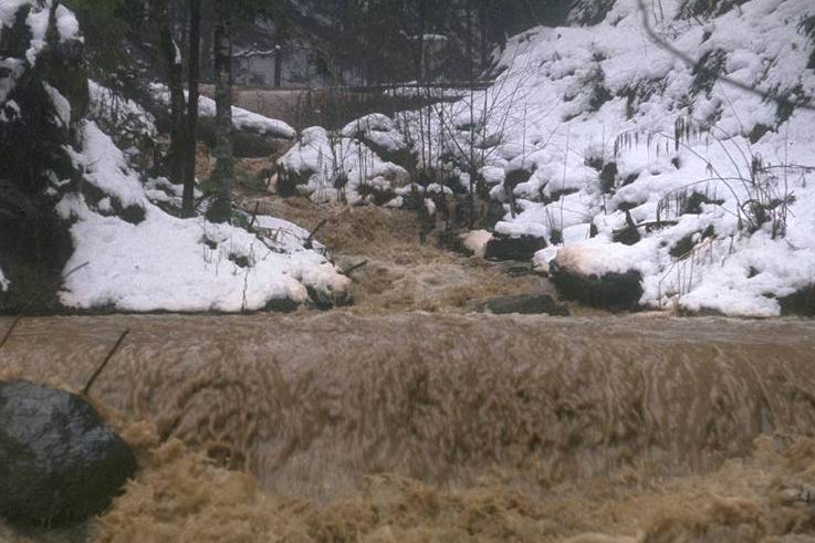
Immediately after Feb. 1996 flood. Fred Swanson in photo.
Photographed by Gordon Grant ..... Date: 2/7/96 ..... Photo: AAE-080
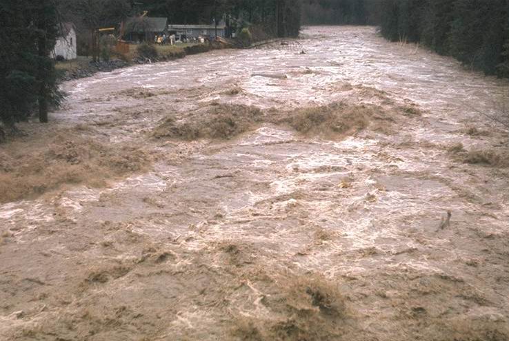
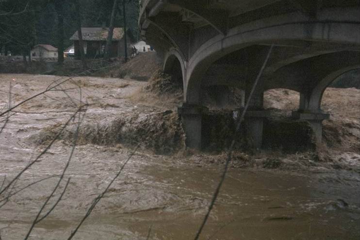
Lookout Creek during receding Feb. 1996 Flood flow. Photo taken from upper Lookout Creek Concrete bridge.
Photographed by Gordon Grant ..... Date: 2/8/96 ..... Photo: AAE-081
Lookout Creek during receding Feb. 1996 Flood flow. Fred Swanson in photo.
Photographed by Gordon Grant ..... Date: 2/8/96 ..... Photo: AAE-082
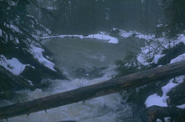
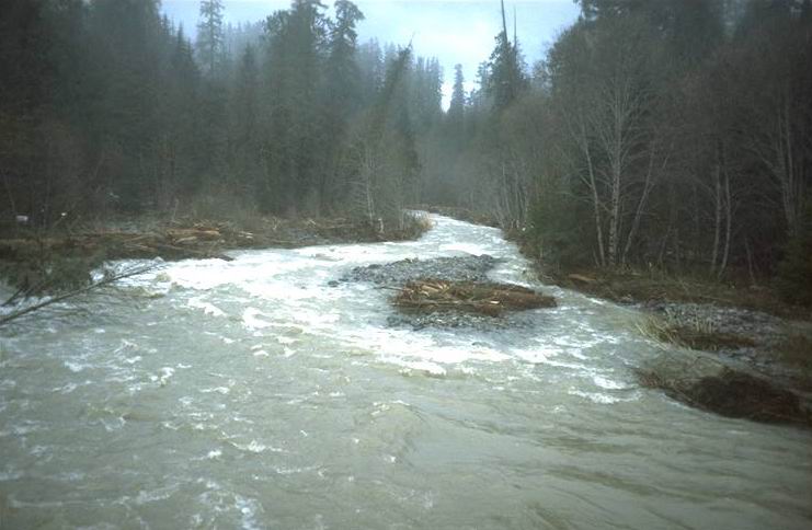
Looking upstream during receding flow of Feb. 1996 Flood.
Photographed by Gordon Grant ..... Date: 2/8/96 ..... Photo: AAE-083

Looking upstream during receding flow of Feb. 1996 Flood.
Photographed by Gordon Grant ..... Date: 2/8/96 ..... Photo: AAE-084
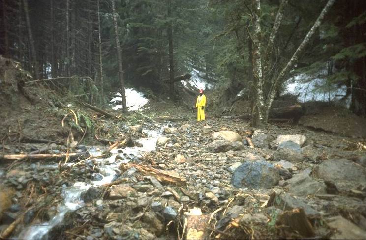
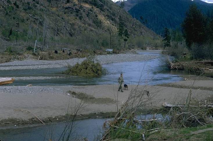
100 yards upstream from Lookout Creek. Fred Swanson pictured here.
Photographed by Gordon Grant ..... Date: 2/7/96 ..... Photo: AAE-085

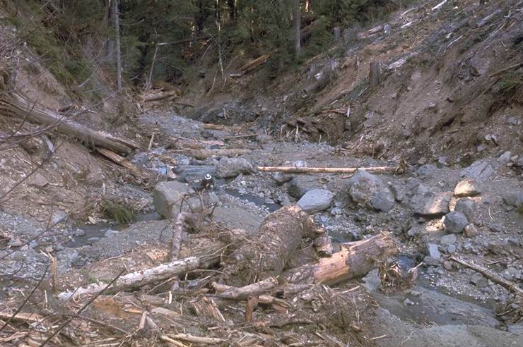
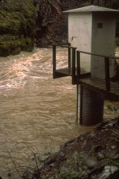
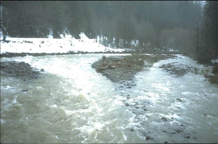
At confluence of Watershed 3. Picture taken during the receding flow of Feb. 1996 Flood.
Photographed by Gordon Grant ..... Date: 2/7/96 ..... Photo: AAE-086
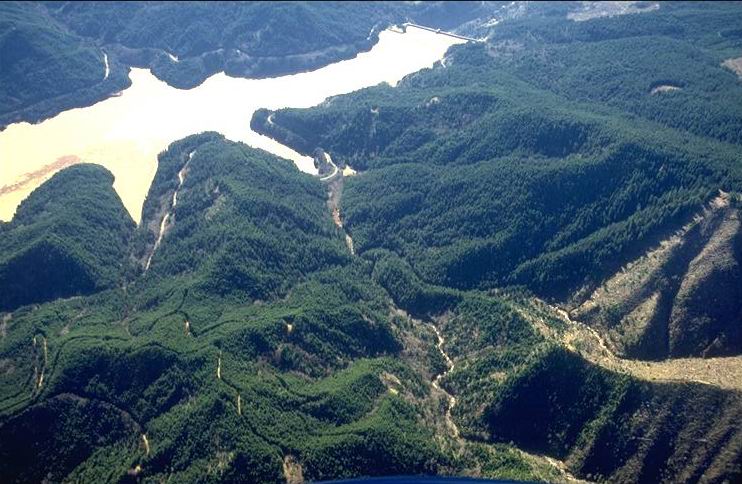
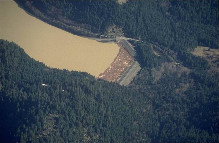
Photo taken at 1:00 pm from plane. Small tribs flowing into Green Peter Reservoir. Note log mat on the left of the reservoir.
Photographed by Al Levno ..... Date: 2/12/96 ..... Photo: AAE-087
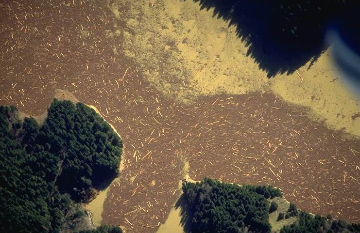
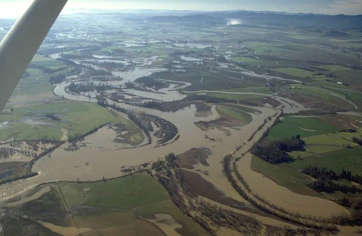
Photo taken at 1:00 pm. from plane, six days following Feb. 1996 Flood.
Photographed by Al Levno ..... Date: 2/12/96 ..... Photo: AAE-088
Aerial view, 6 days after Feb. 1996 Flood.
Photographed by Al Levno ..... Date: 2/12/96 ..... Photo: AAE-089
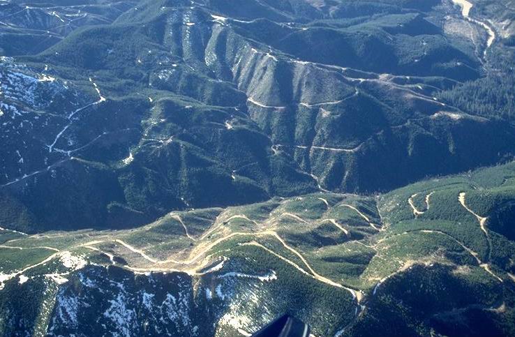
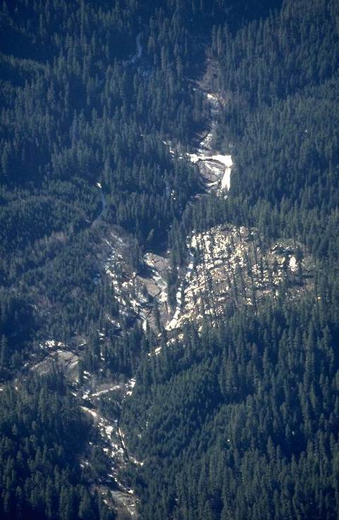
Aerial view showing logging roads on steep terrain with debris filled canyon, just above Green Peter Reservoir. Six days following Feb. 1996 Flood.
Photographed by Al Levno ..... Date: 2/12/96 ..... Photo: AAE-090
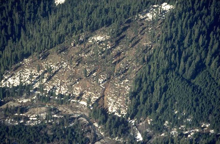
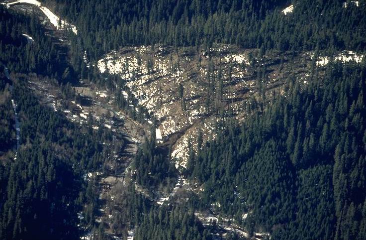
Aerial view, showing debris flows created by the Feb. 1996 Flood. Close up of CD #E-092.
Photographed by Fred Swanson ..... Date: 2/12/96 ..... Photo: AAE-091
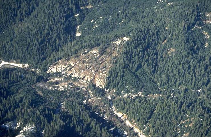
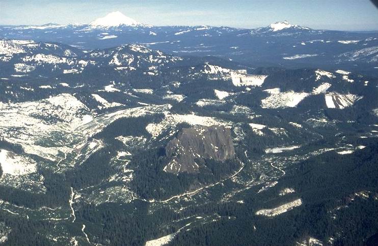
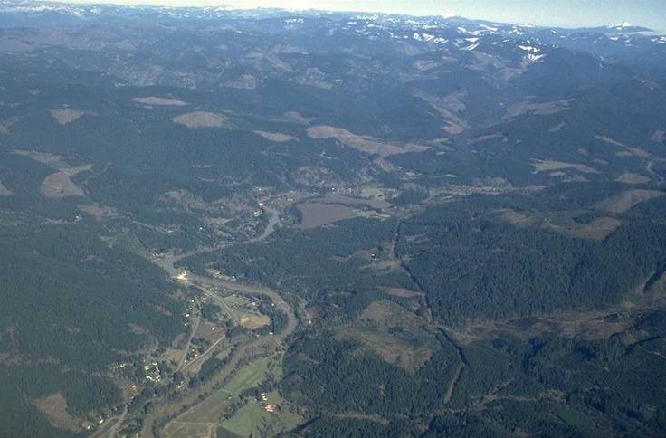
Aerial view
Photographed by Fred Swanson ..... Date: 2/12/96 ..... Photo: AAE-092
Aerial view. Log mat generated by the Feb. 1996 Flood.
Photographed by Fred Swanson ..... Date: 2/12/96 ..... Photo: AAE-093
Aerial view, 6 days following Feb. 1996 Flood.
Photographed by Fred Swanson ..... Date: 2/12/96 ..... Photo: AAE-094

Aerial view, beginning at Road 1501, Unit 236, and travelling down channel, and crossing Road 15 into Blue River Reservoir. Six days following Feb. 1996 Flood.
Photographed by Fred Swanson ..... Date: 2/12/96 ..... Photo: AAE-095
Six days following Feb. 1996 flood
Photographed by Fred Swanson ..... Date: 2/12/96 ..... Photo: AAE-096
Aerial view of Medle Unit, McRae Creek going into Lookout Creek, six days following Feb. 1996 Flood.
Photographed by Fred Swanson ..... Date: 2/12/96 ..... Photo: AAE-097

Six days following Feb. 1996 Flood.
Photographed by Fred Swanson ..... Date: 2/12/96 ..... Photo: AAE-098
Above Blue River, six days following Feb. 1996 Flood.
Photographed by Fred Swanson ..... Date: 2/12/96 ..... Photo: AAE-099