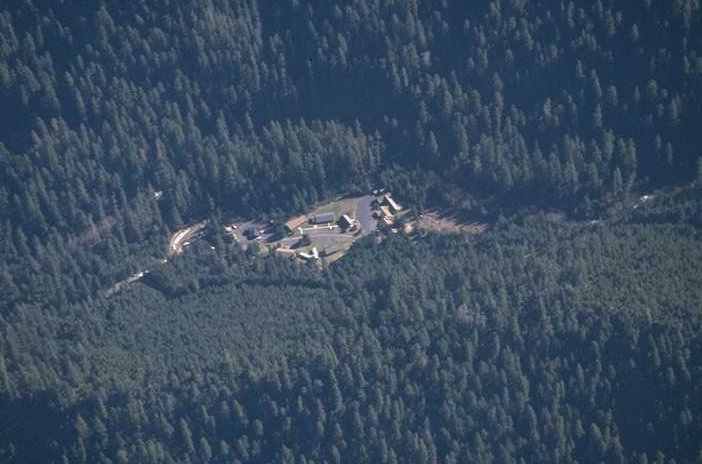
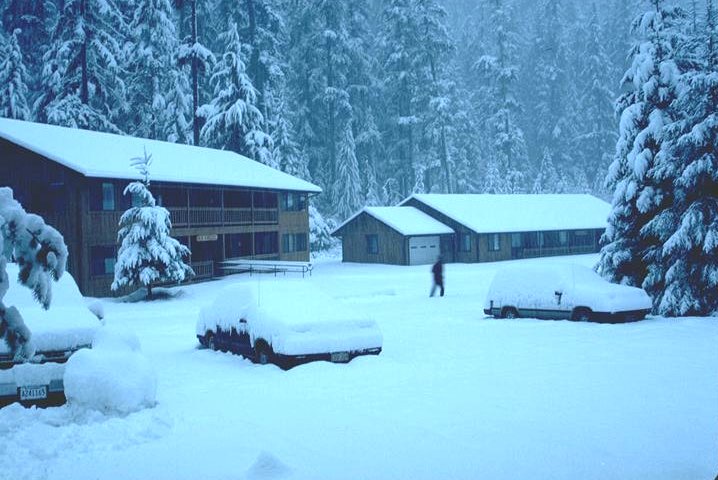
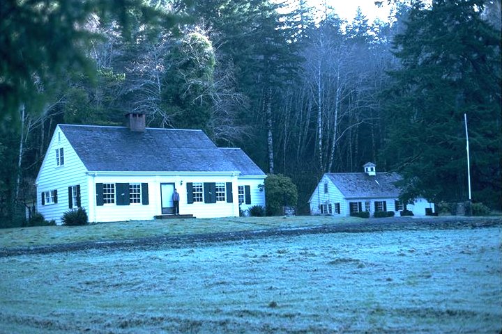
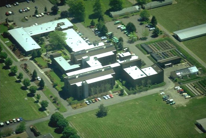
H.J. Andrews Headquarters Compound nested in an old-growth Douglas-fir forest near the mouth of Lookout Creek on the Andrews Experimental Forest.
Photographed by Al Levno ..... Date: 2/95 ..... Photo: AAB-001

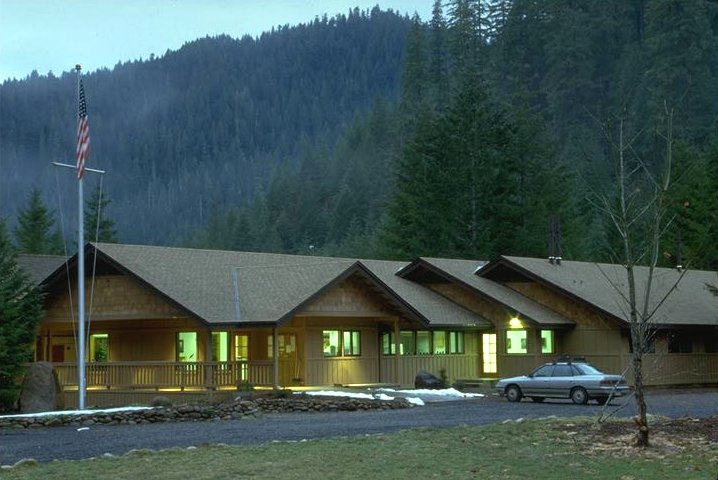
The office/lab building contains administration offices, 5 small field laboratories, a computer room, and a small library. Salt Salmon open-air pavilion is used for group gatherings during mild weather.
Photographed by Al Levno ..... Date: 1/95 ..... Photo: AAB-002
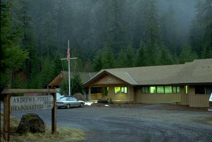
H.J. Andrews Headquarters Compound, office/lab building.
Photographed by Al Levno ..... Date: 1/95 ..... Photo: AAB-003
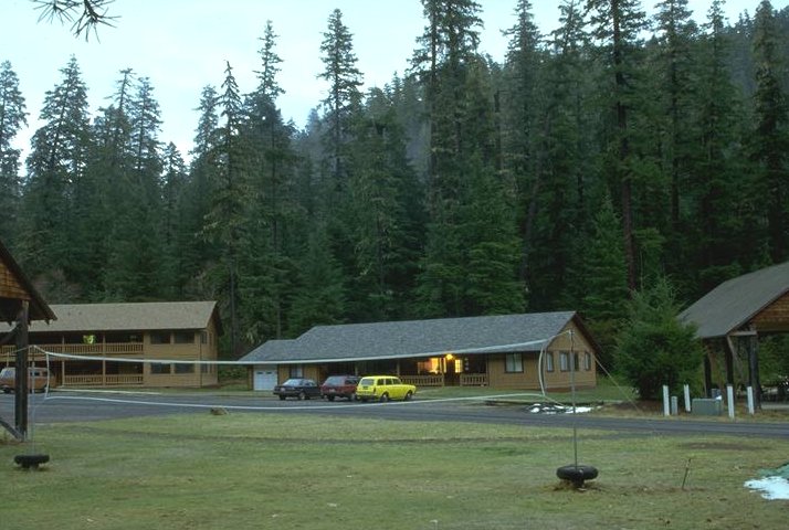
H.J. Andrews Headquarters Compound, office/lab building.
Photographed by Al Levno ..... Date: 1/95 ..... Photo: AAB-004
Rainbow and Roswell Ridge apartment buildings contain 4-bedroom apartments with kitchens.
Photographed by Al Levno ..... Date: 1/95 ..... Photo: AAB-005
Facilities are open year-round for visitor lodging.
Photographed by Al Levno ..... Date: 1/93 ..... Photo: AAB-006
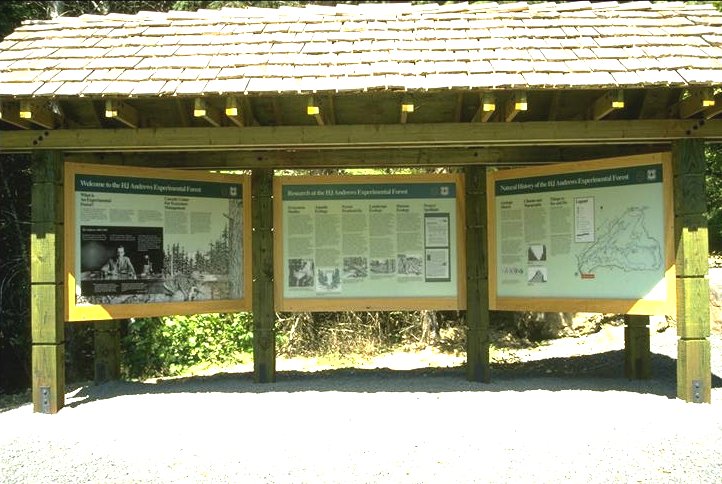
Public information kiosk located at the entrance to the Andrews Forest features a large picture of Horace Andrews and short verbiage about research at the Forest.
Photographed by Al Levno ..... Date: 8/93 ..... Photo: AAB-007

Entrance to the H.J. Andrews Experimental Forest, August 1993.
Photographed by Al Levno ..... Date: 8/93 ..... Photo: AAB-008
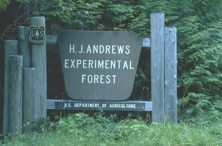
H.J. Andrews entrance sign.
Photographed by Al Levno ..... Date: 8/93 ..... Photo: AAB-009

Entrance to H.J. Andrews Experimental Forest, July 1957, before blowdown from the Columbus Day Storm, October 1961.
Photographed by Jack Rothacher ..... Date: 7/57 ..... Photo: AAB-010
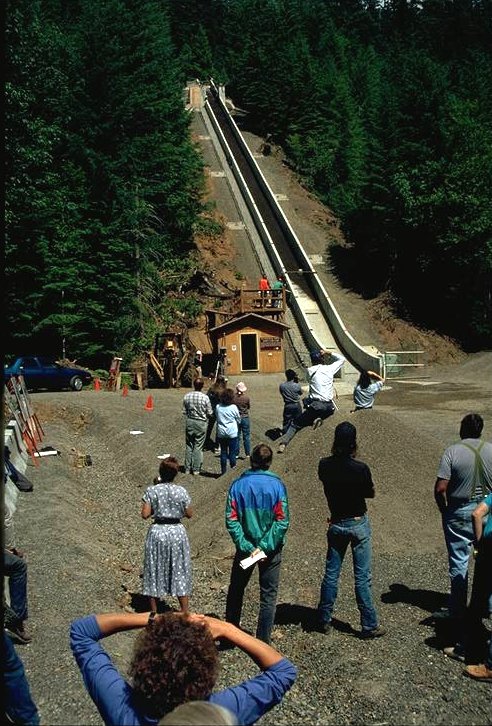
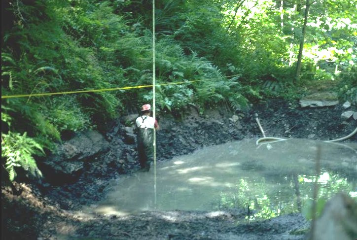
The U.S. Geological Survey constructed and operates an experimental debris flume located near the Andrews headquarters site. This flume is currently the largest experimental flume in existance.
Photographed by Al Levno ..... Date: 6/92 ..... Photo: AAB-011
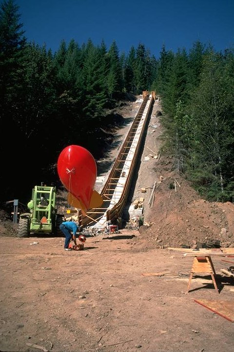
USGS experimental debris flume located at H.J. Andrews Experimental Forest. Photography blimp in the foreground.
Photographed by Al Levno ..... Date: 10/91 ..... Photo: AAB-012
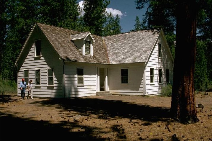
Cascade Head Experimental Forest, residence house and office building (right side).
Photographed by Al Levno ..... Date: 1/89 ..... Photo: AAB-013

At Cascade Head Experimental Forest with view of Cascade Head and the Salmon River Estuary.
Photographed by Al Levno ..... Date: 2/91 ..... Photo: AAB-014
Pringle Falls Experimental Forest, residence house.
Photographed by Al Levno ..... Date: 7/91 ..... Photo: AAB-015
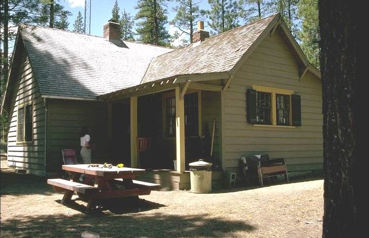
Pringle Falls Experimental Forest, lodge/bunkhouse building.
Photographed by Al Levno ..... Date: 7/91 ..... Photo: AAB-016
Aerial oblique, Forestry Sciences Laboratory, Corvallis, Oregon.
Photographed by Al Levno ..... Date: 5/90 ..... Photo: AAB-017
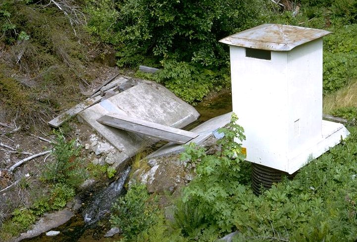
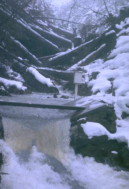
Original flume and gage house established in 1952.
Photographed by Jack Rothacher ..... Date: 7/66 ..... Photo: AAB-018
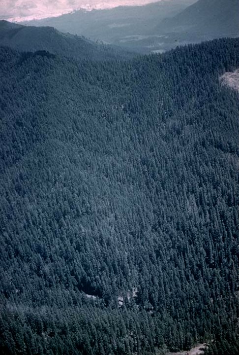
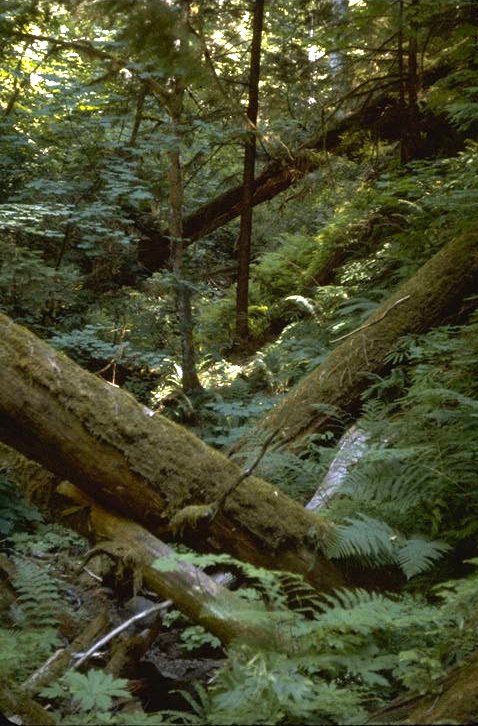
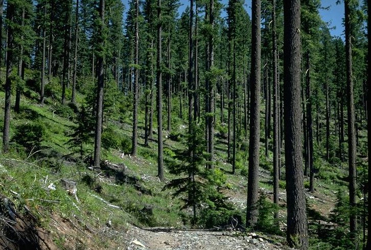
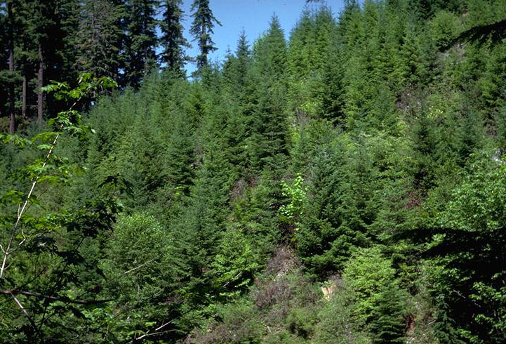
Aerial oblique of Watershed 1 covered with an old-growth Douglas-fir forest before logging.
Photographed by Unknown ..... Date: 1957? ..... Photo: AAB-019
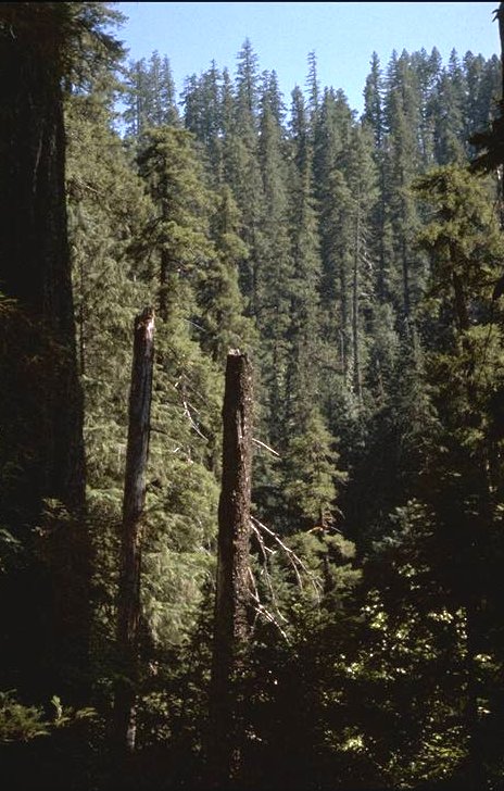
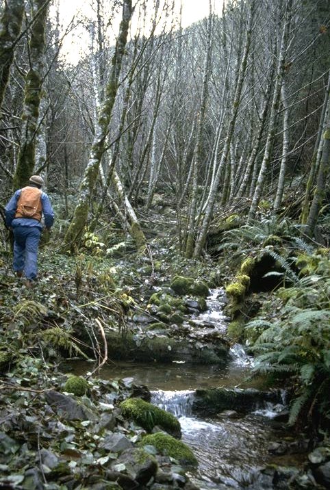
Watershed 1 before logging, looking up south tributary above the forks.
Photographed by Dick Fredriksen ..... Date: 7/62 ..... Photo: AAB-020
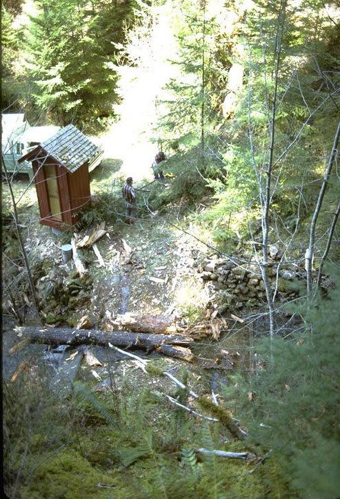
Stream channel in Watershed 1 before logging. Photo taken 1 ch. up from stream survey station 35+00.
Photographed by Dick Fredriksen ..... Date: 7/62 ..... Photo: AAB-021
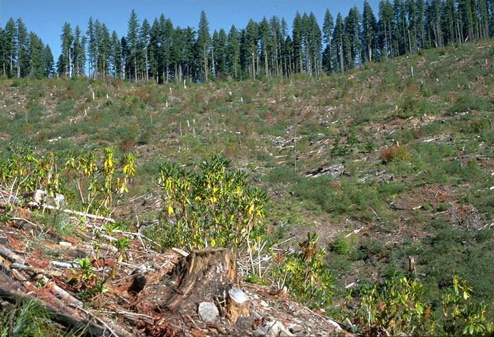
Watershed 1 logging nearly completed July 1966.
Photographed by Dick Fredriksen ..... Date: 7/66 ..... Photo: AAB-022
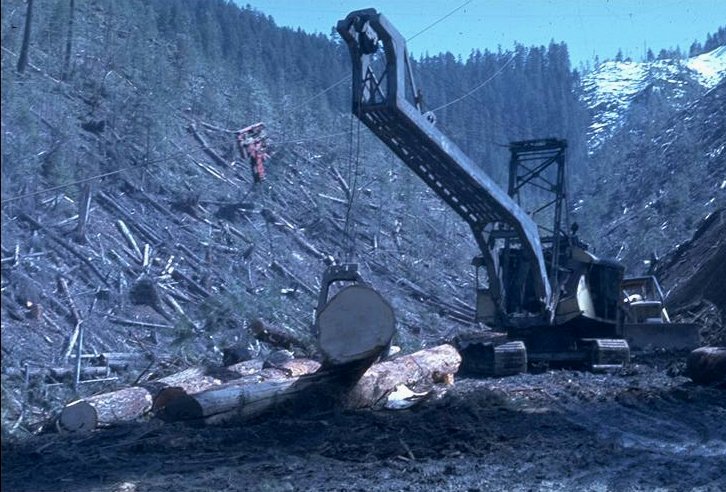
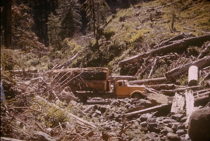
Watershed 1 logging in progress March 1964. Wyssen Skyline Crane in the background, and a conventional loader in the foreground.
Photographed by Jack Rothacher ..... Date: 3/64 ..... Photo: AAB-023

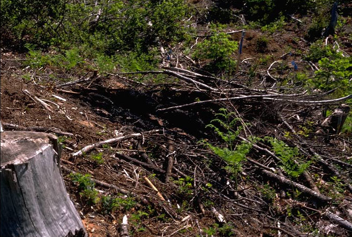
Watershed 1 after slash burning but before stream channel cleaning, November 1967.
Photographed by Jack Rothacher ..... Date: 11/66 ..... Photo: AAB-024
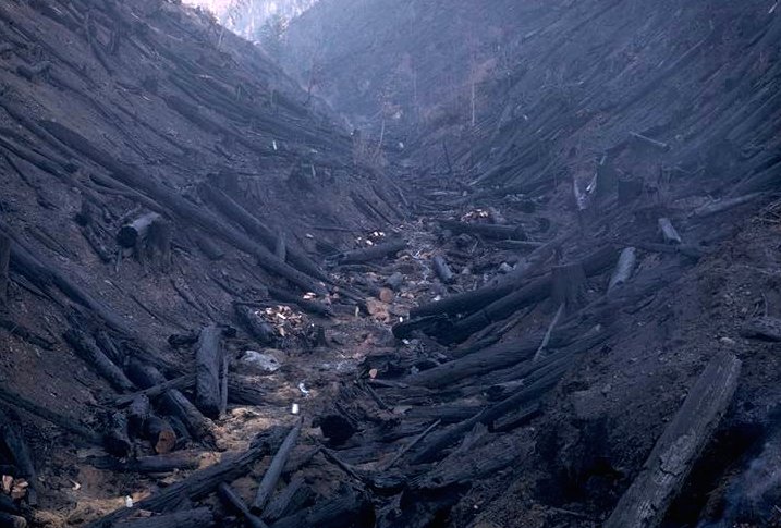
Watershed 1 stream channel after slash burning and after channel cleaning. The idea of cleaning was to have the loggers remove material from the stream that was introduced by the logging. This involved a great deal of material as can be seen from photo 24.
Photographed by Jack Rothacher ..... Date: 11/66 ..... Photo: AAB-025
Watershed 1 rain-on-snow runoff after logging.
Photographed by Unknown ..... Date: 1/28/65 ..... Photo: AAB-026
Watershed 1 stream channel 24 years following logging.
Photographed by Al Levno ..... Date: 11/90 ..... Photo: AAB-027
Watershed 1 vegetation plot 6-7, first summer following slash burning.
Photographed by Ted Dyrness ..... Date: 8/3/67 ..... Photo: AAB-028
Watershed 1 vegetation plot 6-7, third summer following slash burning.
Photographed by Ted Dyrness ..... Date: 8/11/69 ..... Photo: AAB-029
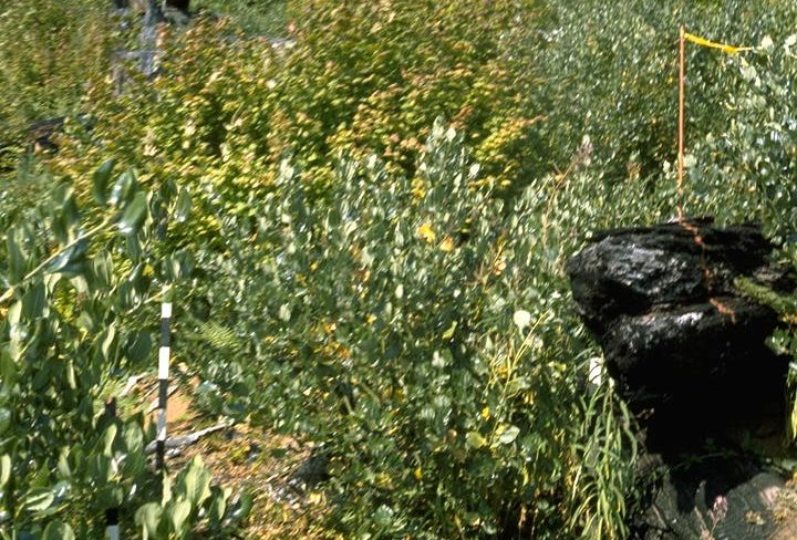
Watershed 1 vegetation plot 6-7, six summers following slash burning.
Photographed by Al Levno ..... Date: 8/8/72 ..... Photo: AAB-030
Watershed 1 Ceanothus stand on northeast corner of the watershed, 12 years following slash burning. Site was previously covered by 150-year-old Douglas-fir.
Photographed by Unknown ..... Date: Unknown..... Photo: AAB-031

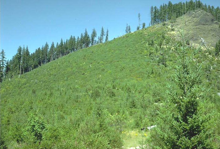
Watershed 1, 20 years following slash burning.
Photographed by Al Levno ..... Date: 4/86 ..... Photo: AAB-032
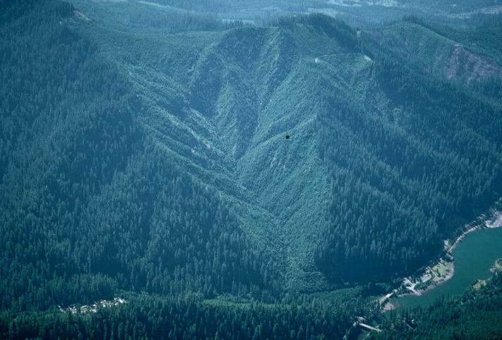
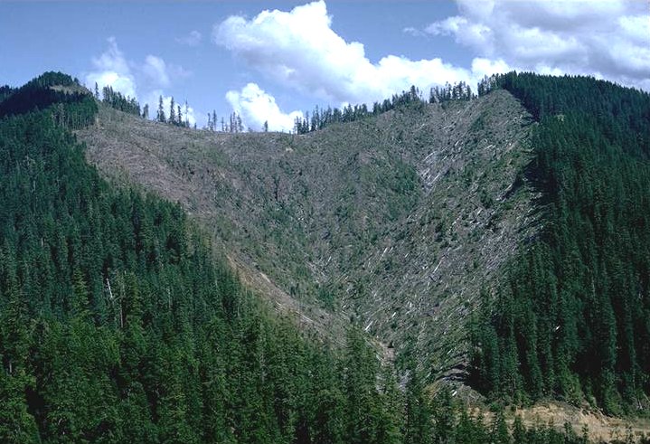
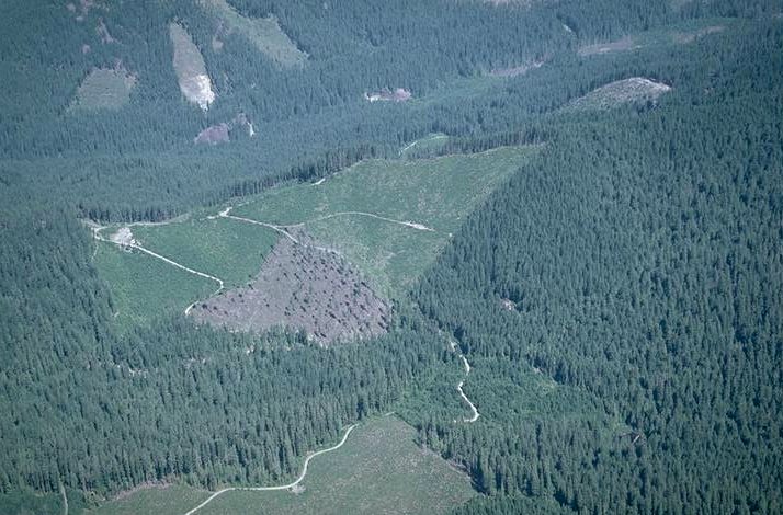
Aerial oblique of Watershed 1, 33 years after photo 19 and 24 years following slash burning.
Photographed by Al Levno ..... Date: 7/16/90 ..... Photo: AAB-033

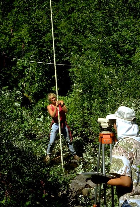
Watershed 1 sediment basin. Eileen McCann measuring annual bedload accumulation.
Photographed by Al Levno ..... Date: 8/85 ..... Photo: AAB-034
Watershed 2, picture taken before treatment to Watersheds 1 and 3.
Photographed by Bob Ruth ..... Date: 6/25/58 ..... Photo: AAB-035

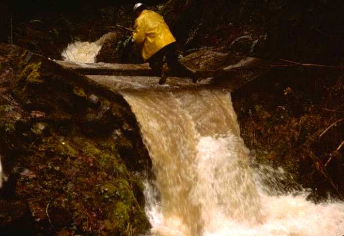
Watershed 2, gaging station during the last 100-year storm, December 21, 1964.
Photographed by Dick Fredriksen ..... Date: 12/21/64 ..... Photo: AAB-036
Sediment basin below the gaging station at Watershed 2.
Photographed by Al Levno ..... Date: 8/81 ..... Photo: AAB-037
Watershed 2 stream channel. Gordon Grant.
Photographed by Al Levno ..... Date: 11/90 ..... Photo: AAB-038
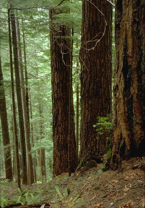
Watershed 2 forest stand, Reference Stand 15. This watershed is paired with two similar watersheds (Watersheds 1 and 3) and serves as a control in studies analyzing the effects of timber-harvest methods on soils, stream chemistry, streamflow patterns, revegetation, etc.
Photographed by Al Levno ..... Date: 5/94 ..... Photo: AAB-039
Watersheds 6, 7, and 8. Small (45-acre) sized watersheds on southwest facing slope. Forested with 150-year-old Douglas-fir stand generated from a natural burn. Some old-growth trees remaining.
Photographed by Unknown ..... Date: Unknown..... Photo: AAB-040

Watershed 6 gage house.
Photographed by Al Levno ..... Date: 2/88 ..... Photo: AAB-041

Roswell Mersereau measuring streamflow in Watershed 6 gaging station equipped with 2-foot H-Flume and Stevens A-35 recorder. Stainless turbulence box used in collecting water chemistry samples for automatic proportional water sampler.
Photographed by Al Levno ..... Date: 12/80 ..... Photo: AAB-042
Watershed 6, 11 years following clearcut logging.
Photographed by Al Levno ..... Date: 4/85 ..... Photo: AAB-043
Roswell Mersereau servicing precipitation chemistry sampler in Watershed 6.
Photographed by Al Levno ..... Date: 1/82 ..... Photo: AAB-044
Al Levno servicing Watershed 7 H-Flume shortly after installation.
Photographed by Dick Fredriksen ..... Date: sprg1963 ..... Photo: AAB-045
Watershed 7 gage house with H-Flume, Stevens A-35 recorder, automatic proportional water sampler.
Photographed by Dick Fredriksen ..... Date: 5/79 ..... Photo: AAB-046
Watershed 7, 4 years following shelterwood cutting.
Photographed by Dick Fredriksen ..... Date: 8/78 ..... Photo: AAB-047
Watershed 7 following cutting of the shelterwood trees, September 1984.
Photographed by Al Levno ..... Date: 9/84 ..... Photo: AAB-048
Watershed 7 following pile burning, December 1985.
Photographed by Al Levno ..... Date: 12/85 ..... Photo: AAB-049
Precipitation gage base of Watershed 7, April 1985.
Photographed by Al Levno ..... Date: 4/85 ..... Photo: AAB-050
Aerochem Metrics air and precipitation chemistry sampler installed on the upper road, middle of Watershed 7.
Photographed by Al Levno ..... Date: 10/88 ..... Photo: AAB-051
John Moreau during winter servicing air/precipitation sampler.
Photographed by Al Levno ..... Date: 1/89 ..... Photo: AAB-052
Watershed 8 gaging station. Watershed 8 is paired with two other small watersheds and serves as the control in studies of the effect of different timber-harvest methods on soils, streamflow patterns, stream chemistry, revegetation, etc.
Photographed by Al Levno ..... Date: 4/85 ..... Photo: AAB-053

H.J. Andrews lower watershed map showing location and manipulation pattern on Watersheds 1 and 3. Map by Jack Rothacker, 12/66
Photographed by Unknown ..... Date: Unknown..... Photo: AAB-054
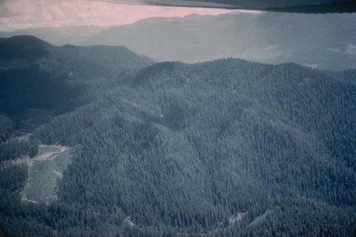
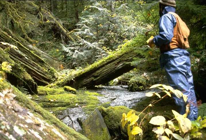
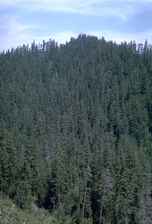
Aerial oblique of Watershed 3 and part of Watershed 2 showing old-growth Douglas-fir forest before logging.
Photographed by Bob Ruth ..... Date: 6/25/58 ..... Photo: AAB-055
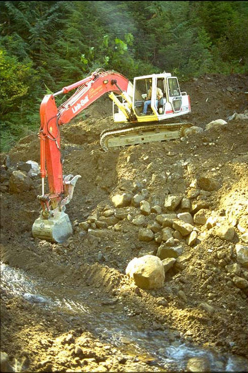
Watershed 3 flume and gage house. Windfall deposited in flume had to be cut out.
Photographed by Al Levno ..... Date: 4/87 ..... Photo: AAB-056
Watershed 3, suspended sediment sampling near peak flow. Unidentified field worker.
Photographed by Unknown ..... Date: 1960's ..... Photo: AAB-057
Watershed 3, Christmas Flood 1964. Second of three debris torants in Watershed 3 wiped out the gaging station, filled the lower channel, deposited a mound of logs and debris on the Lookout Creek Road, and deposited an undetermined amount of material into Lookout Creek.
Photographed by Dick Fredriksen ..... Date: 12/21/64 ..... Photo: AAB-058

Watershed3 lower logged unit first summer following 1964 flood. Shows scoured stream channel and revegetation second summer following logging.
Photographed by Unknown ..... Date: 8/1/65 ..... Photo: AAB-059
Watershed 3 lower logged unit seven summers following logging.
Photographed by Dick Fredriksen ..... Date: 7/71 ..... Photo: AAB-060

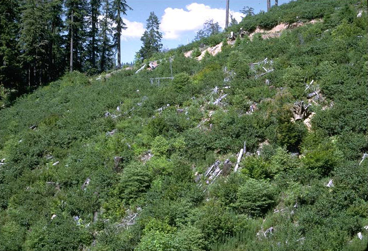
Watershed 3 lower logged unit 13 summers following logging.
Photographed by Al Levno ..... Date: 9/77 ..... Photo: AAB-061
Watershed 3 lower logged unit 16 summers following logging.
Photographed by Al Levno ..... Date: 8/80 ..... Photo: AAB-062

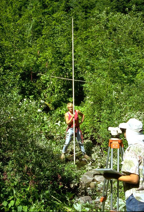
Watershed 3 sediment basin. Eileen McCann and George Lienkaemper measuring bedload accumulation.
Photographed by Al Levno ..... Date: 8/85 ..... Photo: AAB-063
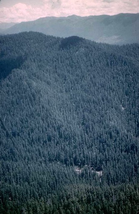
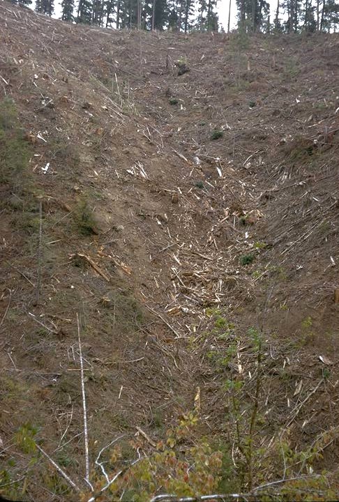
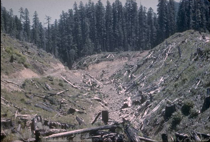
Watershed 10 before logging; 21-acre, old-growth Douglas-fir forested watershed.
Photographed by Dick Fredriksen ..... Date: 11/67 ..... Photo: AAB-064
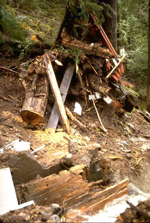
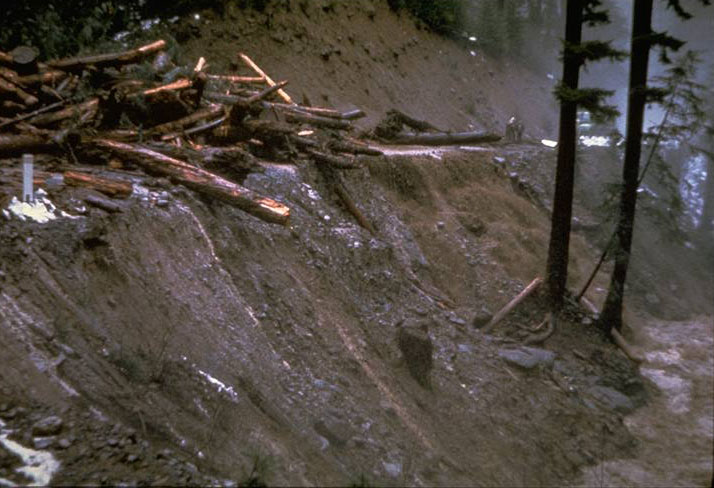
Watershed 10 gaging station destroyed by debris avalanche 11 years following logging.
Photographed by Al Levno ..... Date: 3/86 ..... Photo: AAB-065
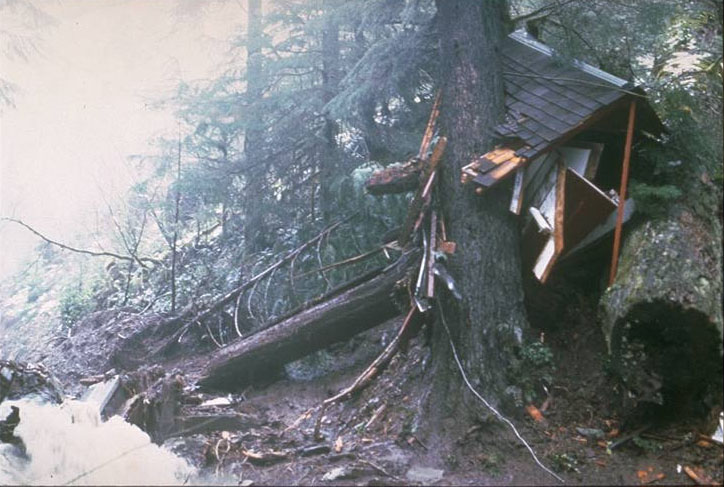
Watershed 10 gaging station destroyed by debris avalanche 11 years following logging. Taken at 1000 2/22/86, 13 hours after debris slide.
Photographed by Al Levno ..... Date: 2/22/86 ..... Photo: AAB-066

Watershed 10 main stream channel immediately following debris avalanche.
Photographed by Al Levno ..... Date: 2/24/86 ..... Photo: AAB-067
Watershed 10, right fork of the stream channel after logging. Debris flow of February 1986 started in this tributary.
Photographed by Dick Fredriksen ..... Date: 10/75 ..... Photo: AAB-068
Mack Creek gaging station with heated orifice rain gage and windshield on the roof. Picture taken during a winter servicing trip.
Photographed by Al Levno ..... Date: 1/89 ..... Photo: AAB-069
Winter flow at Mack Creek.
Photographed by Al Levno ..... Date: 1/89 ..... Photo: AAB-070
Timber harvest unit below the Mack Creek stream gage after logging 1958.
Photographed by Jack Rothacher ..... Date: 8/58 ..... Photo: AAB-071
Salvage road ford across Mack Creek.
Photographed by E.G. Dunford ..... Date: 8/55 ..... Photo: AAB-072
Alice Wolff and Hazel Hammond measuring stream cross-sections in logged unit below Mack Creek gage 35 years following logging.
Photographed by Al Levno ..... Date: 8/90 ..... Photo: AAB-073
Alice Wolff and Hazel Hammond measuring cross sections in logged unit below Mack Creek gage 35 years following logging.
Photographed by Al Levno ..... Date: 8/90 ..... Photo: AAB-074
Removing culvert from Mack Creek on Road 1506 to allow for fish passage. Removal is 36 years after installation.
Photographed by Al Levno ..... Date: 9/94 ..... Photo: AAB-075
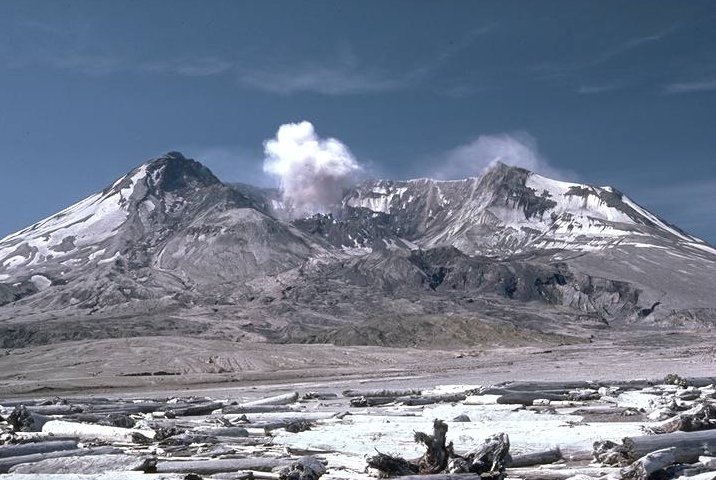
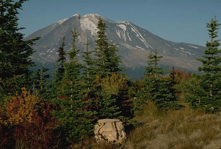
Mt. St. Helens 4 years following the eruption. Dome building is still in progress.
Photographed by Al Levno ..... Date: 6/85 ..... Photo: AAB-076
Mt. Jefferson from Cool Camp viewpoint on the Sweet Home District.
Photographed by Al Levno ..... Date: 2/86 ..... Photo: AAB-077
Mt. Jefferson from Cool Camp viewpoint on the Sweet Home District.
Photographed by Al Levno ..... Date: 2/86 ..... Photo: AAB-078
Mt. Adams from Steamboat Natural Area.
Photographed by Al Levno ..... Date: 9/89 ..... Photo: AAB-079

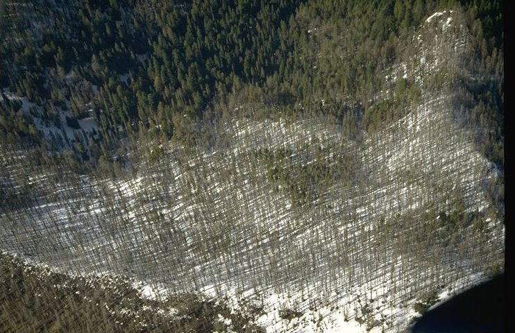
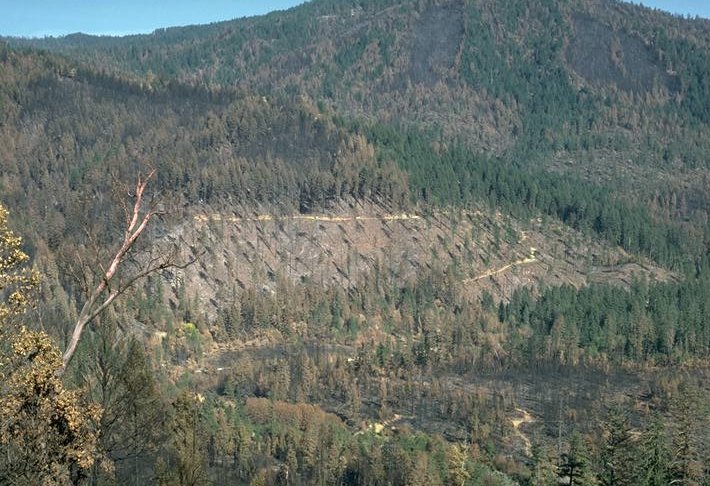
Aerial oblique of Warner Creek Burn of October 1992. Oakridge Ranger District, Willamette National Forest.
Photographed by Al Levno ..... Date: 2/95 ..... Photo: AAB-080
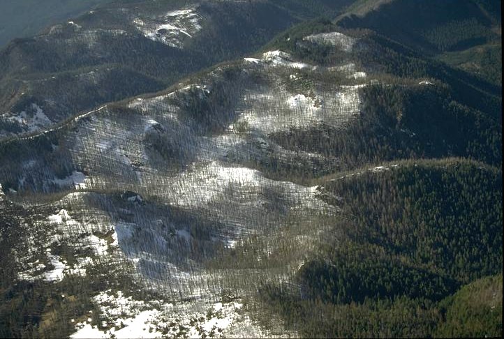
Aerial oblique of Warner Creek Burn of October 1992. Oakridge Ranger District, Willamette National Forest.
Photographed by Al Levno ..... Date: 3/94 ..... Photo: AAB-081
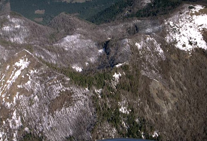
Aerial oblique of Warner Creek Burn of October 1992. Oakridge Ranger District, Willamette National Forest.
Photographed by Al Levno ..... Date: 3/94 ..... Photo: AAB-082
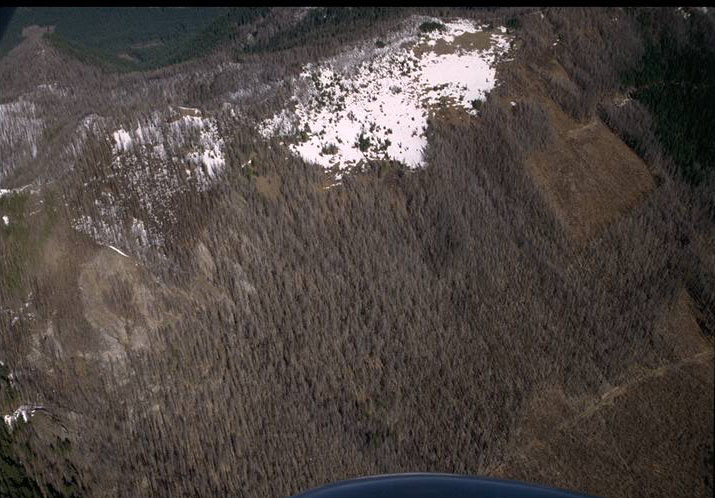
Aerial oblique of Warner Creek Burn of October 1992. Oakridge Ranger District, Willamette National Forest.
Photographed by Al Levno ..... Date: 2/93 ..... Photo: AAB-083
Aerial oblique of Warner Creek Burn of October 1992. Oakridge Ranger District, Willamette National Forest.
Photographed by Al Levno ..... Date: 2/93 ..... Photo: AAB-084
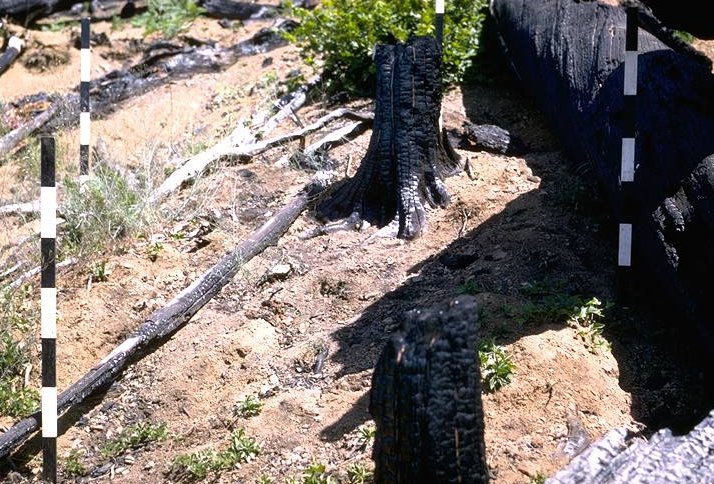
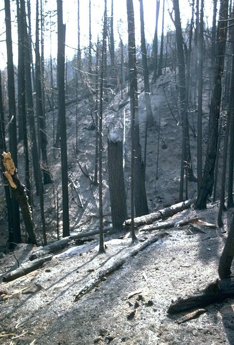
Silver Complex Burn of 1987.
Photographed by Al Levno ..... Date: 10/87 ..... Photo: AAB-085
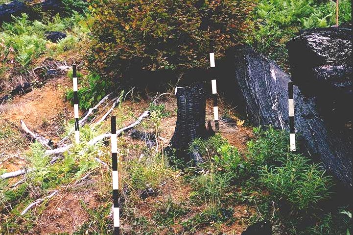
Silver Complex Burn of 1987.
Photographed by Al Levno ..... Date: 10/87 ..... Photo: AAB-086
Fred Bierlmaier taking a reading from the Sacramento storage gage during a winter servicing trip at Wildcat Mountain Research Natural Area.
Photographed by Al Levno ..... Date: 3/89 ..... Photo: AAB-087
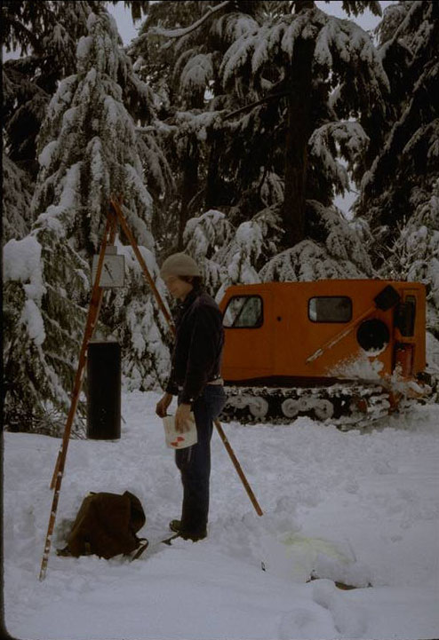
John Moreau weighing precipitation at a gage on the original LTER rain gage network.
Photographed by Al Levno ..... Date: 3/82 ..... Photo: AAB-088

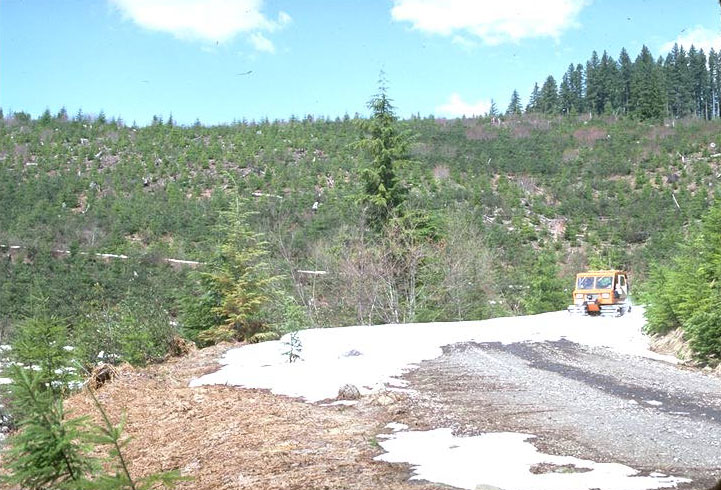
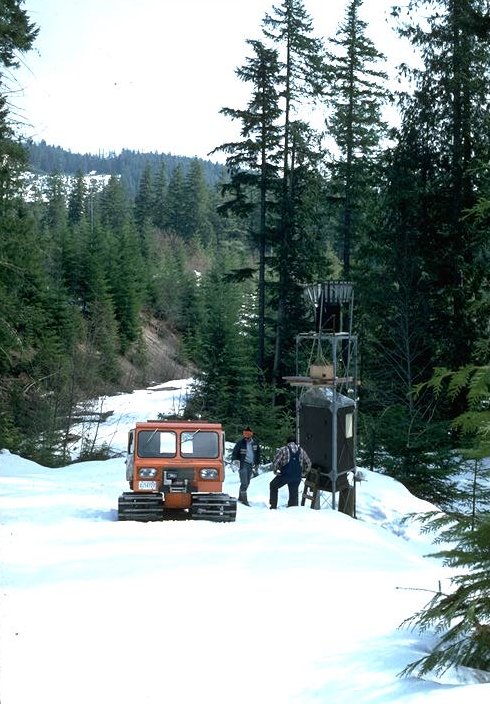
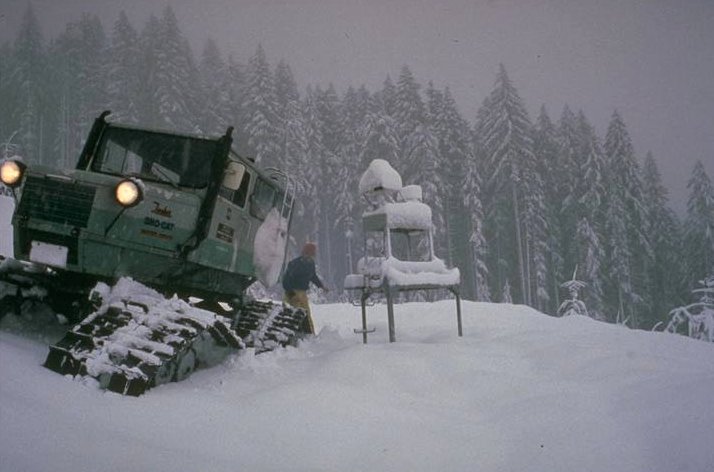
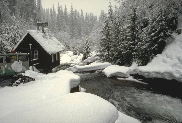
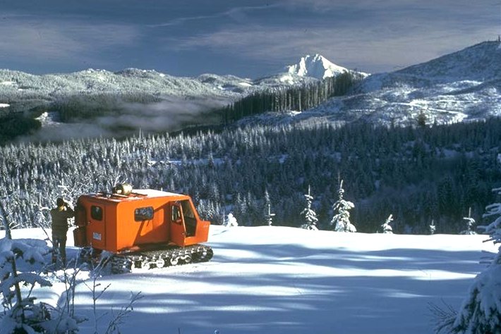
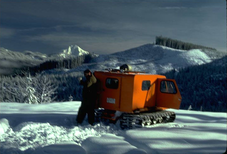
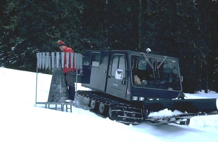
1971 Tucker snow cat making a routine winter field servicing trip around the Andrews Forest.
Photographed by Al Levno ..... Date: 1/89 ..... Photo: AAB-089

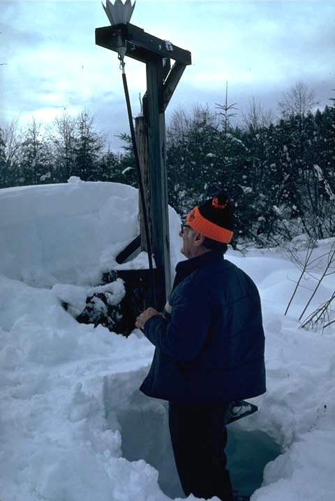
Hazel Hammond takes water content readings from the snow pack at Wildcat Mountain Research Natural Area.
Photographed by Al Levno ..... Date: 12/88 ..... Photo: AAB-090
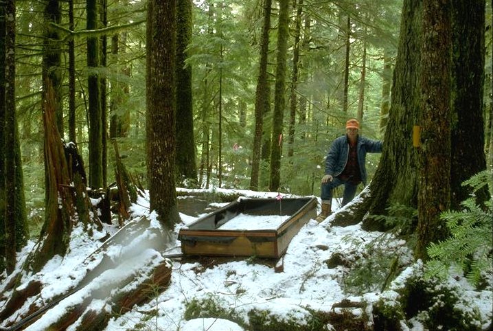
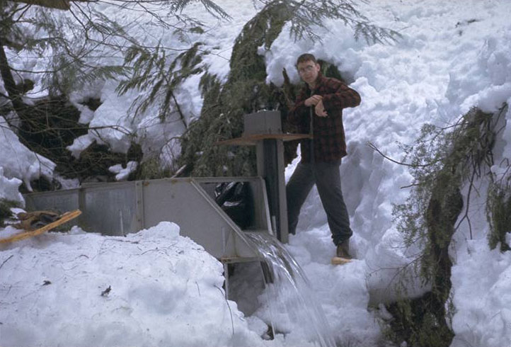
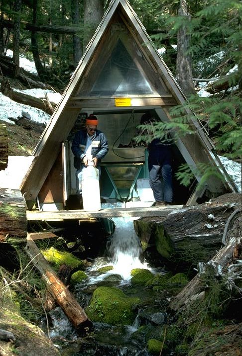
Al Levno servicing snow melt lysimeter in a forested setting at Dennis Harr's rain on snow study, Flynn Cr., Mt. Baker-Snoqualmie N.F.
Photographed by Al Levno ..... Date: 3/91. ..... Photo: AAB-091
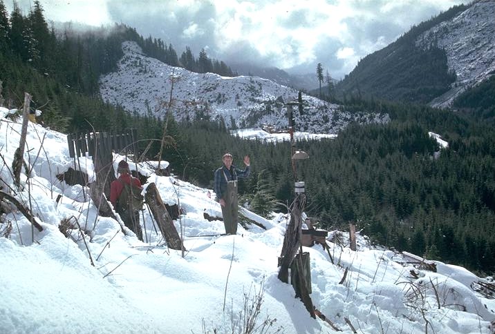
Dennis Harr and Greg Downing servicing a clearcut site of the rain on snow study. Rain gage is disguised as a stump to discourage target practice. Flynn Creek, Mt. Baker-Snoqualmie N.F.
Photographed by Al Levno ..... Date: 3/91 ..... Photo: AAB-092
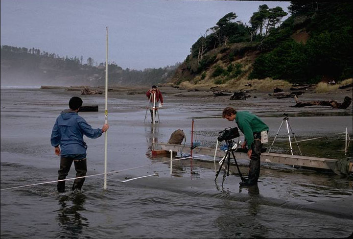
Gordon Grant, Craig Creel, and Greg Downing measuring stream profile and the oscillating wave action of an unrestrained stream running through the sand on an Oregon beach.
Photographed by Al Levno ..... Date: 2/92 ..... Photo: AAB-093

Gordon Grant, Craig Creel, and Greg Downing measuring stream profile and the oscillating wave action of a unrestrained stream running through the sand on an Oregon beach.
Photographed by Al Levno ..... Date: 2/92 ..... Photo: AAB-094
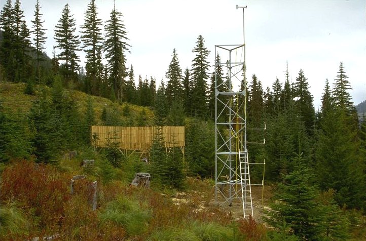
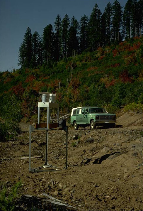
Newly installed sensor tower with a profile of air temperature sensors, wind and relative humidity. Valdias shield in the background.
Photographed by Al Levno ..... Date: 10/94 ..... Photo: AAB-095
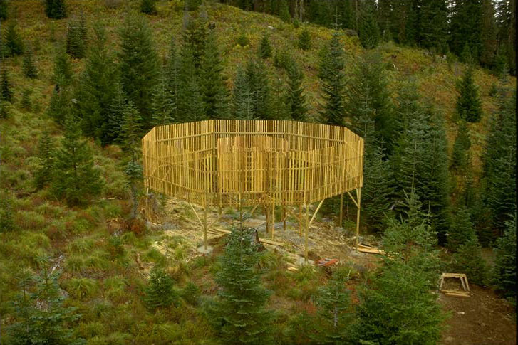
Newly constructed Valdias shield to keep the wind from blowing rain and particularly soft snowaway from the precipitation collector orface providing a better rainfall catch. Gage is built of 4-foot cedar slats in a 30-foot diameter circle. Inner circle is 10 foot in diameter.
Photographed by Al Levno ..... Date: 10/94 ..... Photo: AAB-096
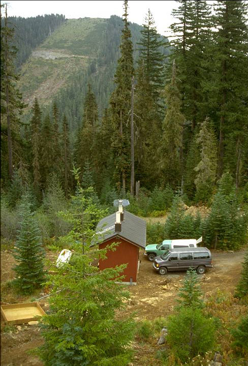
Heated instrument/survival hut, built with high walls to accommodate the 15-20 snow pack. Heated orface rain gage and radiometer housed on top.
Photographed by Al Levno ..... Date: 10/94 ..... Photo: AAB-097
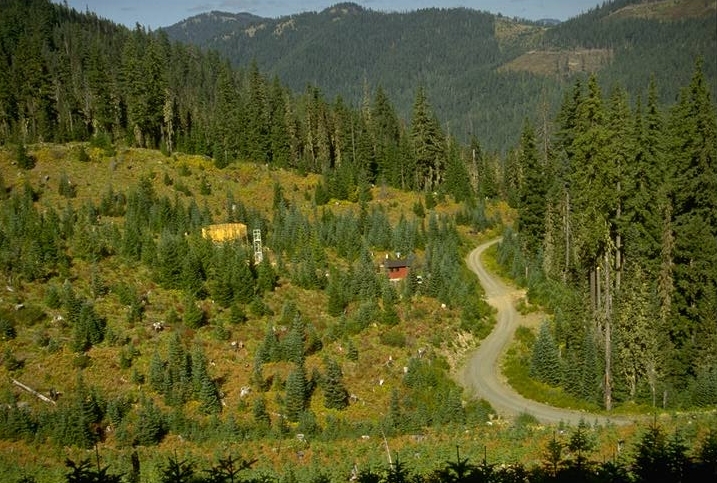
Upper Lookout climate station overview, showing the location of the components on the site. This climate station is located in the southeast corner of the Andrews.
Photographed by Al Levno ..... Date: 10/94 ..... Photo: AAB-098
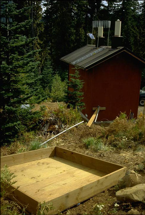
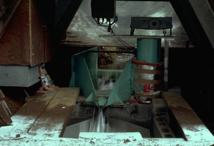
Snow melt lysimeter located upslope of the instrument house. Melting snow water is plumbed to a tipping bucket installed in the heated instrument house to prevent freezing.
Photographed by Al Levno ..... Date: 10/94 ..... Photo: AAB-099
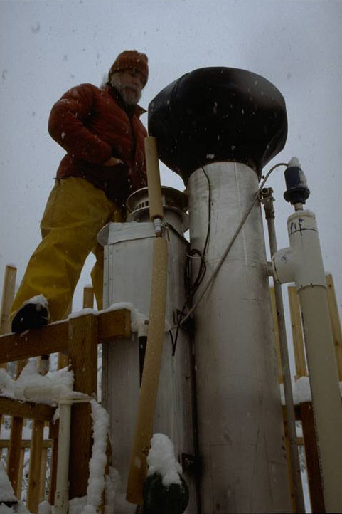
Fred Bierlmaier servicing newly developed stand-alone, heated orface rain gage. Gage is mounted on a 15-foot aluminum storage pipe with a 20-inch collection orifice fitted on top. Funnel contains a coil of copper wire through which heated antifreeze is pumped when the orifice temperature drops below 37_F.
Photographed by Al Levno ..... Date: 11/94 ..... Photo: AAB-100