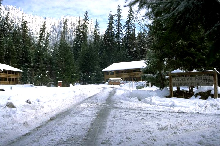
A large snow storm deposited heavy amounts of snow on the Andrews Forest during the last half of Jan. 96. There was about 12 inches of fresh snow at the Andrews Headquarters site before the Feb. storm.
Photographed by Al Levno ..... Date: 1/16/96 ..... Photo: AAD-001

HJA McRae Creek gate . Three feet of new snow was deposited in five days at the 2300 ft. elevation during the January, 1996 snow storm before the flood .
Photographed by Al Levno ..... Date: 1/16/96 ..... Photo: AAD-002
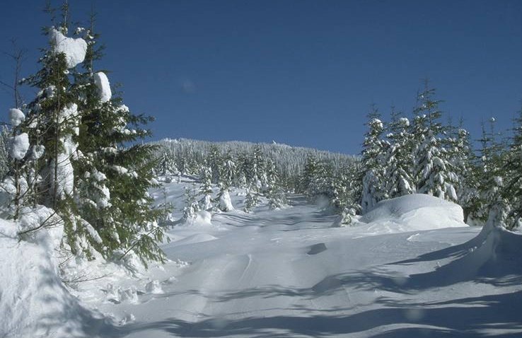
Top of WS #6 in the Andrews, 4 ft. of new snow was deposited at this elevation (3,300 ft.) in January before the Feb. 5-9, 1996 flood.
Photographed by Al Levno ..... Date: 1/16/96 ..... Photo: AAD-003
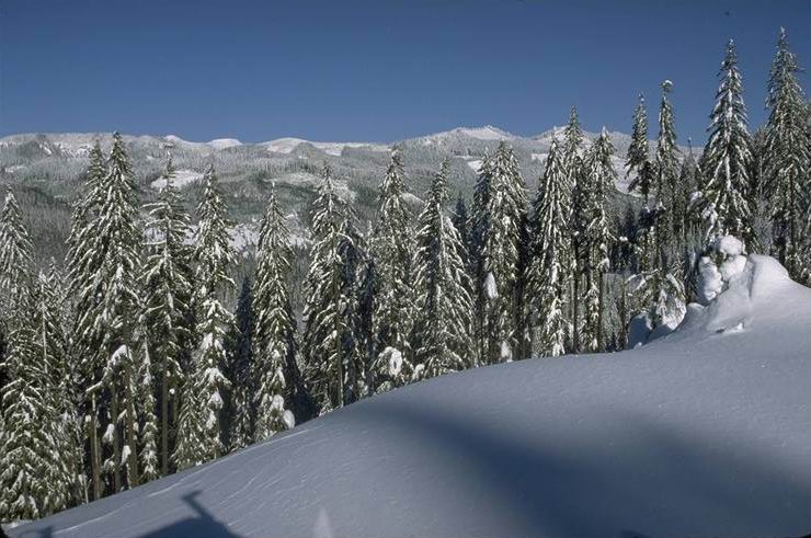
Blue River drainage from WS 6 ridge on 1/16/96. Four ft. of snow had accumulated at 3,500 ft elevation.
Photographed by Al Levno ..... Date: 1/16/96 ..... Photo: AAD-004
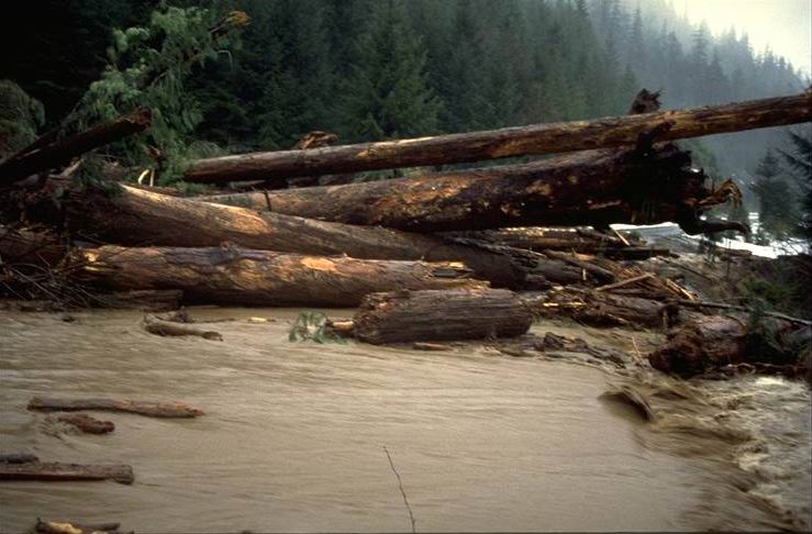
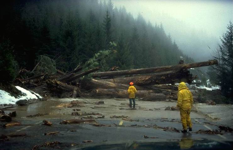
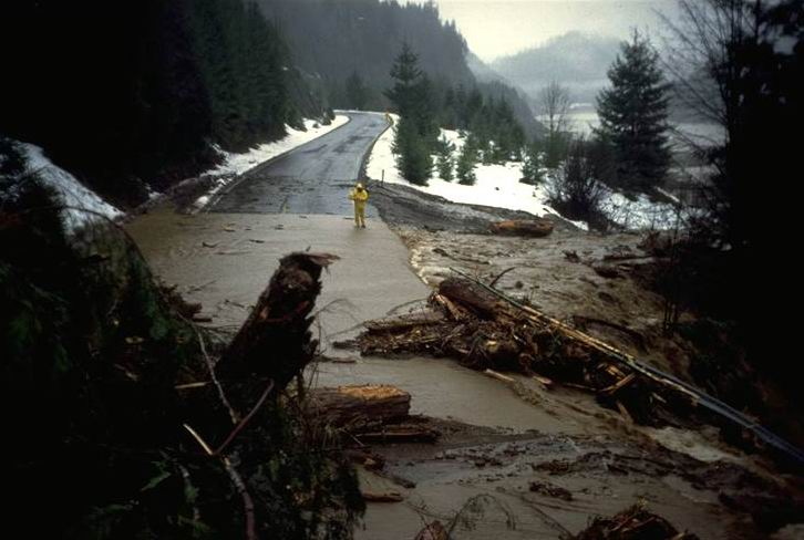
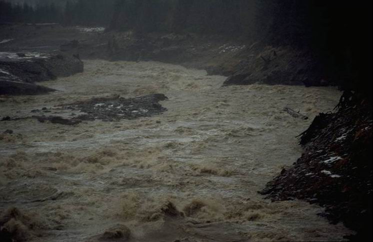
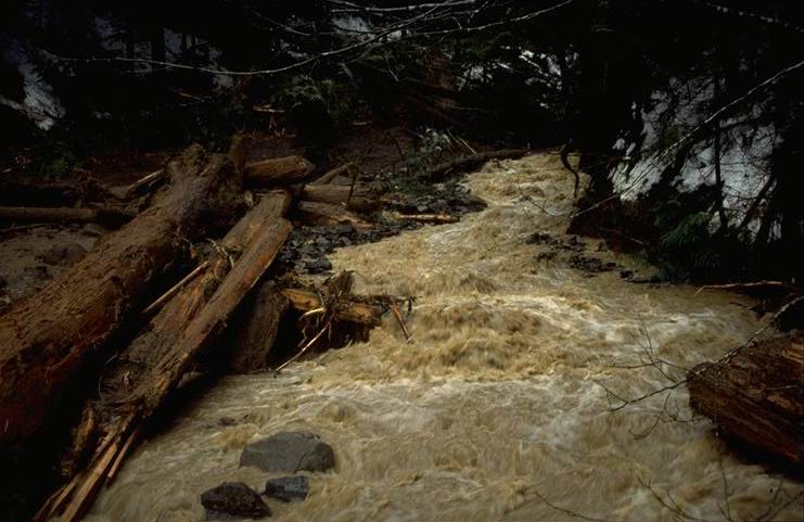
This slide occurred in one of the small stream channels above the Blue River Reservior Road between 7:45 and 8:00 on the morning of Feb. 7th and blocked all access to the Andrews Forest for several hours. A large debris avalanche deposited a mass of logs, mud, and debris above and onto Road 15, with a small amount of debris going over the road surface and into the reservoir. Photo taken at 8:30 am.
Photographed by Al Levno ..... Date: 2/07/96 ..... Photo: AAD-005
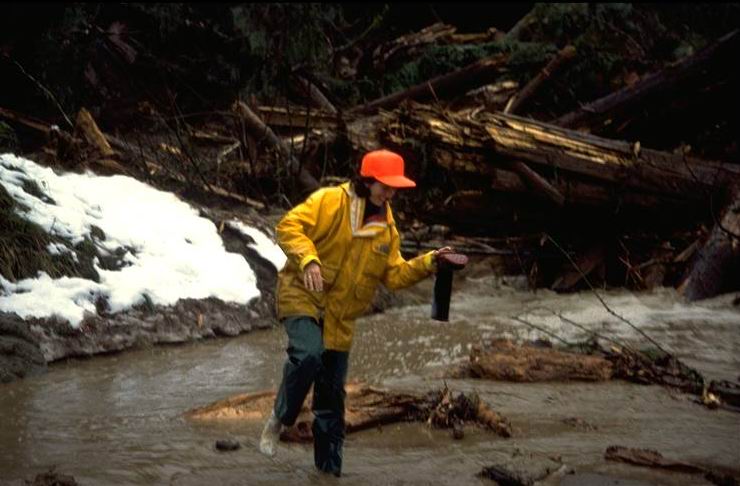
The Blue River Res. Slide occurred at around 8 AM on Feb. 7th. We arrived on the scene at 8:30. Beverely Wimple and Sharyl Kammerzell wade out toward the slide to take a closer look. Photo taken at 8:30 am.
Photographed by Al Levno ..... Date: 2/07/96 ..... Photo: AAD-006

Blue River Res. Slide occurred between 7:30 and 8:00 am on the morning of Feb. 7th. Logs 3 ft. in diameter with lengths of 100+ ft. stacked on top of the debris flow on the road surface.
Photographed by Al Levno ..... Date: 2/07/96 ..... Photo: AAD-007
Trees 3 ft. in diameter and 100 ft in length came down on top of the debris flow onto the road. Photo taken at 8:30 am.
Photographed by Al Levno ..... Date: 2/07/96 ..... Photo: AAD-008
Beverley Wemple went in over her boot tops while walking along the ditch line of the Blue River Slide. Photo taken at 8:30 am.
Photographed by Al Levno ..... Date: 2/07/96 ..... Photo: AAD-009

Researchers walking under the logs on the debris flow of the Blue River Res. Slide. Photo taken at 8:30 am.
Photographed by Al Levno ..... Date: 2/07/96 ..... Photo: AAD-010
Water washes over the edge of the roadway where a guard rail is downed by the debris flow. Photo taken at 8:30 am.
Photographed by Al Levno ..... Date: 2/07/96 ..... Photo: AAD-011
Streamflow from the debris flow flowing over the road surface shortly after the flow occurred. Photo taken at 12:00 pm.
Photographed by Al Levno ..... Date: 2/07/96 ..... Photo: AAD-012

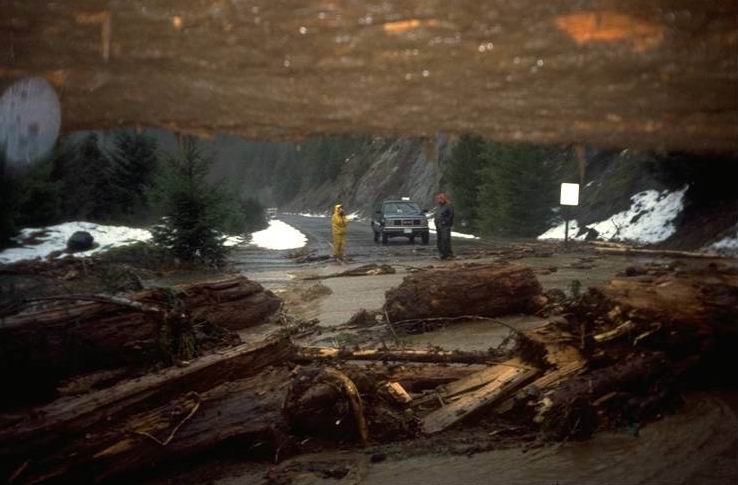
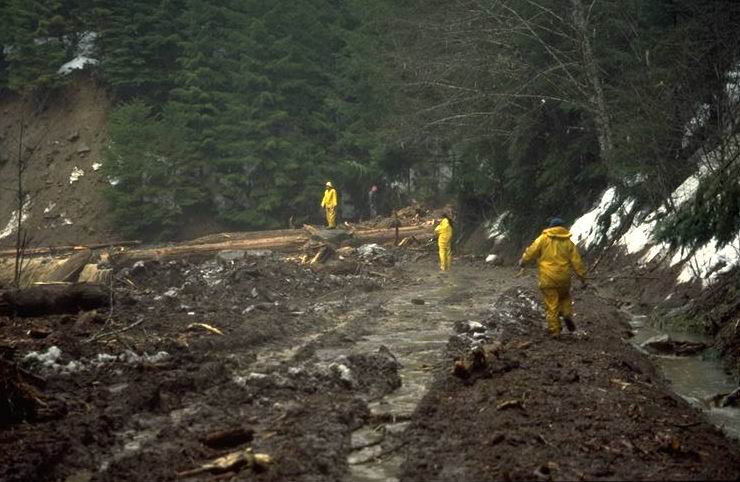
Blue River District personnel cut the logs and cleared the road leading to the Andrews Experimental Forest after only 3 hours, rescuing researchers trapped behind the slide. Photo taken at 12:00 pm.
Photographed by Al Levno ..... Date: 2/07/96 ..... Photo: AAD-013
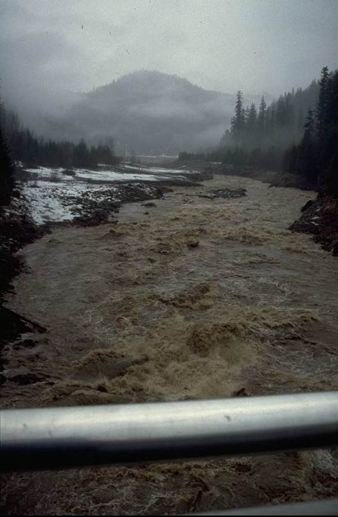
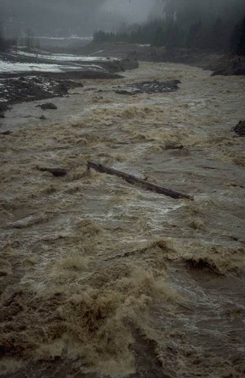
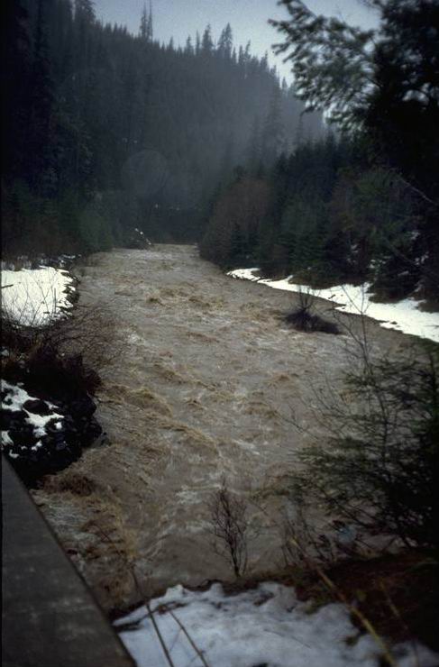
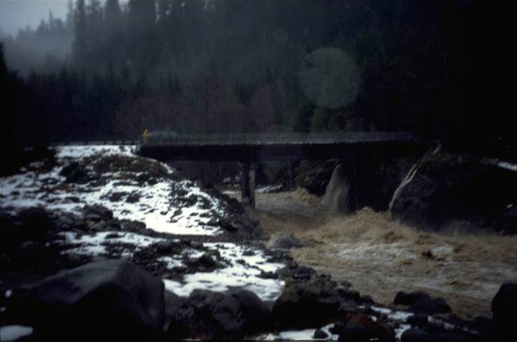
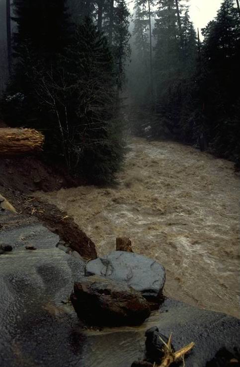
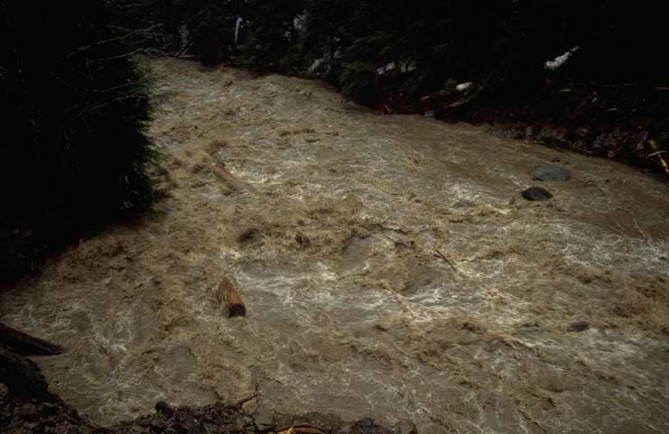
Blue River from Tidbits Bridge shortly before peak flow. Taken from Tidbits Bridge looking downstream toward Tidbits Creek. Photo taken at 12:00 pm.
Photographed by Al Levno ..... Date: 2/07/96 ..... Photo: AAD-014
Looking down stream at Blue River from the Mona Cr. bridge. Peak Flow at --- cfs. Photo taken at 3:00 pm.
Photographed by Al Levno ..... Date: 2/07/96 ..... Photo: AAD-015

Blue River from Mona Cr. Bridge. Photo taken at 12:00 pm.
Photographed by Al Levno ..... Date: 2/07/96 ..... Photo: AAD-016
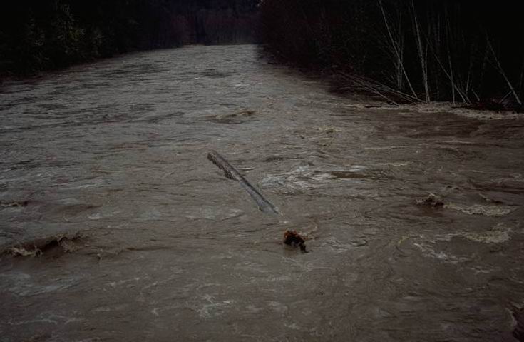
Large tree stem 3 ft. x 100 ft. moving down stream Blue River through huge hydrolic jump just below the Mona Cr. Bridge. Peak flow on 2/7/96 at 12:00 pm. Photo taken at 12:00 pm.
Photographed by Al Levno ..... Date: 2/07/96 ..... Photo: AAD-017
Large tree stem 3 ft. x 100 ft. moving down stream Blue River through huge hydraulic jump just below the Mona Cr. Bridge, near peak flow 2/7/96 @ 1200. Photo taken at 12:00 pm.
Photographed by Al Levno ..... Date: 2/07/96 ..... Photo: AAD-018
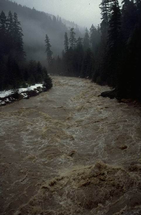
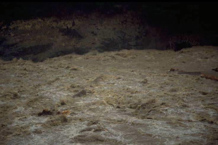
Peak Flow on Blue River looking upstream from the Tidbits Bridge. Photo taken at 12:00 pm.
Photographed by Al Levno ..... Date: 2/07/96 ..... Photo: AAD-019
Peak flow on Blue River looking upstream from Mona Cr. Photo taken at 12:00 pm.
Photographed by Al Levno ..... Date: 2/07/96 ..... Photo: AAD-020

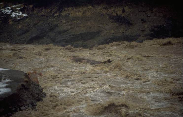
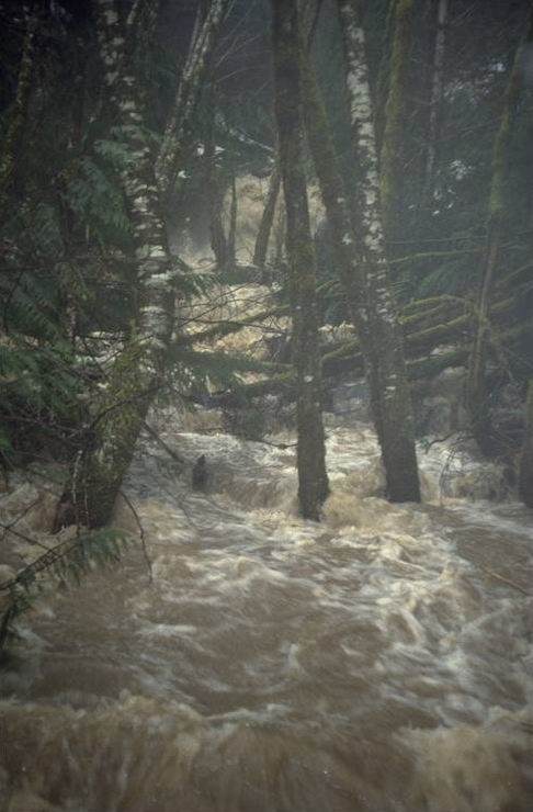
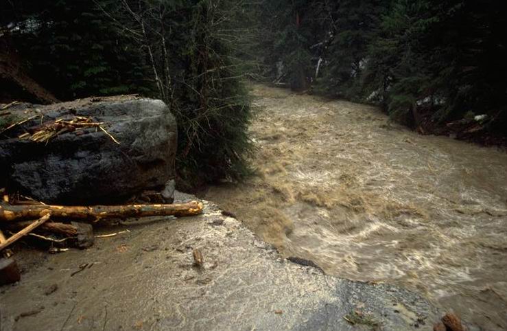
Blue River near the junction of Lookout Cr. on rising stage. Large logs are beginning to move. Photo taken at 8:00 am.
Photographed by Al Levno ..... Date: 2/07/96 ..... Photo: AAD-021
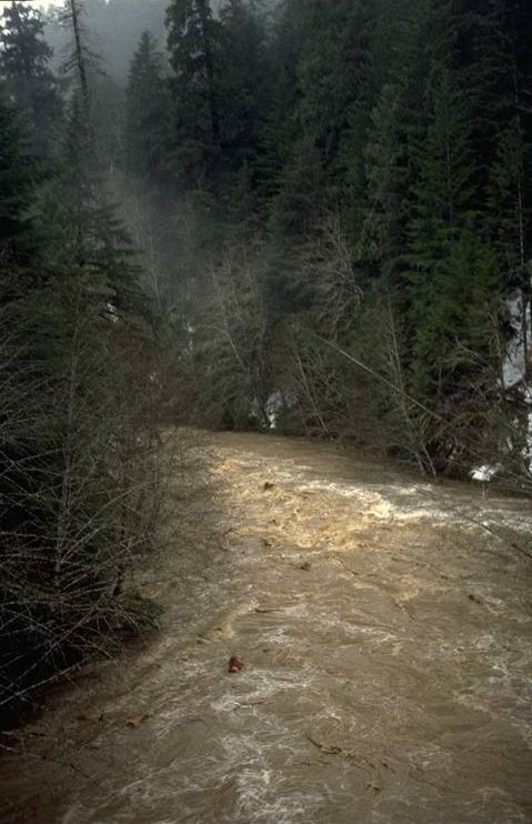
Large organic debris moving in Lookout Cr. near the junction of Blue River. Photo taken at 12:00 pm.
Photographed by Al Levno ..... Date: 2/07/96 ..... Photo: AAD-022
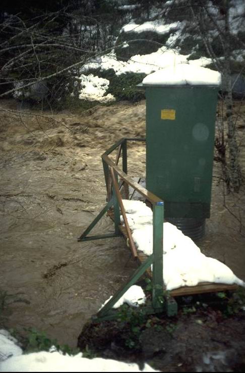
Near peak flow at the Lookout Creek Gage House. Stage 9.9 ft. (10,000 cfs) at 11:30 2/7/96. Photo taken at 11:30 am.
Photographed by Al Levno ..... Date: 2/07/96 ..... Photo: AAD-023
Peak flow looking downstream at the gaging station on Lookout Creek. Gage height reading 9.9 ft., CFS 10,000. Photo taken at 11:30 am.
Photographed by Al Levno ..... Date: 2/07/96 ..... Photo: AAD-024
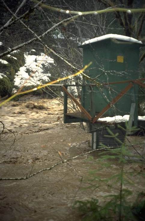
Peak flow at the Lookout Creek Gaging station was 10.00 ft. (near 10,000 cfs). Photo taken at 11:30 am.
Photographed by Al Levno ..... Date: 2/07/96 ..... Photo: AAD-025
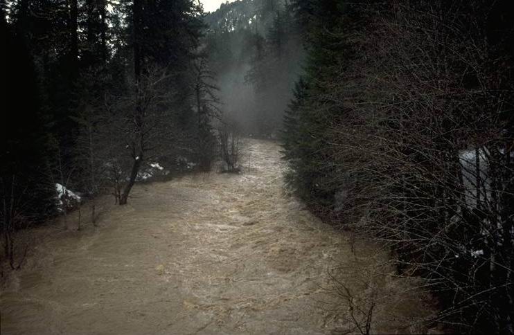
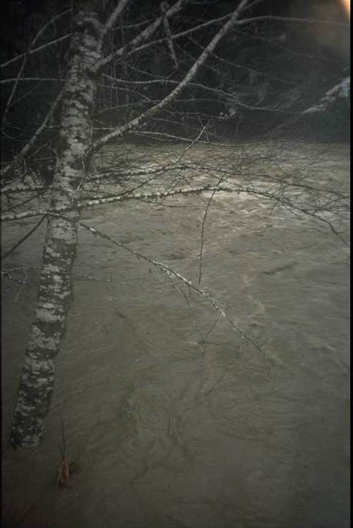
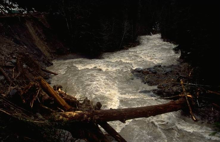
Lookout Creek looking upstream from the Reservoir Bridge during the rising leg of the storm. Photo taken at 8:00 am.
Photographed by Al Levno ..... Date: 2/07/96 ..... Photo: AAD-026

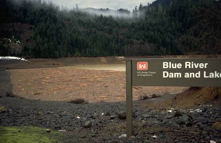
Looking downstream at Lookout Creek as it flows into an empty Blue River Res. during the rising leg of the storm. Taken from Blue River Res. Bridge. Photo taken at 8:00 am.
Photographed by Al Levno ..... Date: 2/07/96 ..... Photo: AAD-027

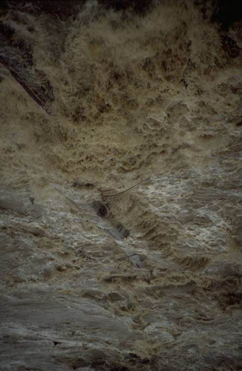
A huge hydraulic jump formed just below the Lookout Creek Bridge during the rising leg of the flood. Photo taken at 8:00 am.
Photographed by Al Levno ..... Date: 2/07/96 ..... Photo: AAD-028
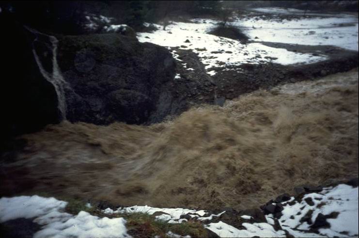
Close-up of the hydraulic jump generated below the Lookout Creek Bridge. Photo taken at 8:00 am.
Photographed by Al Levno ..... Date: 2/07/96 ..... Photo: AAD-029
Lookout Creek flowing under the Blue River Reservoir Bridge during the sharply rising stage of the 2/7/96 storm. Photo taken at 8:00 am.
Photographed by Al Levno ..... Date: 2/07/96 ..... Photo: AAD-030

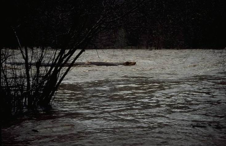
Large (3 ft. x 100 ft.) conifer tree trunk flowing out of the Lookout Creek Watershed during the rising leg of the Feb. 96 storm. Photo taken from the lower Lookout Creek Bridge at around 8:00 am. CFS estimate 7,000.
Photographed by Al Levno ..... Date: 2/07/96 ..... Photo: AAD-031
Large (3 ft x 100 ft) conifer tree trunk being carried downstream and out of the Lookout Creek Watershed during the rising leg of the Feb. 96 flood. Photo taken from the lower Lookout Creek Concrete Bridge at about 8:00 am. Estimated 7,000 CFS from a 15,000 acre watershed.
Photographed by Al Levno ..... Date: 2/07/96 ..... Photo: AAD-032
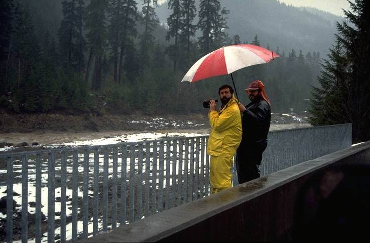
Several members of the watershed staff were fortunate enough to be trapped up in the Andrews Experimental Forest during the Feb., 1996 Flood. Here Gordon Grant and Craig Creel are observing flood action from the Lower Lookout Creek Bridge with the help of a video camera and umbrella. Photo taken around 8:00 am. Flow estimated to be 7,000 CFS from 15,000 acre Andrews Experimental Forest.
Photographed by Al Levno ..... Date: 2/07/96 ..... Photo: AAD-033

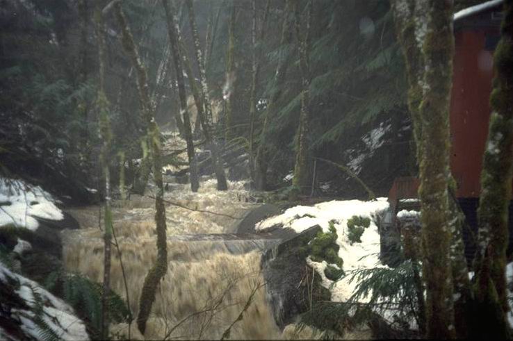
The sediment basin below 237 acre WS 1 (100 % clearcut and burned in 1967). The basin filled and overflowed during the Feb. 96 flood but no major disturbances occurred. Photo taken from above the sediment basin at 10:00 am.
Photographed by Al Levno ..... Date: 2/07/96 ..... Photo: AAD-034

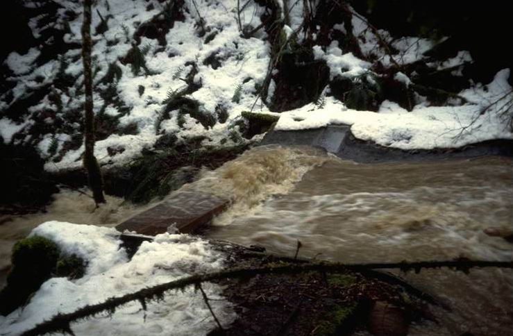
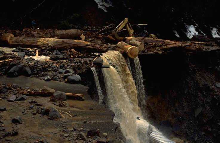
Peak flow coming over a 10 ft waterfall below the gaging station at Experimental Watershed 1 on the Andrews Forest. Flow from WS 1 was the highest ever recorded (82 CFS) from the 237 acre watershed. Photo taken at 10:00 am.
Photographed by Al Levno ..... Date: 2/07/96 ..... Photo: AAD-035
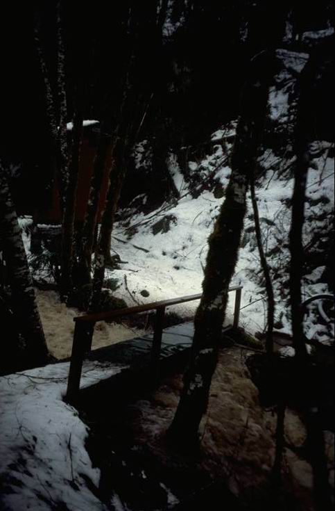
Peak flow from the Feb. 96 Flood is splashing over the foot bridge at WS 1. Photo taken at 10:00 am.
Photographed by Al Levno ..... Date: 2/07/96 ..... Photo: AAD-036
Peak flow from HJ Andrews WS 1. Flow was 1.83 ft. through the 2 ft trapazial flume, 82 CFS from a 237 acre watershed. This was the highest flow recorded in 45 years. Photo taken at 10:00 am.
Photographed by Al Levno ..... Date: 2/07/96 ..... Photo: AAD-037
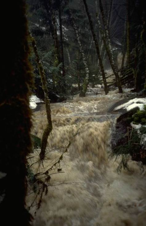
Peak flow from HJ Andrews WS 1. Flow was 1.85 ft. through the 2 ft trapazial flume, 82 CFS from a 237 acre watershed. This was the highest flow recorded in 45 years. Photo taken at 10:00 am.
Photographed by Al Levno ..... Date: 2/07/96 ..... Photo: AAD-038
Peak flow from HJ Andrews WS 1. Flow was 1.83 ft. through the 2 ft trapazial flume, 82 CFS from a 237 acre watershed. This was the highest flow recorded in 45 years.Peak flow from HJ Andrews WS 1. Photo taken at 10:00 am.
Photographed by Al Levno ..... Date: 2/07/96 ..... Photo: AAD-039
Peak flow from HJ Andrews WS 1. Flow was 1.83 ft. through the 2 ft. trapazial flume, 82 CFS from a 237 acre watershed. This was the highest flow recorded in 45 years.Peak flow from HJ Andrews WS 1. Photo taken at 10:00 am.
Photographed by Al Levno ..... Date: 2/07/96 ..... Photo: AAD-040
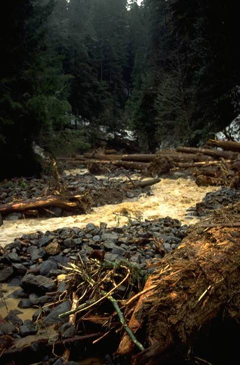
First view if the WS 3 debris flow from WS 3 on the morning of Feb. 7th. Researchers rush to view the damage. Photo taken at 9:00 am.
Photographed by Al Levno ..... Date: 2/07/96 ..... Photo: AAD-041

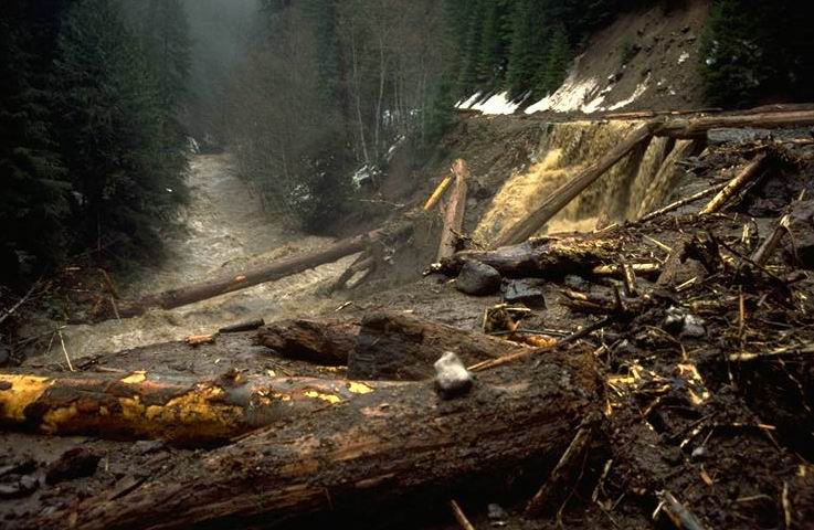
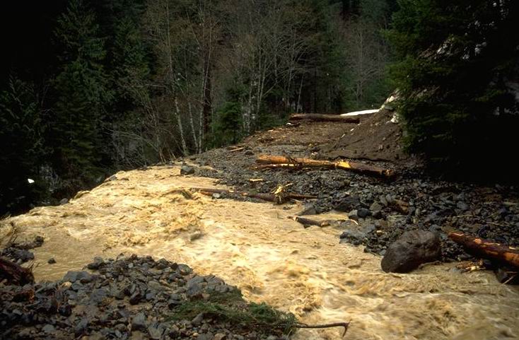
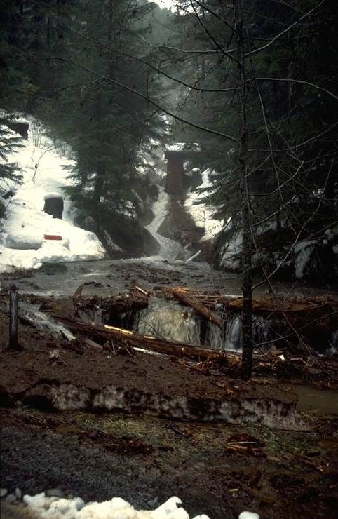
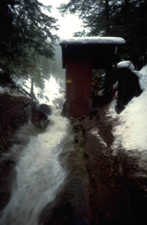
Debris flow from WS 3 occurred between 1600 and 2200 on the evening of the Feb. 6th. The flow covered the trapezodial flume and completly, demolished the gage house and carried it away. It is not known if the sediment basin was lost or just covered up. This was the 2nd major debris avalanche since the gaging of this watershed. This slide deposited about 5,000 cu. ft. of material behind the road at the bottom of the watershed. Photo taken at 9:00 am.
Photographed by Al Levno ..... Date: 2/07/96 ..... Photo: AAD-042
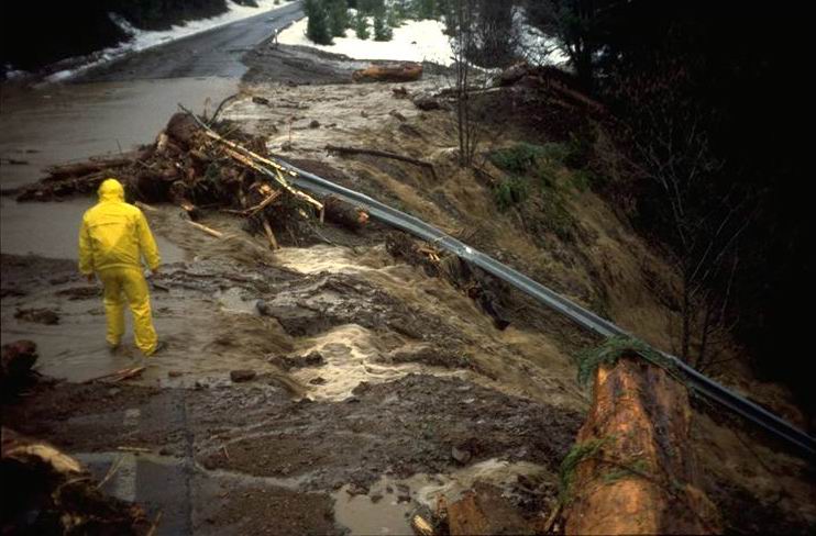
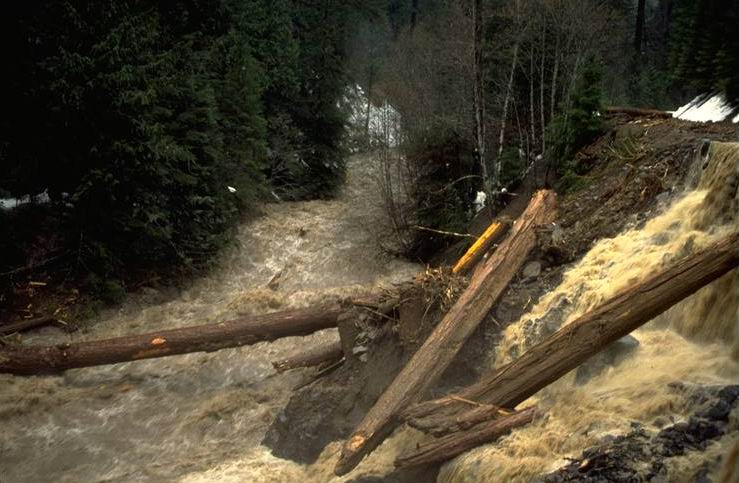
Water, logs and other debris flowed over the road prism and were washed away by Lookout Creek. Photo taken at 9:00 am.
Photographed by Al Levno ..... Date: 2/07/96 ..... Photo: AAD-043
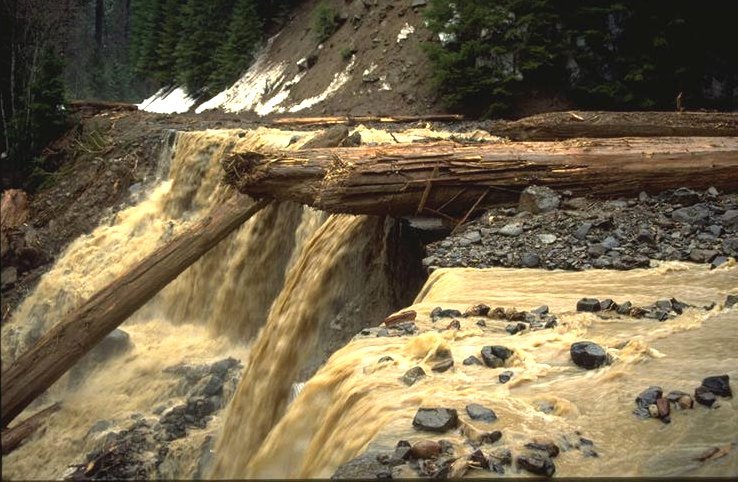
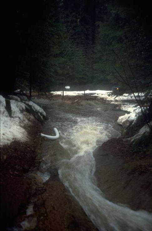
Peak flows in excess of 60 cfs from this 250 acre watershed were flowing over the paved road prism causing undercutting as they fell onto the plugged culvert 30 ft below. Photo taken at 9:00 am.
Photographed by Al Levno ..... Date: 2/07/96 ..... Photo: AAD-044
Looking upstream at the 5,000 cu. ft. of debris deposited above the road. The WS 3 gaging station would be seen in the center of the photo had the slide not occurred. Photo taken at 9:00 am.
Photographed by Al Levno ..... Date: 2/07/96 ..... Photo: AAD-045

Looking upstream at top of debris flow at area where Gage House and flume should be. Taken at 9:00 am.
Photographed by Al Levno ..... Date: 2/07/96 ..... Photo: AAD-046
Looking upstream in area where Gage House should be. Photo taken at 9:00 am.
Photographed by Al Levno ..... Date: 2/07/96 ..... Photo: AAD-047

Looking downstream from debres in area where sediment basin was. Photo taken at 9:00 am.
Photographed by Al Levno ..... Date: 2/07/96 ..... Photo: AAD-048
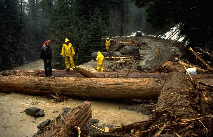
Photo taken at 9:00 am.
Photographed by Al Levno ..... Date: 2/07/96 ..... Photo: AAD-049
Looking downstream at Lookout Cr. from edge of Black Top. Photo taken at 9:00 am.
Photographed by Al Levno ..... Date: 2/07/96 ..... Photo: AAD-050
Boulder and stream from WS 3 slide. Photo taken at 9:00 am.
Photographed by Al Levno ..... Date: 2/07/96 ..... Photo: AAD-051
WS 3 stream flowing over road edge into Lookout Creek. Photo taken at 9:00 am.
Photographed by Al Levno ..... Date: 2/07/96 ..... Photo: AAD-052
Looking upstream at debris covering sediment basin and gage house at WS 3. Photo taken at 9:00 am.
Photographed by Al Levno ..... Date: 2/07/96 ..... Photo: AAD-053
Looking upstream at Lookout Creek from WS 3 washout. Photo taken at 9:00 am.
Photographed by Al Levno ..... Date: 2/07/96 ..... Photo: AAD-054
Looking downstream Lookout Creek at Large Organic Debris from WS 3 Road. Photo taken at 9:00 am.
Photographed by Al Levno ..... Date: 2/07/96 ..... Photo: AAD-055
Large organic debris floating down Lookout Creek. Photo taken at 9:00 am. from WS 3 road.
Photographed by Al Levno ..... Date: 2/07/96 ..... Photo: AAD-056
Looking downstream Lookout Creek from WS 3 slide area. Photo taken at 10:00 am.
Photographed by Al Levno ..... Date: 2/08/96 ..... Photo: AAD-057

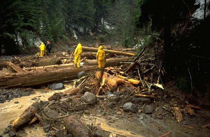
WS #3 debris flow causes water to pour over the road surface into Lookout Creek. Backhoe pushing cut logs over edge of road to clear snow cat trail. Photo taken at 10:00 am.
Photographed by Al Levno ..... Date: 2/08/96 ..... Photo: AAD-058
Backhoe pushing cut logs over edge of road to clear snow cat trail. Photo taken at 10:00 am.
Photographed by Al Levno ..... Date: 2/08/96 ..... Photo: AAD-059
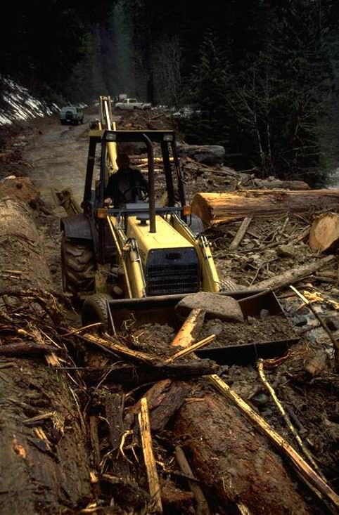
Photo taken at 10:00 am.
Photographed by Al Levno ..... Date: 2/08/96 ..... Photo: AAD-060
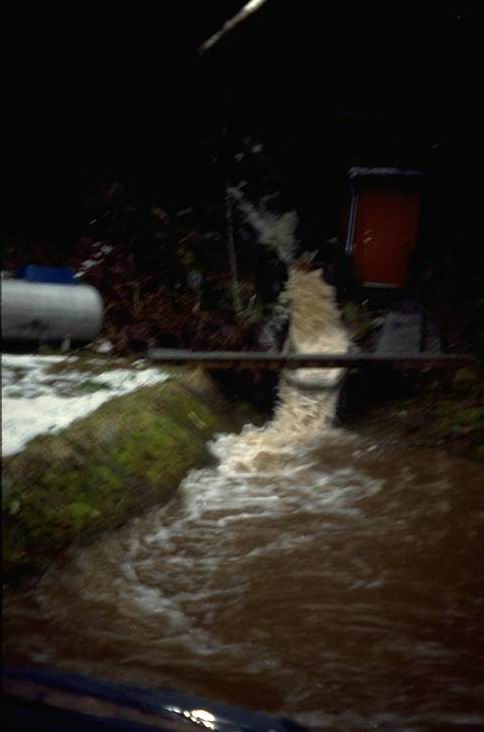
Photo taken at 8:30 a.m.
Photographed by Al Levno ..... Date: 2/07/96 ..... Photo: AAD-061
Slide in sediment basin and gage house. Photo taken at 2:00 pm.
Photographed by Al Levno ..... Date: 2/07/96 ..... Photo: AAD-062
Downstream side of gage house shortly after peak flow. Photo taken at 2:00 pm.
Photographed by Al Levno ..... Date: 2/07/96 ..... Photo: AAD-063
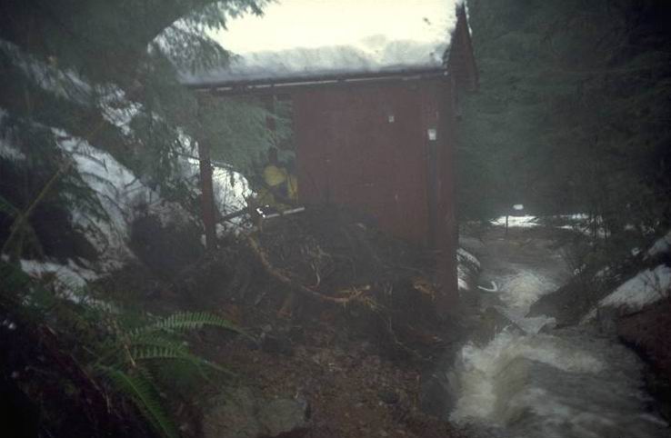
Photo taken at 2:00 pm.
Photographed by Al Levno ..... Date: 2/07/96 ..... Photo: AAD-064
Looking down on full sediment basin just after peak flow. Photo taken at 2:00 pm.
Photographed by Al Levno ..... Date: 2/07/96 ..... Photo: AAD-065
Debris in lake came in during the last 24 hours. Photo taken at 3:00 pm.
Photographed by Al Levno ..... Date: 2/07/96 ..... Photo: AAD-066

Natural debris storage, upper end of reservoir. Photo taken at 3:00 pm.
Photographed by Al Levno ..... Date: 2/07/96 ..... Photo: AAD-067
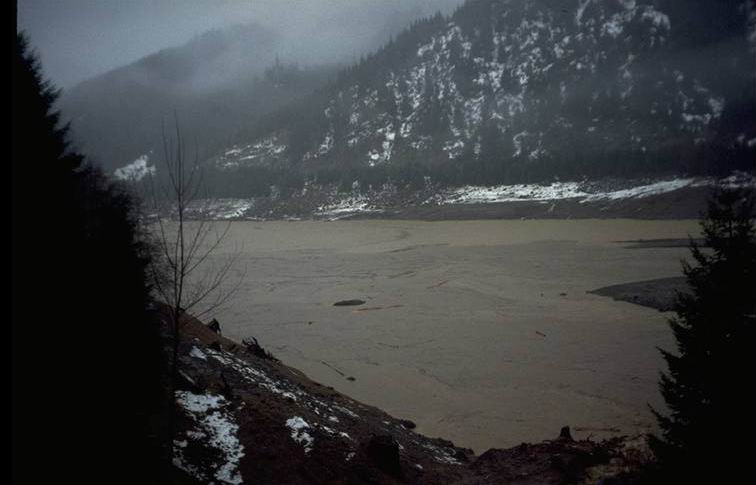
Photo taken at 8:30 am.
Photographed by Al Levno ..... Date: 2/07/96 ..... Photo: AAD-068
McKenzie River from 1500 Road, looking downstream. Photo taken at 4:00 pm.
Photographed by Al Levno ..... Date: 2/07/96 ..... Photo: AAD-069
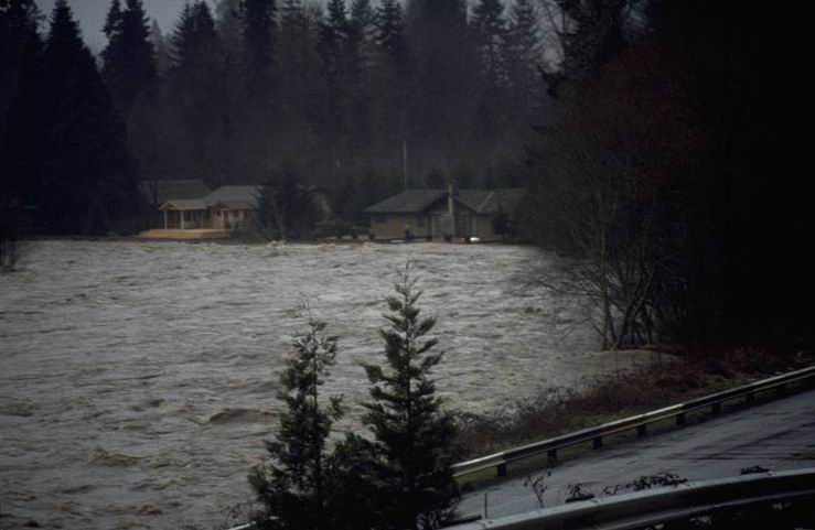
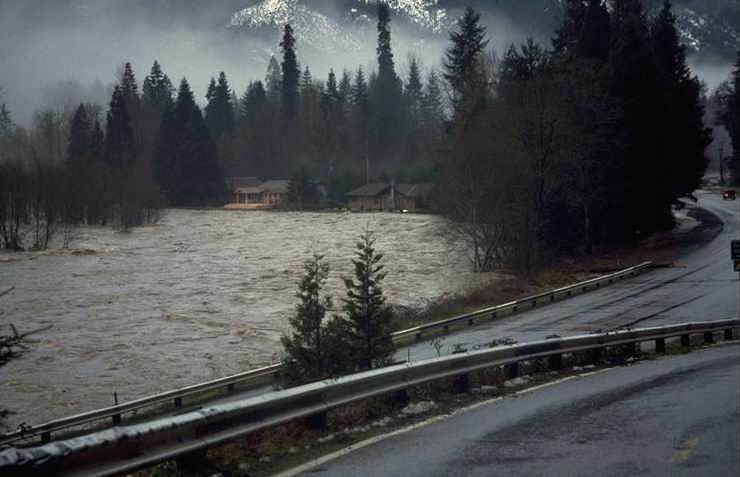
Houses on McKenzie River below 1500 Road. Photo taken at 4:00 pm.
Photographed by Al Levno ..... Date: 2/07/96 ..... Photo: AAD-070

Floating porta-potty at boat landing below 1500 Road. Photo taken at 4:00 pm.
Photographed by Al Levno ..... Date: 2/07/96 ..... Photo: AAD-071
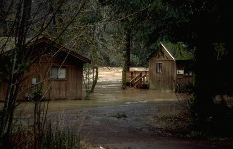
McKenzie River cabins below Redsides. Photo taken at 5:00 pm.
Photographed by Al Levno ..... Date: 2/07/96 ..... Photo: AAD-072
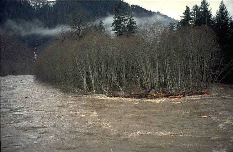
McKenzie River looking downstream from Finn Rock Bridge. Photo taken at 4:00 pm.
Photographed by Al Levno ..... Date: 2/07/96 ..... Photo: AAD-073

McKenzie River looking upstream from Finn Rock Bridge. Photo taken at 4:00 pm.
Photographed by Al Levno ..... Date: 2/07/96 ..... Photo: AAD-074
150 foot log coming into Finn Rock Bridge. Photo taken at 4:00 pm.
Photographed by Al Levno ..... Date: 2/07/96 ..... Photo: AAD-075
Large log going downstream at boat landing below 1500 Road. Photo taken at 4:00 pm.
Photographed by Al Levno ..... Date: 2/07/96 ..... Photo: AAD-076